Strong Fall Front Fires Up Severe Chances Through Monday Morning

October has been relatively quiet in terms of severe weather. That all came to an end Saturday as storms rumbled through the Central and Southern Plains. A few storms actually produced severe weather reports, some of which were classified as tornadoes.
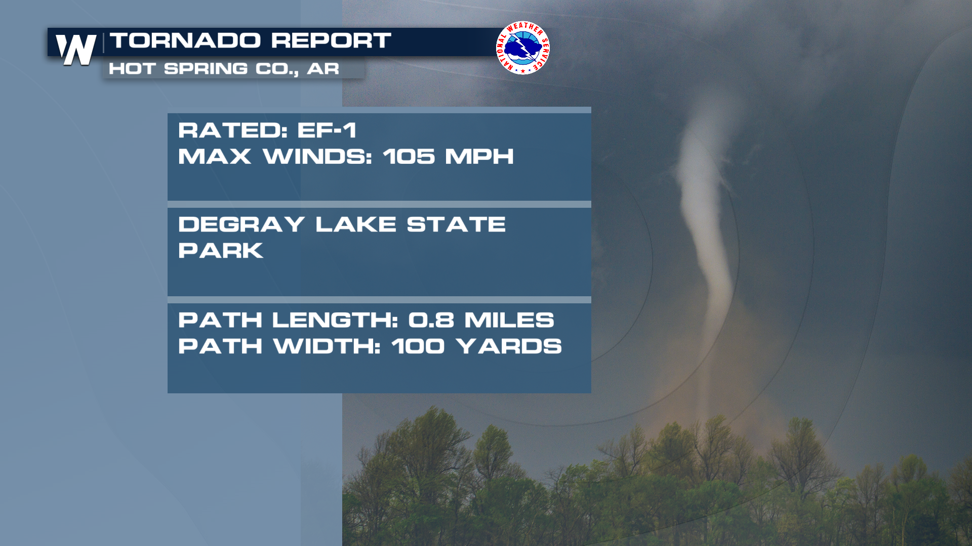
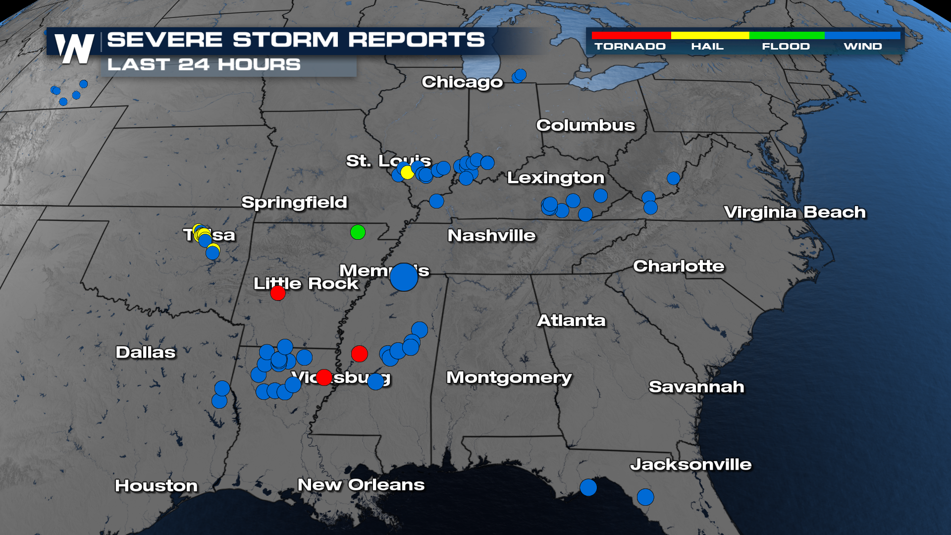 The National Weather Service in Little Rock, Arkansas, confirmed an EF-1 tornado was found in Hot Spring County from Saturday's storms.
Forecast Timing
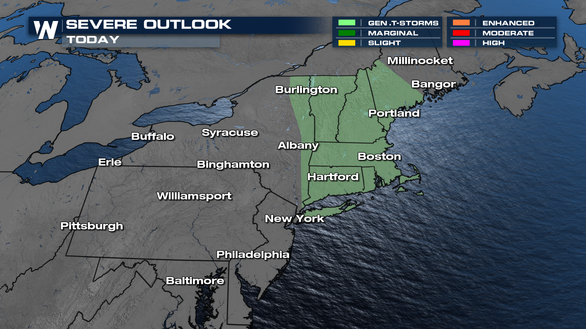
Now, the front is aiming for the northeastern U.S. One thing we've noticed is the lack of lightning with these thunderstorms, but the winds have been howling along the front. Through Monday morning, the severe weather threat continues into New England, for cities such as Boston, MA.
Severe Outlook
As for severe weather, not much is expected behind this front. The SPC only calling for general thunderstorms in the forecast for some of the coastal northeast cities.
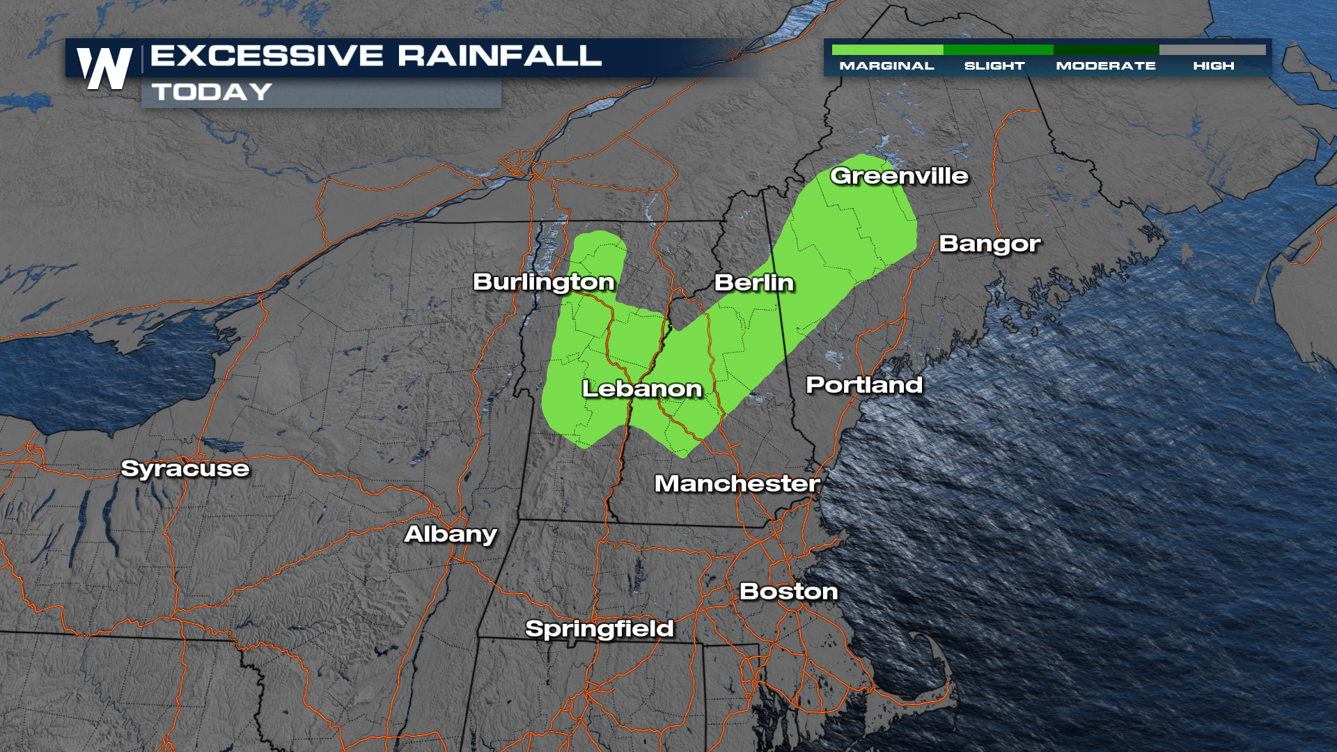
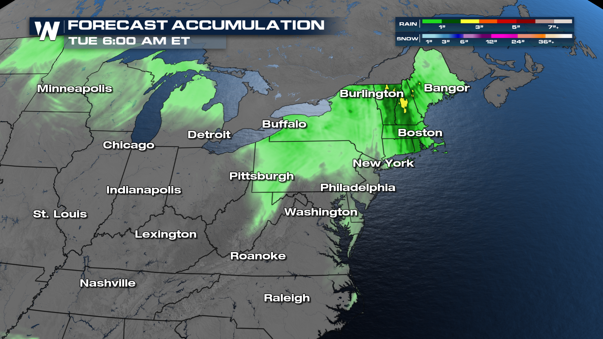
With regards to rainfall, the northeast is not totally out of the woods yet. We still have a marginal (level 1 out of 4) risk for excessive rain.
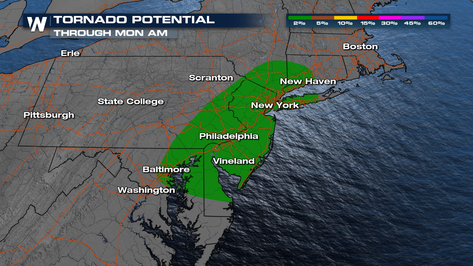
The Storm Prediction Center's tornado outlook is low, but non-zero, for cities including Baltimore, New York, and Philadelphia. It may not be until early Monday morning before the front actually moves through.
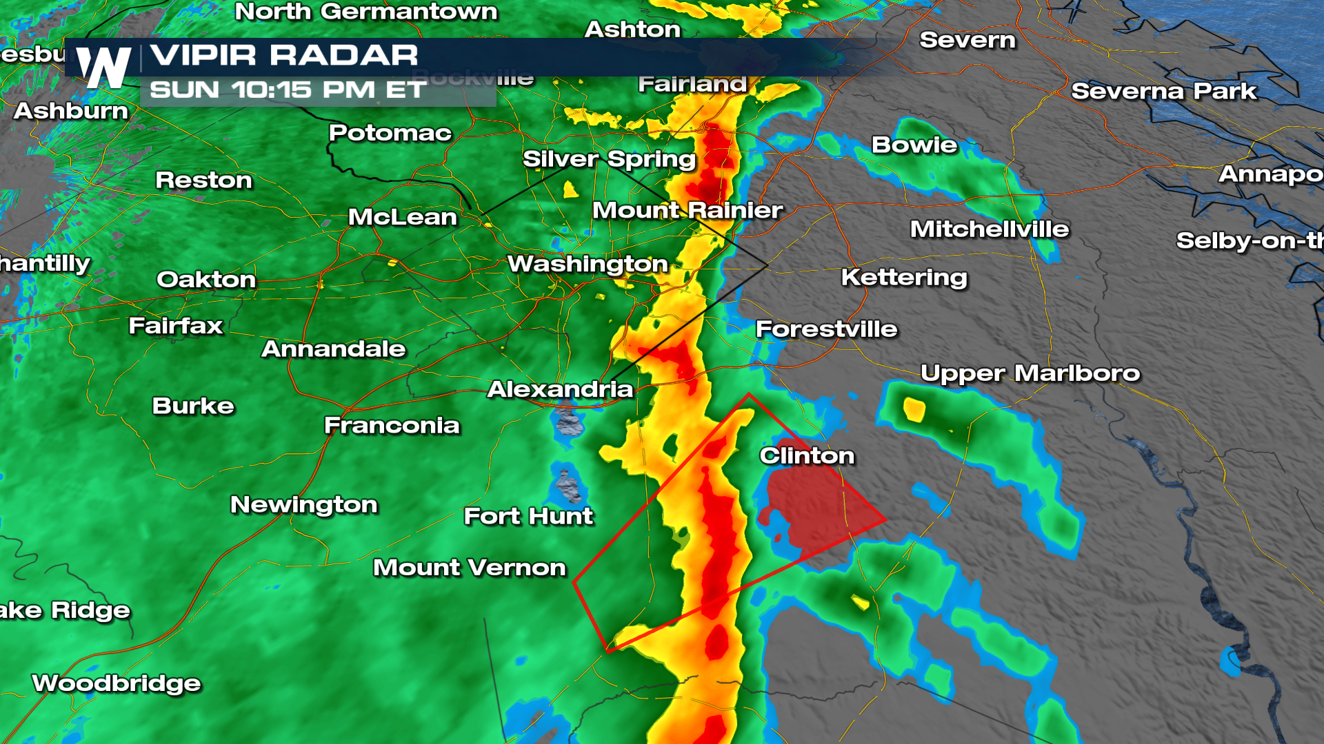
 In fact, on Sunday night, a tornado warning happened just south of the D.C. area.
Total Accumulation
The severe storms will also be capable of producing heavy rainfall that could lead to flooding. A few locations could see an inch or two, which could lead to some localized areas of flooding.
Tune into WeatherNation TV for the latest details.


