Severe Storm Threat Continues in the Midwest
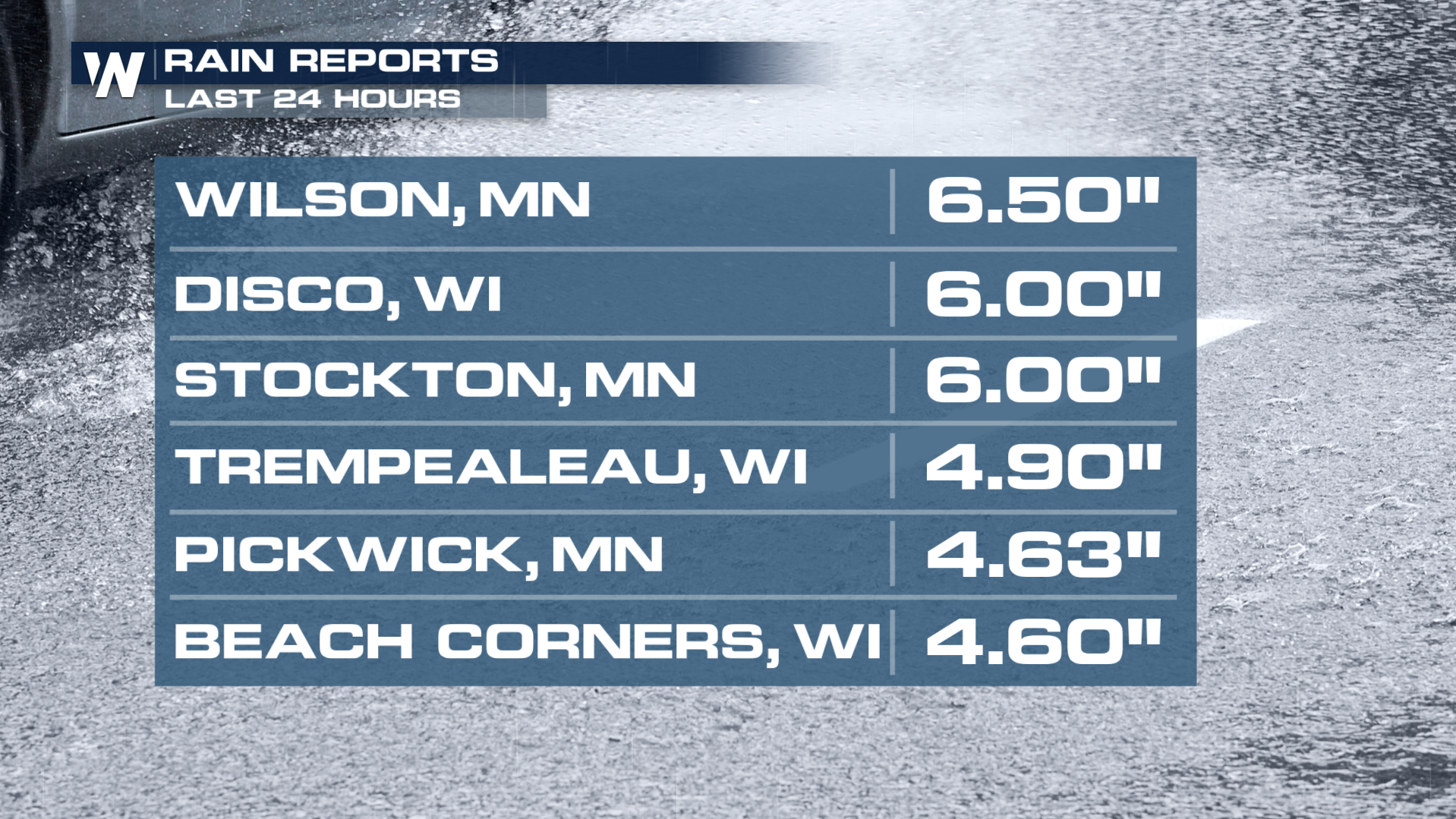
Strong storms have been battering the Plains and Upper-Midwest this week, as a cold front taps into warm and humid conditions. Rainfall in Wisconsin and Minnesota (where the weather system is coming from) have reached as high as four to six inches!

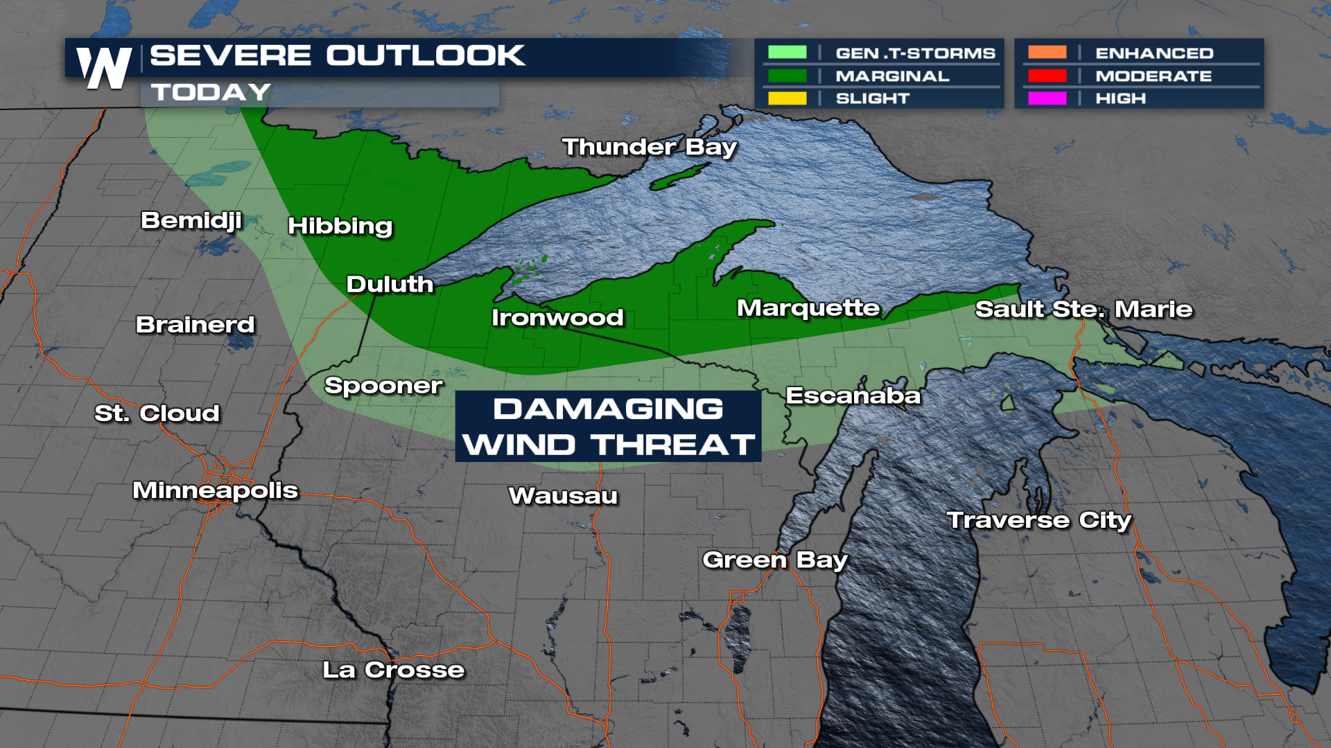
A trailing low pressure system will bring a threat for severe storms to the Upper-Midwest Saturday afternoon and evening. Damaging winds are the primary threat, so be sure to secure loose outdoor objects!

Storms are anticipated in the afternoon and evening primarily, as the cold front moves across Lake Superior.
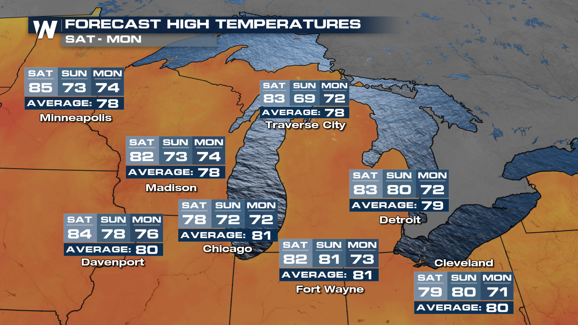
Additional heavy rain is not expected to pose a flood threat, but temperatures will certainly cool down behind the front!

Stay with WeatherNation for the latest on this developing situation and gear up for this multi-day severe weather threat.