Study Shows Hurricane Model Forecasts Improved with Hurricane Hunter Data
Special Stories
13 Jul 2022 1:00 AM
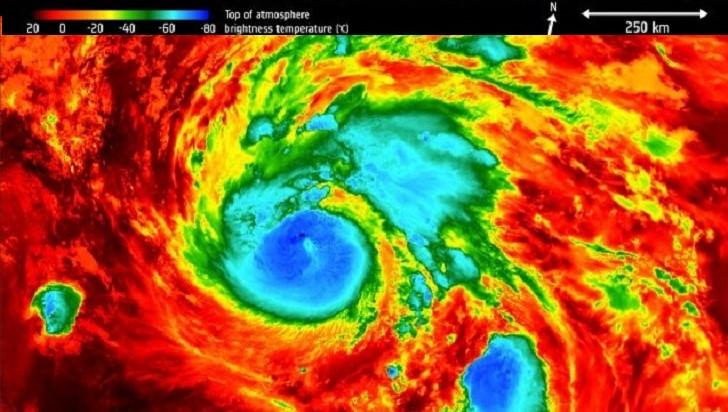
[Written by NOAA Hurricane Research Division] A new report shows data gathered from Hurricane Hunter missions into tropical cyclones substantially improves tropical cyclone track forecasts.
■ Summary:
Ingesting observations from Hurricane Hunter aircraft into computer models is known to improve forecasts of tropical cyclones. Among these observations are those from instruments that are released from the aircraft and report pressure, temperature, humidity, and wind velocity as they fall to the surface (known as dropwindsondes), and instruments aboard the aircraft that report the same data at the plane location.
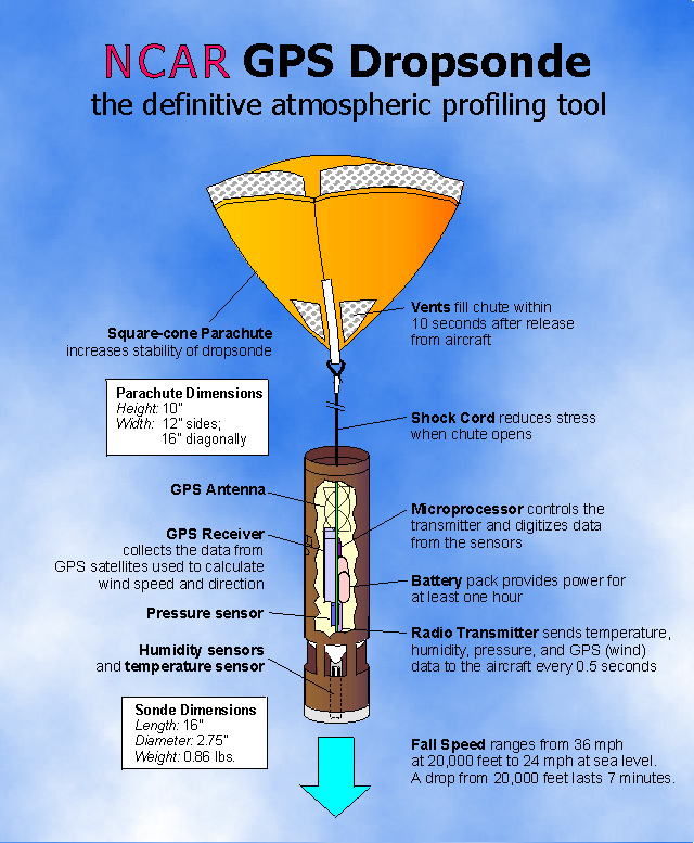
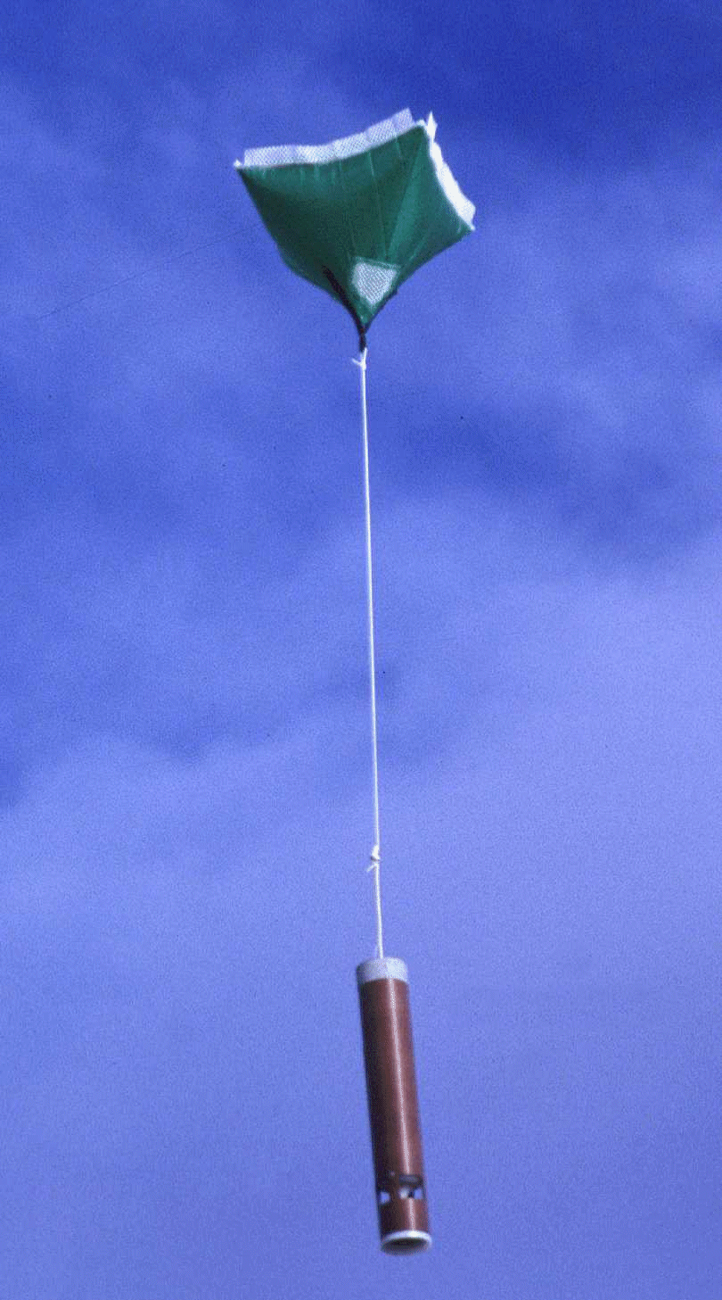 [A dropsonde. From NOAA]
Though all of these observations have been used in NOAA tropical cyclone models in the past, many have never before been used in NOAA’s global model, known as the Global Forecast System. This study reviews the impact of ingesting these additional data on the accuracy of tropical cyclone forecasts. Additional methods to measure forecast accuracy are proposed, since existing methods can be incomplete or even misleading.
[A dropsonde. From NOAA]
Though all of these observations have been used in NOAA tropical cyclone models in the past, many have never before been used in NOAA’s global model, known as the Global Forecast System. This study reviews the impact of ingesting these additional data on the accuracy of tropical cyclone forecasts. Additional methods to measure forecast accuracy are proposed, since existing methods can be incomplete or even misleading.
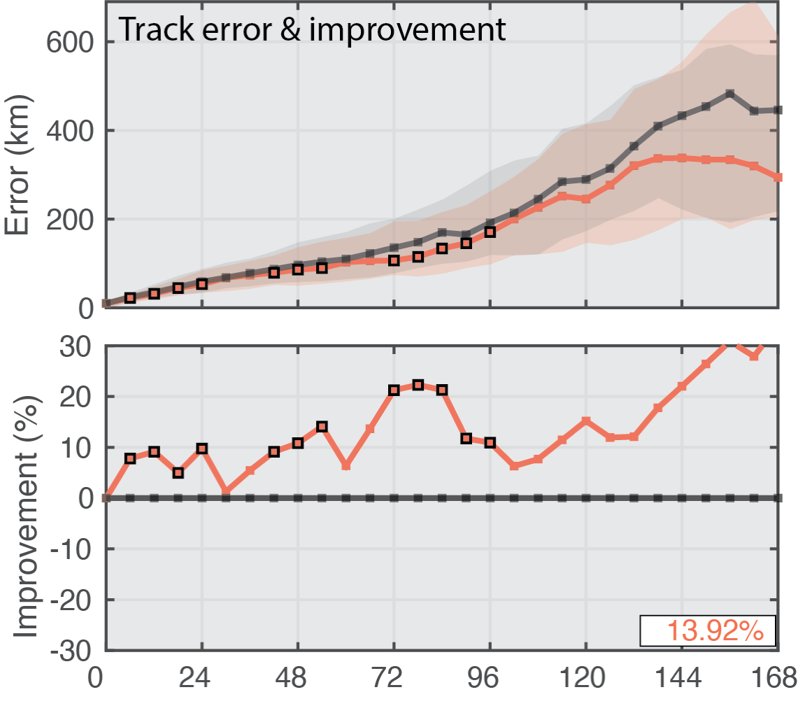
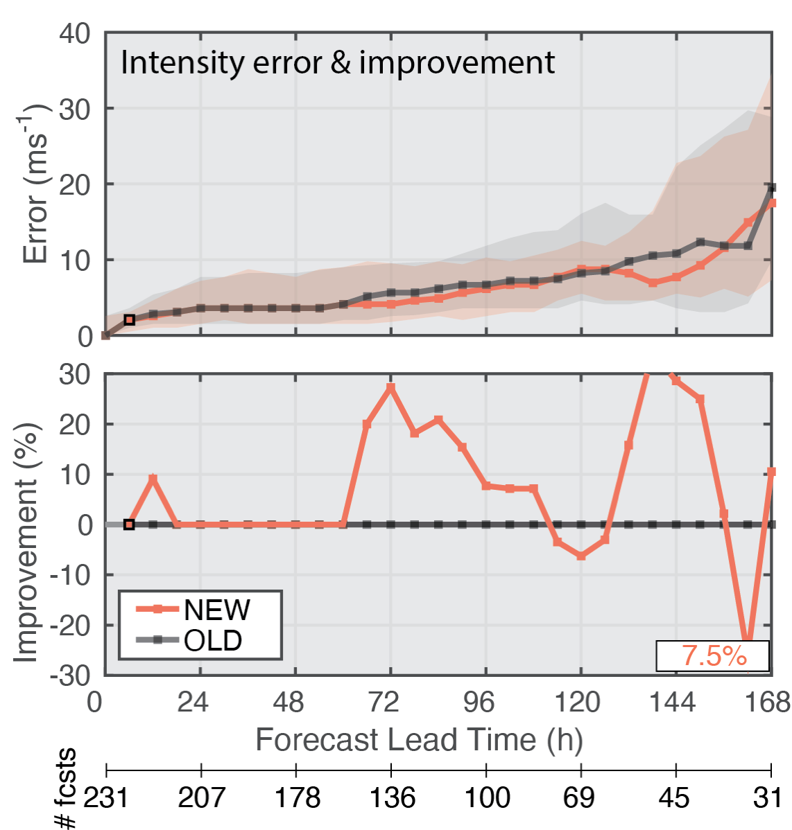
 The table images below show median track and intensity forecast errors with (NEW) and without (OLD) the added Hurricane Hunter aircraft data; there are as many cases with errors larger than the median as there are with errors smaller than the median. One half of all the error values fall within the shaded regions. The average percent improvement across all lead times is shown in the bottom right of panels. Square markers along the NEW lines indicate when there is a 95% chance that the model errors with the additional data are smaller than those without the additional data based on a statistical analysis of the results.
 ■ Important Conclusions:
Data from Hurricane Hunter aircraft substantially improve forecasts of where the tropical cyclone will go (track forecasts) through one week in NOAA’s Global Forecast System (above image).
The same data slightly improve how intense the tropical cyclone will be (intensity forecasts) in the same model (below image).
■ Important Conclusions:
Data from Hurricane Hunter aircraft substantially improve forecasts of where the tropical cyclone will go (track forecasts) through one week in NOAA’s Global Forecast System (above image).
The same data slightly improve how intense the tropical cyclone will be (intensity forecasts) in the same model (below image).
 The full text can be found at this link.
[A dropsonde. From NOAA]
Though all of these observations have been used in NOAA tropical cyclone models in the past, many have never before been used in NOAA’s global model, known as the Global Forecast System. This study reviews the impact of ingesting these additional data on the accuracy of tropical cyclone forecasts. Additional methods to measure forecast accuracy are proposed, since existing methods can be incomplete or even misleading.
The table images below show median track and intensity forecast errors with (NEW) and without (OLD) the added Hurricane Hunter aircraft data; there are as many cases with errors larger than the median as there are with errors smaller than the median. One half of all the error values fall within the shaded regions. The average percent improvement across all lead times is shown in the bottom right of panels. Square markers along the NEW lines indicate when there is a 95% chance that the model errors with the additional data are smaller than those without the additional data based on a statistical analysis of the results.
■ Important Conclusions:
Data from Hurricane Hunter aircraft substantially improve forecasts of where the tropical cyclone will go (track forecasts) through one week in NOAA’s Global Forecast System (above image).
The same data slightly improve how intense the tropical cyclone will be (intensity forecasts) in the same model (below image).
The full text can be found at this link.All Weather News
More
Hurricane Flossie Continues to Weaken
Hurricane FlossieThe National Hurricane Cente
3 Jul 2025 2:50 AM

NHC Monitoring Front in the Southeast Ahead of 4th of July
Later this week, a frontal boundary is expect
3 Jul 2025 1:00 AM

Northern Plains to Upper Midwest Severe Storms Threaten Holiday Travel
NORTHERN PLAINS - A frontal system is expecte
3 Jul 2025 1:00 AM


Northwest Heat Met With Thunderstorm Risk
NORTHWEST - Today, portions of Montana are un
3 Jul 2025 12:00 AM

Near Seasonal Temperatures for Many Come July 4th!
AAA is expecting over 70 million travelers to
2 Jul 2025 6:40 PM

Severe Weather Threat Continues in the Midwest
It has been an active, severe season across t
30 Jun 2025 9:00 PM