Sub-Freezing Temps Heading To California
Special Stories
17 Feb 2018 2:30 PM
Some rather cold February air is on the way to parts of California. This may come as a shock to many residents, due to the warm temps that have been blanketing the state for much of the winter. But the weather patterns will be changing a bit, and the new set-up will bring down colder air from the north. High temperatures will certainly cool down. Record highs will not be likely for the next few days. In fact, high temps fall below average for a change. And the overnight lows be noticeably colder. Temps will chill down below the freezing mark. The National Weather Service has issued Freeze Watches for the region.
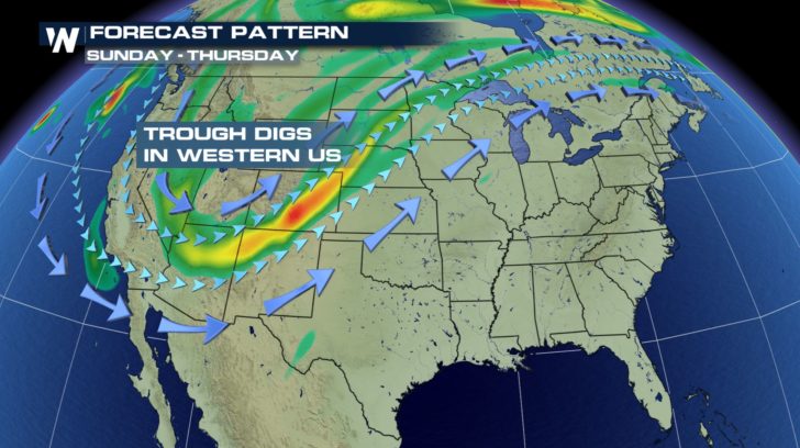
Here's the weather set-up Sunday through Thursday. The jetstream will dive southward from Canada into the southwest. This will bring down colder air into California.
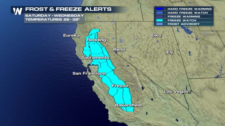
 A Freeze Watch is in effect from Monday night through Thursday morning for the valleys of central California.
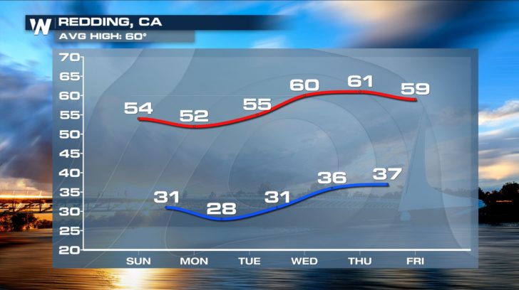
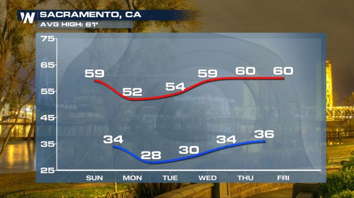
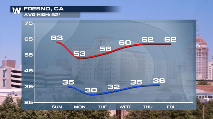
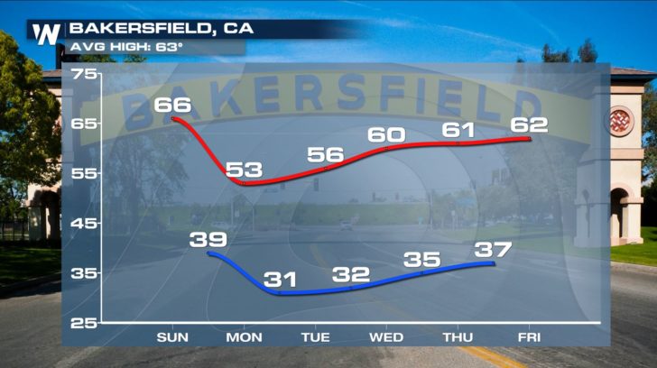
 Redding, Sacramento, Fresno, and Bakersfield are the largest cities included in the Freeze Watch area. Below are the temperature forecasts for those four cities. Focus on the temperatures Tuesday, Wednesday, and Thursday mornings. Temps will be at or below freezing in all locations on Tuesday and Wednesday. Thursday morning will also be pretty chilly.
 So this week, remember the Four P's.... People, Pets, Plants, and Pipes. All could be affected by the cold temps arriving this week. It's certainly going to feel like February very soon!
For WeatherNation: Meteorologist Matt Monroe
 A Freeze Watch is in effect from Monday night through Thursday morning for the valleys of central California.
 Redding, Sacramento, Fresno, and Bakersfield are the largest cities included in the Freeze Watch area. Below are the temperature forecasts for those four cities. Focus on the temperatures Tuesday, Wednesday, and Thursday mornings. Temps will be at or below freezing in all locations on Tuesday and Wednesday. Thursday morning will also be pretty chilly.


 So this week, remember the Four P's.... People, Pets, Plants, and Pipes. All could be affected by the cold temps arriving this week. It's certainly going to feel like February very soon!
For WeatherNation: Meteorologist Matt Monroe
So this week, remember the Four P's.... People, Pets, Plants, and Pipes. All could be affected by the cold temps arriving this week. It's certainly going to feel like February very soon!
For WeatherNation: Meteorologist Matt MonroeAll Weather News
More