Severe Threat Overnight For The Plains

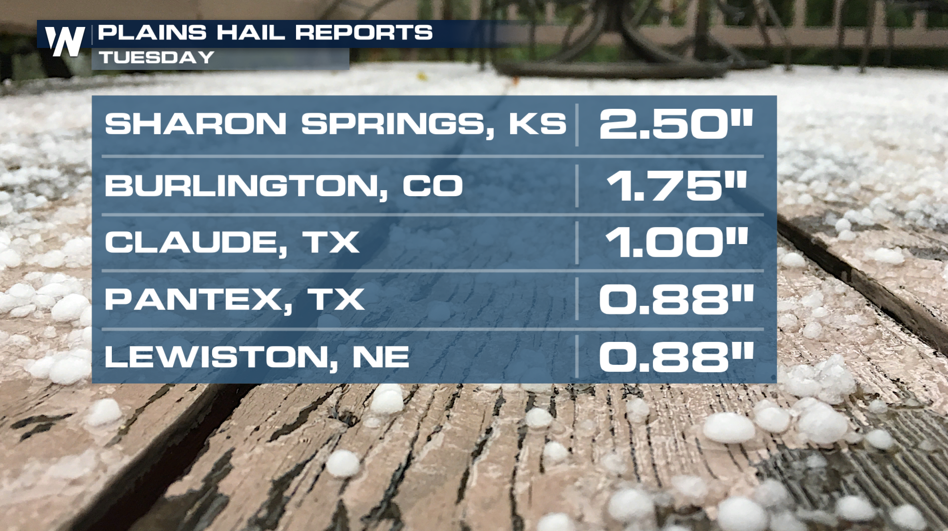
The southern plains has been hounded with storms over the last few days, with flooding being a major issue in central Kansas. Rainfall totals were 4"-10" on Monday into Tuesday. More storms worked through on Tuesday, with localized flooding, hail, and winds being the biggest concerns. Sharon Springs, Kansas saw hailstones of 2.50", this is larger than a golfball! The threat of a few strong severe storms will continue into the overnight hours.
 OVERNIGHT - The Storm Prediction Center has issued a Slight (level 2 out of 5) risk for severe storms overnight east of the Front Range and into the Plains. Damaging winds and large hail are the primary threats.
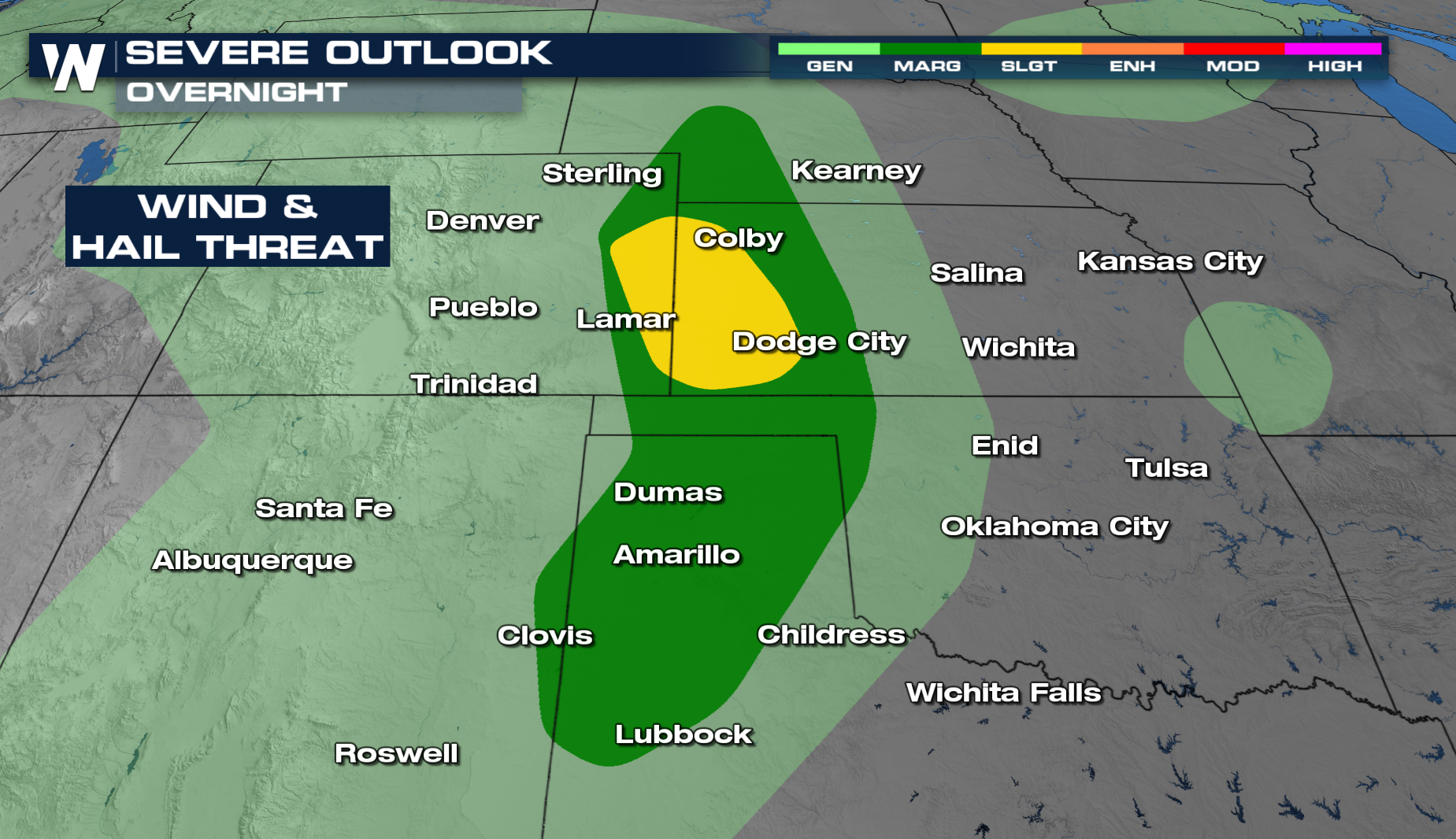 Although storms will be isolated overnight, some will have the potential to be strong to severe. With the loss of daytime heating, instability will be limited.
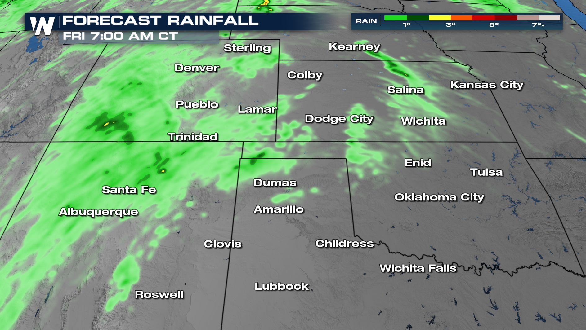
Through Friday morning, we can see some localized heavy rainfall of 1"-2".
 More updates are on the way on WeatherNation.


