Midwest Storms Causing Flood Problems
Top Stories
7 Sep 2020 2:00 PM
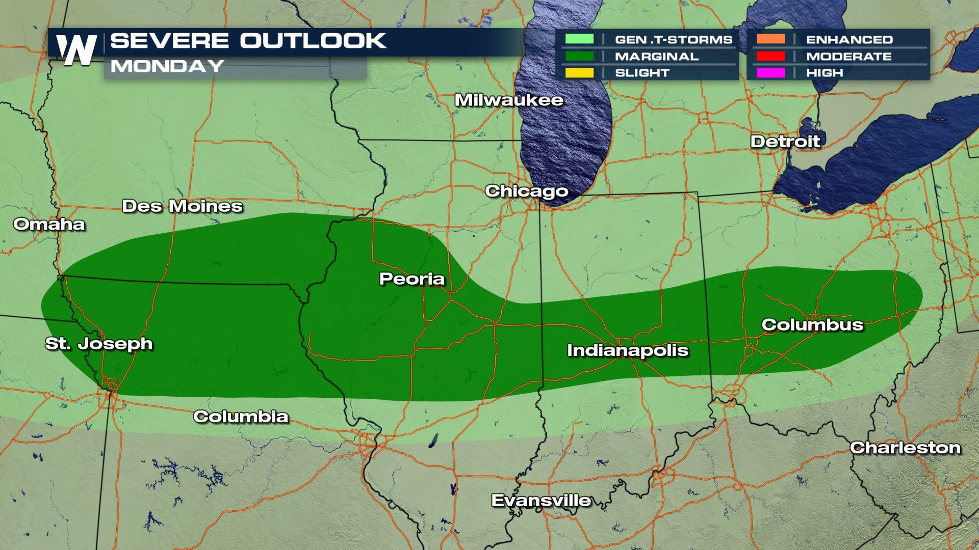
With ongoing storms in the Ohio Valley this Labor Day Monday, we are looking at the potential to see some isolated strong to severe storms through tonight from the Ohio Valley into the lower Missouri Valley. As a cold front stalls out in the Ohio Valley thunderstorms may run into regions with high CAPE (Convective Available Potential Energy) and instability and produce some marginally severe hail and strong wind gusts. The window for severe weather is narrow.
Severe Outlook
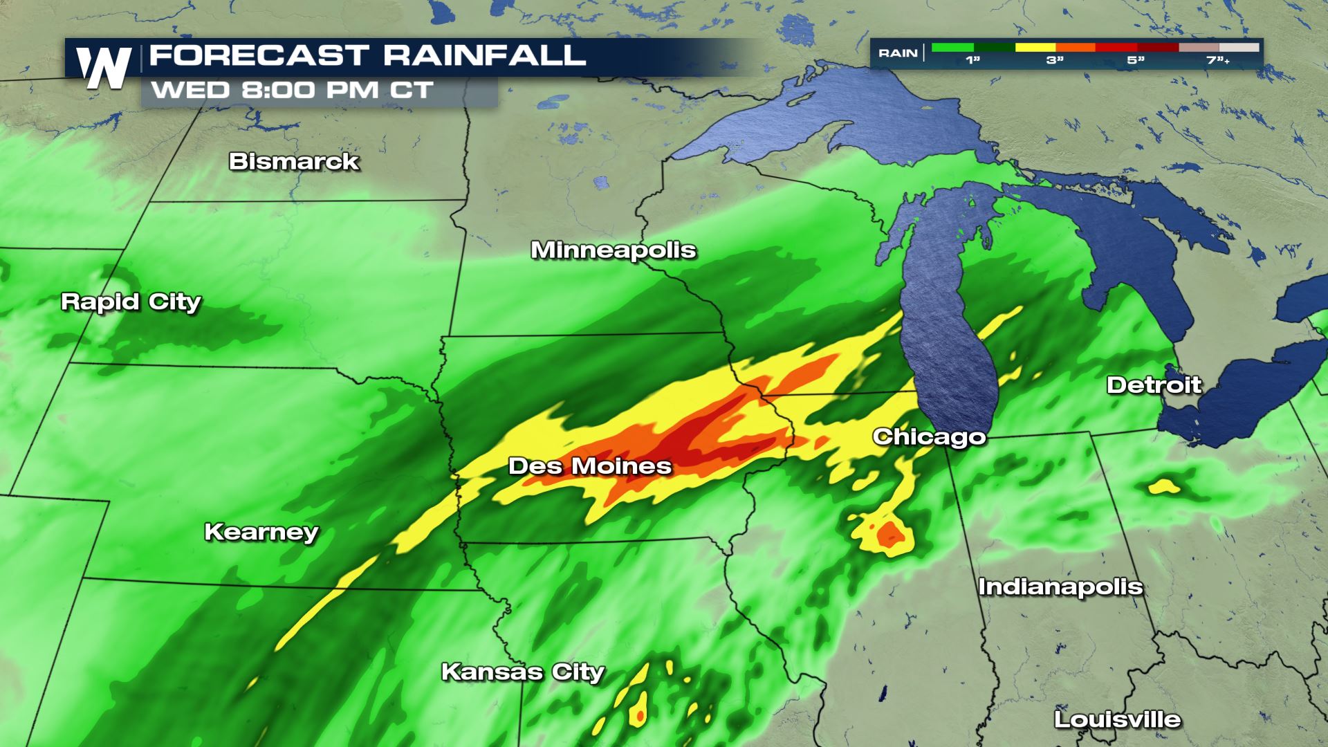
However, such strong storms have dropped high amounts of rain over the past 12 hours or so, and that's prompted flash flood and flood warnings around the Cleveland area in Ohio. There is the potential for heavy rain to continue along a general line, and radiating outward north and south thereof, from Kansas City, to Peoria, to Indianapolis, to Columbus, OH through tonight.
Excessive Rain Outlook
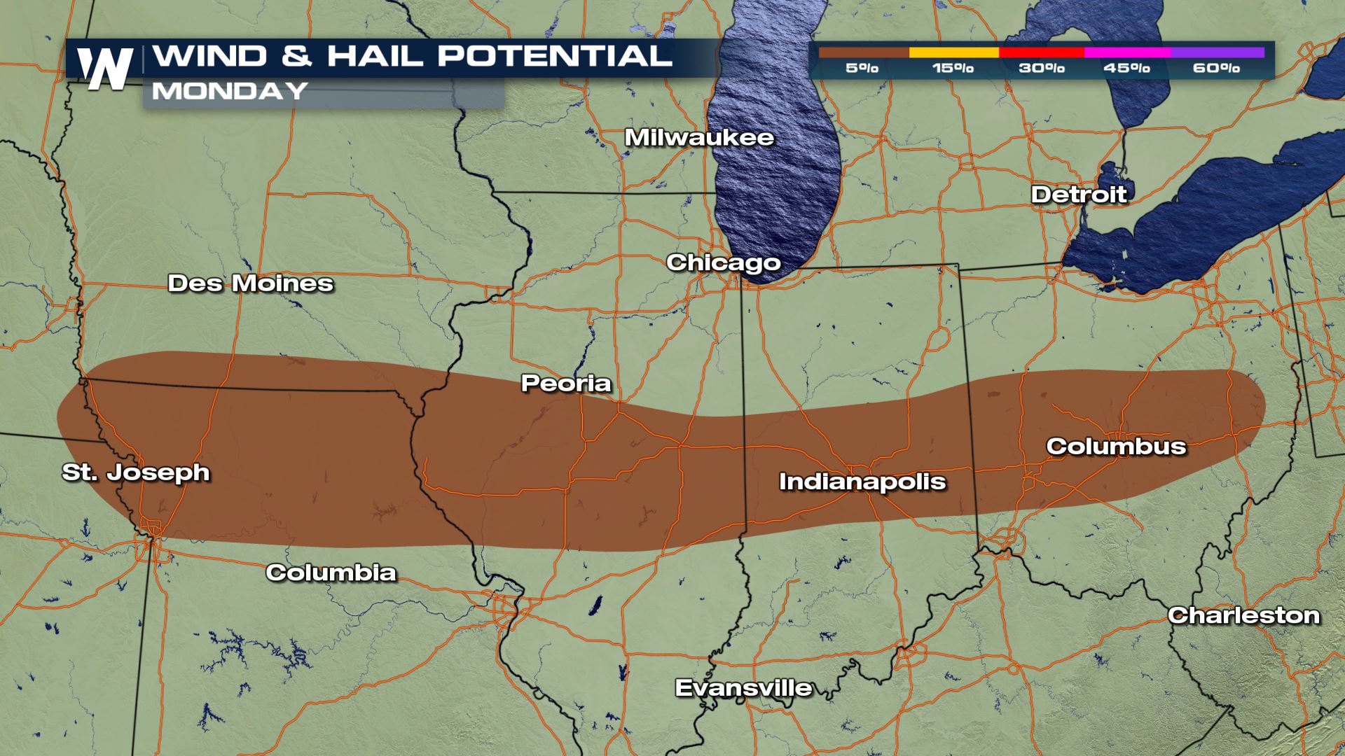 Severe risk will include marginally severe hail and some strong wind gusts.
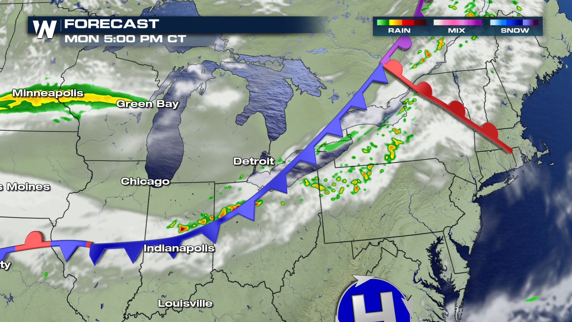
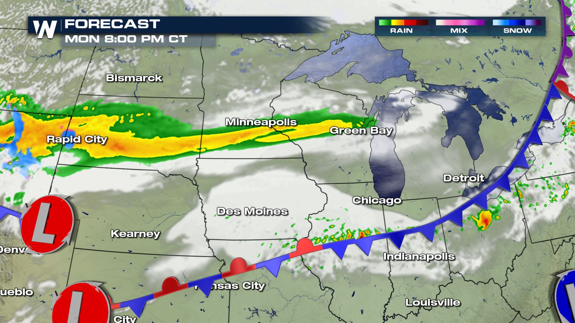
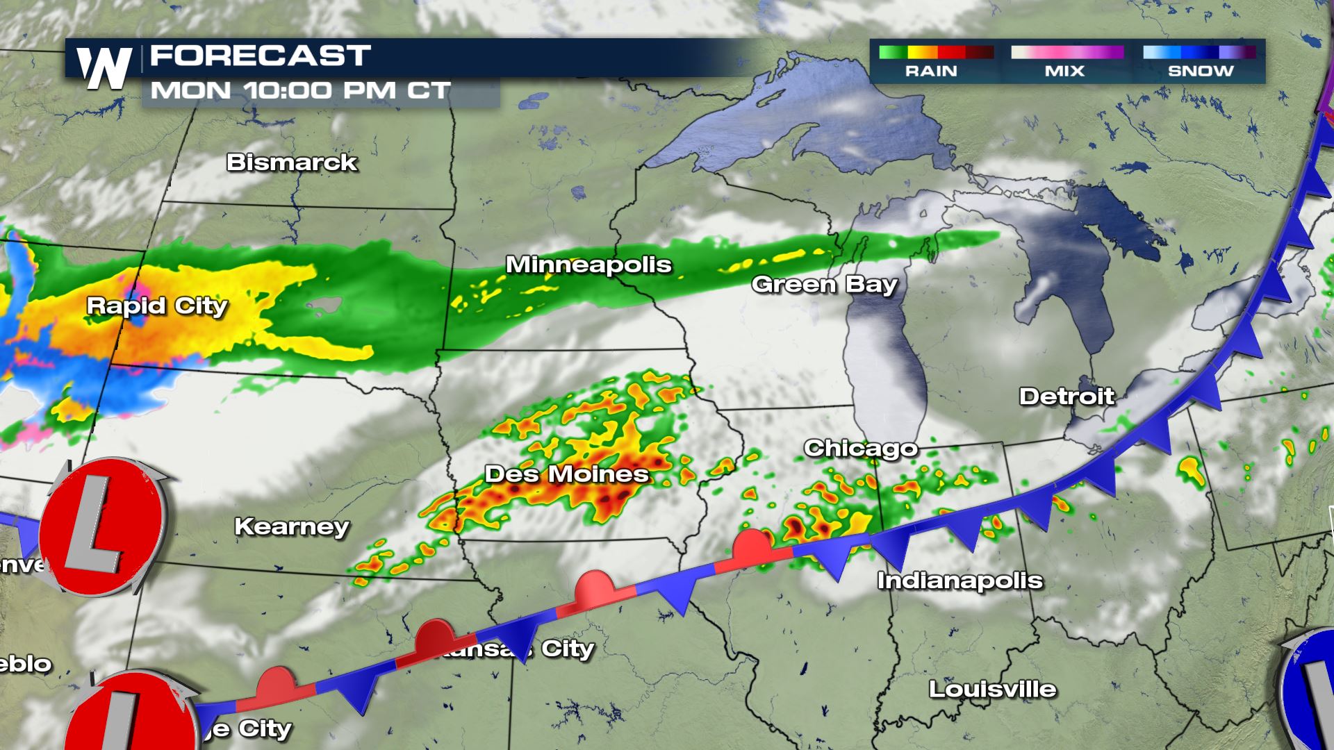 The timing of today's storms will be later this afternoon into tonight. Over the next 24-36 hours we could see some pretty high rainfall totals along the stalled out front as seen below, with Iowa seeing some of the highest totals.
 Keep checking with WeatherNation for more updates on your Labor Day Severe storm chances.
Severe Outlook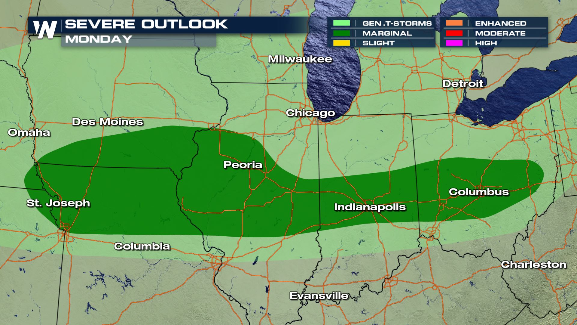
However, such strong storms have dropped high amounts of rain over the past 12 hours or so, and that's prompted flash flood and flood warnings around the Cleveland area in Ohio. There is the potential for heavy rain to continue along a general line, and radiating outward north and south thereof, from Kansas City, to Peoria, to Indianapolis, to Columbus, OH through tonight.
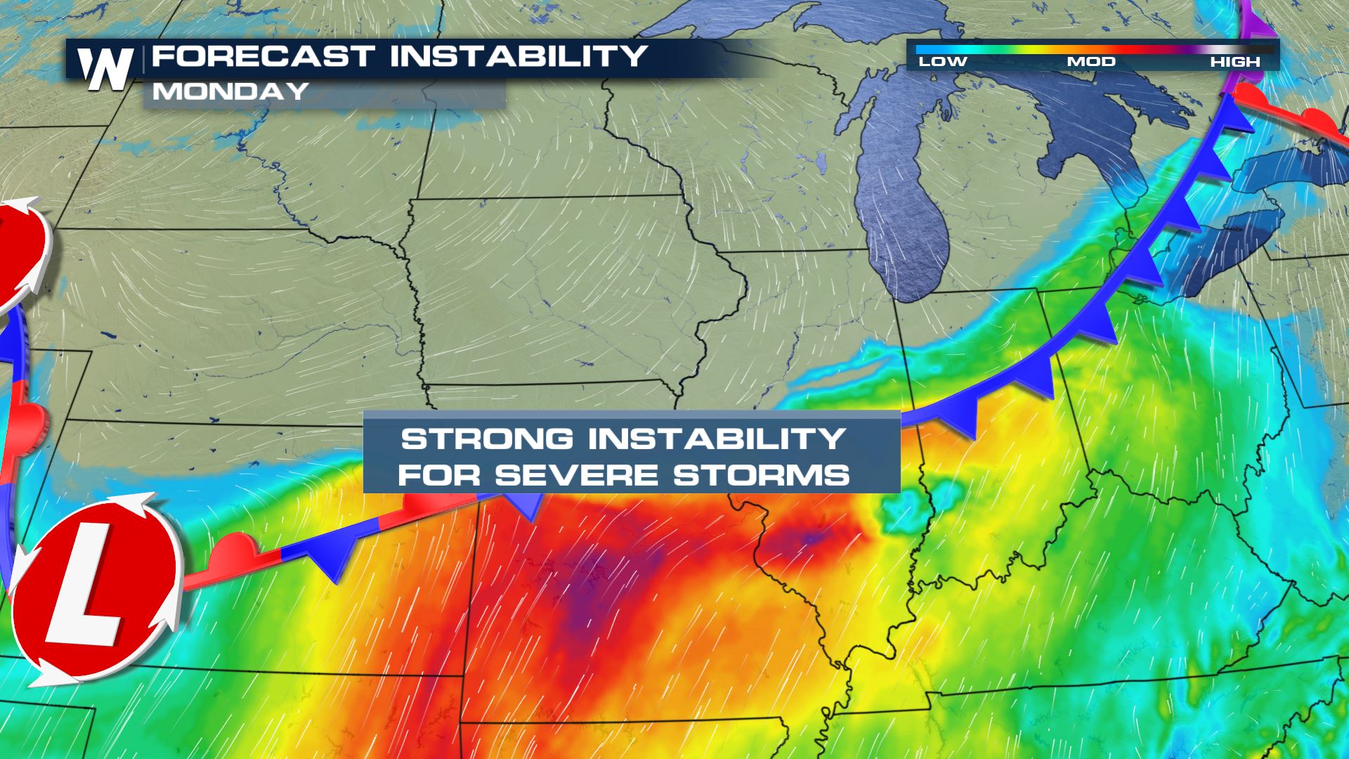
Excessive Rain Outlook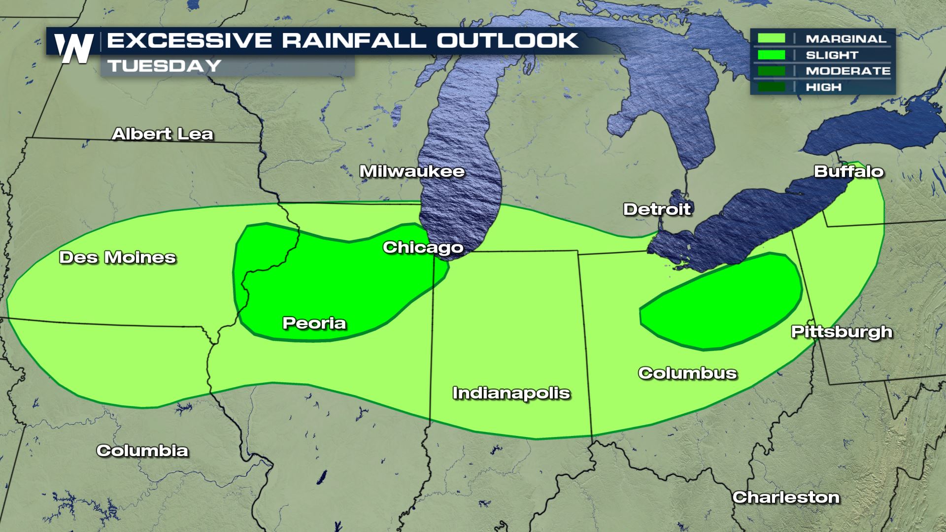 Strong instability with today's forecast will allow for severe storms to develop south of the cold front. This is where we will likely see isolated severe storms.
Severe Risks
Severe risk will include marginally severe hail and some strong wind gusts.
Forecast
The timing of today's storms will be later this afternoon into tonight. Over the next 24-36 hours we could see some pretty high rainfall totals along the stalled out front as seen below, with Iowa seeing some of the highest totals.
Keep checking with WeatherNation for more updates on your Labor Day Severe storm chances.All Weather News
More


More Storms for the East Sunday and Monday
A low-pressure system crashing through the Mi
2 Aug 2026 2:20 AM

After Reaching Category 5, Genevieve Weakens in the Pacific
PacificGenevieve formed on last Friday south
2 Aug 2026 1:30 AM

Flooding, Severe Storms Target the Midwest Again
After an active week of storms across the nor
1 Aug 2026 1:40 AM

Flooding Risk Increases as Heavy Rain Targets the Tri-State Area
Tuesday, heavy rainfall moved across the Nort
30 Jul 2026 12:25 AM

Severe Weather: Energy From the Midwest Now in the Southeast
UPPER MIDWEST - Through Monday, dangerous tor
29 Jul 2026 10:30 PM