Swath of Heavy Snow from the Upper Midwest to the Blue Ridge Mountains
Special Stories
22 Mar 2018 3:45 PM
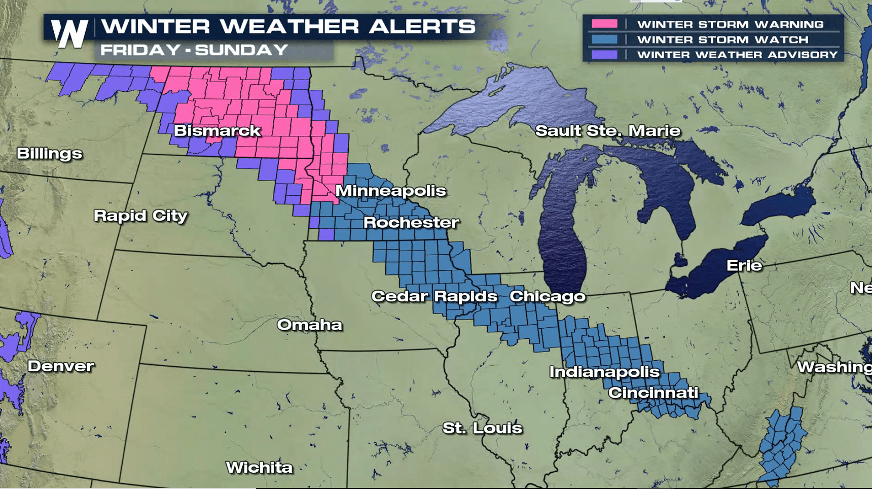
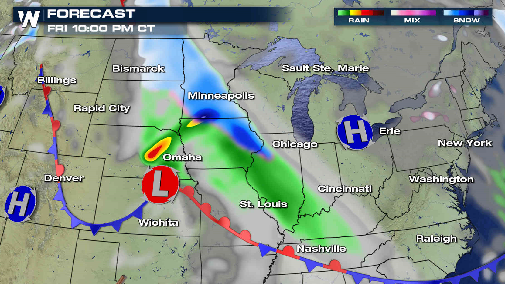
A fast moving low pressure center will put down a swath of heavy snow from the Upper Midwest and Corn Belt to the Blue Ridge Mountains Friday into Saturday. Winter weather alerts extend from North Dakota to Virginia. Most totals will be the 3" to 6" range, but isolated areas could see up to a foot of accumulation.

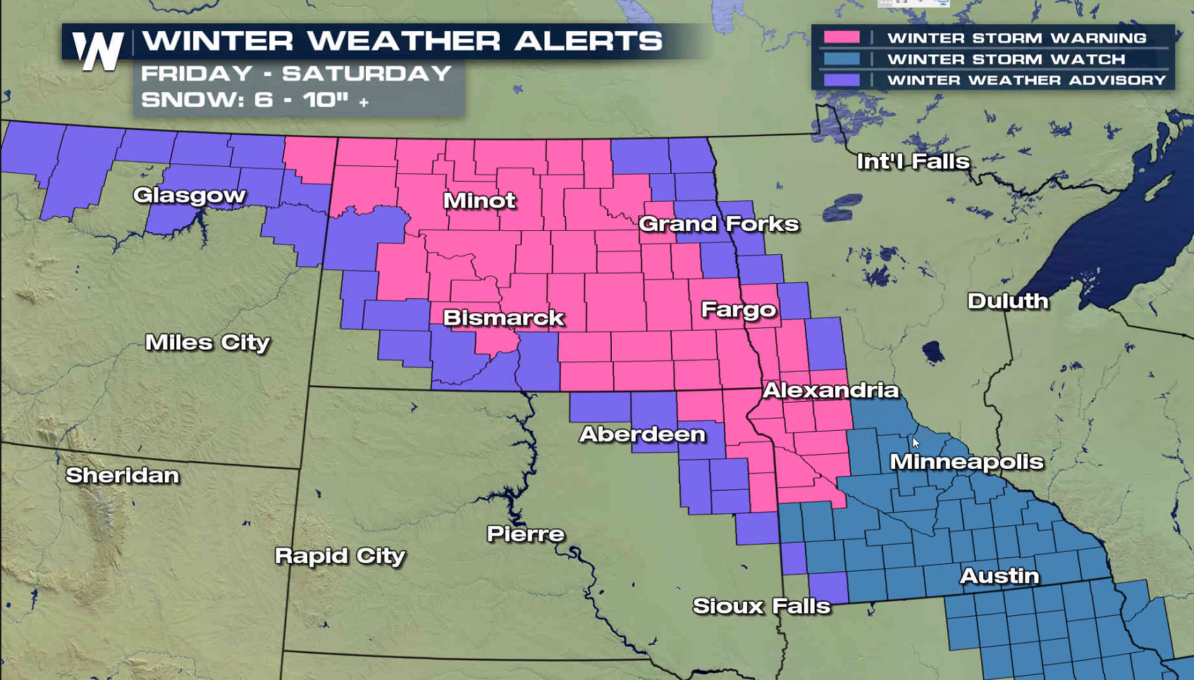
 The first wave of snow will move into North Dakota Friday morning, spreading south to Iowa by Friday night. Along with pockets of heavy snow, wind gusts of 30-40 mph will create blowing snow, reducing visibility.
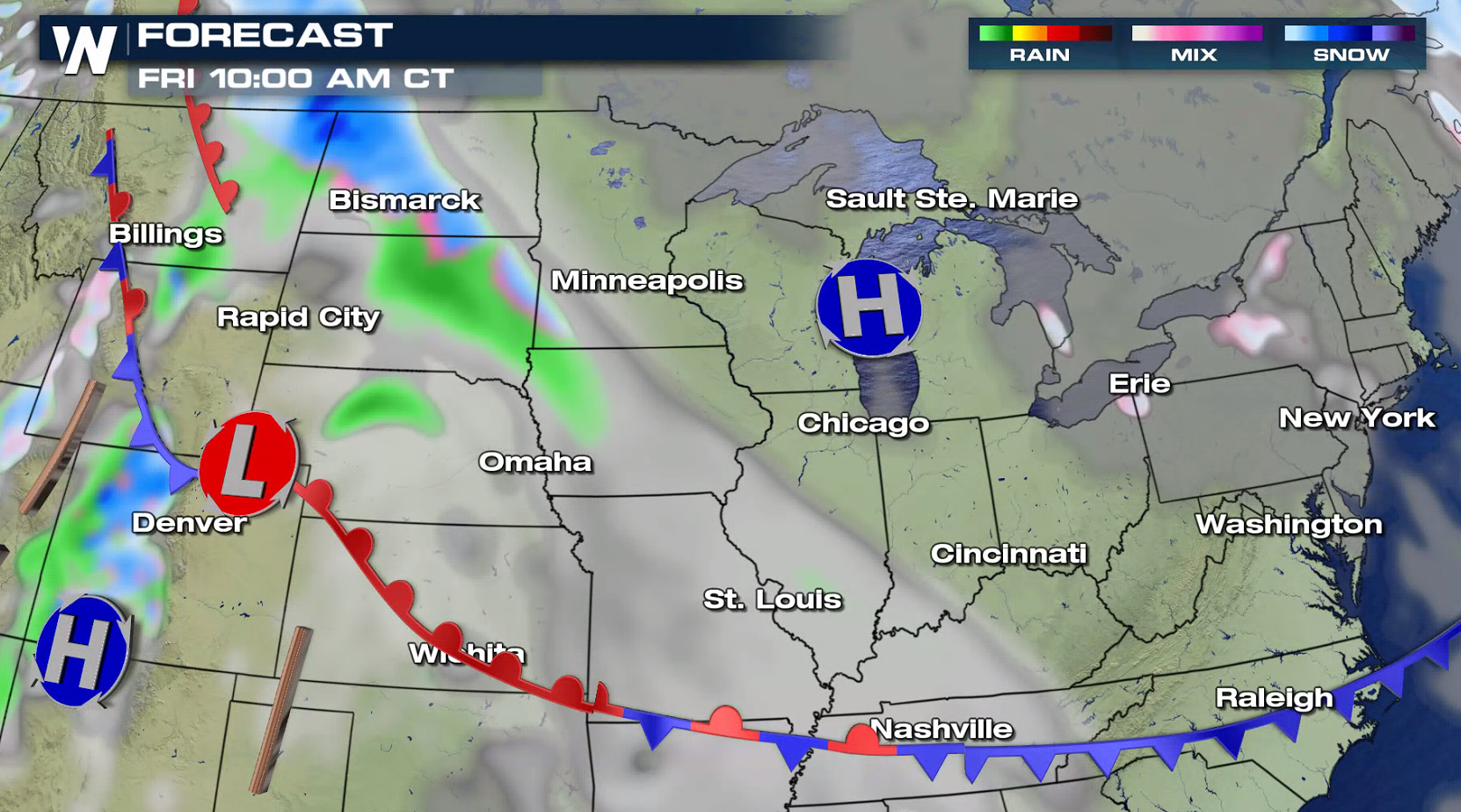
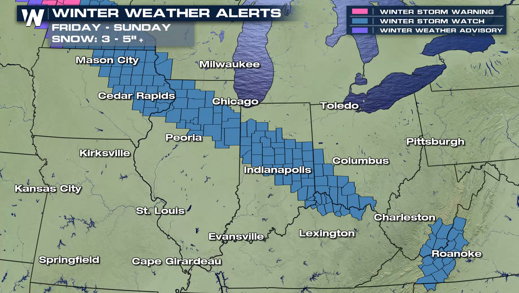
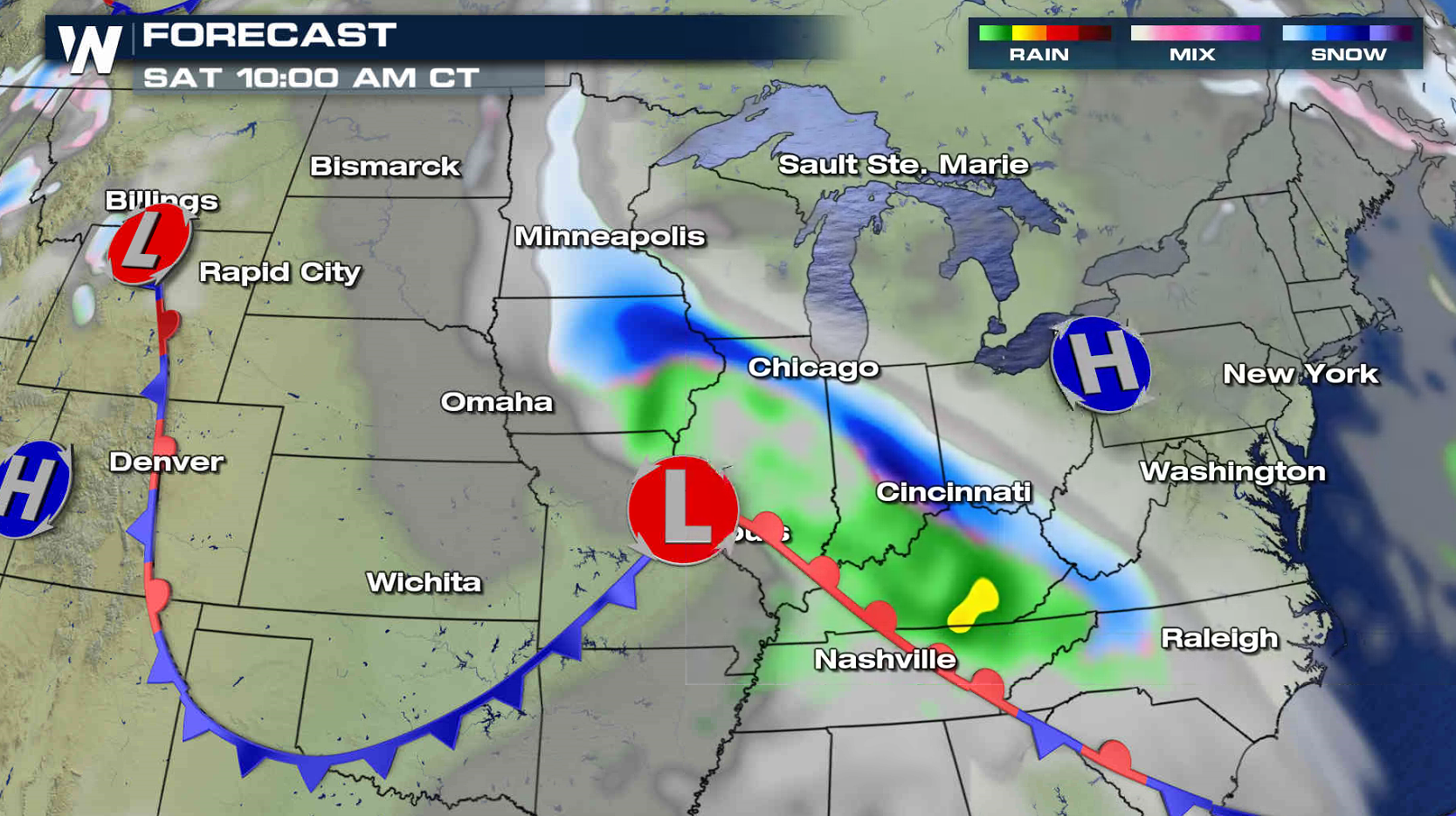
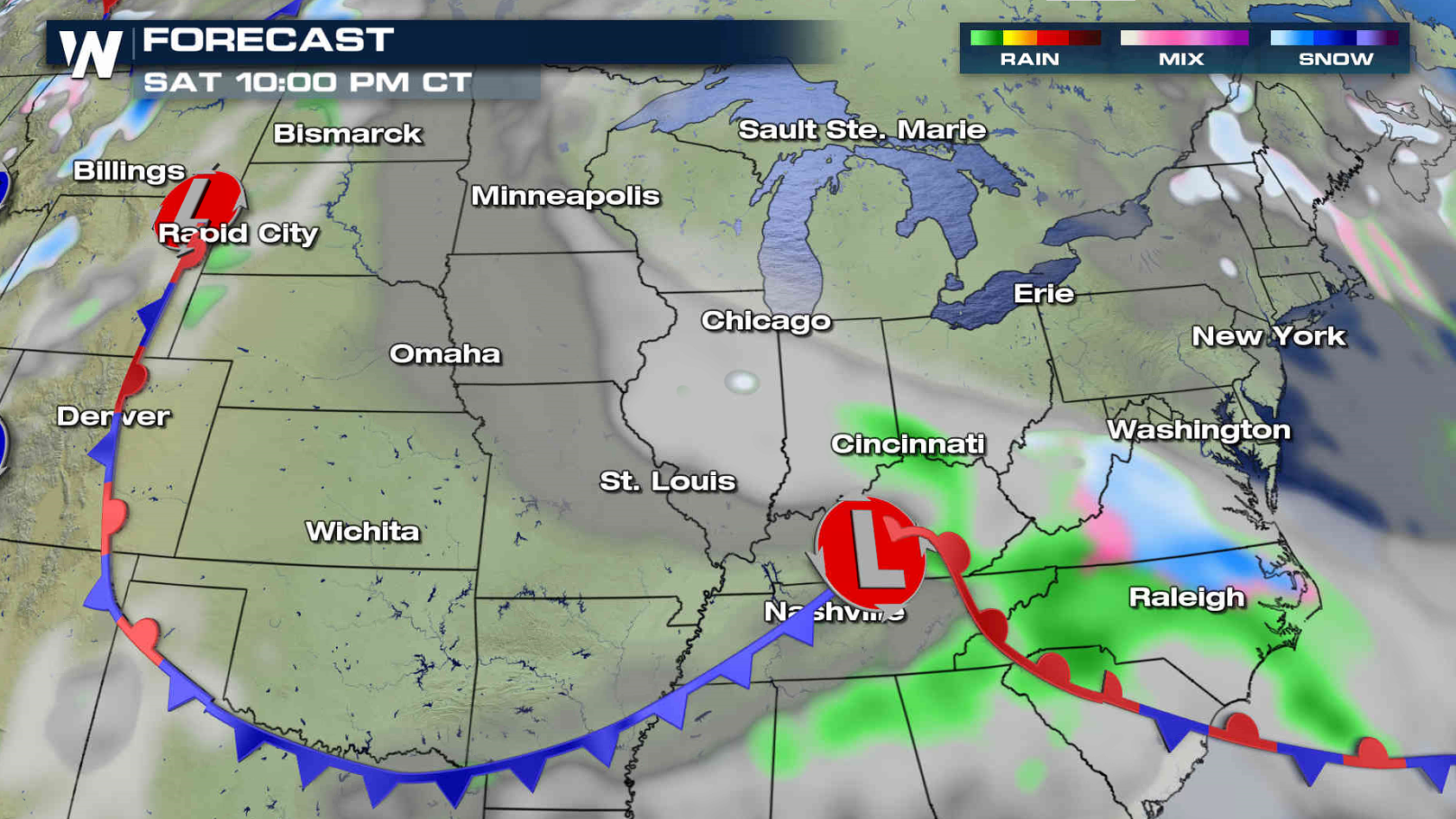
 The snow will push through the Ohio Valley Friday night. On Saturday, snowfall will move into the Middle Atlantic and the Outer Banks of North Carolina. The system moves out to sea Sunday, into the Atlantic Ocean.
 For WeatherNation: Meteorologist Mace Michaels
The first wave of snow will move into North Dakota Friday morning, spreading south to Iowa by Friday night. Along with pockets of heavy snow, wind gusts of 30-40 mph will create blowing snow, reducing visibility.
The snow will push through the Ohio Valley Friday night. On Saturday, snowfall will move into the Middle Atlantic and the Outer Banks of North Carolina. The system moves out to sea Sunday, into the Atlantic Ocean.
For WeatherNation: Meteorologist Mace MichaelsAll Weather News
More
East Gears Up for Stormy, Wet Weekend
A low pressure system crashing through the Mi
1 Aug 2026 6:15 PM


Flooding, Severe Storms Target the Midwest Again
After an active week of storms across the nor
1 Aug 2026 1:40 AM

After Reaching Category 5, Genevieve Weakens in the Pacific
PacificFausto is now a post-tropical cyclone.
31 Jul 2026 1:30 AM

Flooding Risk Increases as Heavy Rain Targets the Tri-State Area
Tuesday, heavy rainfall moved across the Nort
30 Jul 2026 12:25 AM

Severe Weather: Energy From the Midwest Now in the Southeast
UPPER MIDWEST - Through Monday, dangerous tor
29 Jul 2026 10:30 PM