15th Anniversary of Hurricane Felix
Special Stories
4 Sep 2022 12:30 AM
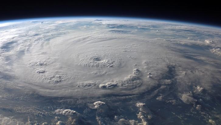
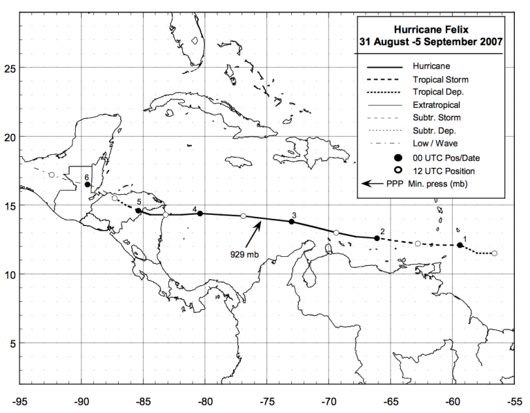
[From NOAA] On August 24, 2007, a tropical wave moved westward off the African coast, gradually becoming organized enough to become a tropical depression a week later almost 200 miles east southeast of Barbados. Within 12 hours, it became Tropical Storm Felix about 60 miles south of Barbados. A period of rapid intensification commenced, and Felix became a hurricane only 24 hour later, and as category-5 hurricane with 175 mph winds only 24 hours after that. Felix eventually made landfall on September 4th near Punta Gorda, Nicaragua, as a category-5 hurricane with 160 mph winds. Felix caused extensive damage along the Mosquito coast and near Puerto Cabezas totaling nearly US$1 billion and led to 130 deaths in Nicaragua and 3 in Honduras.
 NOAA conducted four research flights into Felix with the two P3 aircraft, mainly to collect Doppler radar data to test the assimilation of the data into the new HWRF model. During the third flight, radar imagery from the aircraft showed that Felix was a very small, but very intense hurricane, with a very intense eyewall. When the aircraft took off, NHC had just upgraded Felix to a category-2 hurricane that was undergoing rapid intensification.
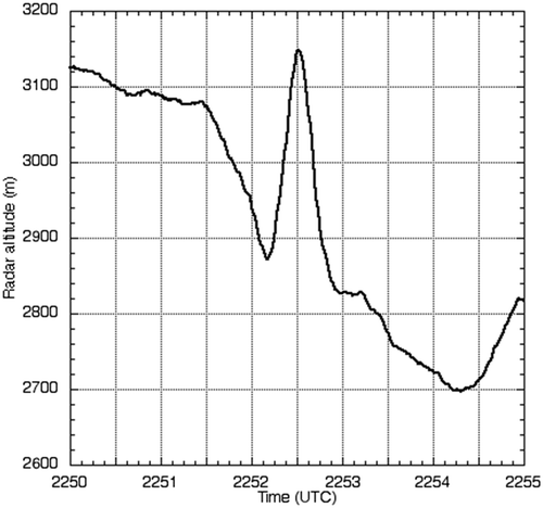
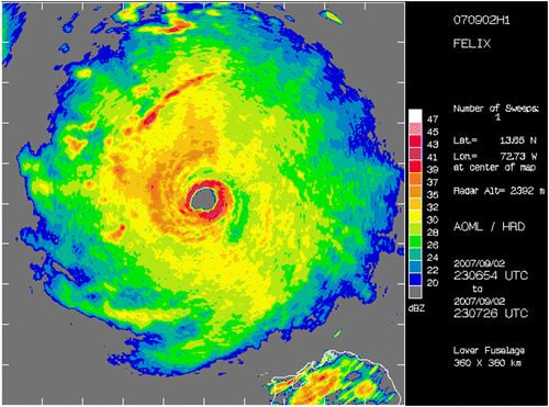 As the plane neared the eyewall, the wind speed at 10,000 feet increased to 186 mph, and the Stepped-Frequency Microwave Radiometer measured winds at the surface at an astounding 194 mph. At the same time, the plane encountered extreme turbulence, with winds moving downward at 22 mph quickly changing to upward at 69 mph. This caused the plane to rise nearly 300 miles and then return to its original level within one minute. This marks the strongest vertical motion the aircraft has ever encountered in a tropical cyclone.
 You can read more about Felix in this report from the National Hurricane Center
Edited for WeatherNation by Meteorologist Mace Michaels
You can read more about Felix in this report from the National Hurricane Center
Edited for WeatherNation by Meteorologist Mace Michaels
NOAA conducted four research flights into Felix with the two P3 aircraft, mainly to collect Doppler radar data to test the assimilation of the data into the new HWRF model. During the third flight, radar imagery from the aircraft showed that Felix was a very small, but very intense hurricane, with a very intense eyewall. When the aircraft took off, NHC had just upgraded Felix to a category-2 hurricane that was undergoing rapid intensification.
As the plane neared the eyewall, the wind speed at 10,000 feet increased to 186 mph, and the Stepped-Frequency Microwave Radiometer measured winds at the surface at an astounding 194 mph. At the same time, the plane encountered extreme turbulence, with winds moving downward at 22 mph quickly changing to upward at 69 mph. This caused the plane to rise nearly 300 miles and then return to its original level within one minute. This marks the strongest vertical motion the aircraft has ever encountered in a tropical cyclone.
You can read more about Felix in this report from the National Hurricane Center
Edited for WeatherNation by Meteorologist Mace MichaelsAll Weather News
More

More Storms for the East Through Monday
A low-pressure system that moved through the
3 Aug 2026 12:20 PM


After Reaching Category 5, Genevieve Weakens in the Pacific
PacificGenevieve formed last Friday south of
3 Aug 2026 12:30 AM

Flooding, Severe Storms Target the Midwest Again
After an active week of storms across the nor
1 Aug 2026 1:40 AM

Flooding Risk Increases as Heavy Rain Targets the Tri-State Area
Tuesday, heavy rainfall moved across the Nort
30 Jul 2026 12:25 AM