Threat for Severe Storms in the Upper Midwest
Special Stories
9 Sep 2019 11:58 AM
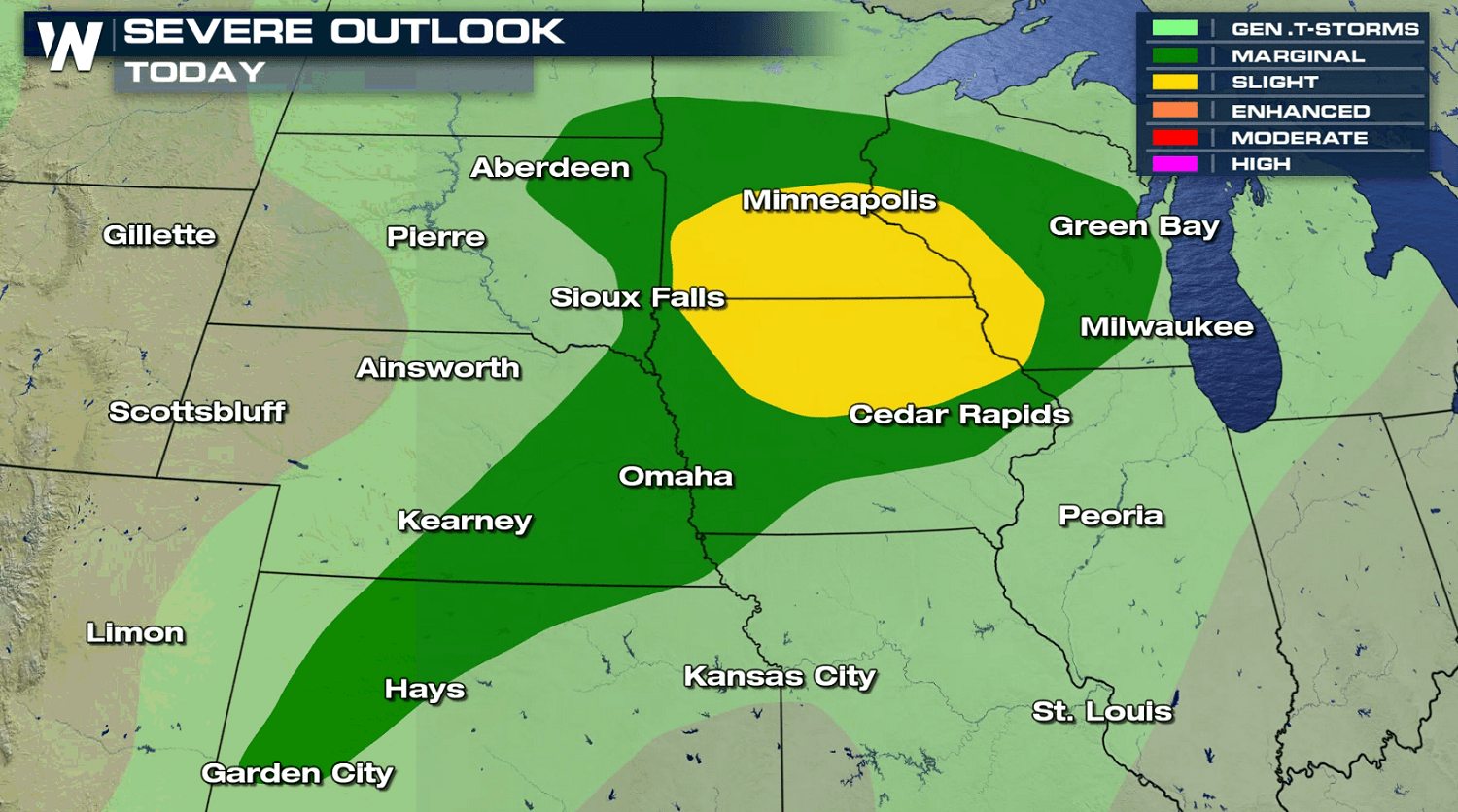
A storm system moving through the Upper Midwest will bring a threat for severe weather to start the work week. A slight risk for severe thunderstorms included parts of Minnesota, Wisconsin and Iowa. A few storms may produce large hail, strong wind gusts, and isolated tornadoes.
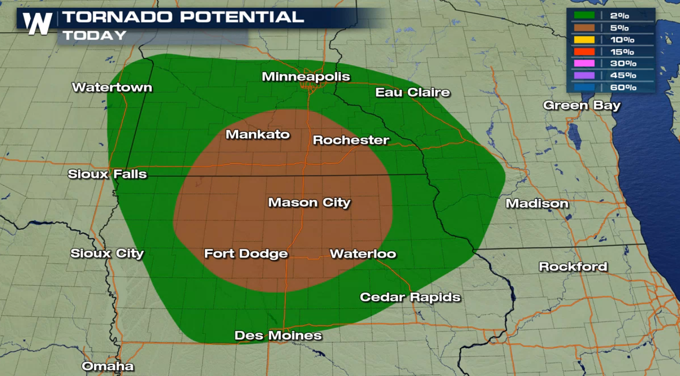
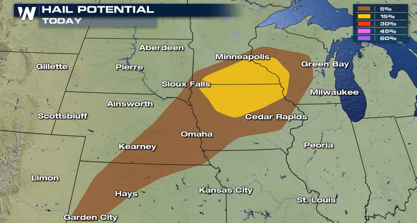
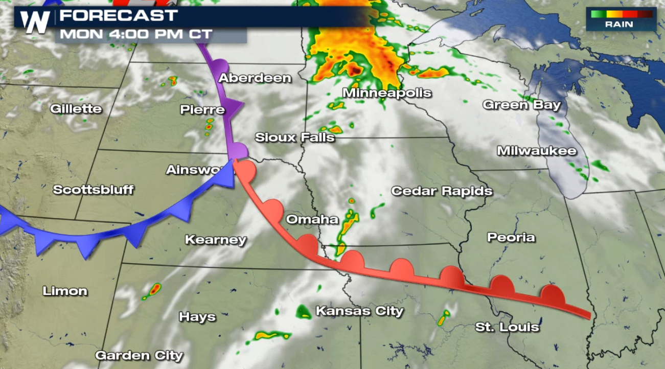
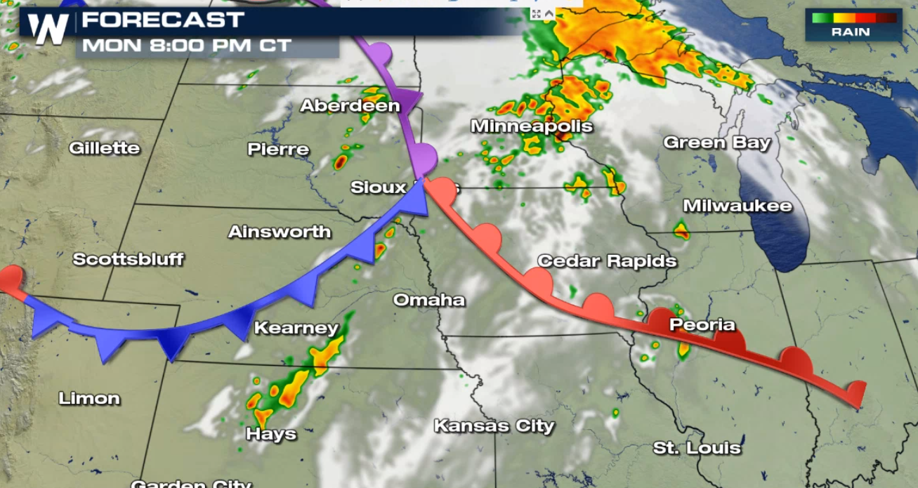
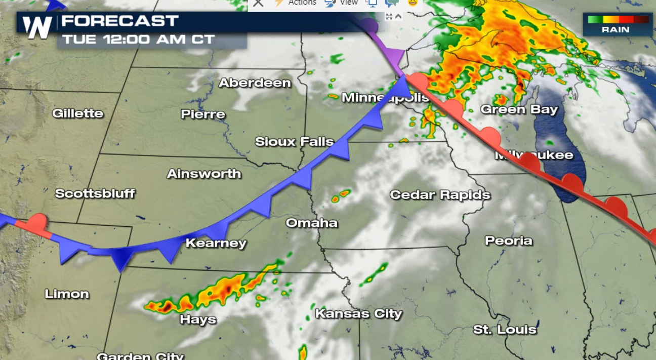
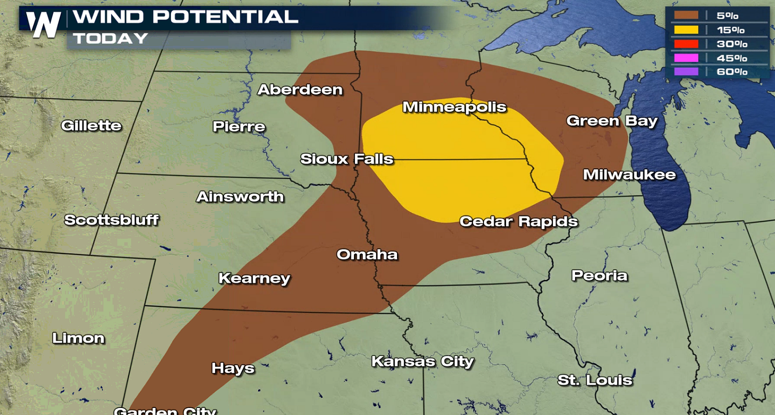 A warm front lifting northward coupled with a low pressure center and cold front from the West will produce several rounds of thunderstorms. Robust Jet Stream energy and increasing wind shear will aid in severe thunderstorm development. The most likely area for severe storms will be north of the warm front and near the triple point. That's the axis of where the the cold front, warm front, and occluded front merge together.
 Stay tuned to WeatherNation on-air and online for severe weather updates.
For WeatherNation: Meteorologist Mace Michaels
Stay tuned to WeatherNation on-air and online for severe weather updates.
For WeatherNation: Meteorologist Mace Michaels
A warm front lifting northward coupled with a low pressure center and cold front from the West will produce several rounds of thunderstorms. Robust Jet Stream energy and increasing wind shear will aid in severe thunderstorm development. The most likely area for severe storms will be north of the warm front and near the triple point. That's the axis of where the the cold front, warm front, and occluded front merge together.
Stay tuned to WeatherNation on-air and online for severe weather updates.
For WeatherNation: Meteorologist Mace MichaelsAll Weather News
More

Flooding, Severe Storms Target the Midwest Again
After an active week of storms across the nor
31 Jul 2026 11:15 PM


After Reaching Category 5, Genevieve Weakens in the Pacific
PacificFausto is now a post-tropical cyclone.
31 Jul 2026 1:30 AM

Flooding Risk Increases as Heavy Rain Targets the Tri-State Area
Tuesday, heavy rainfall moved across the Nort
30 Jul 2026 12:25 AM

Severe Weather: Energy From the Midwest Now in the Southeast
UPPER MIDWEST - Through Monday, dangerous tor
29 Jul 2026 10:30 PM