Thunderstorms and Heavy Rain Today from the Ohio Valley to the Gulf Coast
Top Stories
5 Feb 2019 3:35 AM
Increasing moisture out of the Gulf of Mexico and a stalled frontal boundary will be the focus for showers and storms today. This particular set-up could lead to heavy rain from the Ohio Valley to the Gulf Coast. Here is the very latest.
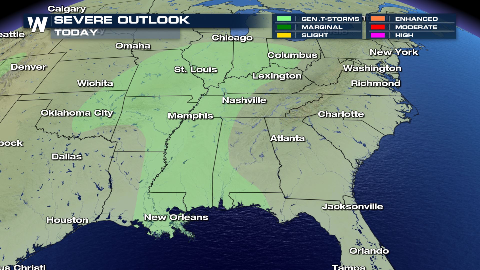 Severe chances will be very low, but some storms that develop today could contain heavy rain and gusty winds.
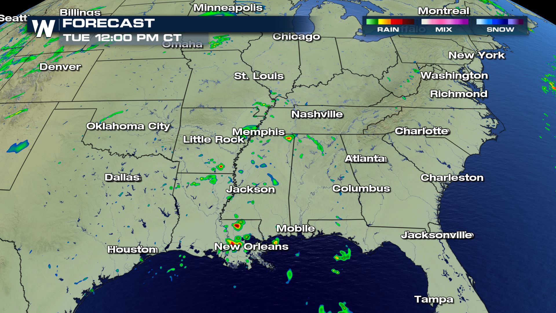
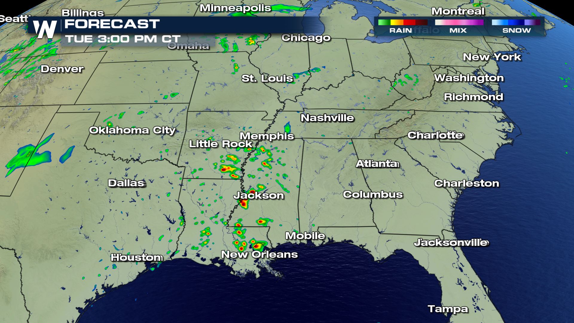
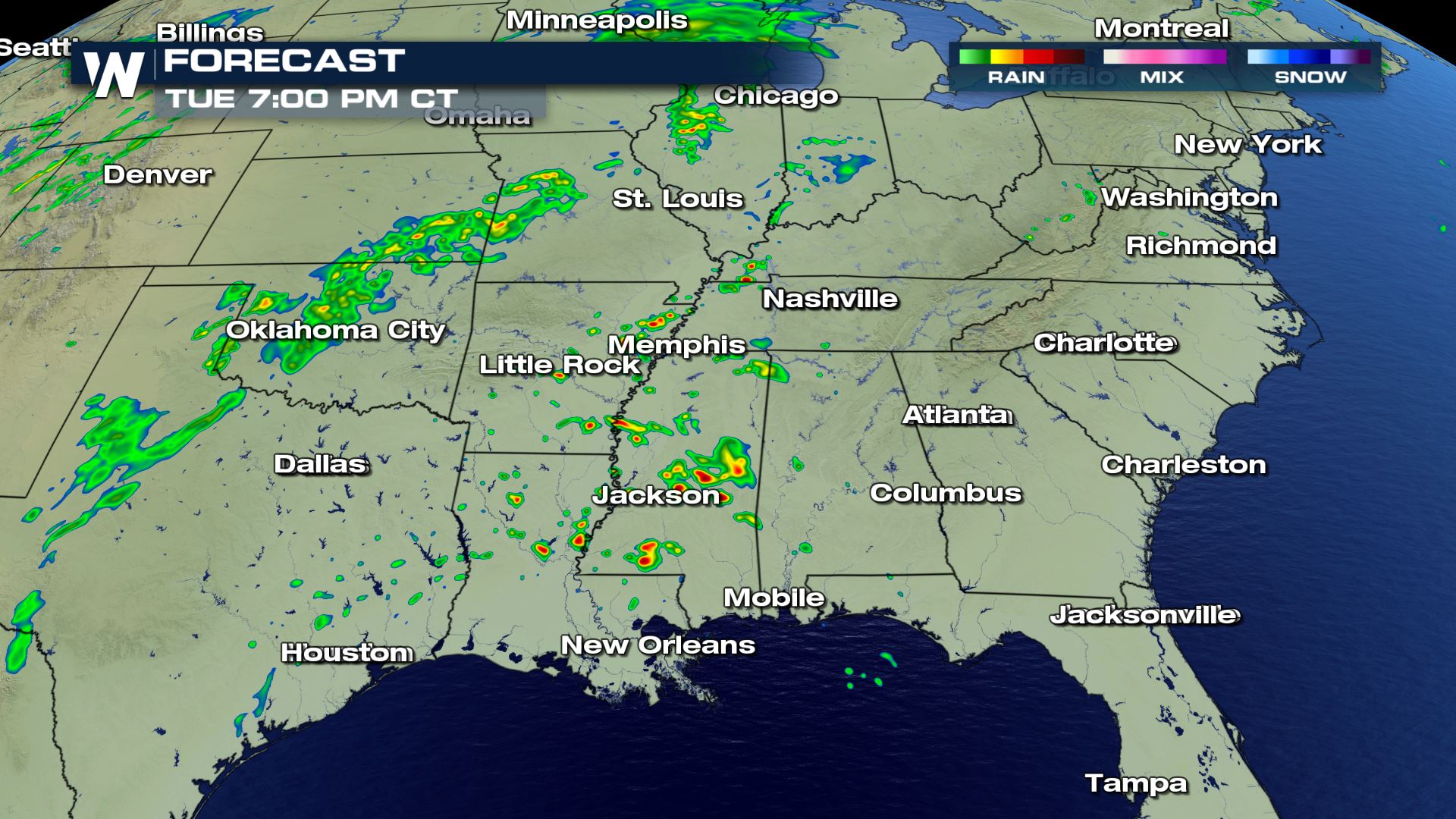
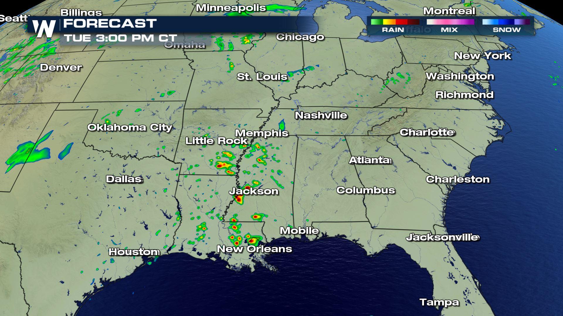
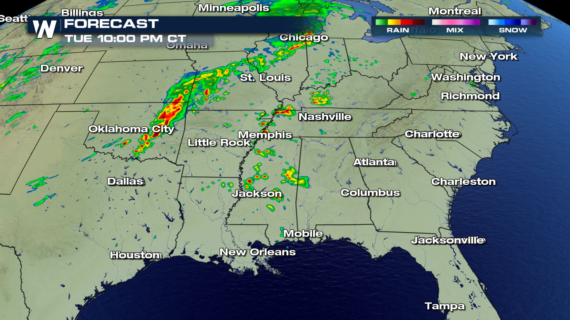 The timing of today's storms will be throughout Tuesday. Most of the storms stay in the lower Mississippi Valley for the first half of the day, before the storm chances become more widespread into the evening. We might need to keep an eye on a severe risk into eastern Oklahoma by early Wednesday morning for damaging winds.
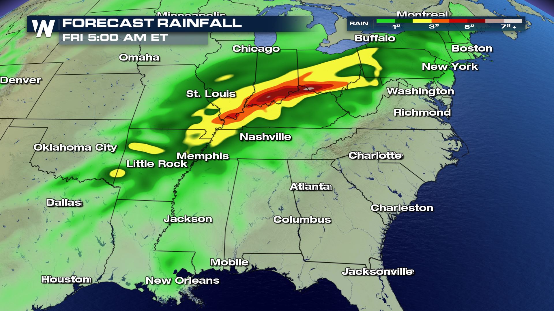 The heavy rain will be the biggest weather risk over the next few days. Take a look at some of the major rainfall in the forecast for parts of Illinois, Indiana and Ohio. Some areas could exceed 5 inches by Friday morning. Flash flood will be possible so please be safe in these areas.
WeatherNation will have more updates throughout the day.
The heavy rain will be the biggest weather risk over the next few days. Take a look at some of the major rainfall in the forecast for parts of Illinois, Indiana and Ohio. Some areas could exceed 5 inches by Friday morning. Flash flood will be possible so please be safe in these areas.
WeatherNation will have more updates throughout the day.
Severe Outlook
Severe chances will be very low, but some storms that develop today could contain heavy rain and gusty winds.
Forecast
The timing of today's storms will be throughout Tuesday. Most of the storms stay in the lower Mississippi Valley for the first half of the day, before the storm chances become more widespread into the evening. We might need to keep an eye on a severe risk into eastern Oklahoma by early Wednesday morning for damaging winds.
Rainfall Potential
The heavy rain will be the biggest weather risk over the next few days. Take a look at some of the major rainfall in the forecast for parts of Illinois, Indiana and Ohio. Some areas could exceed 5 inches by Friday morning. Flash flood will be possible so please be safe in these areas.
WeatherNation will have more updates throughout the day.All Weather News
More
Tropics: Fausto Heads towards Hawaii; Genevieve Cat 4 Hurricane
PacificHurricane Fausto continues to track we
27 Jul 2026 11:00 PM

Severe Storms Target the Midwest to the Northeast
UPPER MIDWEST - Dangerous tornadoes have alre
27 Jul 2026 10:20 PM


Southeast Flood Risk Lingers Near Stalled Front
A stalled boundary over the Southeast will ke
25 Jul 2026 10:55 AM

Another Round of Storms Targets the Northeast
Tuesday brought severe weather again across p
23 Jul 2026 1:15 AM

Another Round of Severe Weather for the Upper Midwest and Great Lakes
The upper-level low train continues to keep t
21 Jul 2026 1:45 AM