Thursday Severe Update
Top Stories
14 Jun 2018 5:46 AM
Severe storms are in the forecast the High Plains on Thursday. All modes of severe weather will be possible with damaging winds, large hail and a few tornadoes all being possible. Here is the very latest.
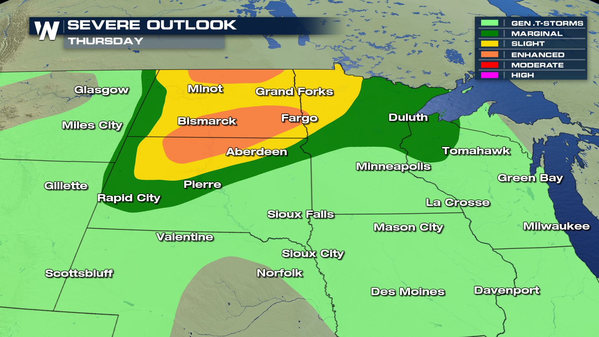 The highest risk for severe weather will be over the Dakotas and NW Minnesota.
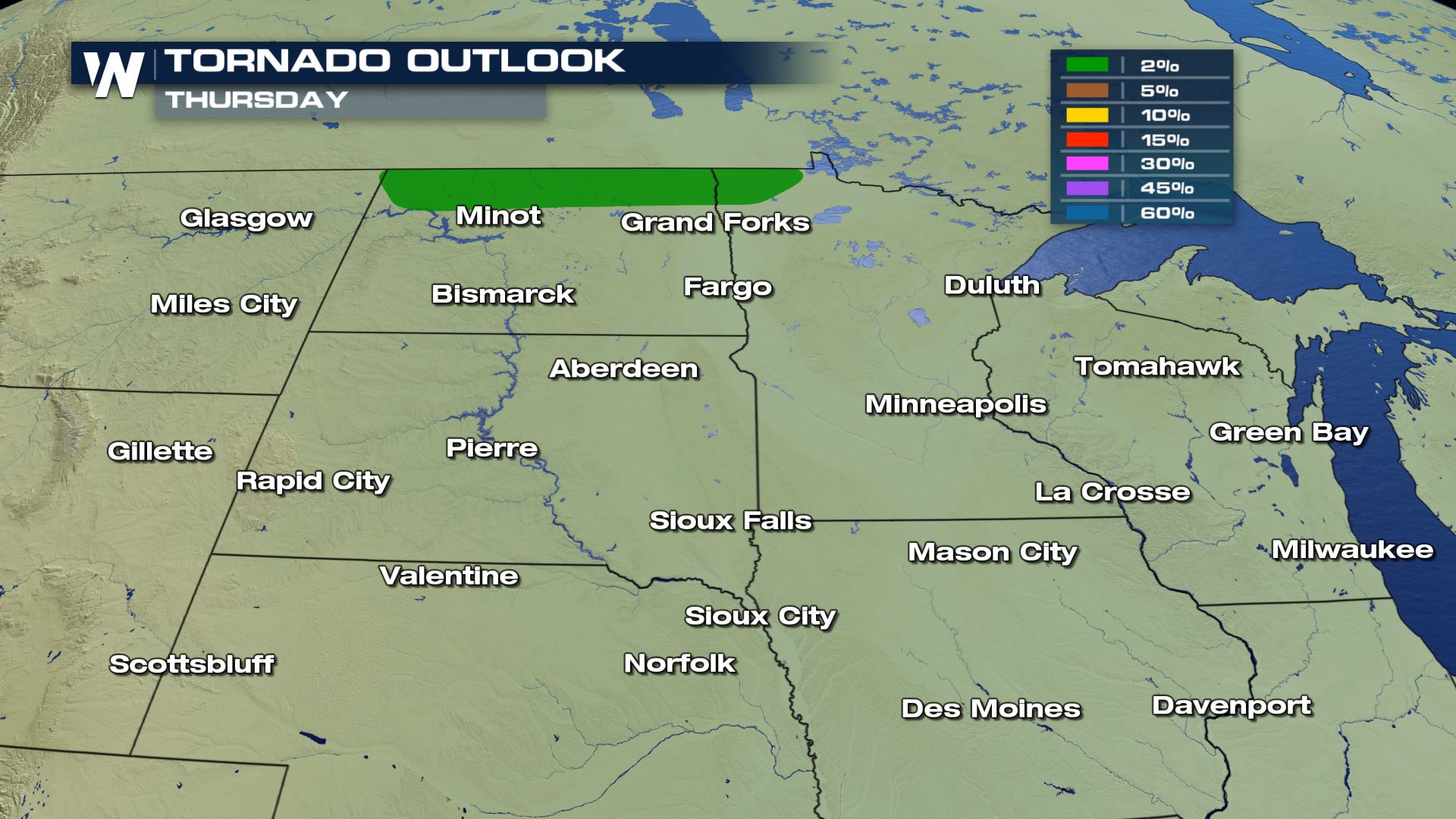

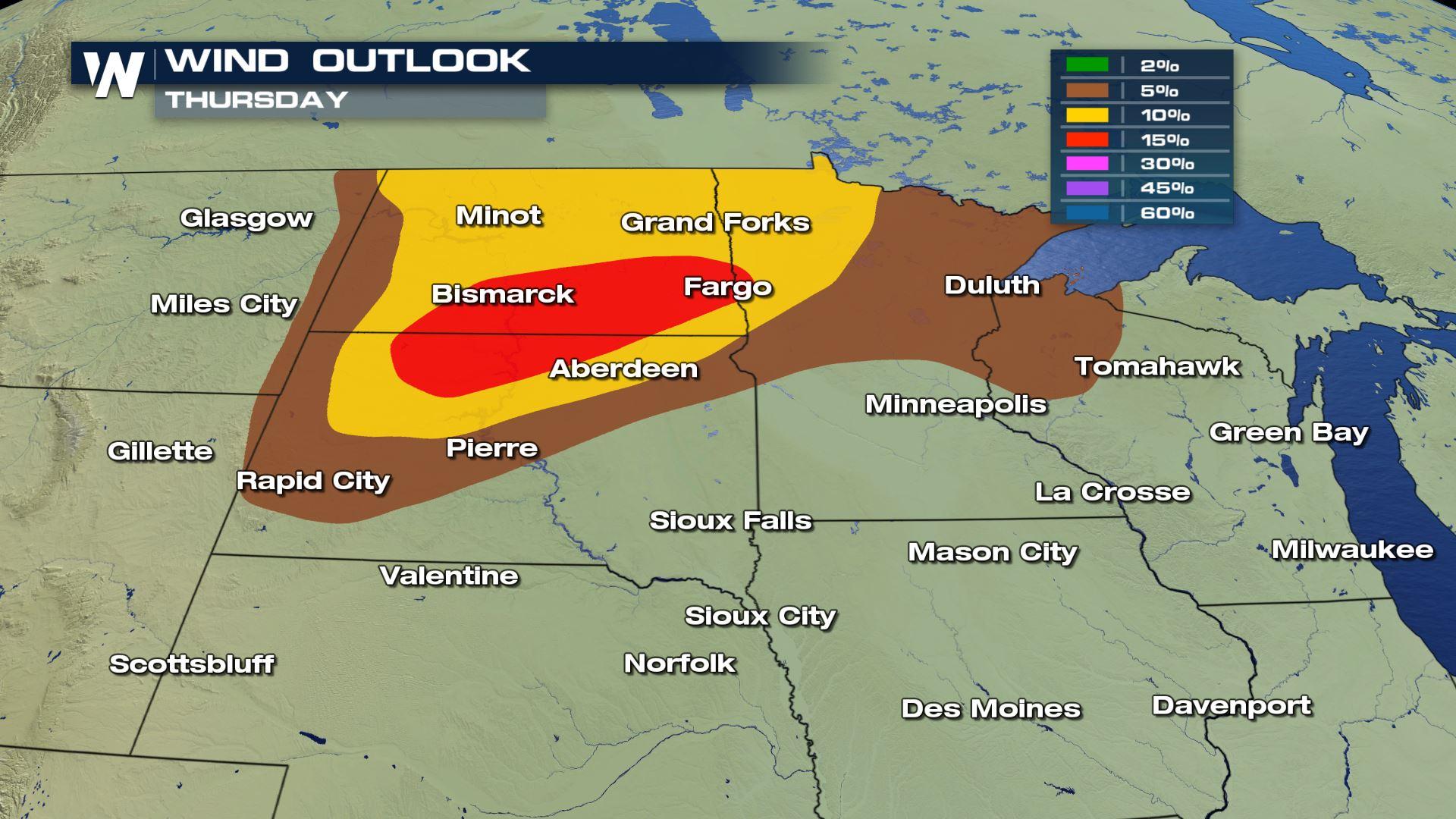
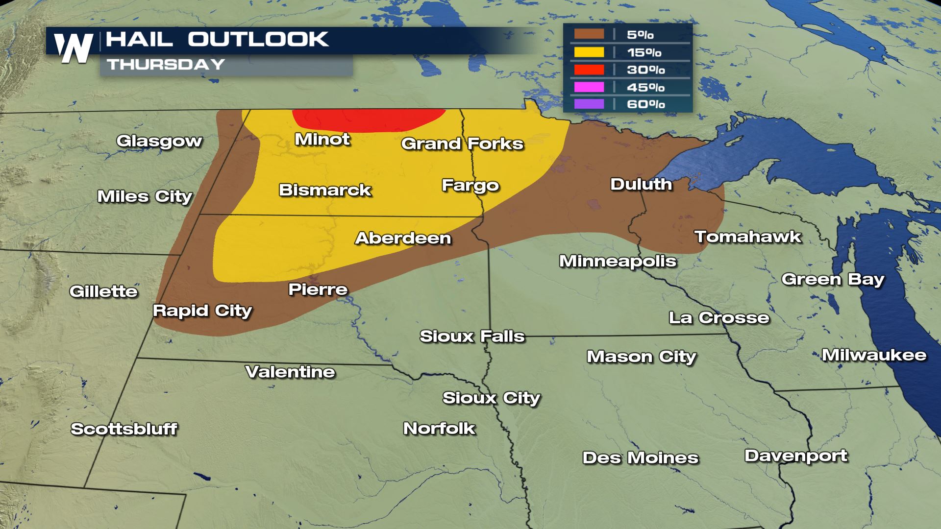 Damaging winds and large hail will be the main severe weather risks with an isolated tornado risk for northern North Dakota as well. The timing for these storms will be for the afternoon and evening. Keep checking back with WeatherNation for the very latest.
Meteorologist Patrick Crawford
Damaging winds and large hail will be the main severe weather risks with an isolated tornado risk for northern North Dakota as well. The timing for these storms will be for the afternoon and evening. Keep checking back with WeatherNation for the very latest.
Meteorologist Patrick Crawford
Severe Outlook
The highest risk for severe weather will be over the Dakotas and NW Minnesota.
Severe Risks
All the severe weather risks will be in these locations.
Damaging winds and large hail will be the main severe weather risks with an isolated tornado risk for northern North Dakota as well. The timing for these storms will be for the afternoon and evening. Keep checking back with WeatherNation for the very latest.
Meteorologist Patrick Crawford
All Weather News
More
More Storms for the East Through Monday
A low-pressure system that moved through the
2 Aug 2026 10:40 PM

Wildfire Outbreak in the Pacific Northwest
SPOKANE, WA - On Saturday, August 1st, the Ol
2 Aug 2026 10:35 PM


After Reaching Category 5, Genevieve Weakens in the Pacific
PacificGenevieve formed on last Friday south
2 Aug 2026 6:25 PM

Flooding, Severe Storms Target the Midwest Again
After an active week of storms across the nor
1 Aug 2026 1:40 AM

Flooding Risk Increases as Heavy Rain Targets the Tri-State Area
Tuesday, heavy rainfall moved across the Nort
30 Jul 2026 12:25 AM

Severe Weather: Energy From the Midwest Now in the Southeast
UPPER MIDWEST - Through Monday, dangerous tor
29 Jul 2026 10:30 PM