Tonight: Big Boomer Storms For WY, CO, NE, KS
Special Stories
17 Jul 2018 3:49 PM
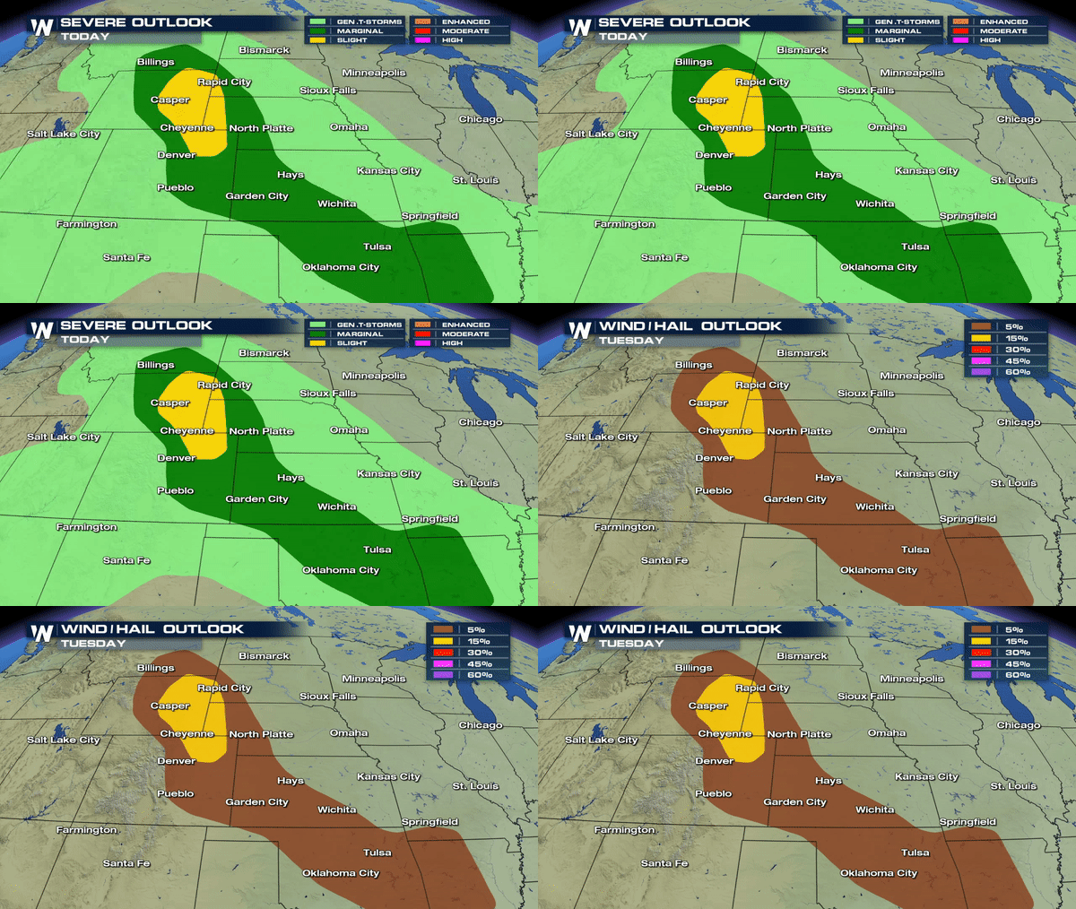
Good flow of moisture moving in from the south is meeting up with a disturbance moving in from the West to yield a few strong storms across parts of the Plains this afternoon and early evening
 Severe T-Storm Watch until 11pm MDT for parts of Colorado, Nebraska, Wyoming and South Dakota
https://twitter.com/WeatherNation/status/1019329810122674176
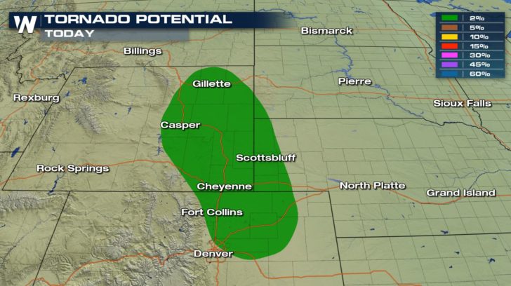
Most of the storms today will produce strong winds and hail;however, there is an isolated tornado potential for areas farther north into Wyoming.
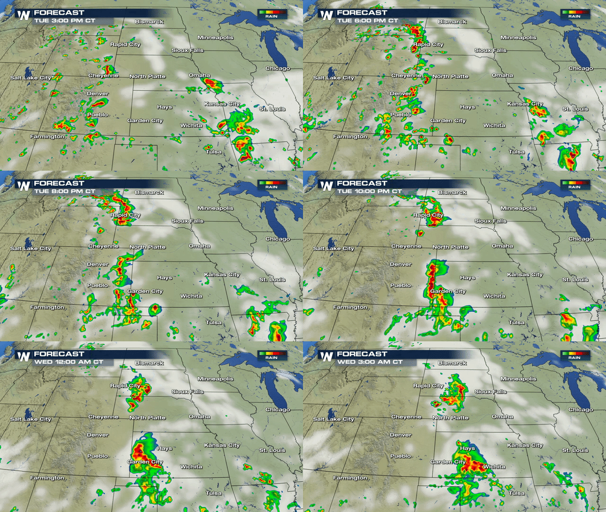
 Forecast model below shows the pattern of these storms by the early evening hours as they continue to track east producing all modes of severe weather. As we approach the midnight hours, most storms will likely remain big wind producers so secure any outdoor items before bedtime if you're joining us from Kansas, Nebraska or South Dakota.
 Stay weather alert
Meteorologist Merry Matthews
 Severe T-Storm Watch until 11pm MDT for parts of Colorado, Nebraska, Wyoming and South Dakota
https://twitter.com/WeatherNation/status/1019329810122674176
Most of the storms today will produce strong winds and hail;however, there is an isolated tornado potential for areas farther north into Wyoming.
 Forecast model below shows the pattern of these storms by the early evening hours as they continue to track east producing all modes of severe weather. As we approach the midnight hours, most storms will likely remain big wind producers so secure any outdoor items before bedtime if you're joining us from Kansas, Nebraska or South Dakota.
 Stay weather alert
Meteorologist Merry Matthews
All Weather News
More