Tornado, Hail, and Flood Threat Grows Across Central U.S.

A widespread and dangerous severe weather outbreak is ramping up again across the central and eastern United States from Texas to New York. This renewed threat comes after several days of active storms that have already produced tornadoes, large hail, and damaging winds across portions of the Plains and Midwest.
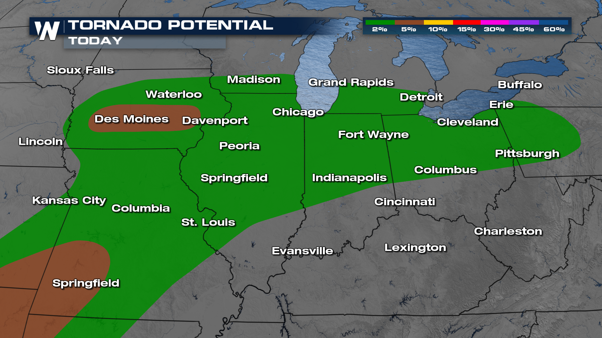
The greatest concern is centered over parts of the Midwest, including areas from eastern Iowa into southern Wisconsin and northern Illinois, where conditions are favorable for intense thunderstorms. These storms could quickly turn severe, bringing the risk of very large hail, powerful wind gusts, and the potential for strong tornadoes.
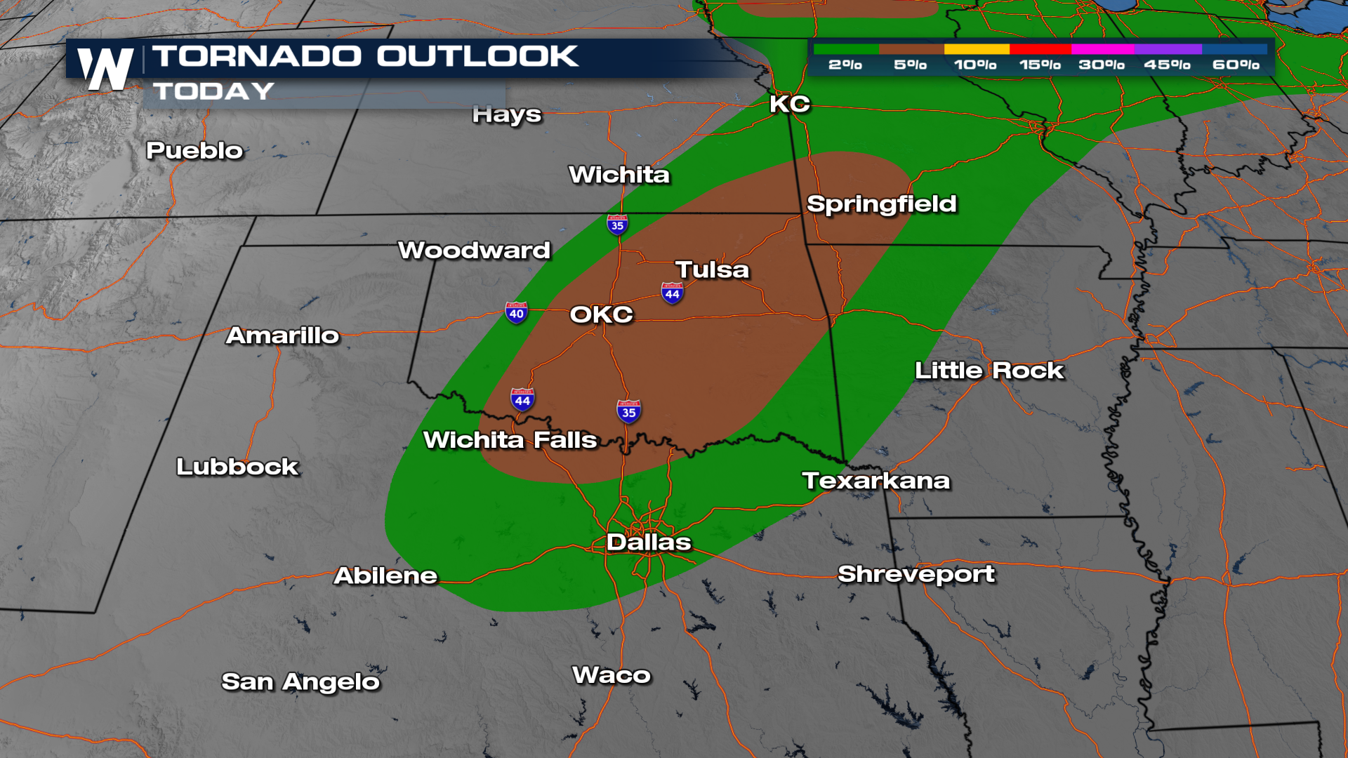
Farther south, storms are also expected to develop along a dryline and frontal boundary stretching through Oklahoma and North Texas. This setup will provide the energy and wind dynamics needed for rotating storms, increasing the likelihood of additional severe weather, including tornadoes and damaging hail.
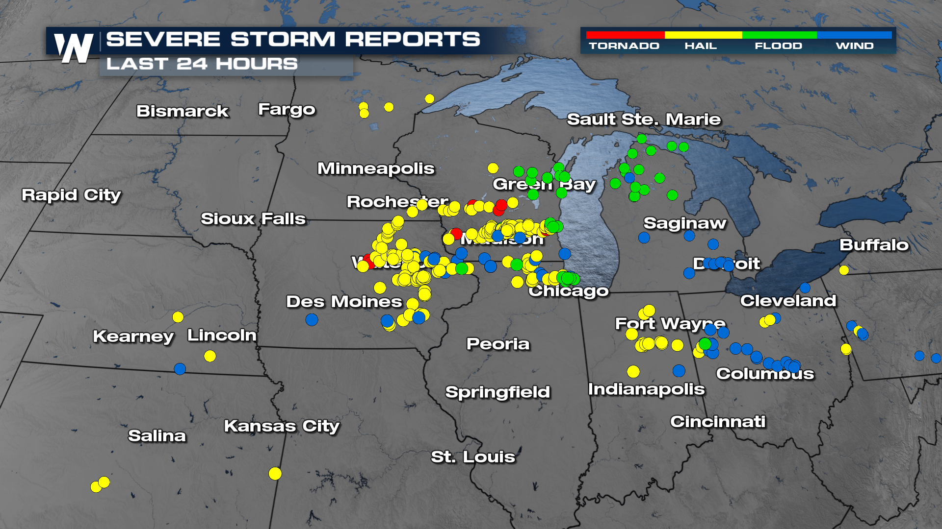
This latest round follows earlier severe weather that caused damage in several states. Reports of tornadoes and large hail have already come in from parts of Kansas, Minnesota, and Wisconsin, with some communities dealing with structural damage and injuries. The threat of tornadoes is possible again on Wednesday.
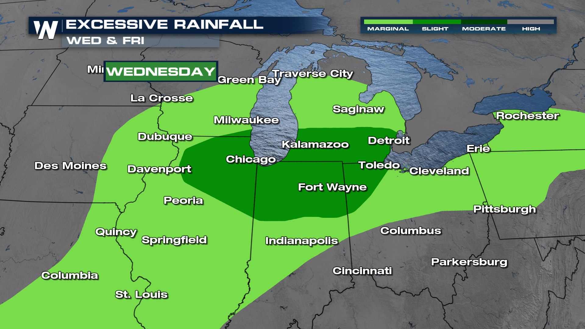
The storm system is expected to continue pushing east, spreading the severe weather threat into the Great Lakes, Ohio Valley, and eventually parts of the Northeast. Along with the threat of tornadoes and damaging winds, repeated rounds of storms could bring heavy rainfall, raising concerns for flash flooding in some areas.
Overall, the pattern reflects a classic spring severe weather setup, with warm, humid air clashing with cooler, drier air, creating the perfect environment for multiple rounds of strong to severe thunderstorms through the week.
Tune into WeatherNation TV for more details.


