Strong Storms Tore Through the Midwest and South on Monday

Strong storms brought numerous severe thunderstorms and tornado warnings from Wisconsin and down through Texas Monday afternoon to evening. So far, no tornadoes have been confirmed, but we wait to hear from the National Weather Services of Milwaukee and the Quad Cities for the details.
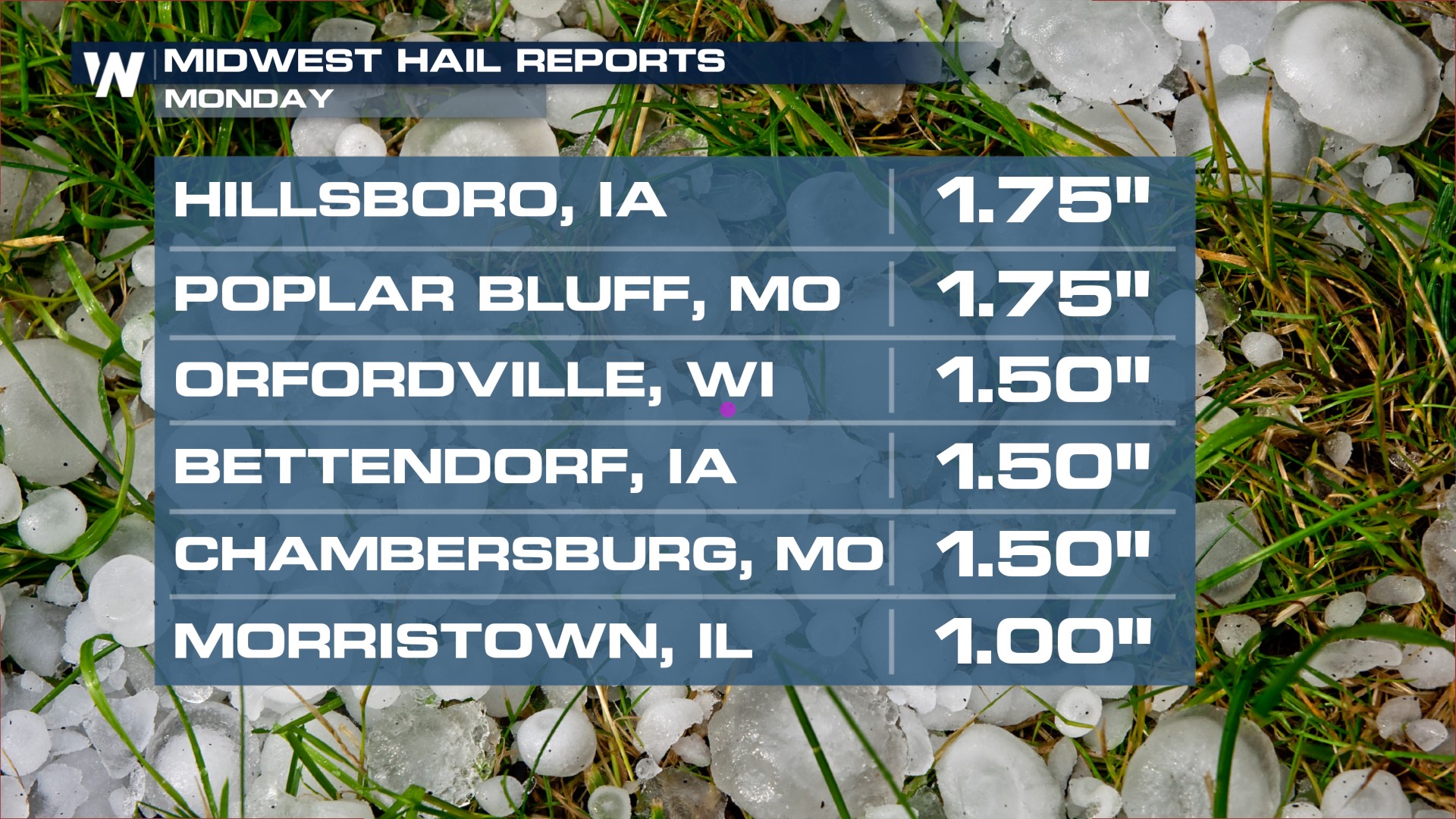
Below showcases the vast amount of hail reports we saw across much of the Central U.S. Hail reports are the yellow dots and the blue dots show us where reported strong winds.
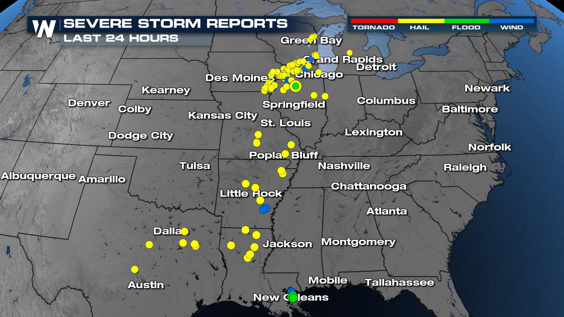
Golf ball-sized hail pelleted parts of Iowa and Missouri Monday afternoon. It was more common to see quarter-sized hail reports farther to the south. Quarter-sized hail is still large enough to produce a little bit of damage.
Someone was able to record one of the storms that rolled through Milwaukee Monday night where the lightning was abundant and the small hail started to accumulate.
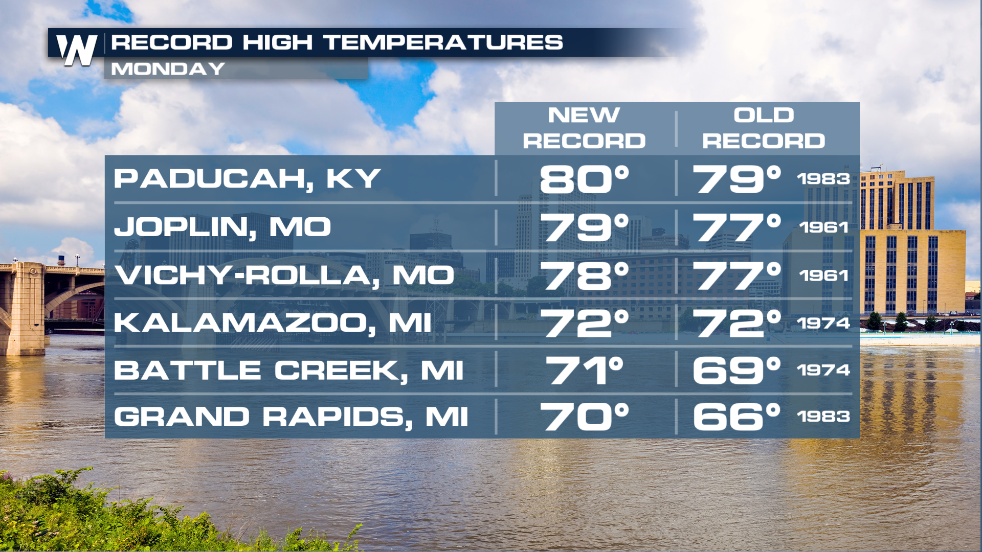
One of the contributing factors to the severe weather threat we had yesterday was the abnormal warmth. We tied or broke many records across the northern tier of the country with widespread highs in the 70s and 80s. For many areas around the Great Lakes and Northeast, highs are normally only in the 40s, so this warmth is quite unusual.
With more storm chances in our future ahead, I encourage you to check out this article for new updates on the threat for the South.


