Tornadoes Caught On Camera In Texas
Special Stories
16 May 2020 8:29 PM
Multiple tornadoes touched down in the Ark-La-Tex region of the South on Saturday. These were confirmed by numerous videos of the unfolding events. Here are just a couple of the examples:
https://twitter.com/WeatherNation/status/1261791829382459392
https://www.facebook.com/WeatherNation/videos/526389518008509/
These tornadoes were moving in a unique direction, to the *northwest* on Saturday. Generally the storms in this part of the country move from west to east, however an unusually-strong low pressure system over Texas was spinning these storms to move in a contrary trajectory.
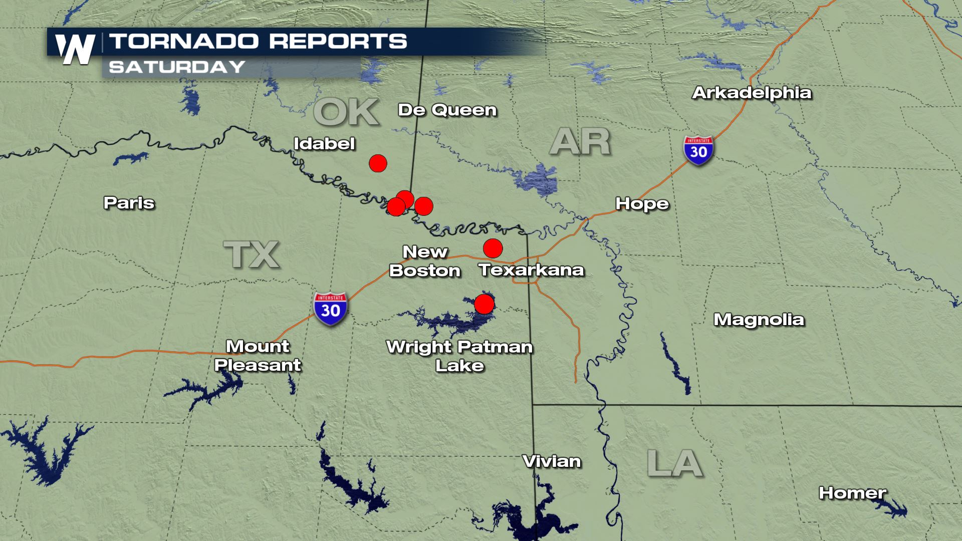 The red dots pictured above show where the reports of tornadoes were on Saturday. The video above was from Wright Patman Lake, which is near the bottom-most red dot on the map.
The severe thunderstorms *should* diminish through the overnight hours and into early Sunday morning, May 17th. However, a few lingering downpours and storms could cause brief, minor flooding as well as strong, gusty winds.
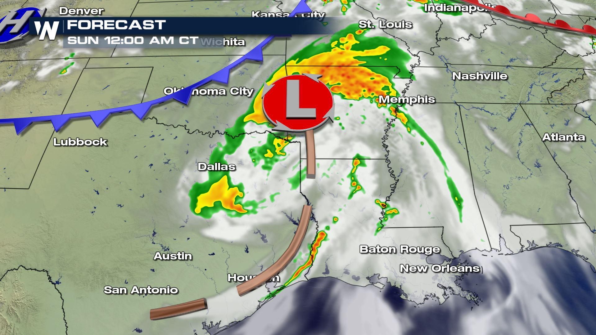
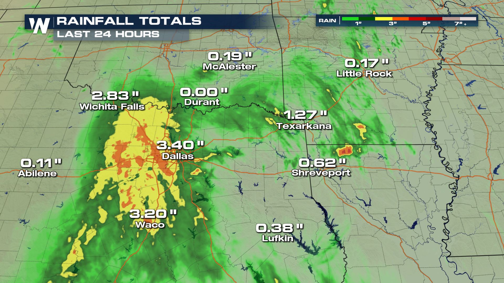
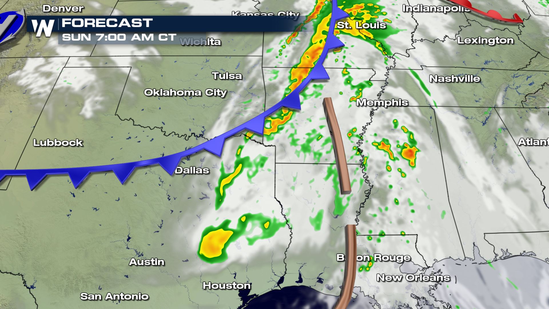 Flooding will be possible overnight because of the recent heavy rainfall. Widespread, heavy rain accumulations of two to four inches occurred across the Dallas-Ft. Worth metro and flooding reports came in from the adjacent states too.
 The rain chances will diminish with time through Sunday but in the meantime, be safe!
 The red dots pictured above show where the reports of tornadoes were on Saturday. The video above was from Wright Patman Lake, which is near the bottom-most red dot on the map.
The severe thunderstorms *should* diminish through the overnight hours and into early Sunday morning, May 17th. However, a few lingering downpours and storms could cause brief, minor flooding as well as strong, gusty winds.

 Flooding will be possible overnight because of the recent heavy rainfall. Widespread, heavy rain accumulations of two to four inches occurred across the Dallas-Ft. Worth metro and flooding reports came in from the adjacent states too.
 The rain chances will diminish with time through Sunday but in the meantime, be safe!
All Weather News
More