Laura now a remnant low, still causing rain and storms
Special Stories
29 Aug 2020 9:00 AM
https://www.facebook.com/WeatherNation/videos/734402294070771
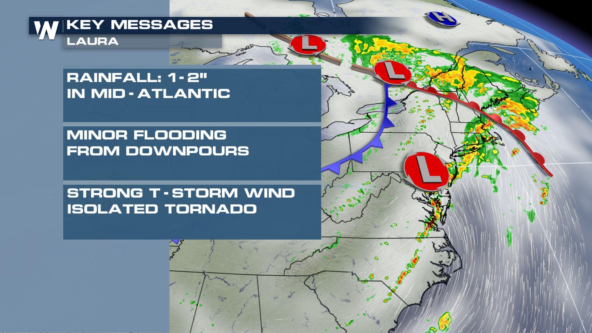
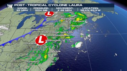
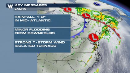
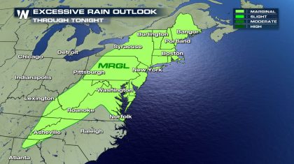
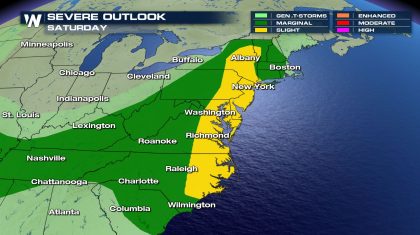
Laura was once a powerful Category 4 hurricane but weakened into a remnant low Saturday morning. The storm has lost all tropical characteristics and is merging with a cold front. Laura's winds are down to 25 mph with higher gusts. Heavy rain is ongoing throughout the Mid-Atlantic and Northeast associated with Laura as well as the cold front it will be absorbed into later Saturday. Flooding remains a concern from the mountains of North Carolina north through the Northeast. Brief spin-up tornadoes are possible for eastern North Carolina through the Delmarva area and into much of the Northeast.
 Laura made landfall near Cameron, Louisiana around 1 am CT on Thursday August 27 as a Category 4 Hurricane with sustained winds around 150 mph. Destructive winds caused widespread structural damage across parts of southwest Louisiana. Rain totals across the upper Texas coast and southwest Louisiana topped 9" in some spots. At one time more than 900,000 customers were without power in Texas, Louisiana and Arkansas.
The remnants of Laura will merge with a cold front passing through the northern United States Saturday. This will set the stage for scattered severe thunderstorms in the Mid-Atlantic and Northeastern US especially into the later afternoon hours. Gusty winds and brief spin-up tornadoes are possible.
Laura made landfall near Cameron, Louisiana around 1 am CT on Thursday August 27 as a Category 4 Hurricane with sustained winds around 150 mph. Destructive winds caused widespread structural damage across parts of southwest Louisiana. Rain totals across the upper Texas coast and southwest Louisiana topped 9" in some spots. At one time more than 900,000 customers were without power in Texas, Louisiana and Arkansas.
The remnants of Laura will merge with a cold front passing through the northern United States Saturday. This will set the stage for scattered severe thunderstorms in the Mid-Atlantic and Northeastern US especially into the later afternoon hours. Gusty winds and brief spin-up tornadoes are possible.
 Any remaining thunderstorms will move into the Atlantic Ocean Saturday night. By Sunday Laura's remnants will be offshore in the open Atlantic waters and fully merged with a frontal system over southern Canada.
 By Sunday Laura's remnants will be offshore in the open Atlantic waters and fully merged with a frontal system over southern Canada.
 WeatherNation will keep you up-to-date on-air and online with the latest information regarding Laura.
Laura made landfall near Cameron, Louisiana around 1 am CT on Thursday August 27 as a Category 4 Hurricane with sustained winds around 150 mph. Destructive winds caused widespread structural damage across parts of southwest Louisiana. Rain totals across the upper Texas coast and southwest Louisiana topped 9" in some spots. At one time more than 900,000 customers were without power in Texas, Louisiana and Arkansas.
The remnants of Laura will merge with a cold front passing through the northern United States Saturday. This will set the stage for scattered severe thunderstorms in the Mid-Atlantic and Northeastern US especially into the later afternoon hours. Gusty winds and brief spin-up tornadoes are possible.
Any remaining thunderstorms will move into the Atlantic Ocean Saturday night. By Sunday Laura's remnants will be offshore in the open Atlantic waters and fully merged with a frontal system over southern Canada.
By Sunday Laura's remnants will be offshore in the open Atlantic waters and fully merged with a frontal system over southern Canada.
WeatherNation will keep you up-to-date on-air and online with the latest information regarding Laura.All Weather News
More


More Storms for the East Through Monday
A low-pressure system that moved through the
3 Aug 2026 1:50 AM

After Reaching Category 5, Genevieve Weakens in the Pacific
PacificGenevieve formed last Friday south of
3 Aug 2026 12:30 AM

Flooding, Severe Storms Target the Midwest Again
After an active week of storms across the nor
1 Aug 2026 1:40 AM

Flooding Risk Increases as Heavy Rain Targets the Tri-State Area
Tuesday, heavy rainfall moved across the Nort
30 Jul 2026 12:25 AM

Severe Weather: Energy From the Midwest Now in the Southeast
UPPER MIDWEST - Through Monday, dangerous tor
29 Jul 2026 10:30 PM