Tropical Development Likely Near the Greater Antillies
Special Stories
12 Nov 2018 10:41 AM
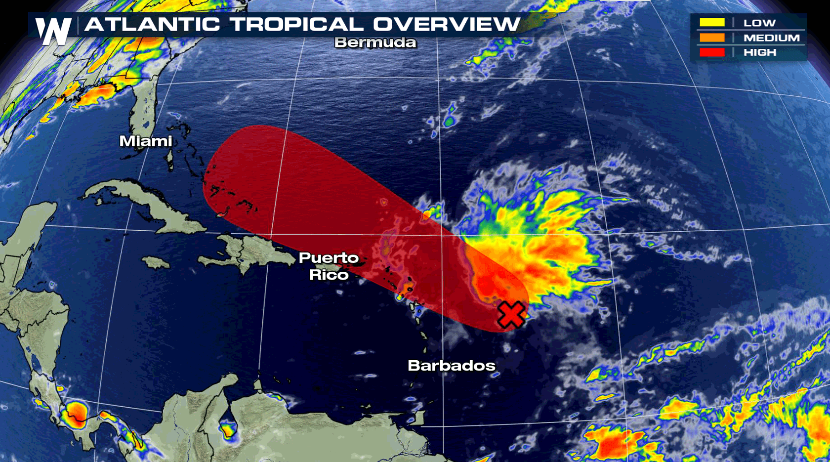
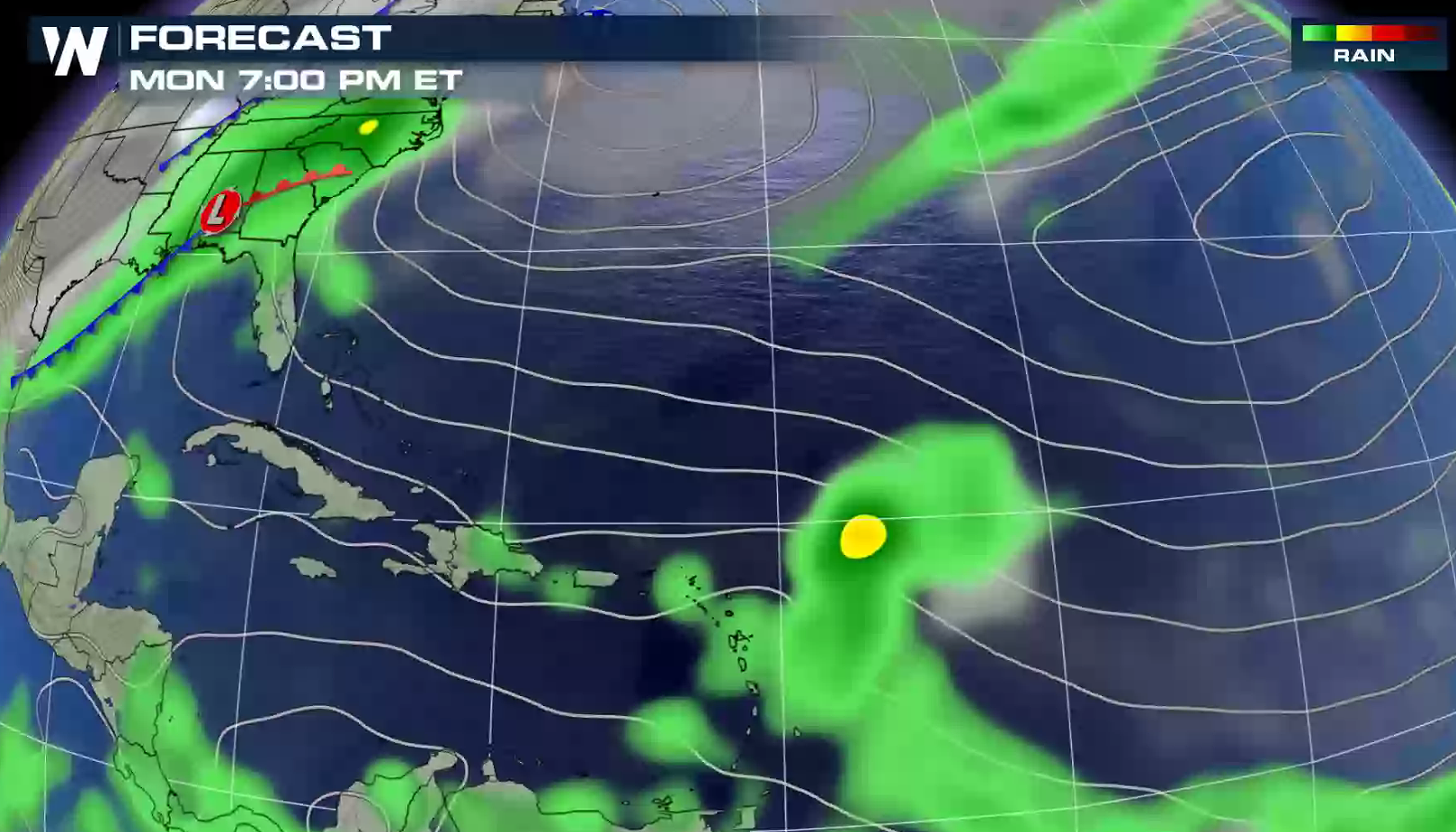
The 2018 Atlantic hurricane season is likely not over as the National Hurricane Center (NHC) is closely watching a strong disturbance around 200 miles east of the Leeward Islands. The vigorous tropical wave is producing a large area of disturbed weather with numerous showers and thunderstorms. Activity has increased and become a little more concentrated this morning. NHC has formation through 48 hours at 50 percent with a high chance at 5 days, listed at 90 percent.
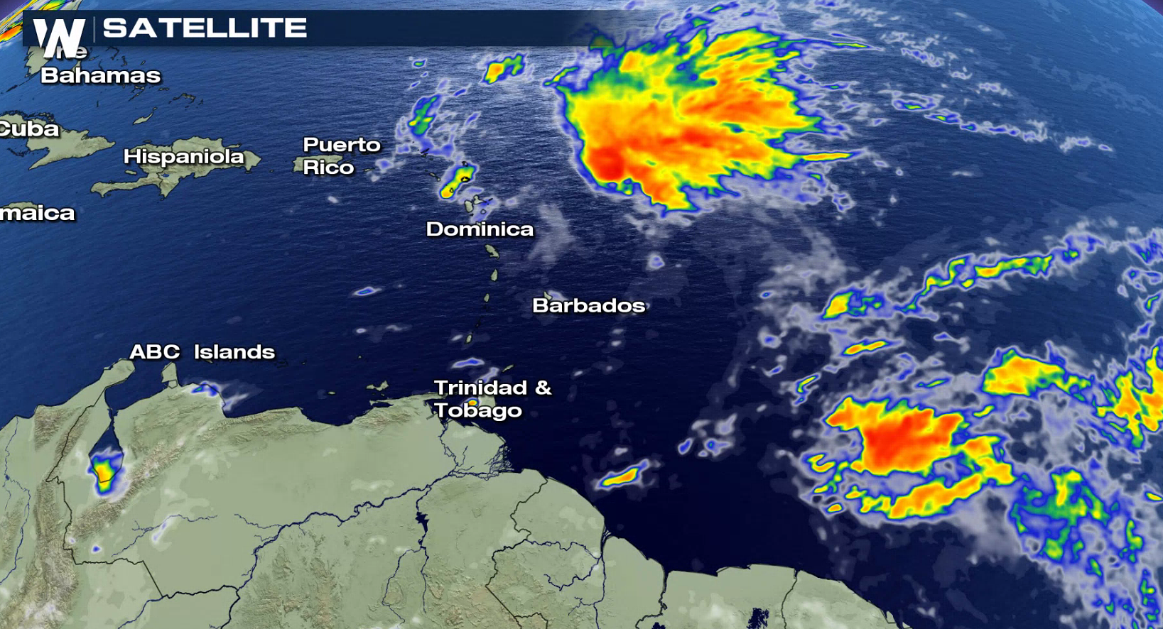
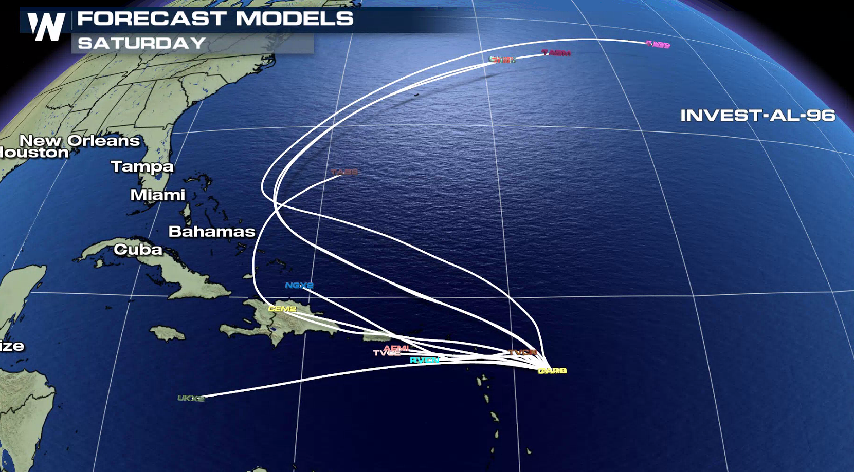
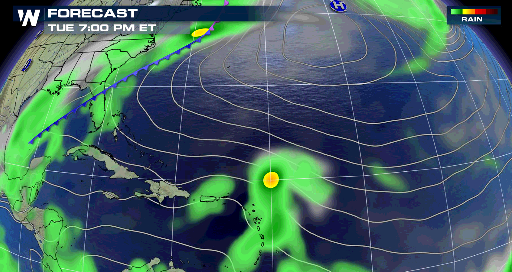
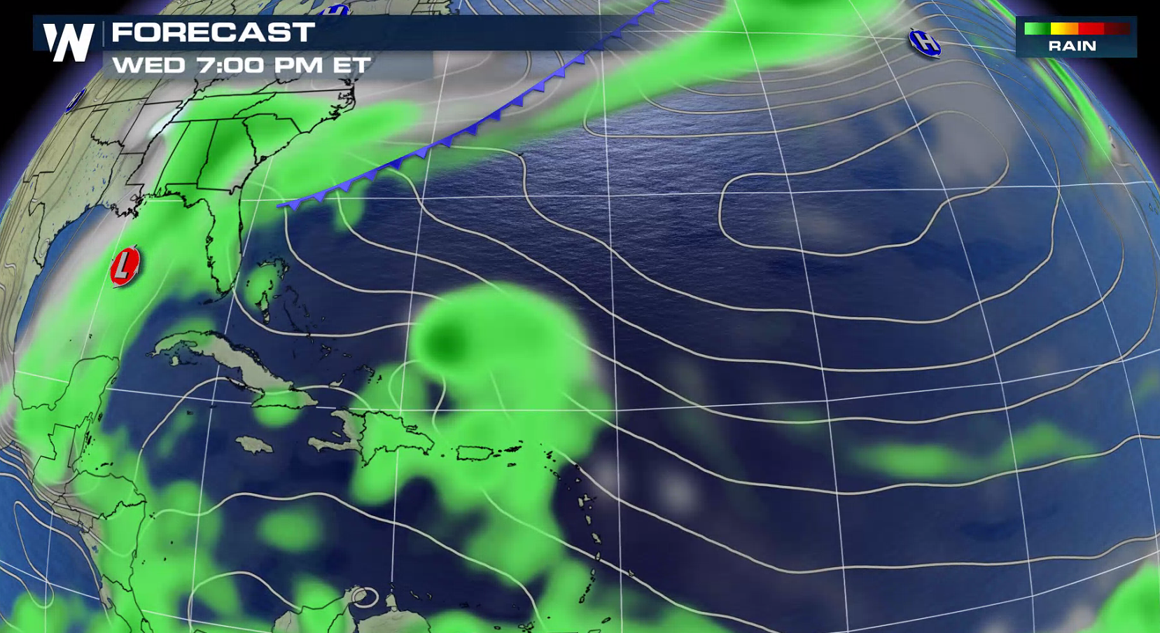
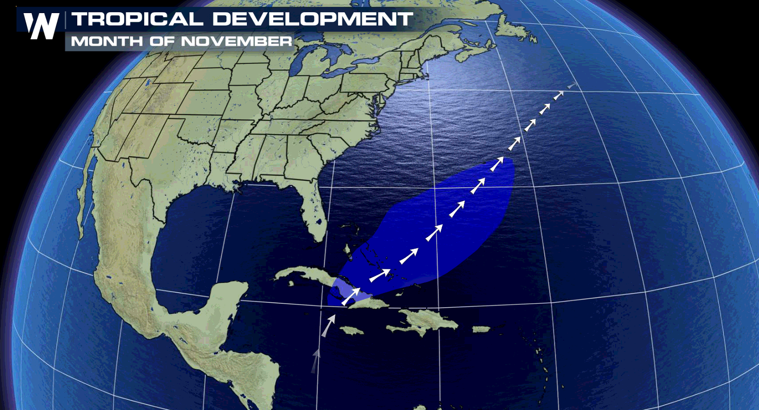 Known now as invest 96-L, if the system gets named, it would be called Patty. Environmental conditions are forecast to gradually become more conducive for the development of a tropical depression or a tropical storm during the next day or so. The disturbance is forecast to move west to northwest for the next few days, passing near or north of the Leeward Islands, Puerto Rico, Hispaniola, and the southeastern Bahamas. The system is in a favored area for development in November. Interests in these areas should closely monitor the progress of this system.
 For WeatherNation: Meteorologist Mace Michaels
Known now as invest 96-L, if the system gets named, it would be called Patty. Environmental conditions are forecast to gradually become more conducive for the development of a tropical depression or a tropical storm during the next day or so. The disturbance is forecast to move west to northwest for the next few days, passing near or north of the Leeward Islands, Puerto Rico, Hispaniola, and the southeastern Bahamas. The system is in a favored area for development in November. Interests in these areas should closely monitor the progress of this system.
For WeatherNation: Meteorologist Mace MichaelsAll Weather News
More
Wildfire Outbreak in the Pacific Northwest
SPOKANE, WA - On Saturday, August 1st, the Ol
3 Aug 2026 1:55 AM

More Storms for the East Through Monday
A low-pressure system that moved through the
3 Aug 2026 1:50 AM


After Reaching Category 5, Genevieve Weakens in the Pacific
PacificGenevieve formed last Friday south of
3 Aug 2026 12:30 AM

Flooding, Severe Storms Target the Midwest Again
After an active week of storms across the nor
1 Aug 2026 1:40 AM

Flooding Risk Increases as Heavy Rain Targets the Tri-State Area
Tuesday, heavy rainfall moved across the Nort
30 Jul 2026 12:25 AM

Severe Weather: Energy From the Midwest Now in the Southeast
UPPER MIDWEST - Through Monday, dangerous tor
29 Jul 2026 10:30 PM