Tropical Storm Tara Soaks Mexico
Special Stories
15 Oct 2018 4:43 PM
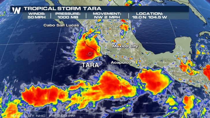
Tropical Storm Tara is the 19th named system to develop during the 2018 Eastern Pacific hurricane season. As of Monday evening, the center of Tara was located just offshore of the southwestern coast of Mexico. A sustained wind speed of 50 mph was observed with higher gusts.
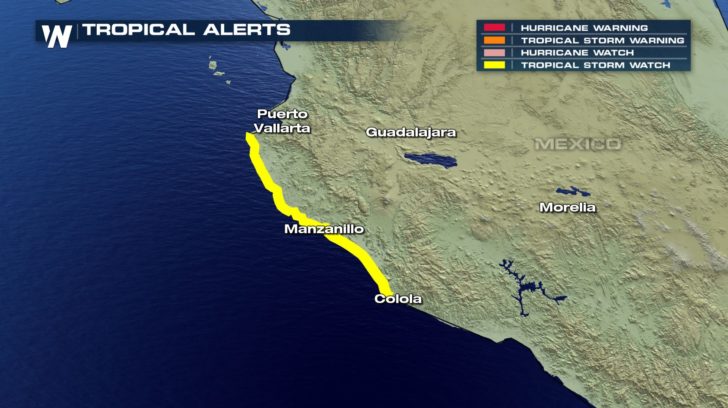
 Tropical Storm Watches were posted for areas between Punta San Telmo and Cabo Corrientes. Tropical Storm conditions will be possible late Monday night and Tuesday.
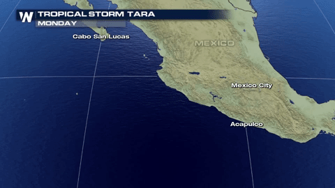
 With a slow and at times nearly stationary movement, this storm is expected to impact the same areas through midweek. This will result in the threat of flash flooding in the Mexican states of Michoacan, Colima, and Jalisco. Total rainfall accumulations of 4 to 8 inches with isolated amounts up to 12 inches are likely in coastal sections of these states.
 Looking ahead, another area of tropical development is possible in the Eastern Pacific basin. According to the National Hurricane Center, an area of low pressure is forecast to develop a couple hundred miles south of Guatemala and the southeastern coast of Mexico around midweek. Environmental conditions---low wind shear and warm sea surface temperatures---are forecast to be prime for development. A tropical depression will most likely form by late week as the system moves west-northwest along and near the southern coast of Mexico.
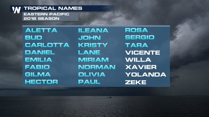
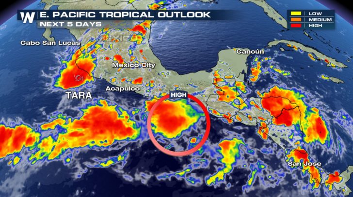 Should that be the case, Vicente would be name of the next storm.
 Keep it tuned to WeatherNation for the latest tropical updates and top weather stories.
- Meteorologist Joe Astolfi
Keep it tuned to WeatherNation for the latest tropical updates and top weather stories.
- Meteorologist Joe Astolfi
Tropical Storm Watches were posted for areas between Punta San Telmo and Cabo Corrientes. Tropical Storm conditions will be possible late Monday night and Tuesday.
With a slow and at times nearly stationary movement, this storm is expected to impact the same areas through midweek. This will result in the threat of flash flooding in the Mexican states of Michoacan, Colima, and Jalisco. Total rainfall accumulations of 4 to 8 inches with isolated amounts up to 12 inches are likely in coastal sections of these states.
Looking ahead, another area of tropical development is possible in the Eastern Pacific basin. According to the National Hurricane Center, an area of low pressure is forecast to develop a couple hundred miles south of Guatemala and the southeastern coast of Mexico around midweek. Environmental conditions---low wind shear and warm sea surface temperatures---are forecast to be prime for development. A tropical depression will most likely form by late week as the system moves west-northwest along and near the southern coast of Mexico.
Should that be the case, Vicente would be name of the next storm.
Keep it tuned to WeatherNation for the latest tropical updates and top weather stories.
- Meteorologist Joe Astolfi
All Weather News
More
Wildfire Outbreak in the Pacific Northwest
SPOKANE, WA - On Saturday, August 1st, the Ol
3 Aug 2026 1:55 AM

More Storms for the East Through Monday
A low-pressure system that moved through the
3 Aug 2026 1:50 AM


After Reaching Category 5, Genevieve Weakens in the Pacific
PacificGenevieve formed last Friday south of
3 Aug 2026 12:30 AM

Flooding, Severe Storms Target the Midwest Again
After an active week of storms across the nor
1 Aug 2026 1:40 AM

Flooding Risk Increases as Heavy Rain Targets the Tri-State Area
Tuesday, heavy rainfall moved across the Nort
30 Jul 2026 12:25 AM

Severe Weather: Energy From the Midwest Now in the Southeast
UPPER MIDWEST - Through Monday, dangerous tor
29 Jul 2026 10:30 PM