Tropical Update
Special Stories
27 Aug 2018 11:03 AM
The eastern Pacific continues to be quite active!
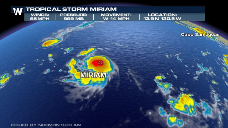
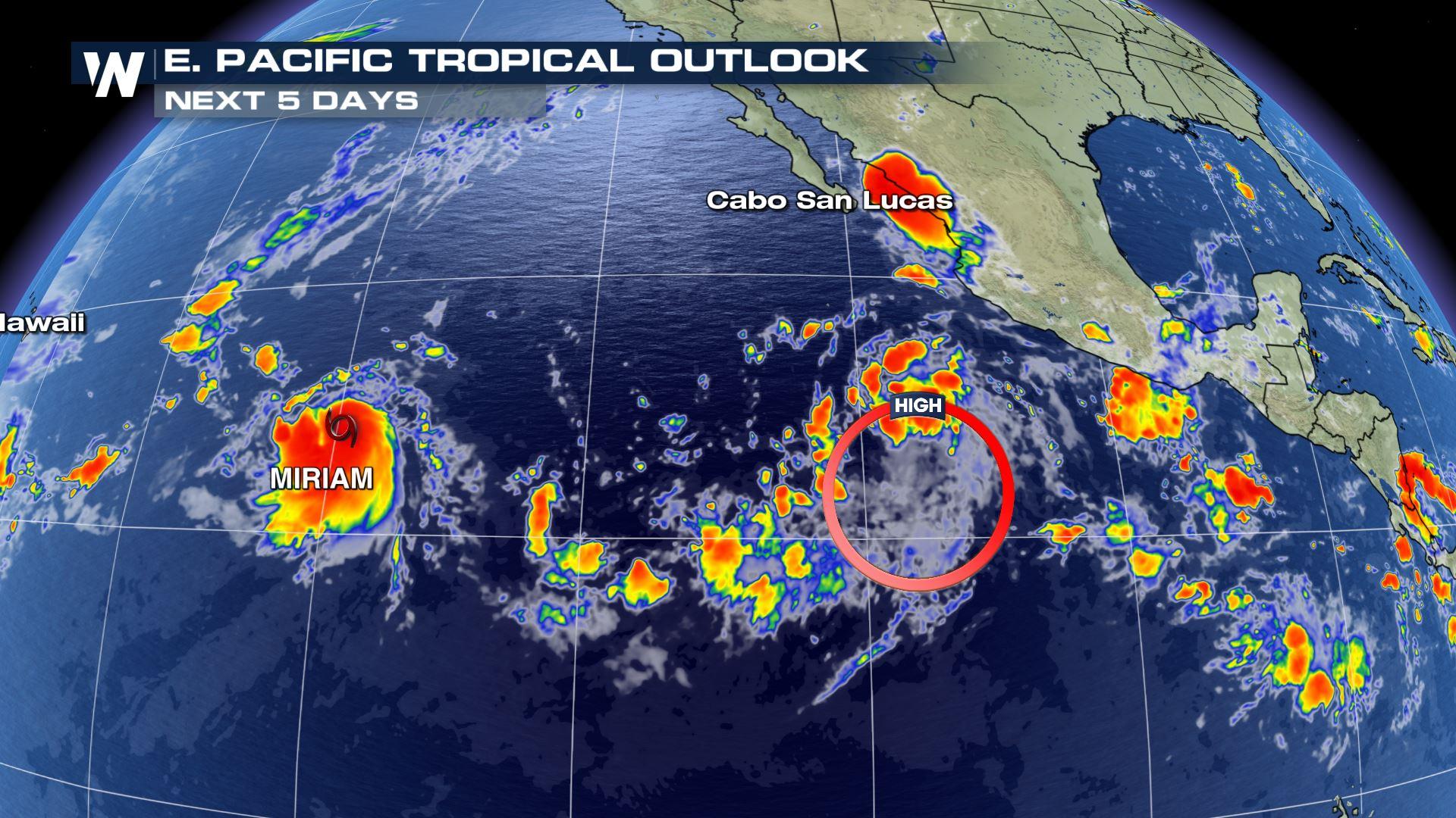
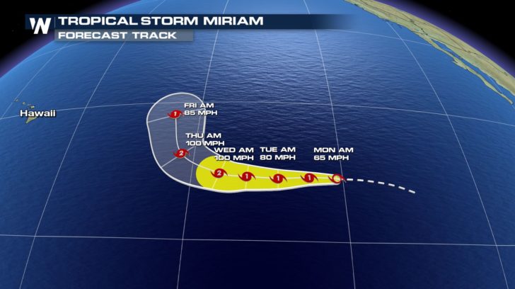 Our newest named storm is Miriam which is currently a tropical storm. It is moving west at 14 mph. Sustained winds are at 65 mph. Currently, Miriam is not looking to make any land impact. The storm will start to curve north by Wednesday night.
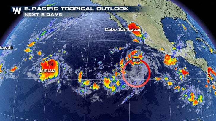 Another storm behind Miriam is starting to show some organization. The storm has about a 90 percent chance of forming into our next named storm.
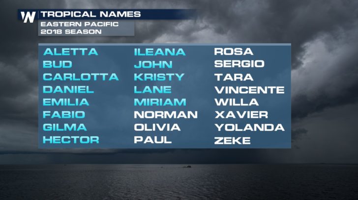 If the low pressure system does strengthen into our next named storm, it will be called Norman.
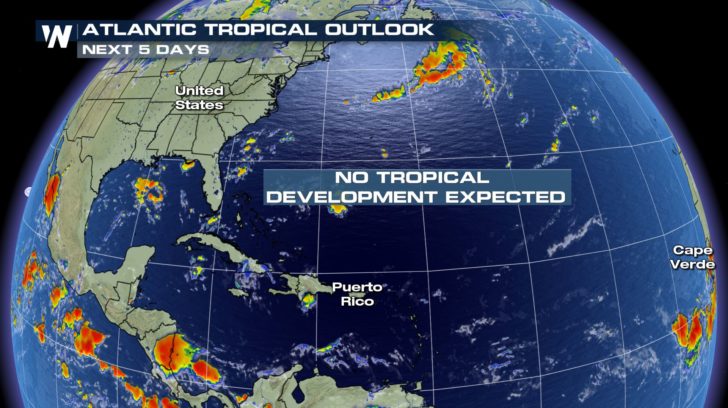 Over in the Atlantic, quiet conditions continue. No tropical development is expected in the next 5 days. We don't want to let our guard down yet, though, because we are heading into the heart of hurricane season. Tropical activity usually ramps up between now and October.
For WeatherNation -Meteorologist Shelly Lindblade
Over in the Atlantic, quiet conditions continue. No tropical development is expected in the next 5 days. We don't want to let our guard down yet, though, because we are heading into the heart of hurricane season. Tropical activity usually ramps up between now and October.
For WeatherNation -Meteorologist Shelly Lindblade
Our newest named storm is Miriam which is currently a tropical storm. It is moving west at 14 mph. Sustained winds are at 65 mph. Currently, Miriam is not looking to make any land impact. The storm will start to curve north by Wednesday night.
Another storm behind Miriam is starting to show some organization. The storm has about a 90 percent chance of forming into our next named storm.
If the low pressure system does strengthen into our next named storm, it will be called Norman.
Over in the Atlantic, quiet conditions continue. No tropical development is expected in the next 5 days. We don't want to let our guard down yet, though, because we are heading into the heart of hurricane season. Tropical activity usually ramps up between now and October.
For WeatherNation -Meteorologist Shelly LindbladeAll Weather News
More

Hurricane Center Monitoring Florida for Tropical Development
Residents and visitors to the Southeast will
30 Jun 2025 10:00 PM

Barry Makes Landfall, Watching Flossie Next
While the Eastern Pacific has made most of th
30 Jun 2025 9:40 PM

Severe Storms For the East Coast Through Tuesday
Frontal systems have been crossing the northe
30 Jun 2025 9:00 PM

Severe Weather Threat Continues in the Midwest
It has been an active, severe season across t
30 Jun 2025 9:00 PM

Where Rain Could Dampen Holiday Travel Plans
AAA is expecting over 70 million travelers to
30 Jun 2025 3:00 PM

Thunderstorms Possible in the Southeast Overnight
SOUTHEAST - Strong thunderstorms have develop
28 Jun 2025 2:40 AM