Subtropical Storm Alberto Forms
Top Stories
25 May 2018 3:45 PM
UPDATE - 4 p.m. CDT
 Tropical Storm Watches have been posted for parts of the Gulf Coast ahead of Subtropical Storm Alberto. Now is the time to begin preparations as tropical storm conditions are expected within 72 hours.
https://www.facebook.com/WeatherNation/videos/10156528396599874/
Stay with WeatherNation for all of the latest on Alberto.
_____________________________________________
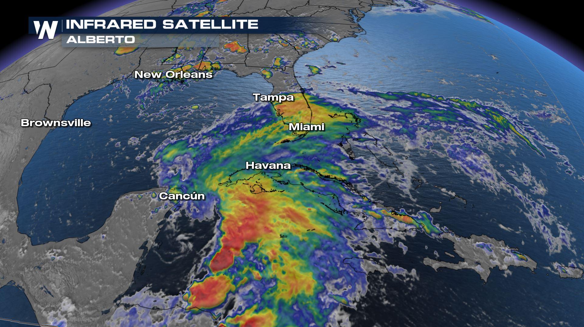
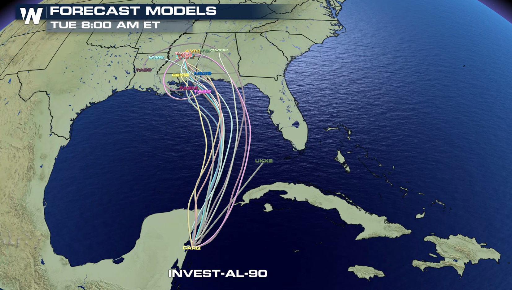
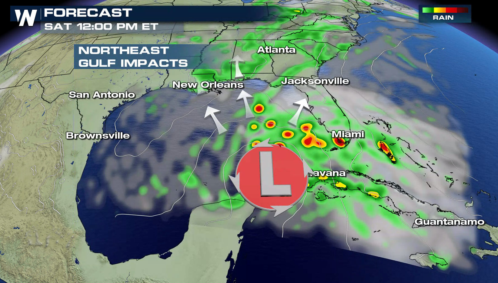
Tropical development has finally happened. What was Invest 90-L is now called Subtropical Storm Alberto. This system will continue to bring the same threat as we have been highlighting in previous forecasts- heavy rain, rip currents, and gusty winds will threaten much of the Gulf Coast for this holiday weekend.
https://twitter.com/NHC_Atlantic/status/1000014433710682115
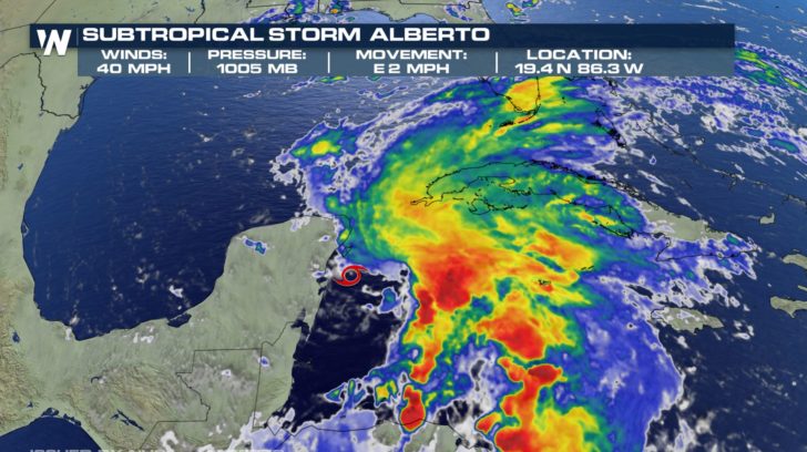
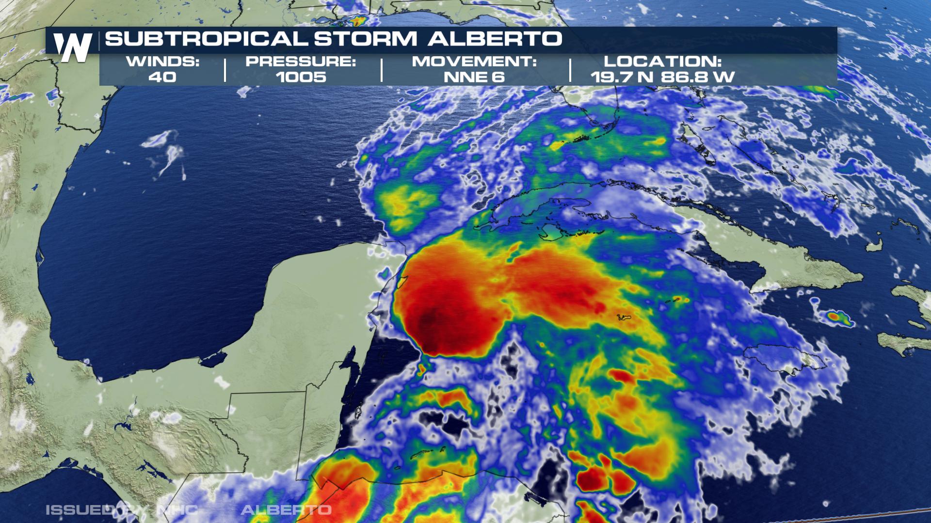
Alberto is located over the northwestern Caribbean Sea just east of the Yucatan Peninsula of Mexico. Satellite images and surface observations indicate that the system has become better defined overnight, and thunderstorm activity has also increased with more organization. An Air Force Hurricane Hunter aircraft is scheduled to investigate the low this afternoon.
Tropical Storm Watches have been posted for parts of the Gulf Coast ahead of Subtropical Storm Alberto. Now is the time to begin preparations as tropical storm conditions are expected within 72 hours.
https://www.facebook.com/WeatherNation/videos/10156528396599874/
Stay with WeatherNation for all of the latest on Alberto.
_____________________________________________
Tropical development has finally happened. What was Invest 90-L is now called Subtropical Storm Alberto. This system will continue to bring the same threat as we have been highlighting in previous forecasts- heavy rain, rip currents, and gusty winds will threaten much of the Gulf Coast for this holiday weekend.
https://twitter.com/NHC_Atlantic/status/1000014433710682115
Alberto is located over the northwestern Caribbean Sea just east of the Yucatan Peninsula of Mexico. Satellite images and surface observations indicate that the system has become better defined overnight, and thunderstorm activity has also increased with more organization. An Air Force Hurricane Hunter aircraft is scheduled to investigate the low this afternoon.
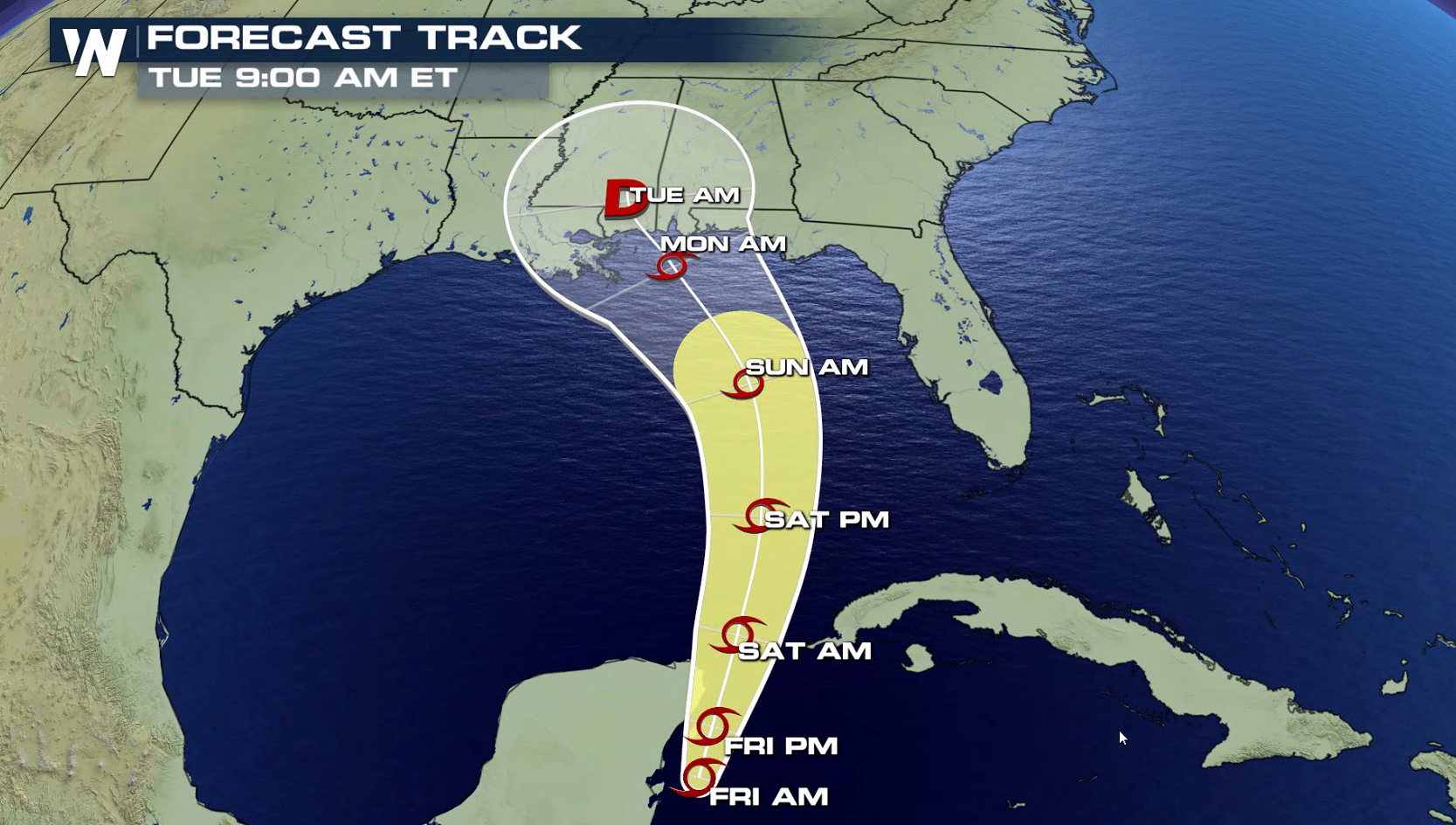
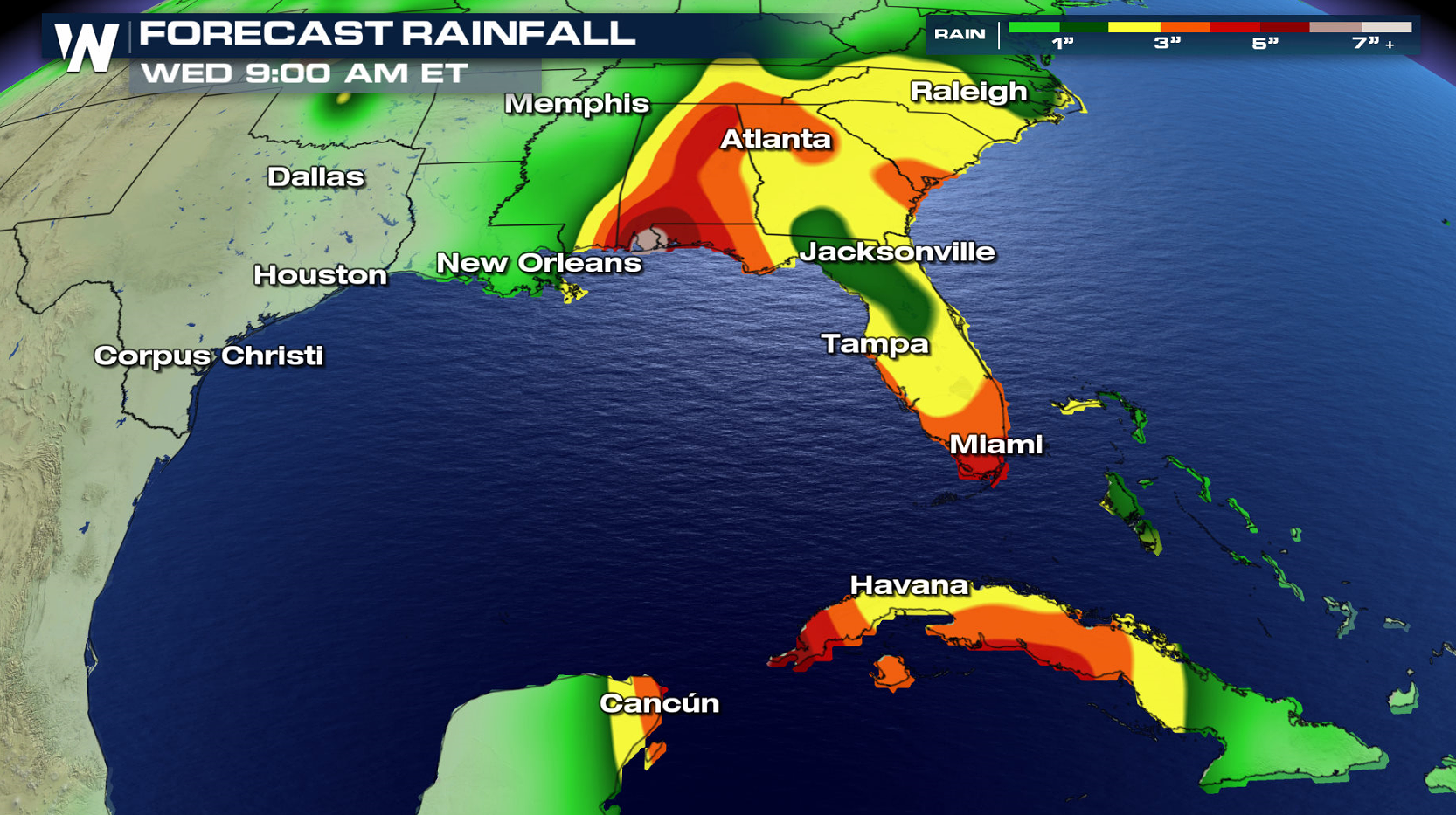
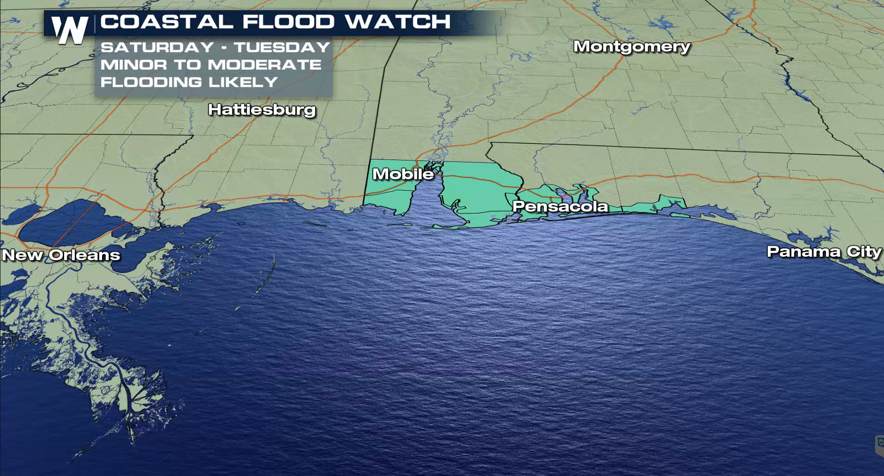
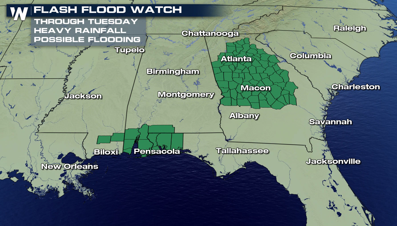
 Locally heavy rainfall is forecast across western Cuba and over much of Florida and the northern Gulf Coast into early next week. Rainfall totals could easily reach above 6" into next week. Flood watches have been issued across portions of the Southeast and will likely be expanded as the storm moves closer to the coast. Subtropical Storm Alberto could also bring tropical-storm-force winds and a storm surge to portions of the northern Gulf Coast by late this weekend or early next week.
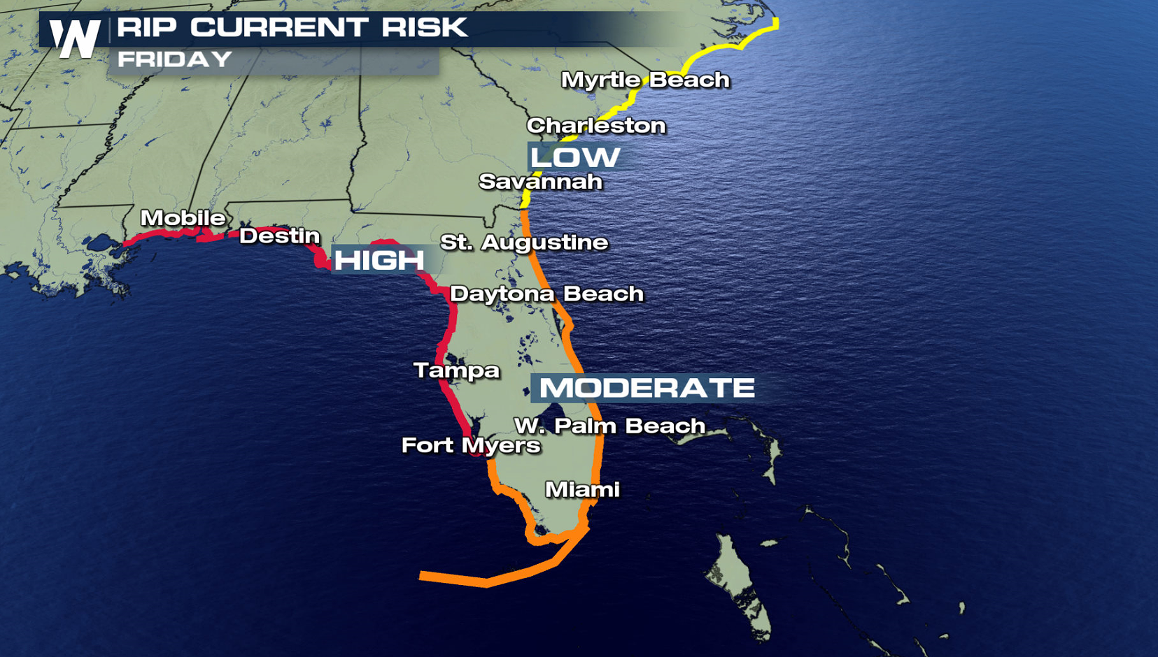
 In addition, the threat of rip currents will steadily increase along the Gulf Coast from Florida westward to Louisiana over the Memorial Day weekend. Stay tuned to WeatherNation on-air and online for updates on Subtropical Storm Alberto.
 For WeatherNation: Meteorologist Mace Michaels
Tropical Storm Watches have been posted for parts of the Gulf Coast ahead of Subtropical Storm Alberto. Now is the time to begin preparations as tropical storm conditions are expected within 72 hours.
https://www.facebook.com/WeatherNation/videos/10156528396599874/
Stay with WeatherNation for all of the latest on Alberto.
_____________________________________________
Tropical development has finally happened. What was Invest 90-L is now called Subtropical Storm Alberto. This system will continue to bring the same threat as we have been highlighting in previous forecasts- heavy rain, rip currents, and gusty winds will threaten much of the Gulf Coast for this holiday weekend.
https://twitter.com/NHC_Atlantic/status/1000014433710682115
Alberto is located over the northwestern Caribbean Sea just east of the Yucatan Peninsula of Mexico. Satellite images and surface observations indicate that the system has become better defined overnight, and thunderstorm activity has also increased with more organization. An Air Force Hurricane Hunter aircraft is scheduled to investigate the low this afternoon.
Locally heavy rainfall is forecast across western Cuba and over much of Florida and the northern Gulf Coast into early next week. Rainfall totals could easily reach above 6" into next week. Flood watches have been issued across portions of the Southeast and will likely be expanded as the storm moves closer to the coast. Subtropical Storm Alberto could also bring tropical-storm-force winds and a storm surge to portions of the northern Gulf Coast by late this weekend or early next week.
In addition, the threat of rip currents will steadily increase along the Gulf Coast from Florida westward to Louisiana over the Memorial Day weekend. Stay tuned to WeatherNation on-air and online for updates on Subtropical Storm Alberto.
For WeatherNation: Meteorologist Mace MichaelsAll Weather News
More
Wildfire Outbreak in the Pacific Northwest
SPOKANE, WA - On Saturday, August 1st, the Ol
3 Aug 2026 1:55 AM

More Storms for the East Through Monday
A low-pressure system that moved through the
3 Aug 2026 1:50 AM


After Reaching Category 5, Genevieve Weakens in the Pacific
PacificGenevieve formed last Friday south of
3 Aug 2026 12:30 AM

Flooding, Severe Storms Target the Midwest Again
After an active week of storms across the nor
1 Aug 2026 1:40 AM

Flooding Risk Increases as Heavy Rain Targets the Tri-State Area
Tuesday, heavy rainfall moved across the Nort
30 Jul 2026 12:25 AM

Severe Weather: Energy From the Midwest Now in the Southeast
UPPER MIDWEST - Through Monday, dangerous tor
29 Jul 2026 10:30 PM