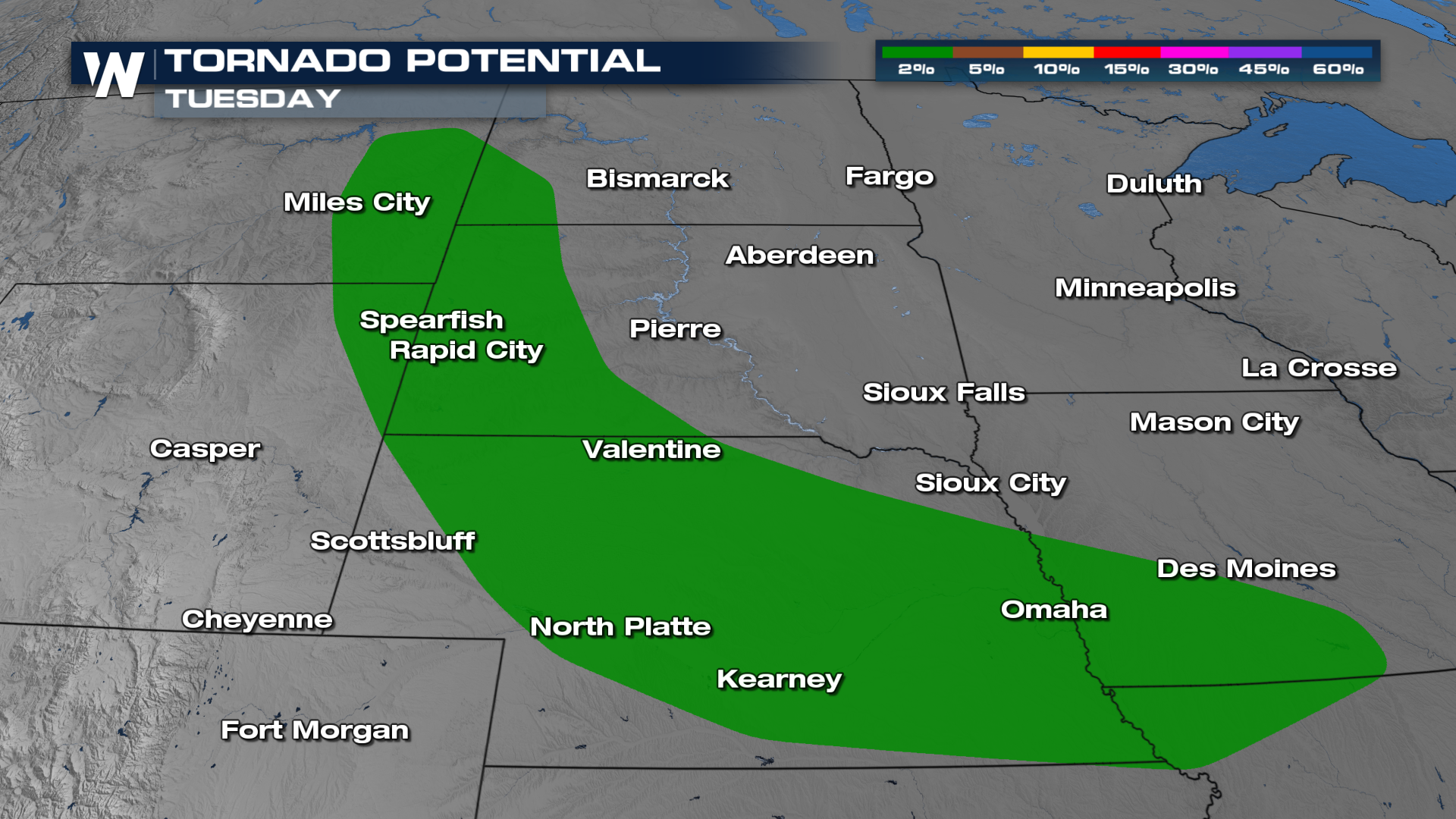
Tuesday Night's Severe Risk: Central & Northern Plains

Strong thunderstorms on Tuesday brought hail up to 3" in diameter across the northern Plains.
Severe Outlook
The Storm Prediction Center has issued a risk from Montana through the Central Plains overnight. In addition, they have upgraded parts of Nebraska to an Enhanced Risk (level 3 of 5), for the high wind component seeming increasingly likely. A Marginal to Slight (levels 1 and 2) extends from Montana through to Illinois and Missouri.
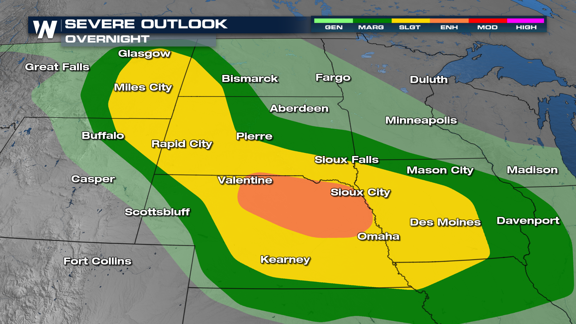
Significant hail larger than golf balls and wind gusts over 75 mph will be possible as storms move southeast through the early morning hours of Wednesday.
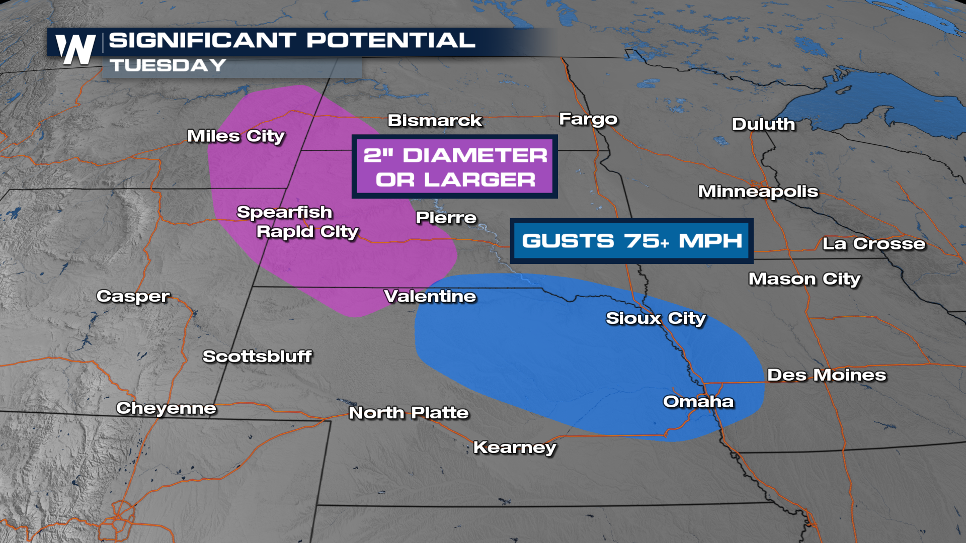
 Storms will likely start out as discrete cells and then merge into a large complex called an MCS (Mesoscale Convective System). That system could move through the Mississippi River Valley overnight and bring damaging winds from Omaha to central Illinois. Due to the overnight nature of these storms - make sure you have multiple ways to get alerts.
We have the most up-to-date forecast in your Central Regional, always :30 past the hour. Stay with Weather Nation for all the latest developments.


