Tuesday Severe Storms for the Central and Southern Plains
Special Stories
21 May 2019 10:09 AM
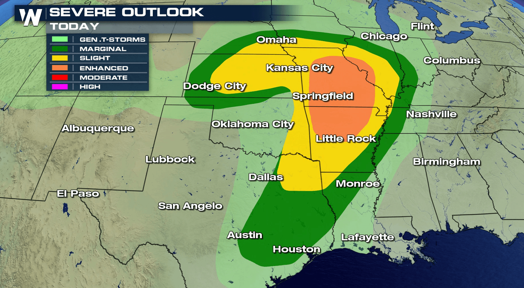
After an active day of severe storms on Monday in the central and southern Plains, severe weather is again likely. An enhanced risk (orange shaded area) has been issued for parts of Missouri, Illinois, and northern Arkansas. Slight and marginal risk areas are shaded in yellow and green, respectively. Tornadoes, large hail and damaging wind gusts are all possible.
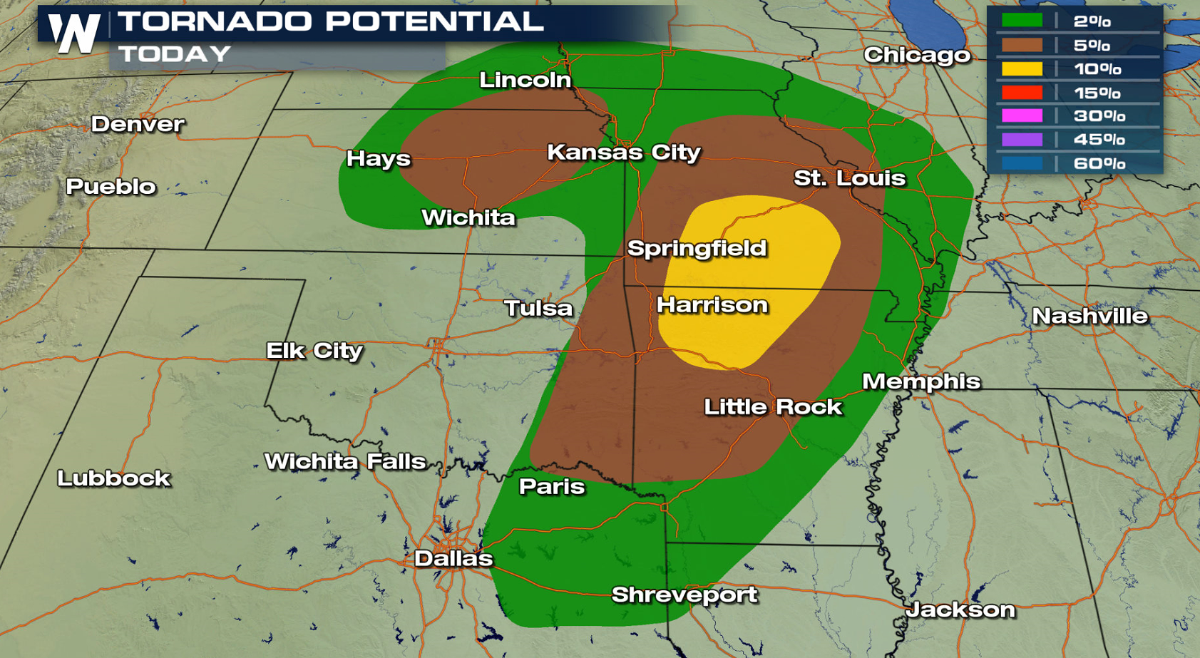
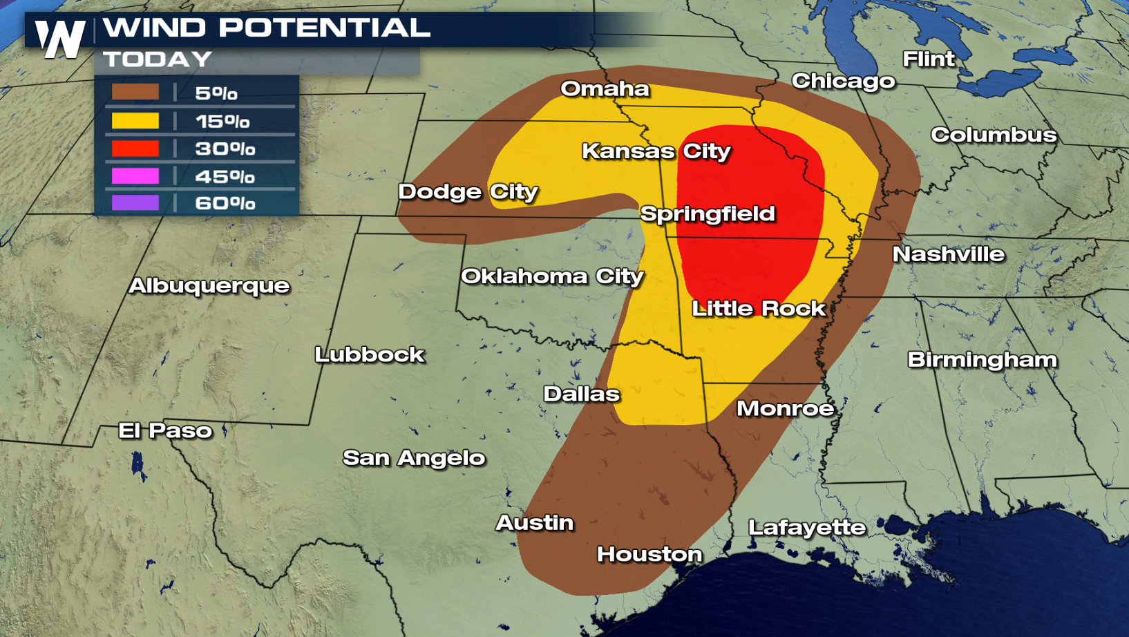
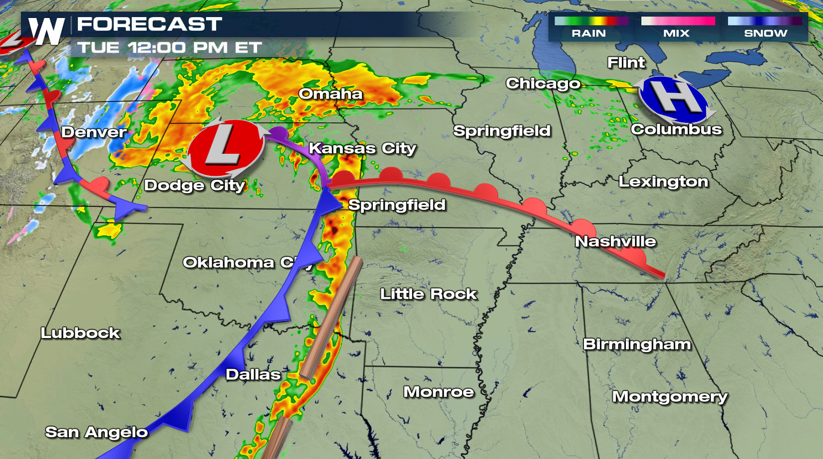
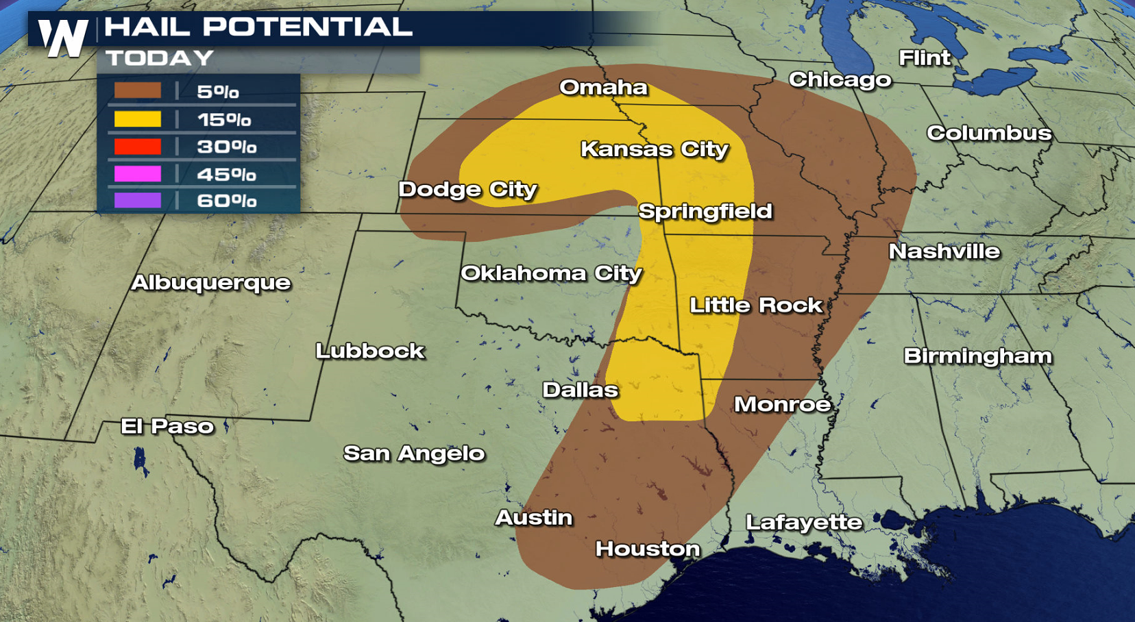 This morning (Tuesday), very heavy rain has been occurring along a warm front. Soaking rain will be likely from Oklahoma City, up through Wichita and Kansas City, across Missouri and into Illinois. By early this afternoon, a cold front will come into play as it moves across the region from west to east. Severe weather becomes much more likely from this point in time forward. Very strong storms will be possible in a line from Iowa down to east Texas. The line will slowly move eastward during the afternoon and evening. All modes of severe weather will be possible, including damaging winds and hail, flooding rain, and tornadoes.
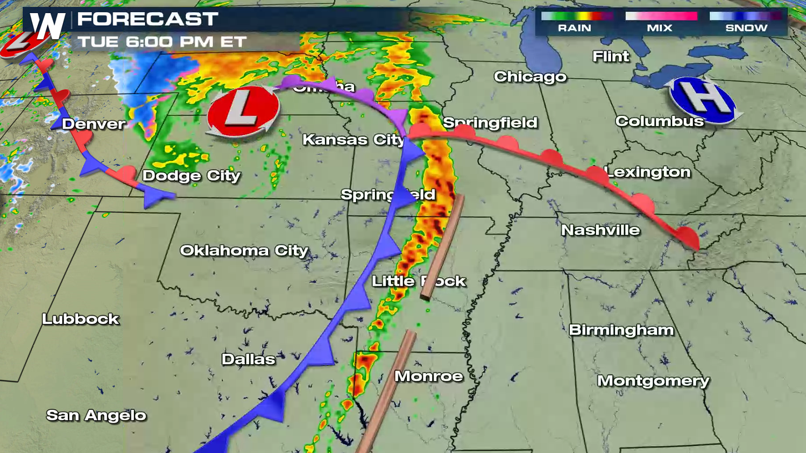
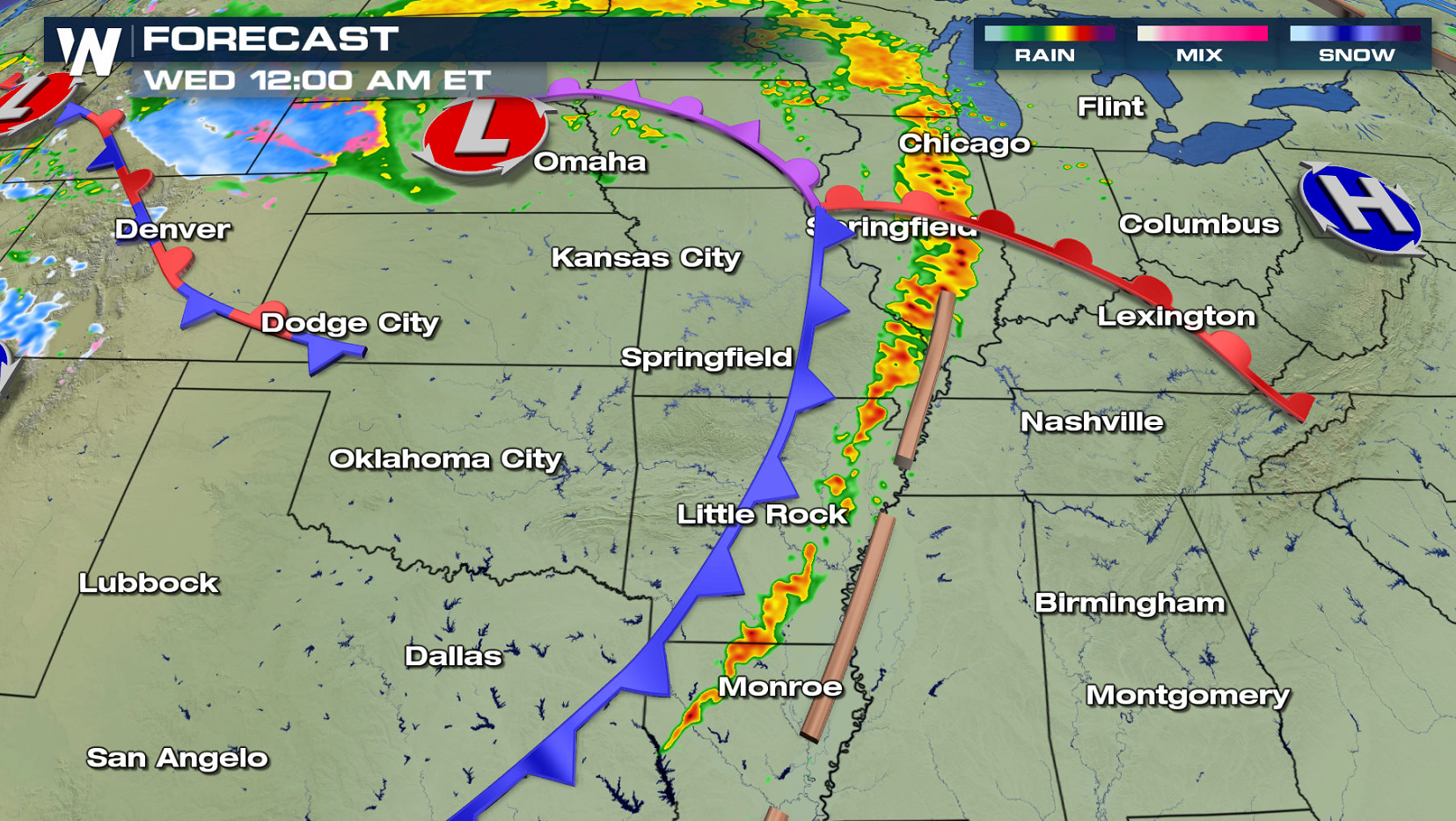 The severe weather threat will continue into the late evening hours from Illinois south into Louisiana. The system will gradually lose strength and fizzle out during the overnight hours. More severe storms are likely for Wednesday into Saturday.
Keep checking with WeatherNation for throughout the day as storms develop. Our team coverage from the studio and in the field continues.
The severe weather threat will continue into the late evening hours from Illinois south into Louisiana. The system will gradually lose strength and fizzle out during the overnight hours. More severe storms are likely for Wednesday into Saturday.
Keep checking with WeatherNation for throughout the day as storms develop. Our team coverage from the studio and in the field continues.
This morning (Tuesday), very heavy rain has been occurring along a warm front. Soaking rain will be likely from Oklahoma City, up through Wichita and Kansas City, across Missouri and into Illinois. By early this afternoon, a cold front will come into play as it moves across the region from west to east. Severe weather becomes much more likely from this point in time forward. Very strong storms will be possible in a line from Iowa down to east Texas. The line will slowly move eastward during the afternoon and evening. All modes of severe weather will be possible, including damaging winds and hail, flooding rain, and tornadoes.
The severe weather threat will continue into the late evening hours from Illinois south into Louisiana. The system will gradually lose strength and fizzle out during the overnight hours. More severe storms are likely for Wednesday into Saturday.
Keep checking with WeatherNation for throughout the day as storms develop. Our team coverage from the studio and in the field continues.All Weather News
More
Texas Facing Major Flood Threat This week
Texas is facing a major flooding threat this
14 Jul 2026 2:05 AM

Rare Enhanced Severe Threat For New England
After several stormy days to end the previous
14 Jul 2026 2:00 AM

Saharan Dust, Excessive Heat, Strong Storms Impact the Southeast
Hazy skies will be hovering over portions of
14 Jul 2026 1:45 AM

Historic Heatwave Hits the Northern Rockies, California Heat Expands
Dangerous heat and record high temperatures c
13 Jul 2026 9:50 PM

Monsoon Moisture Returns to the Southwest, Increasing Storm and Flash Flood Potential
After weeks of hot and mostly dry weather, th
13 Jul 2026 9:30 PM

Another Day of Storms for the Plains & Front Range
Several rounds of severe weather have been ro
11 Jul 2026 1:50 AM

Babylon Fire in UT Surpasses 100,000 Acres, CO Fires Continue to Grow
The Aspen Acres fire continues to burn in Sou
10 Jul 2026 1:40 AM