Tuesday Severe Weather Update
Top Stories
14 Jan 2020 4:58 AM
The stationary front that brought the heavy rain and strong storms to the Southeast yesterday is back again today. This same front will bring more of the same including heavy rain and the risk of severe weather from the Mississippi Valley to northwest Georgia. Here is the latest severe weather forecast.
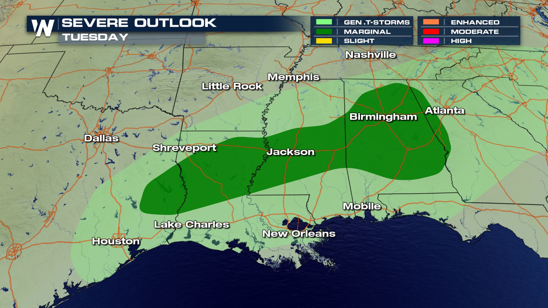 From east Texas to western Georgia strong storms will be possible. The risk of severe storms will be isolated, but it's a risk nonetheless that you need to be prepared.
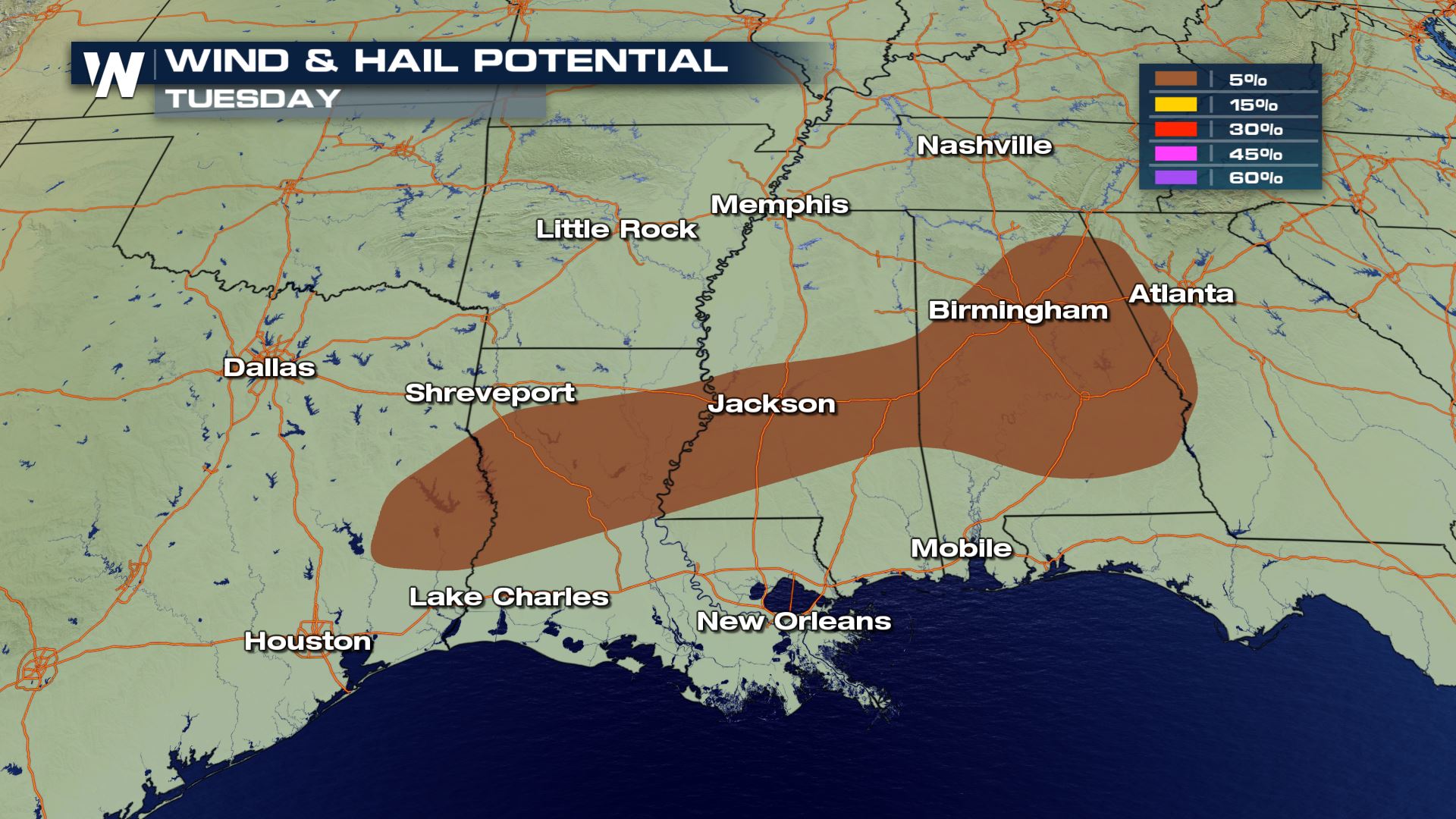 Large hail and damaging winds will be the primary risks with any severe storms today. Even though the tornado risk is low, you can't completely let your guard down for some isolated rotation.
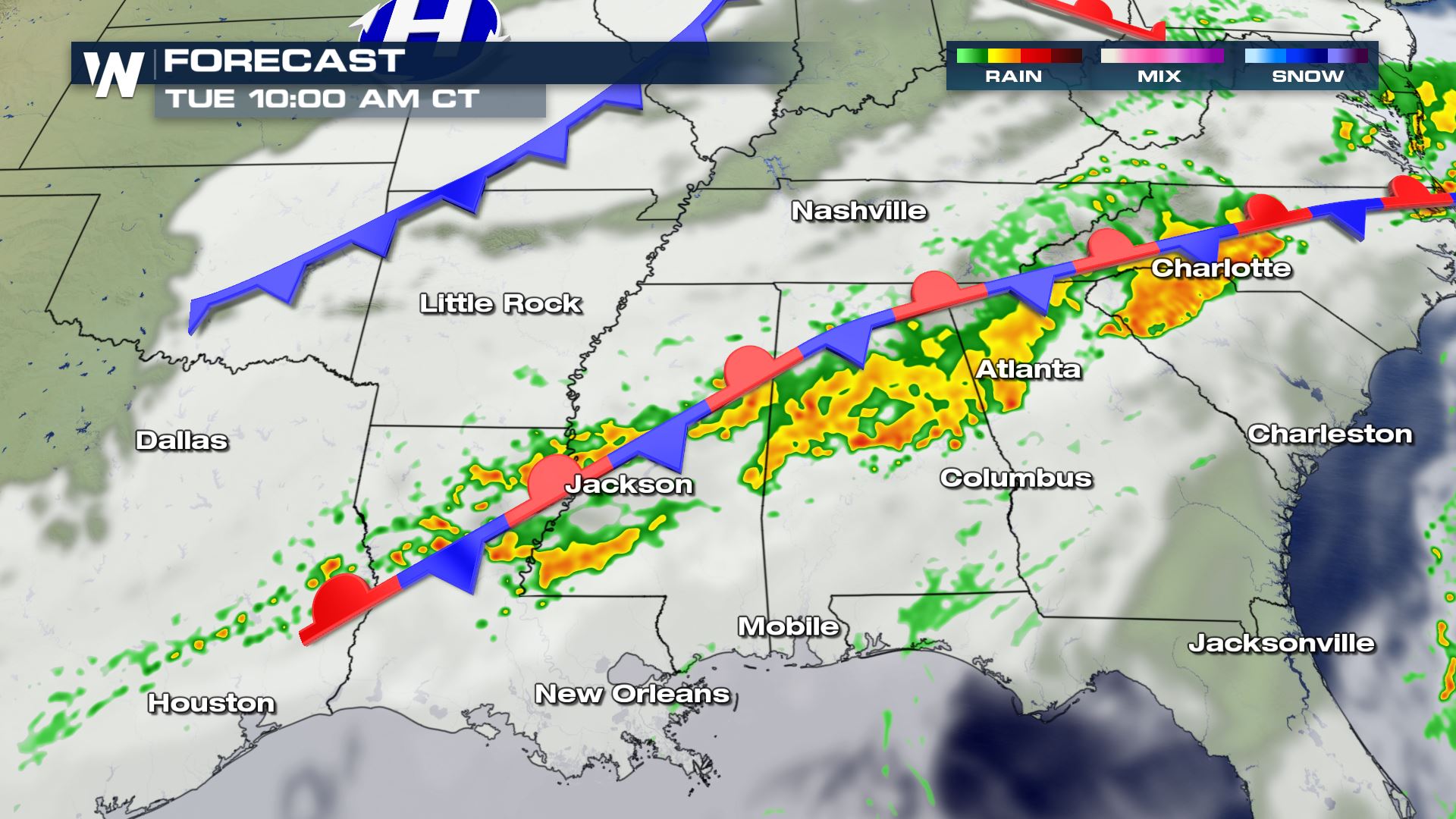
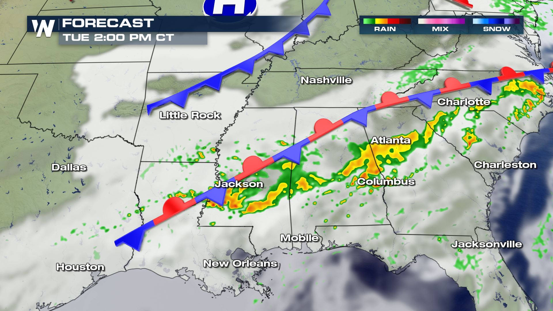
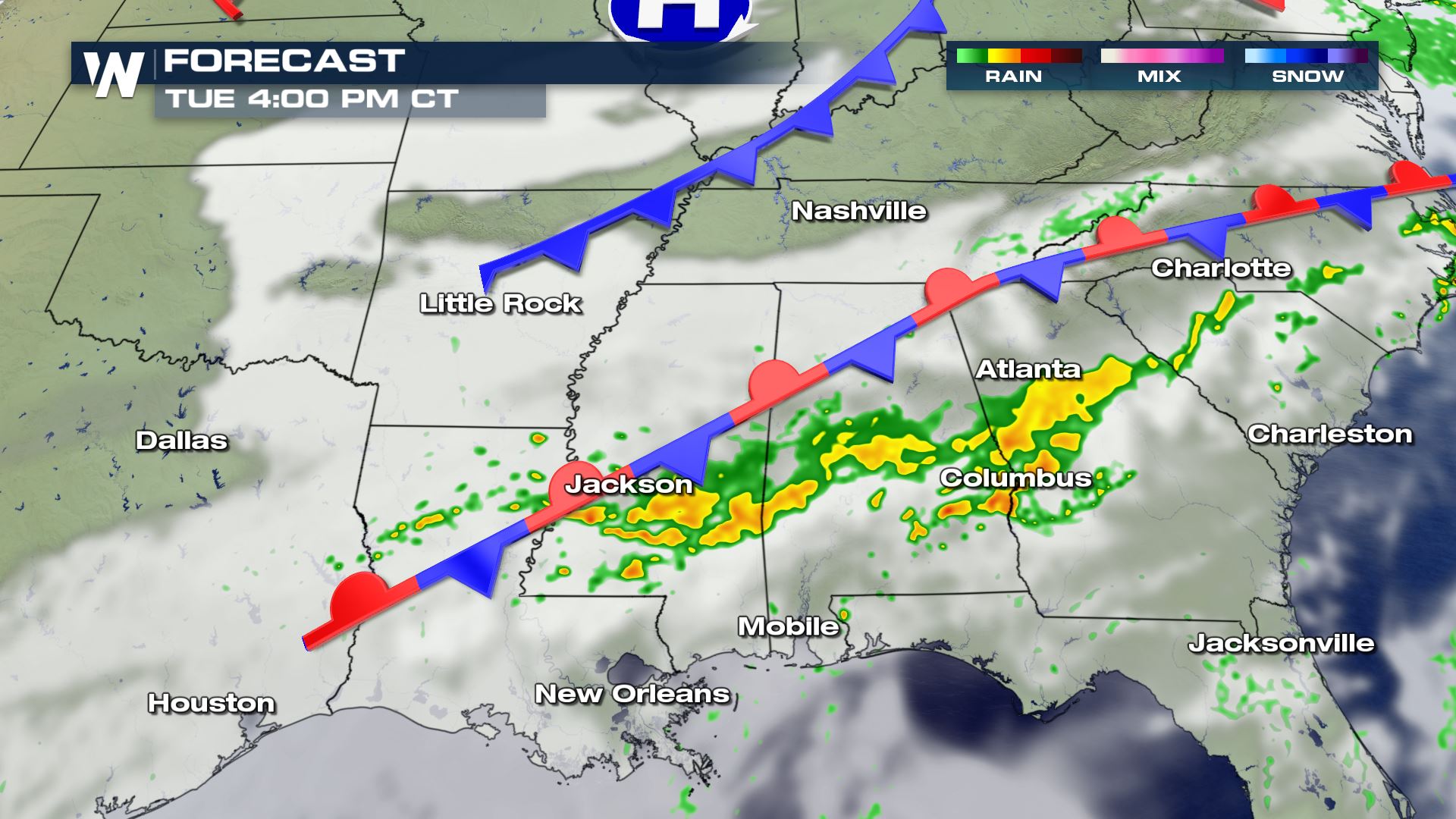 The timing for today's storms will be from this morning and into the early afternoon. Once a cold front takes over we will see a break in the storms tonight. Another cold front will bring more storms Wednesday for the Tennessee Valley.
Severe Outlook
 From east Texas to western Georgia strong storms will be possible. The risk of severe storms will be isolated, but it's a risk nonetheless that you need to be prepared.
Severe Risks
 Large hail and damaging winds will be the primary risks with any severe storms today. Even though the tornado risk is low, you can't completely let your guard down for some isolated rotation.
Forecast


 The timing for today's storms will be from this morning and into the early afternoon. Once a cold front takes over we will see a break in the storms tonight. Another cold front will bring more storms Wednesday for the Tennessee Valley.
All Weather News
More