Tuesday Severe Weather Update
Top Stories
31 Mar 2020 11:12 AM
https://twitter.com/WeatherNation/status/1245010568416641025
https://twitter.com/WeatherNation/status/1245002918899539968
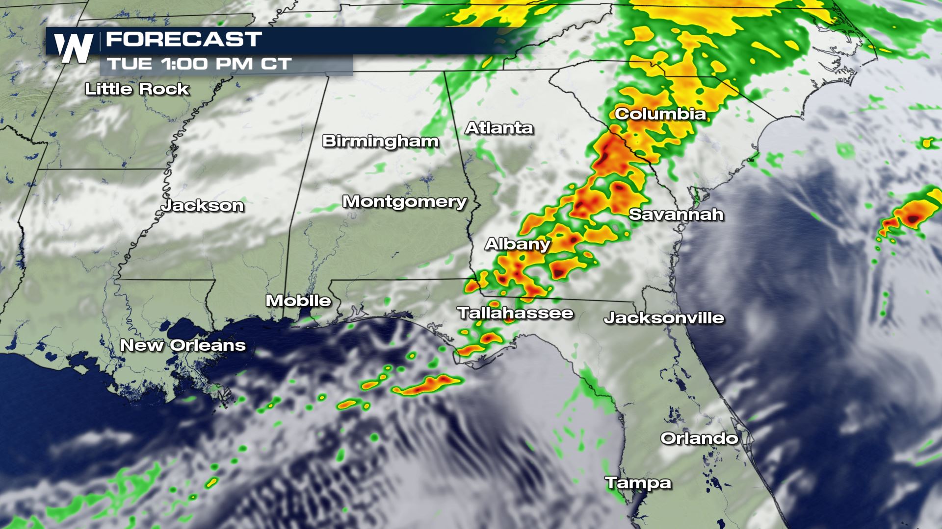
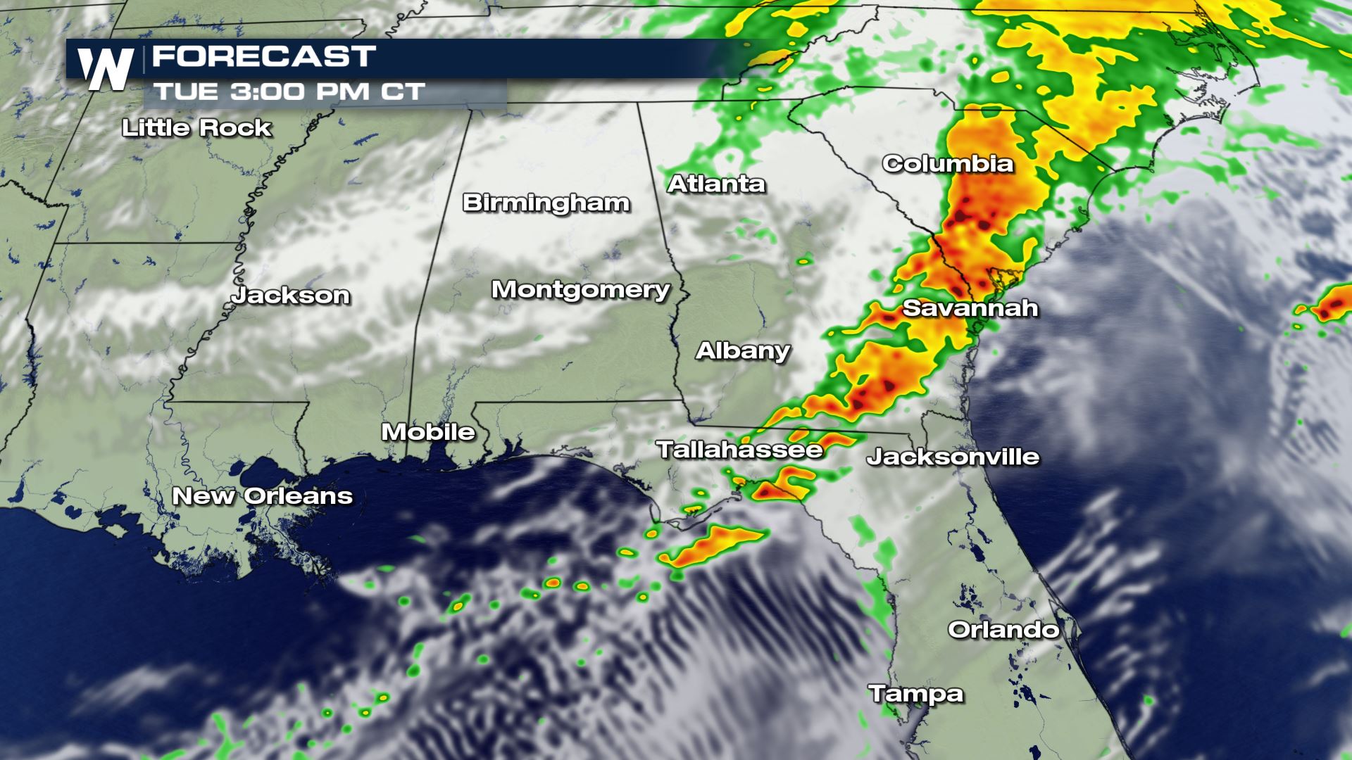
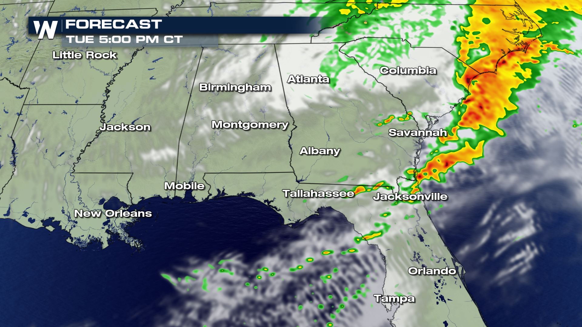
The system that brought the severe storms to the Lower Mississippi Valley this morning will continue to impact the southeast through the afternoon . All modes of severe weather will be possible, including the risk of tornadoes. We will continue to track this weather event throughout the day. Here is the latest forecast.
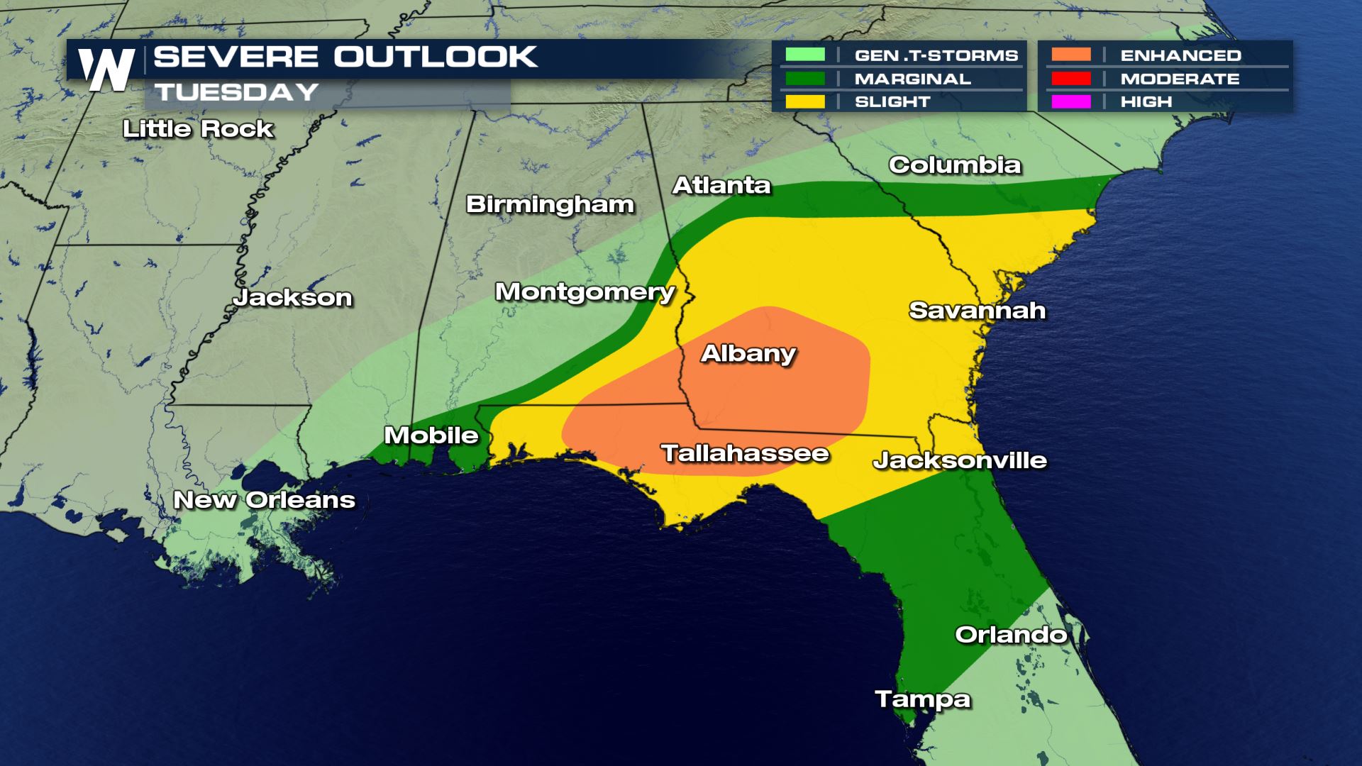 An Enhanced Risk (numerous) of severe storms was added to the severe outlook for the rest of Monday. This is to follow along with the intense storms have have moved through Mississippi and Alabama today.

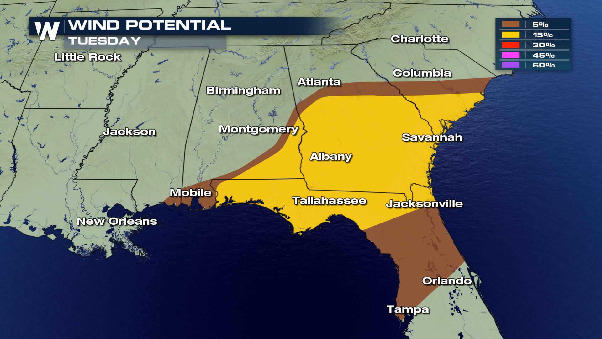
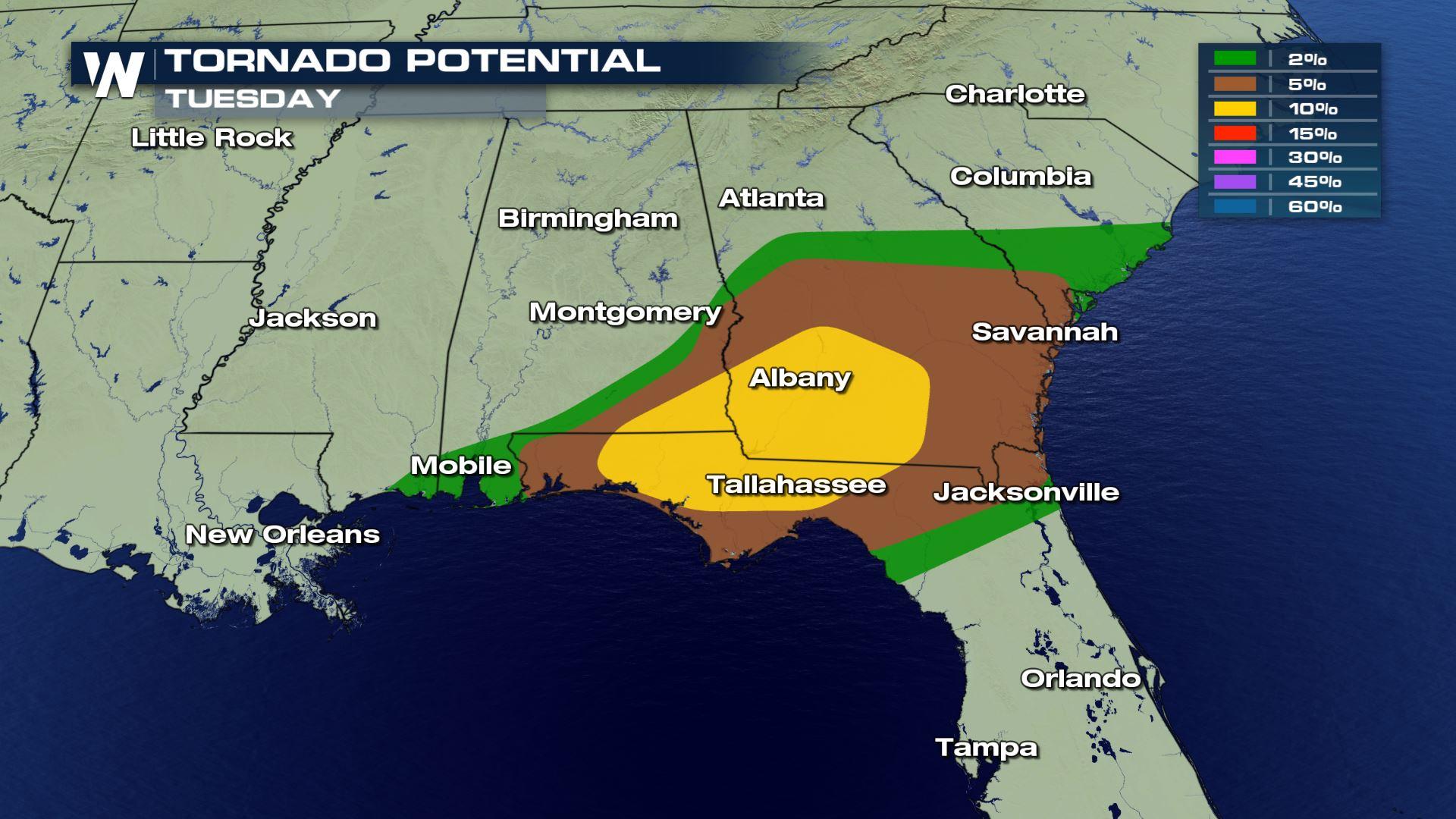
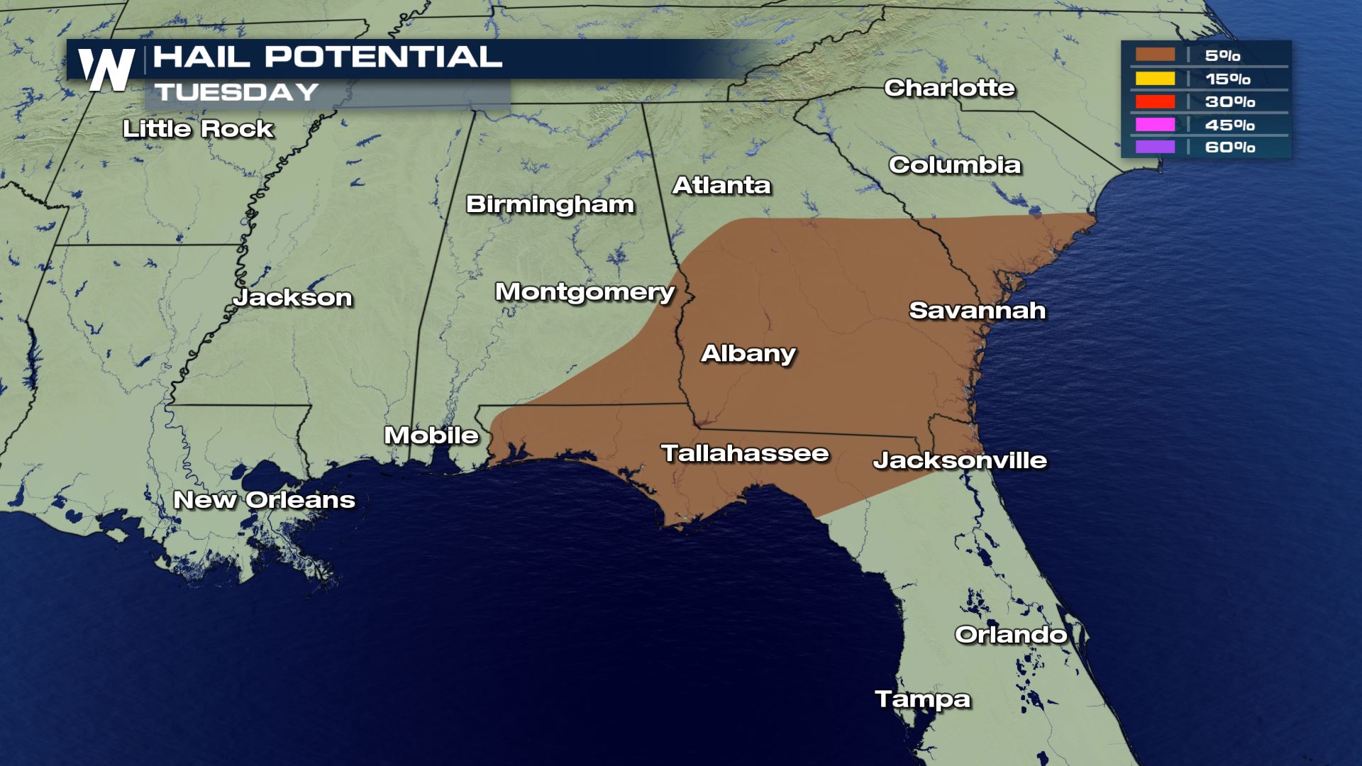 All modes of severe weather are in the forecast today. This means storms will be capable of producing damaging winds, large hail and tornadoes. The tornado risk was upgraded to a 10% risk with the history of these storms dropping tornadoes.
 These intense storms will keep moving to the Atlantic coast during the afternoon and early evening. Once these storms move over the Atlantic waters, the severe risk will fall apart. Keep checking with WeatherNation for more on today's severe risk.
Severe Outlook
An Enhanced Risk (numerous) of severe storms was added to the severe outlook for the rest of Monday. This is to follow along with the intense storms have have moved through Mississippi and Alabama today.
Severe Risks
All modes of severe weather are in the forecast today. This means storms will be capable of producing damaging winds, large hail and tornadoes. The tornado risk was upgraded to a 10% risk with the history of these storms dropping tornadoes.
Forecast
These intense storms will keep moving to the Atlantic coast during the afternoon and early evening. Once these storms move over the Atlantic waters, the severe risk will fall apart. Keep checking with WeatherNation for more on today's severe risk.
All Weather News
More
Tropics: Fausto Heads to Hawaii; Genevieve Has Formed and Could Become a Major Hurricane
Atlantic BasinBertha has dissipated after mov
24 Jul 2026 10:40 PM

Very Hot Temperatures For the Western and Central United States
Are you over the summer heat yet? Well, more
24 Jul 2026 10:10 PM

Severe Chances Return for the Midwest
The upcoming stretch of hot temperatures will
24 Jul 2026 8:10 PM

Southeast Flood Risk Lingers Near Stalled Front
A stalled boundary over the Carolinas will ke
24 Jul 2026 8:00 PM

Hot & Smoky w/ a Chance of Lightning
Conditions have been really dry out west. We'
24 Jul 2026 11:15 AM

Another Round of Storms Targets the Northeast
Tuesday brought severe weather again across p
23 Jul 2026 1:15 AM

Another Round of Severe Weather for the Upper Midwest and Great Lakes
The upper-level low train continues to keep t
21 Jul 2026 1:45 AM