Severe Weather Threat in the Southern Plains
Top Stories
24 Nov 2020 3:30 PM
Severe Thunderstorm threat continues the rest of Tuesday and into Wednesday in the Southern Plains with ongoing severe storms in the Texas/Oklahoma panhandle through this evening and eventually moving into the lower Mississippi Valley through tomorrow (Wednesday). In the upper levels of the atmosphere, a strong mid to upper level trough of low pressure continues to move in which will energize storms and set-up more severe storms. And down at the surface levels, a surface front will guide storms eastbound.
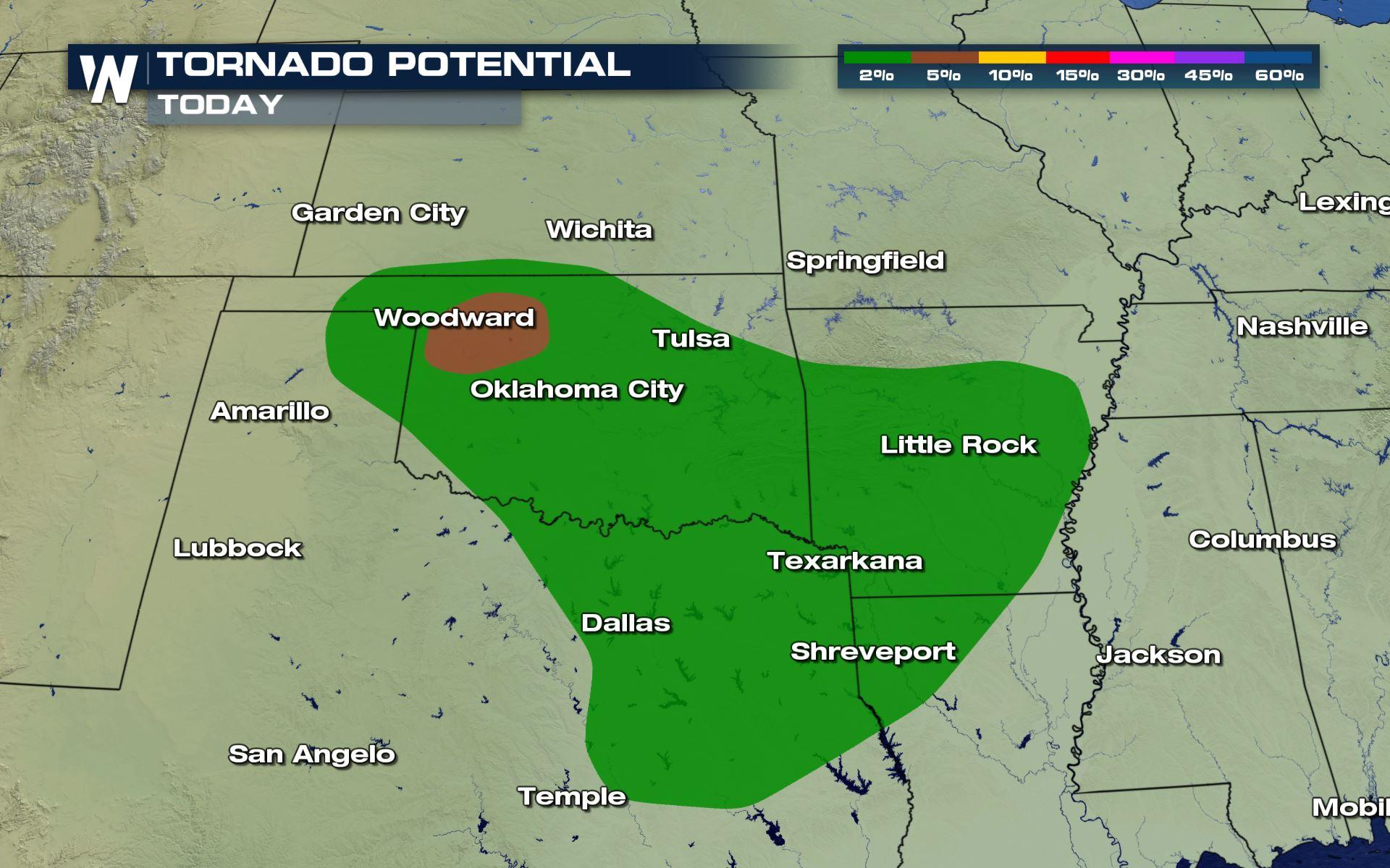
 A large area will be under a marginal (level 1 out of 5) to slight (level 2 out of 5) risk for severe storms for the rest of Tuesday. Areas of west and central Oklahoma including Oklahoma City, Tulsa, Enid through Ponca City will have a higher risk to see damaging hail and isolated tornadoes. The marginal risk will include cities from Texas through Texarkana and as far north as central Missouri and east as Tennesee.
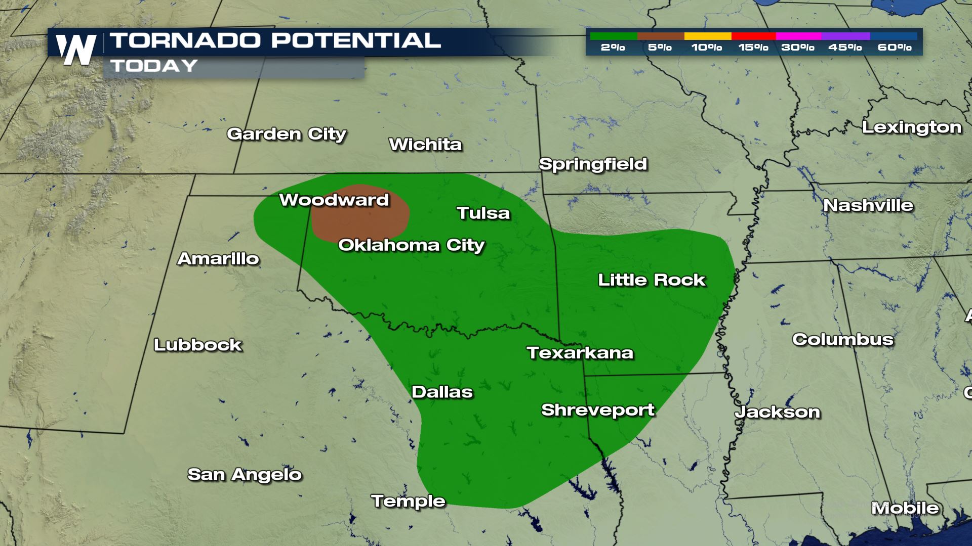
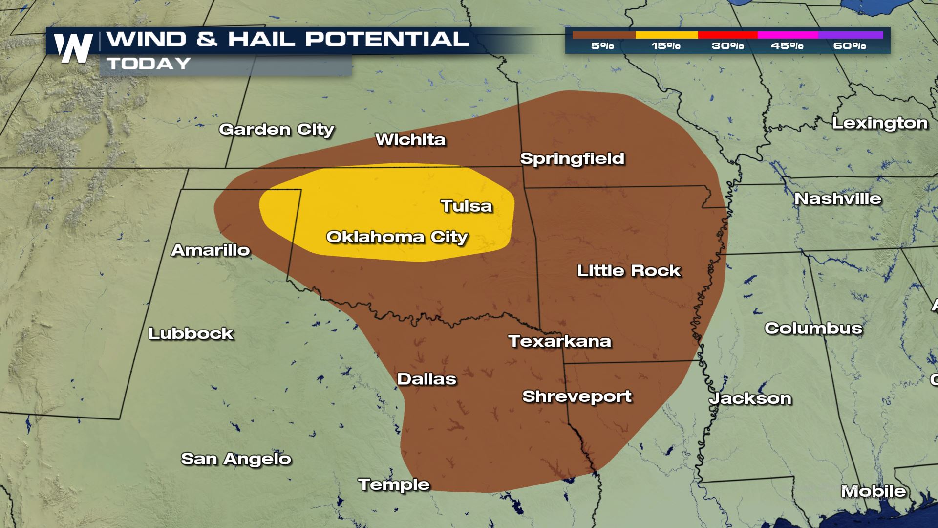 The risk of severe storms will be for the threat of damaging winds up to 60-70 mph and isolated tornadoes. The tornado risk is on the low end, but it only takes one tornado to do damage to life and property. There could be some small hail within some of the storms, but it doesn't look like the hail threat will be severe (2" in diameter or larger).
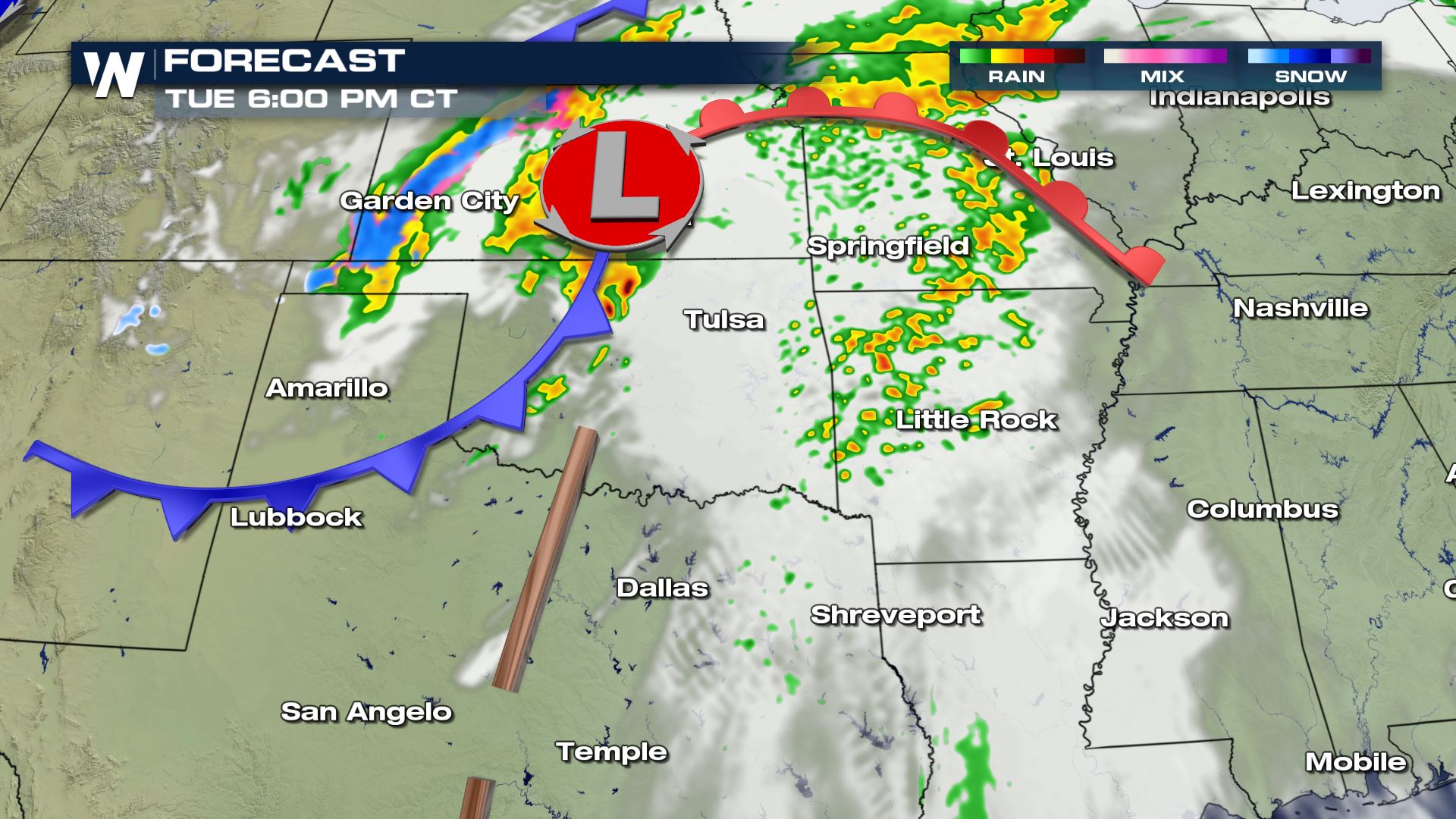 The cold front catches up to the discrete thunderstorms ahead of the boundary and will move east and drive the storms to the east tonight.
 Through early Wednesday morning storms organize along the front and move into Central Arkansas. They may gain more strength as they head into the Mississippi Valley during the afternoon hours which will keep the severe threat going into Wednesday's forecast.
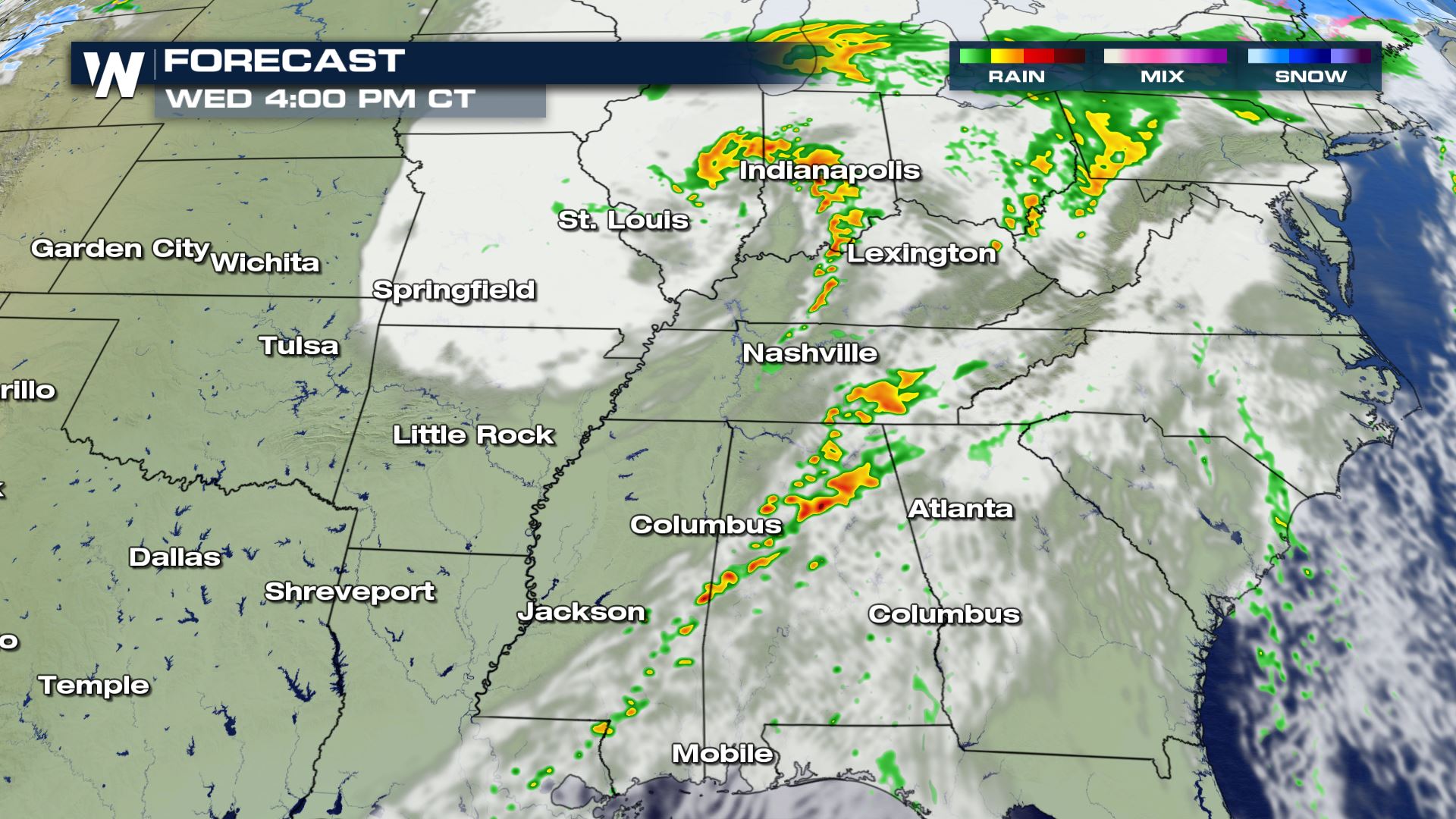
 By Wednesday, along the frontal boundary storms are likely from the Lower-Mid Mississippi Valley to the Ohio/Tennessee Valley with lots of moisture to work with and strong daytime heating ahead of the cold front. Because of this instability storms will move east throughout the day Wednesday.
 For the latest on this ongoing severe weather threat make sure to tune into WeatherNation for live updates with VIPIR radar!
Severe Outlook - Tuesday
A large area will be under a marginal (level 1 out of 5) to slight (level 2 out of 5) risk for severe storms for the rest of Tuesday. Areas of west and central Oklahoma including Oklahoma City, Tulsa, Enid through Ponca City will have a higher risk to see damaging hail and isolated tornadoes. The marginal risk will include cities from Texas through Texarkana and as far north as central Missouri and east as Tennesee.
Severe Risks
The risk of severe storms will be for the threat of damaging winds up to 60-70 mph and isolated tornadoes. The tornado risk is on the low end, but it only takes one tornado to do damage to life and property. There could be some small hail within some of the storms, but it doesn't look like the hail threat will be severe (2" in diameter or larger).
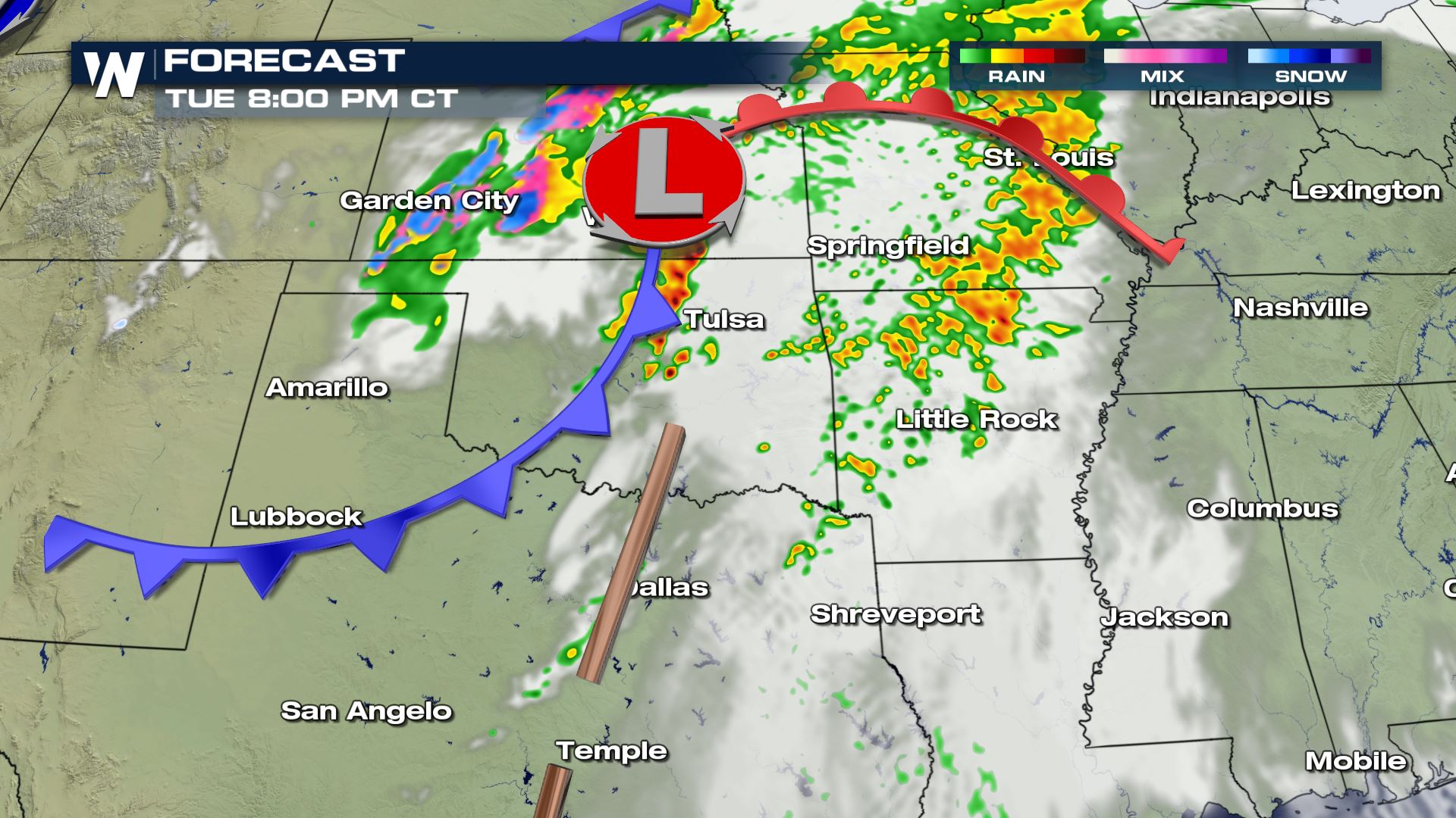
Tuesday Forecast
Storms have initialized in the Texas - Oklahoma panhandle and will continue to be guided east into Central Oklahoma through this evening.
The cold front catches up to the discrete thunderstorms ahead of the boundary and will move east and drive the storms to the east tonight.
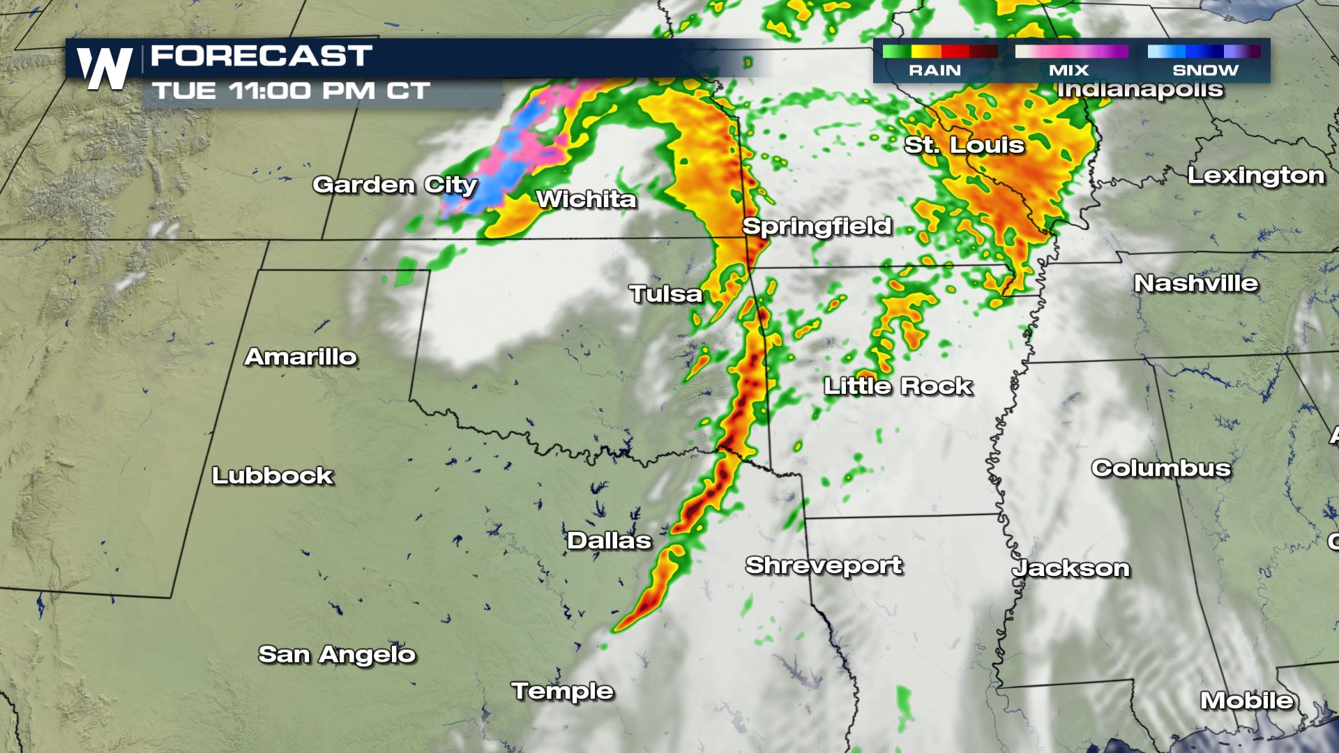
Through early Wednesday morning storms organize along the front and move into Central Arkansas. They may gain more strength as they head into the Mississippi Valley during the afternoon hours which will keep the severe threat going into Wednesday's forecast.
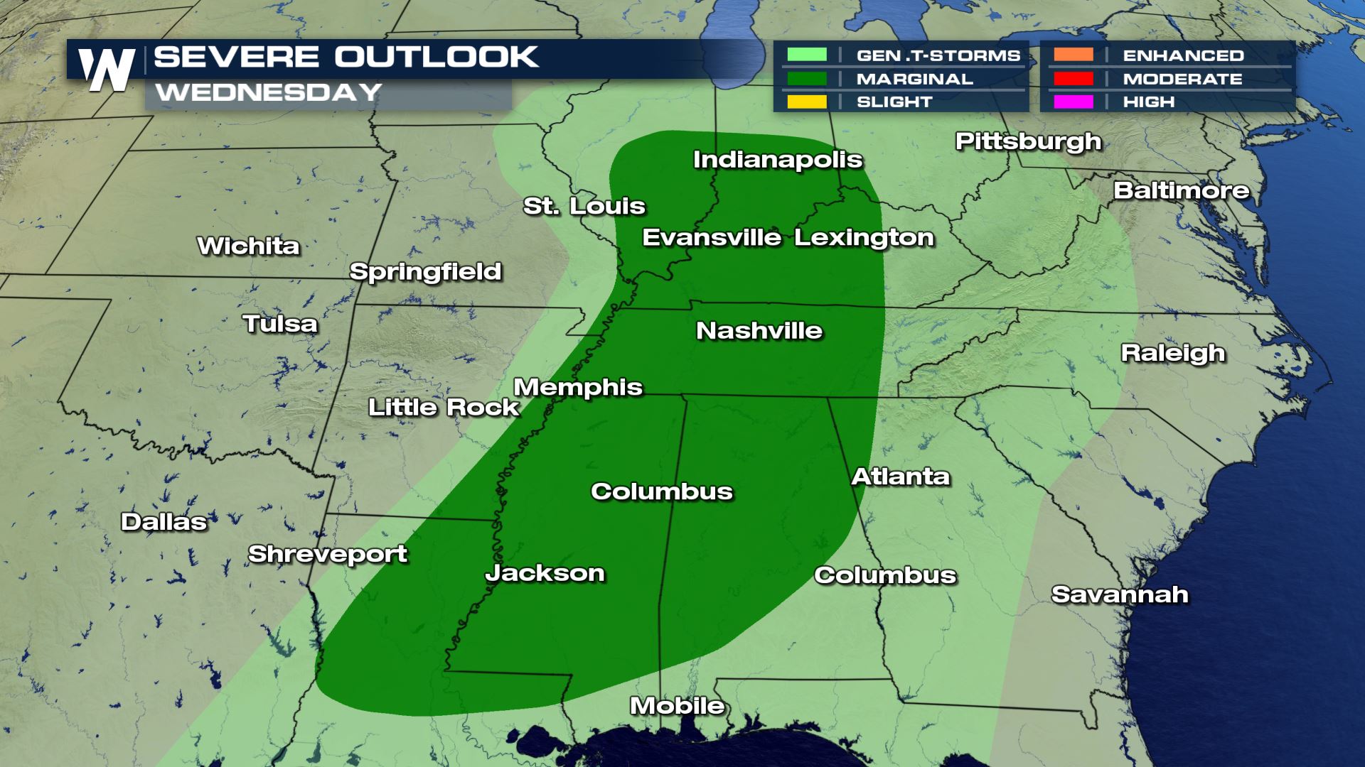
Severe Outlook - Wednesday
By Wednesday, along the frontal boundary storms are likely from the Lower-Mid Mississippi Valley to the Ohio/Tennessee Valley with lots of moisture to work with and strong daytime heating ahead of the cold front. Because of this instability storms will move east throughout the day Wednesday.
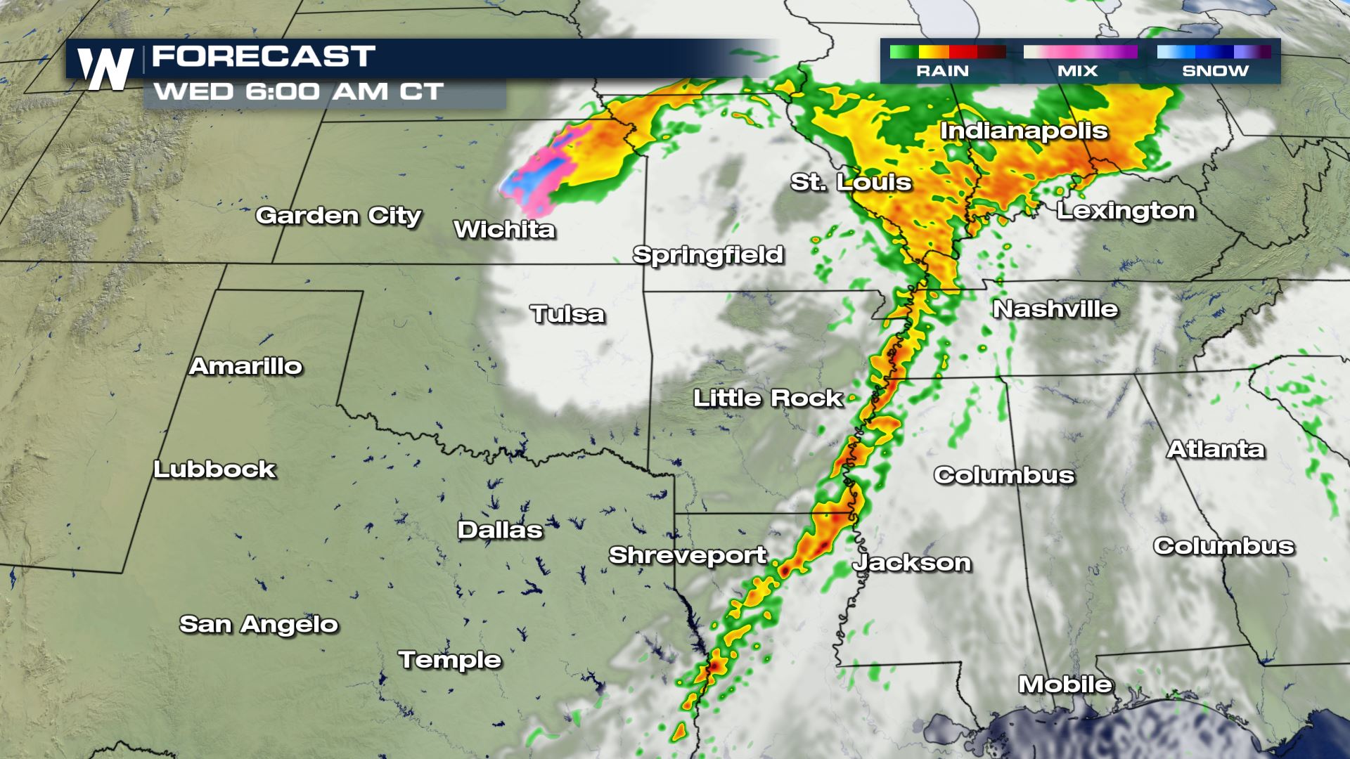
Wednesday Forecast
For the latest on this ongoing severe weather threat make sure to tune into WeatherNation for live updates with VIPIR radar!All Weather News
More
Severe Storm Threat Returns to the Midwest
After several tornadoes ripped through the Mi
31 Jul 2026 2:20 AM


After Reaching Category 5, Genevieve Weakens in the Pacific
PacificFausto is now a post-tropical cyclone.
31 Jul 2026 1:30 AM

Flooding Risk Increases as Heavy Rain Targets the Tri-State Area
Tuesday, heavy rainfall moved across the Nort
30 Jul 2026 12:25 AM

Severe Weather: Energy From the Midwest Now in the Southeast
UPPER MIDWEST - Through Monday, dangerous tor
29 Jul 2026 10:30 PM

Southeast Flood Risk Lingers Near Stalled Front
A stalled boundary over the Southeast will ke
25 Jul 2026 10:55 AM