Two Billion-Dollar Disasters So Far This Year
[An aerial view of Offutt Air Force Base and the surrounding areas affected by flood waters March 17, 2019. An increase in water levels of surrounding rivers and waterways caused by record-setting snowfall over the winter in addition to a large drop in air pressure caused widespread flooding across the state of Nebraska. From Tech. Sgt. Rachelle Blake/U.S. Air Force via NOAA.]
[NOAA] The so-called bomb cyclone that brought heavy snow, blizzard conditions and major flooding to the Midwest in March landed with a resounding meteorological “ka-boom!” and became one of two billion-dollar weather and climate disasters this year.
The other was a severe storm that struck the Northeast, Southeast and Ohio Valley in late February - and it’s only April.
Here's a closer look at highlights from NOAA's latest U.S. climate report from the National Centers for Environmental Information (NCEI):
Climate by the numbers
March 2019
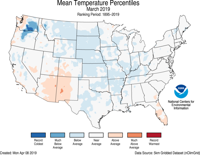
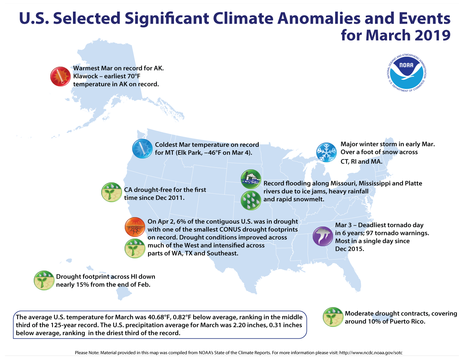
The average temperature for the contiguous U.S. during March was 40.68 degrees F (0.82 of a degree below average), ranking in the middle third of the 125-year record for the month, according to scientists at NOAA's NCEI.
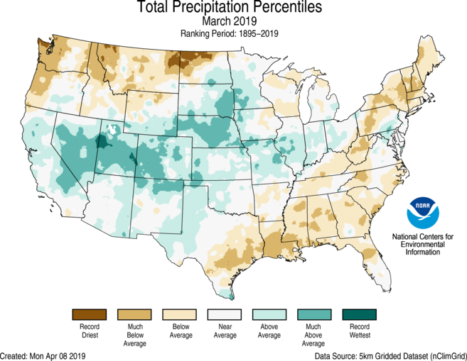
The total precipitation for March for the contiguous U.S. was 2.20 inches (0.31 of an inch below average), which fell within the driest third of the 125-year period of record.
Year to date I January through March 2019
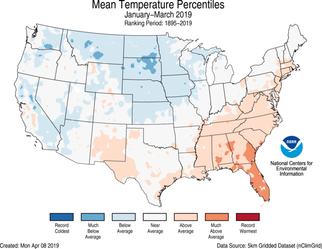
The average U.S. temperature for the year to date (January through March) was 35.03 degrees F (0.12 of a degree F below average), which landed among the middle third of the record. This was the coldest start to a year since 2014.
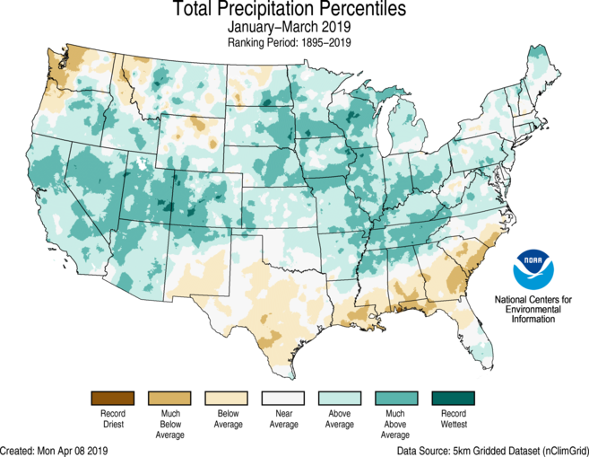
The total precipitation was 8.03 inches (1.07 inches above average), tying with 1949 as 12th wettest YTD on record.
Other noteworthy highlights
-
A baked Alaska: Last month's temperatures in Alaska were 15.9 degrees F above average, making it the hottest March for the state in the 95-year record.
-
Drought improved: At the end of March, about 6 percent of the contiguous U.S. was in drought, down from 12 percent at the end of February.
- Bomb Cyclone: During mid-March, a “bomb cyclone” developed across the central U.S. bringing snow, blizzard conditions, heavy rainfall and above-freezing temperatures across parts of the interior U.S., which already had significant snowpack on the ground. This resulted in widespread flash flooding due to the combination of new rainfall, rapidly melting snow and frozen ground. A State of Emergency was declared for parts of Nebraska, Iowa, South Dakota and Wisconsin as the Missouri, Platte and Mississippi rivers breached their banks.