Updated Winter Outlook - Warm & Dry South and East, Cool & Wet Northwest
Special Stories
23 Nov 2021 11:00 AM
How bad is the weather going to be this winter? It’s one of the most frequently asked questions to meteorologists this time of year. For those of you with inquiring minds, we have an answer. NOAA's Climate Prediction Center has updated the Winter Outlook, covering the months of December, January and February. Only a few cosmetic changes are noted, when compared to the original outlook issued in October.
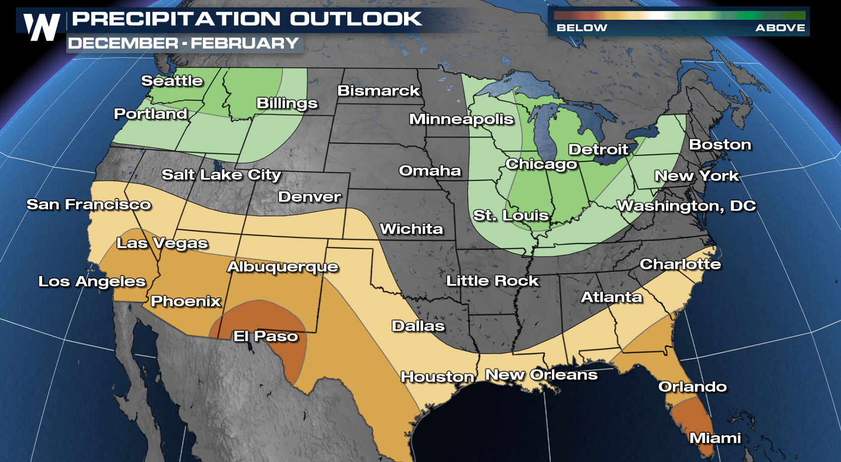
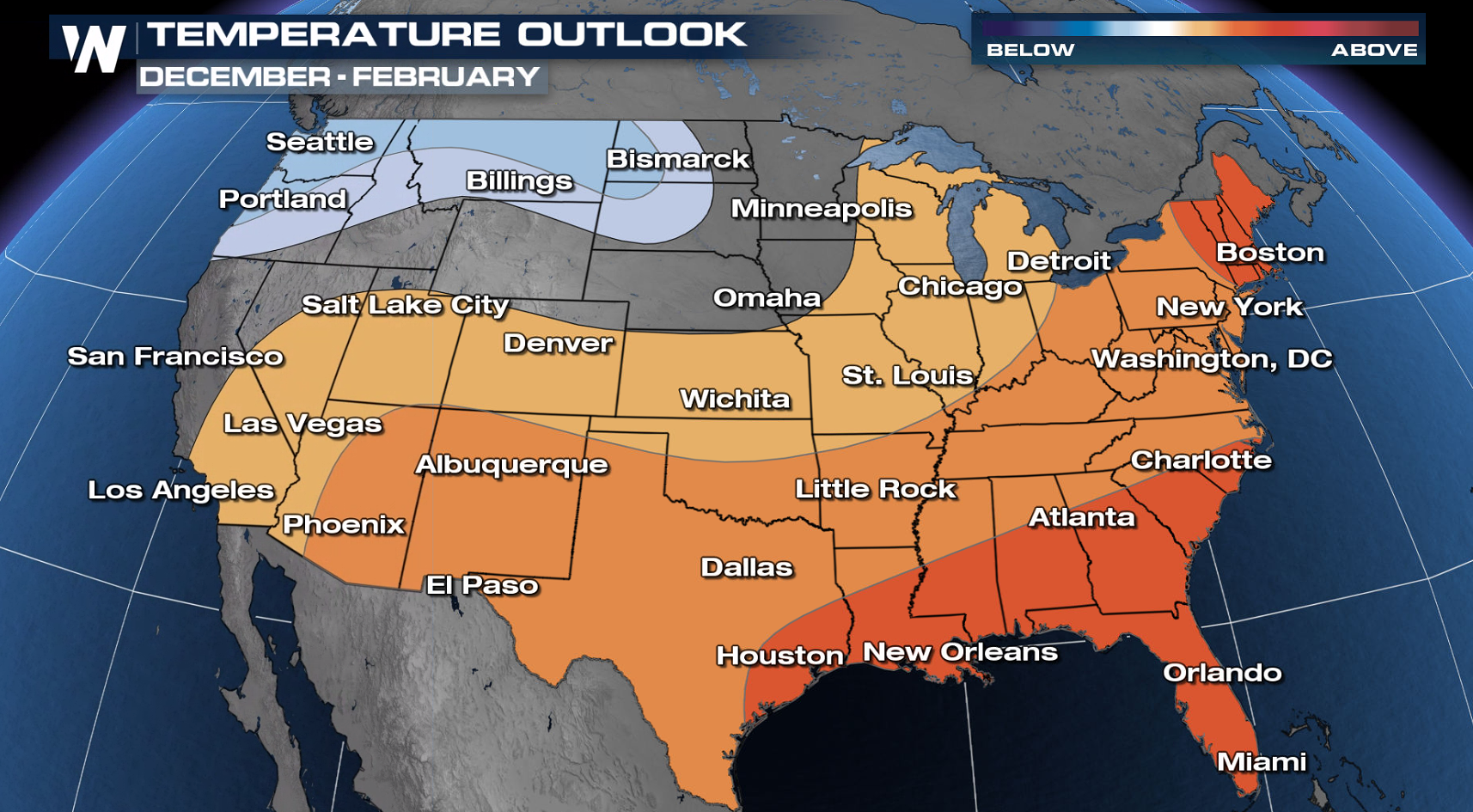 This year, NOAA forecasts cooler-than-average temperatures in the Northwest. The East coast is predicted to be warmer-than-normal, as is all of the South. For precipitation, the southern third of the nation has a higher likelihood of coming in drier-than-average. After a record-setting dry water year for California, that’s not the wet season forecast they were hoping to see. The Ohio Valley, Great Lakes, and Pacific Northwest have the best chance at seeing wetter-than-normal conditions.
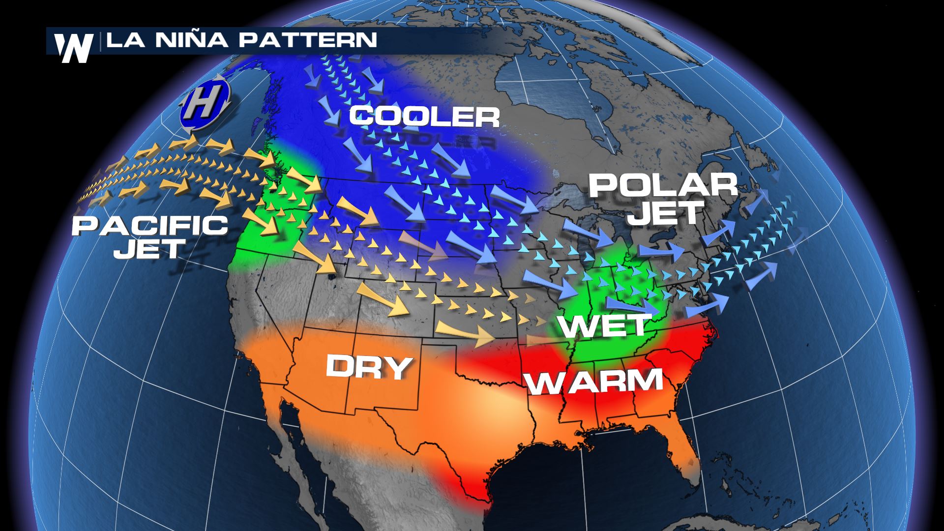
 La Nina was the driving factor in the forecast for the upcoming Winter and the Climate Prediction Center expects conditions to last for several months. La Nina occurs when the waters of the Pacific Ocean show a general trend of cooling, the opposite of an El Nino. During La Nina periods, the Jet Stream is not usually active in the Southern U.S. This usually leads to less storms systems and below average precipitation. Cooler than normal weather typically occurs across the northern tier of the country and occasionally wetter periods as well.
 This year, NOAA forecasts cooler-than-average temperatures in the Northwest. The East coast is predicted to be warmer-than-normal, as is all of the South. For precipitation, the southern third of the nation has a higher likelihood of coming in drier-than-average. After a record-setting dry water year for California, that’s not the wet season forecast they were hoping to see. The Ohio Valley, Great Lakes, and Pacific Northwest have the best chance at seeing wetter-than-normal conditions.
 La Nina was the driving factor in the forecast for the upcoming Winter and the Climate Prediction Center expects conditions to last for several months. La Nina occurs when the waters of the Pacific Ocean show a general trend of cooling, the opposite of an El Nino. During La Nina periods, the Jet Stream is not usually active in the Southern U.S. This usually leads to less storms systems and below average precipitation. Cooler than normal weather typically occurs across the northern tier of the country and occasionally wetter periods as well.

All Weather News
More