Upper Midwest and Plains Severe Weather Risk
Special Stories
7 Aug 2019 9:58 AM
A storm system sliding through the Upper Midwest and Central Plains will bring the risk for severe weather this afternoon and evening.
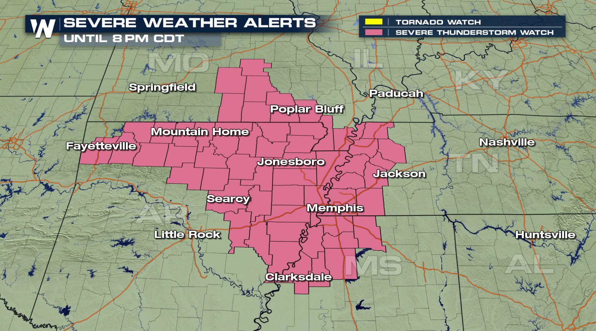
A severe thunderstorm watch is in effect until 8 p.m. Central Time this evening.
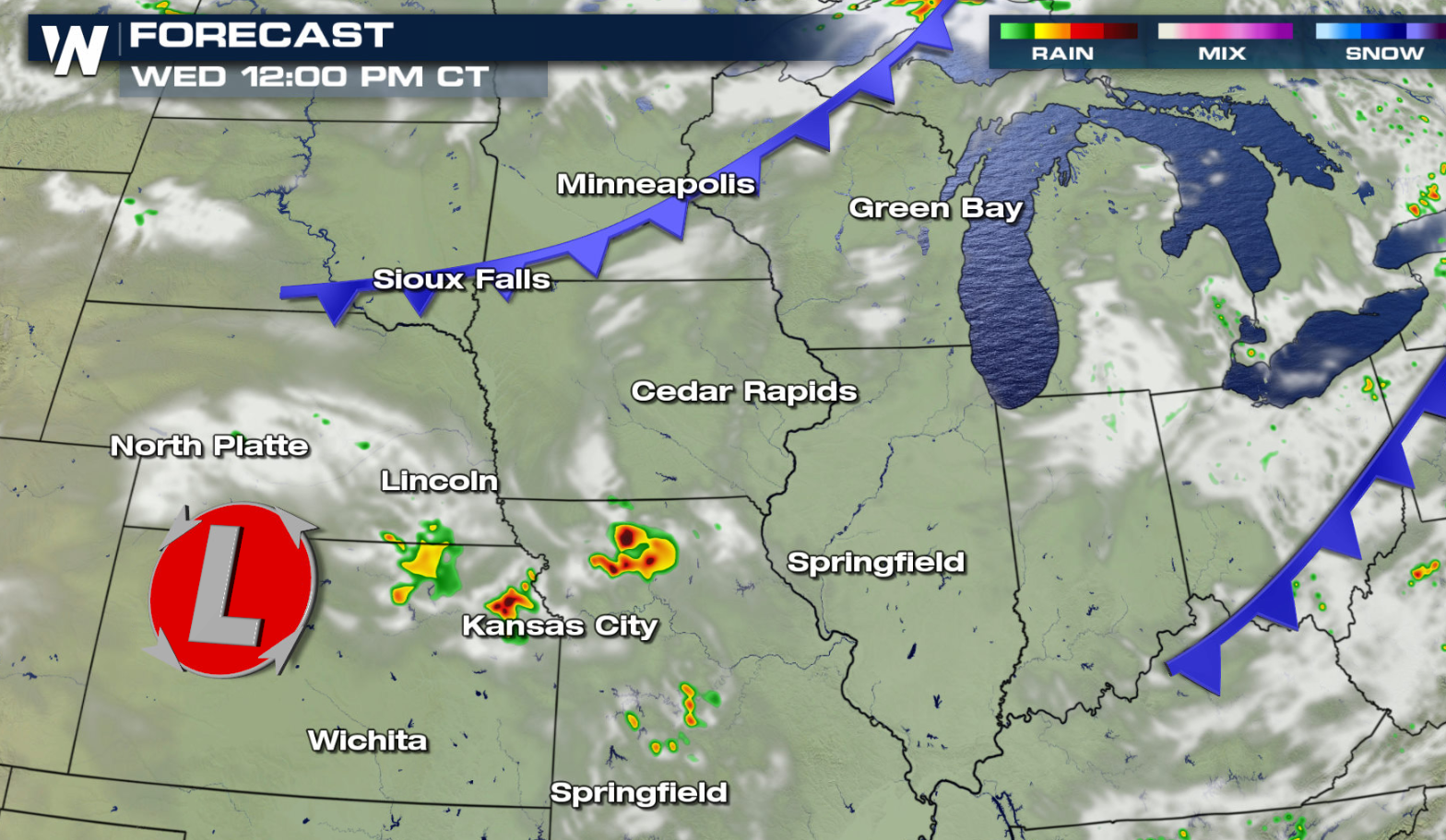
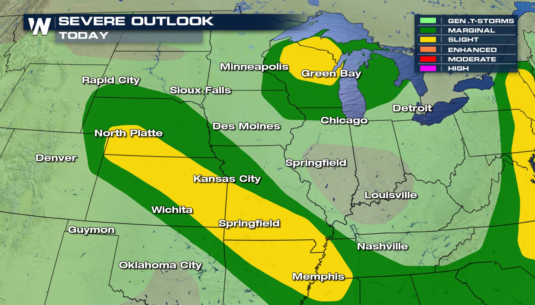 A marginal risk for severe storms extends from the Western Great Lakes to the Central Plains. A slight risk includes the Upper Peninsula of Michigan, most of Wisconsin and Southeast Minnesota. A second areas mapped out by the Storm Prediction Center highlights areas from Northwest Arkansas to the Kansas-Nebraska border.
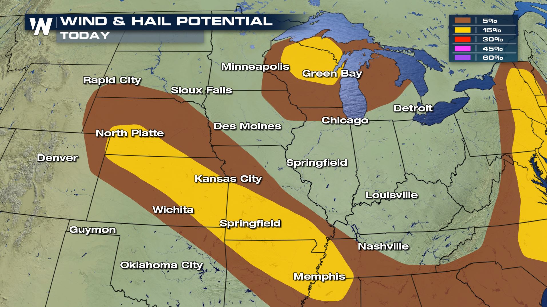
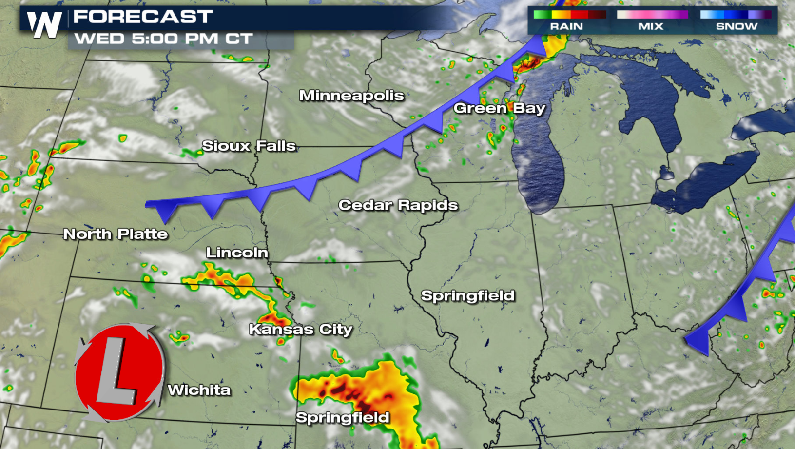
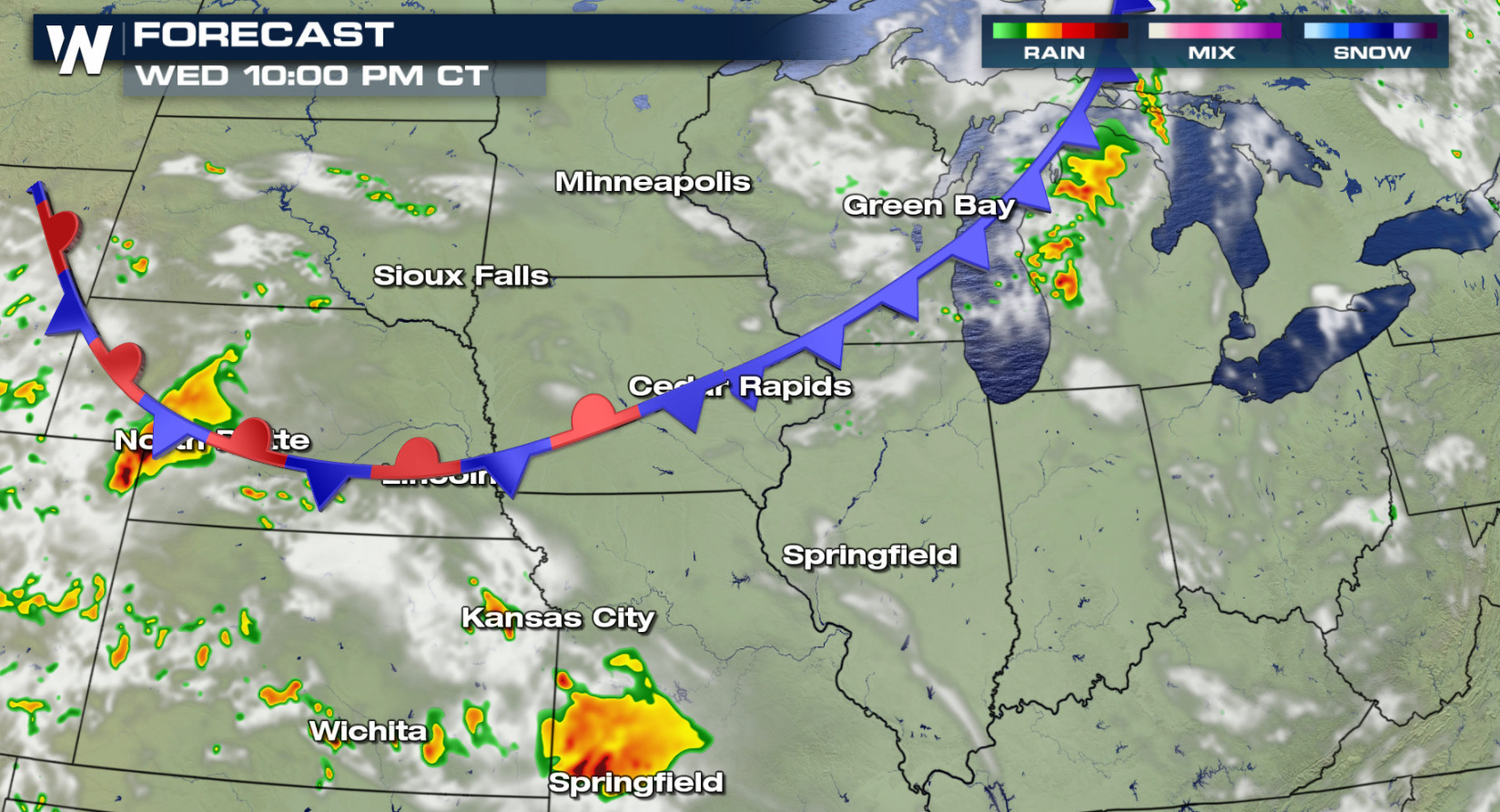
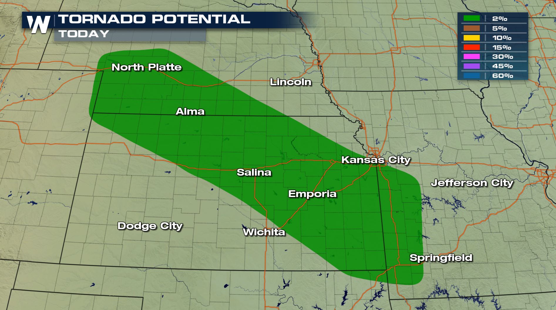 Strong wind gusts and large hail are the biggest concerns for today (Wednesday). The risk for tornadoes is low in the Central Plains. A cold front will drop slowly southward throughout the day. It will be the focus for thunderstorm development. Two lows - one near the Canadian Border and the other in Kansas - will enhance storm strength and help to produce severe storms.
 Check back with WeatherNation throughout the day for the latest updates on-air and online if you are in the severe weather risk areas.
Want to understand more about the Storm Prediction Center risk categories? Watch to learn more about what a marginal, slight, enhanced, moderate, and high risk means when the SPC issues these threats around the country.
https://youtu.be/_lunoaofhN0
For WeatherNation: Meteorologist Mace Michaels
Check back with WeatherNation throughout the day for the latest updates on-air and online if you are in the severe weather risk areas.
Want to understand more about the Storm Prediction Center risk categories? Watch to learn more about what a marginal, slight, enhanced, moderate, and high risk means when the SPC issues these threats around the country.
https://youtu.be/_lunoaofhN0
For WeatherNation: Meteorologist Mace Michaels
A marginal risk for severe storms extends from the Western Great Lakes to the Central Plains. A slight risk includes the Upper Peninsula of Michigan, most of Wisconsin and Southeast Minnesota. A second areas mapped out by the Storm Prediction Center highlights areas from Northwest Arkansas to the Kansas-Nebraska border.
Strong wind gusts and large hail are the biggest concerns for today (Wednesday). The risk for tornadoes is low in the Central Plains. A cold front will drop slowly southward throughout the day. It will be the focus for thunderstorm development. Two lows - one near the Canadian Border and the other in Kansas - will enhance storm strength and help to produce severe storms.
Check back with WeatherNation throughout the day for the latest updates on-air and online if you are in the severe weather risk areas.
Want to understand more about the Storm Prediction Center risk categories? Watch to learn more about what a marginal, slight, enhanced, moderate, and high risk means when the SPC issues these threats around the country.
https://youtu.be/_lunoaofhN0
For WeatherNation: Meteorologist Mace MichaelsAll Weather News
More


More Storms for the East Sunday and Monday
A low-pressure system crashing through the Mi
2 Aug 2026 2:20 AM

After Reaching Category 5, Genevieve Weakens in the Pacific
PacificGenevieve formed on last Friday south
2 Aug 2026 1:30 AM

Flooding, Severe Storms Target the Midwest Again
After an active week of storms across the nor
1 Aug 2026 1:40 AM

Flooding Risk Increases as Heavy Rain Targets the Tri-State Area
Tuesday, heavy rainfall moved across the Nort
30 Jul 2026 12:25 AM

Severe Weather: Energy From the Midwest Now in the Southeast
UPPER MIDWEST - Through Monday, dangerous tor
29 Jul 2026 10:30 PM