SEVERE WEATHER: Major Severe Threat for Midwest
Special Stories
19 Jul 2019 6:04 AM
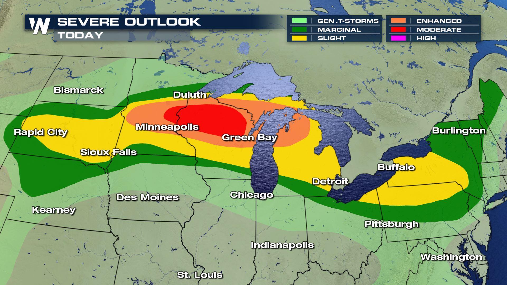
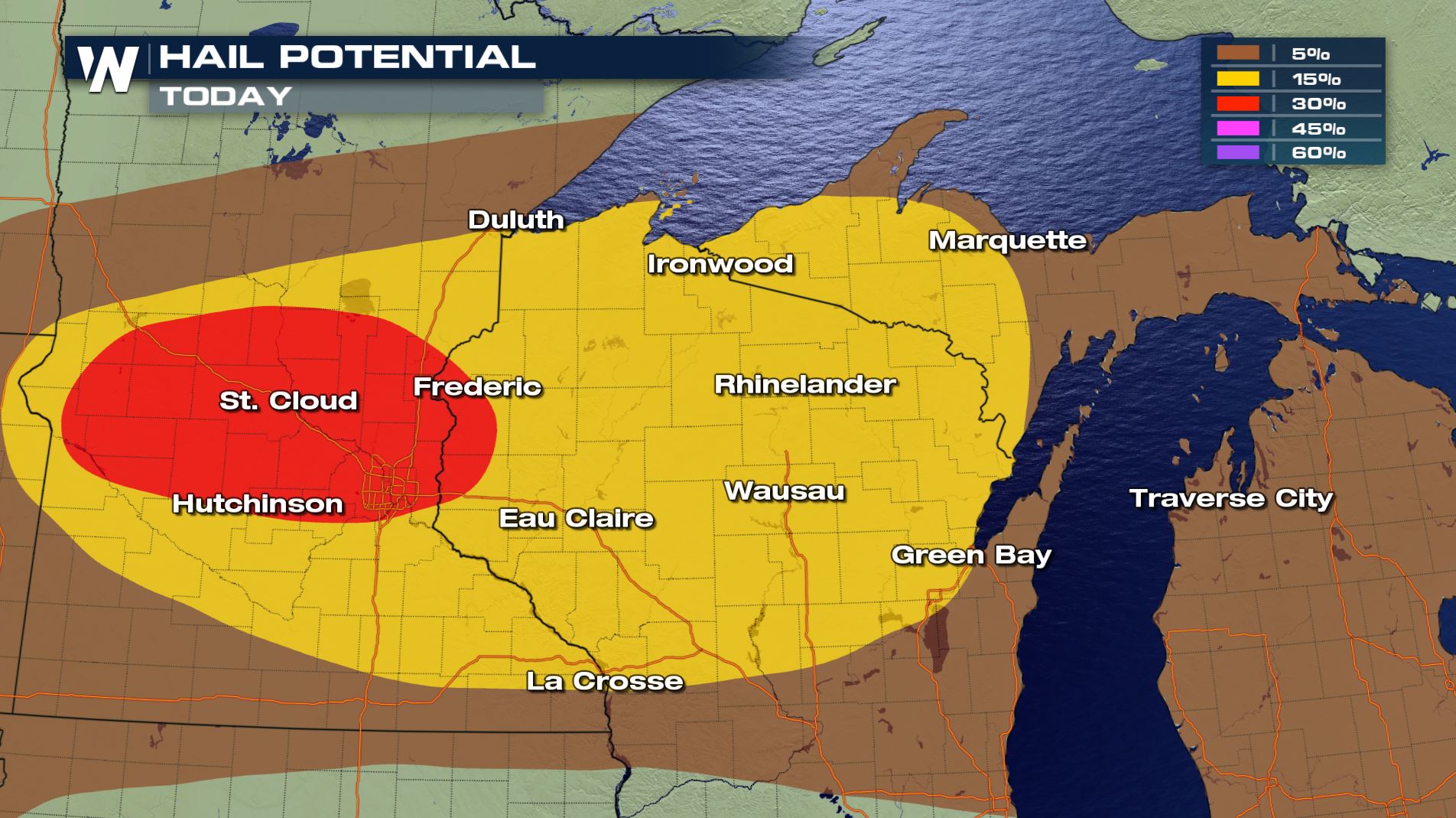
Severe thunderstorms and flooding rains have been occurring in the Upper Midwest and Northern Plains the last few days and more adverse weather is ahead. Large hail, damaging wind gusts, and a few tornadoes are possible again today (Friday), mainly in Minnesota and Wisconsin.
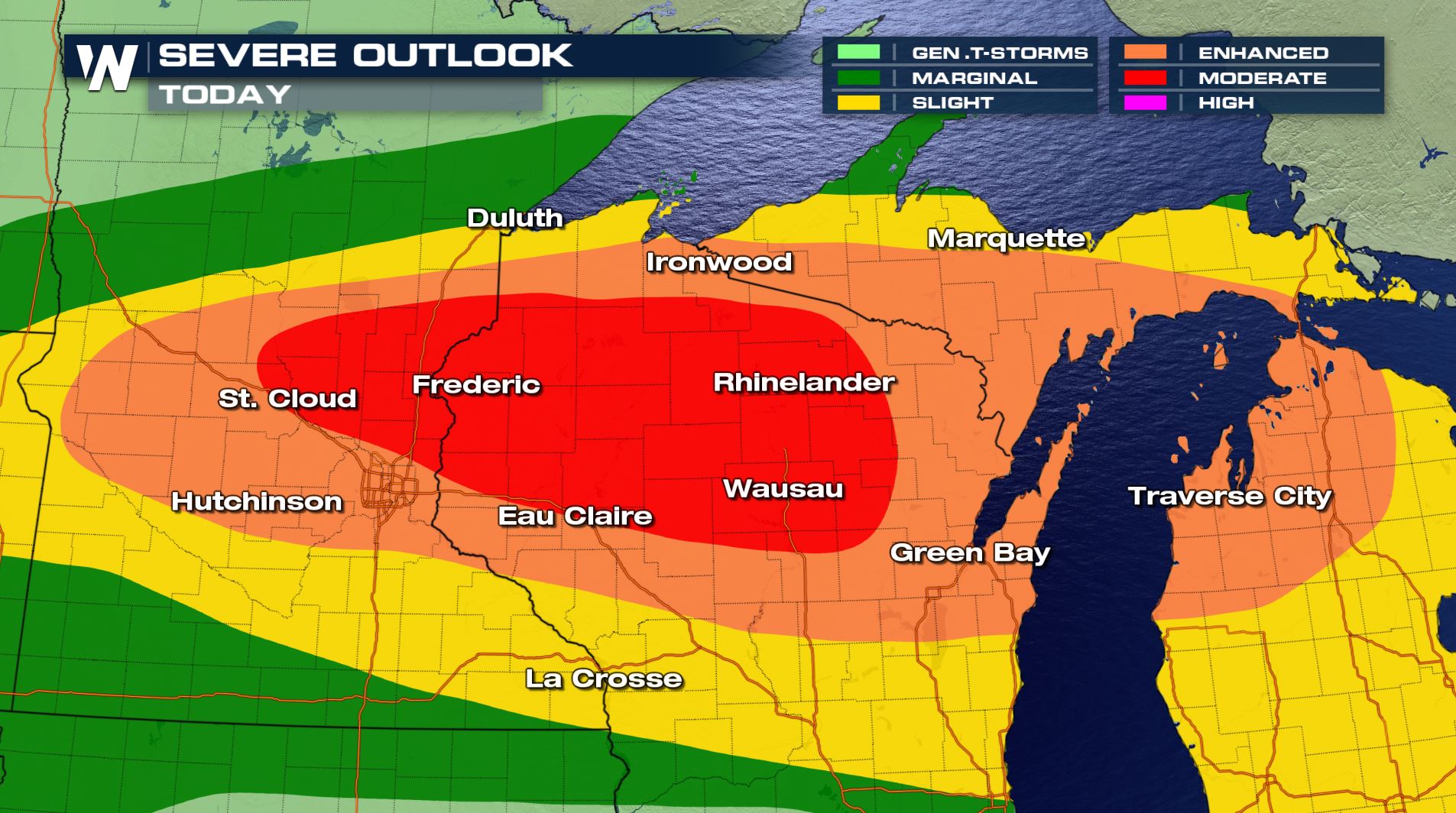
As of Friday morning, the Storm Prediction Center has upgraded the risk to a 'moderate' risk, the 2nd highest threat level on the severe weather scale.
 Warm temperatures and high humidity will lead to strong instability in the afternoon and evening. This will fuel severe thunderstorms throughout the day, which will last into the night.
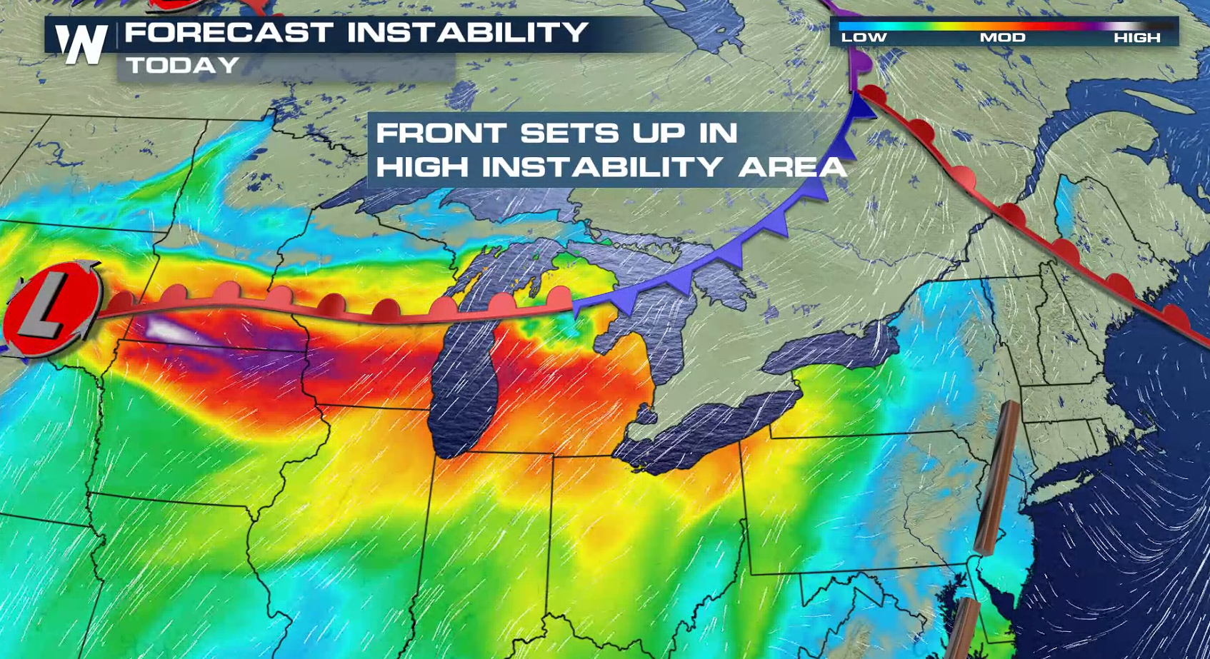
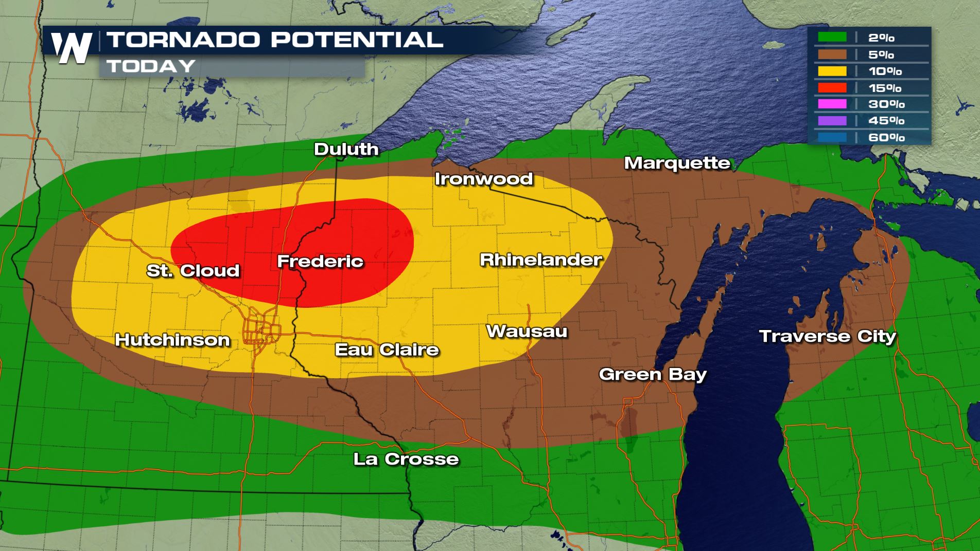
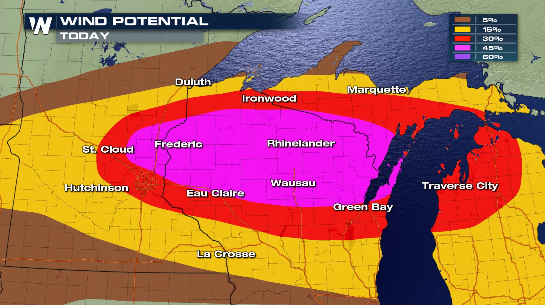
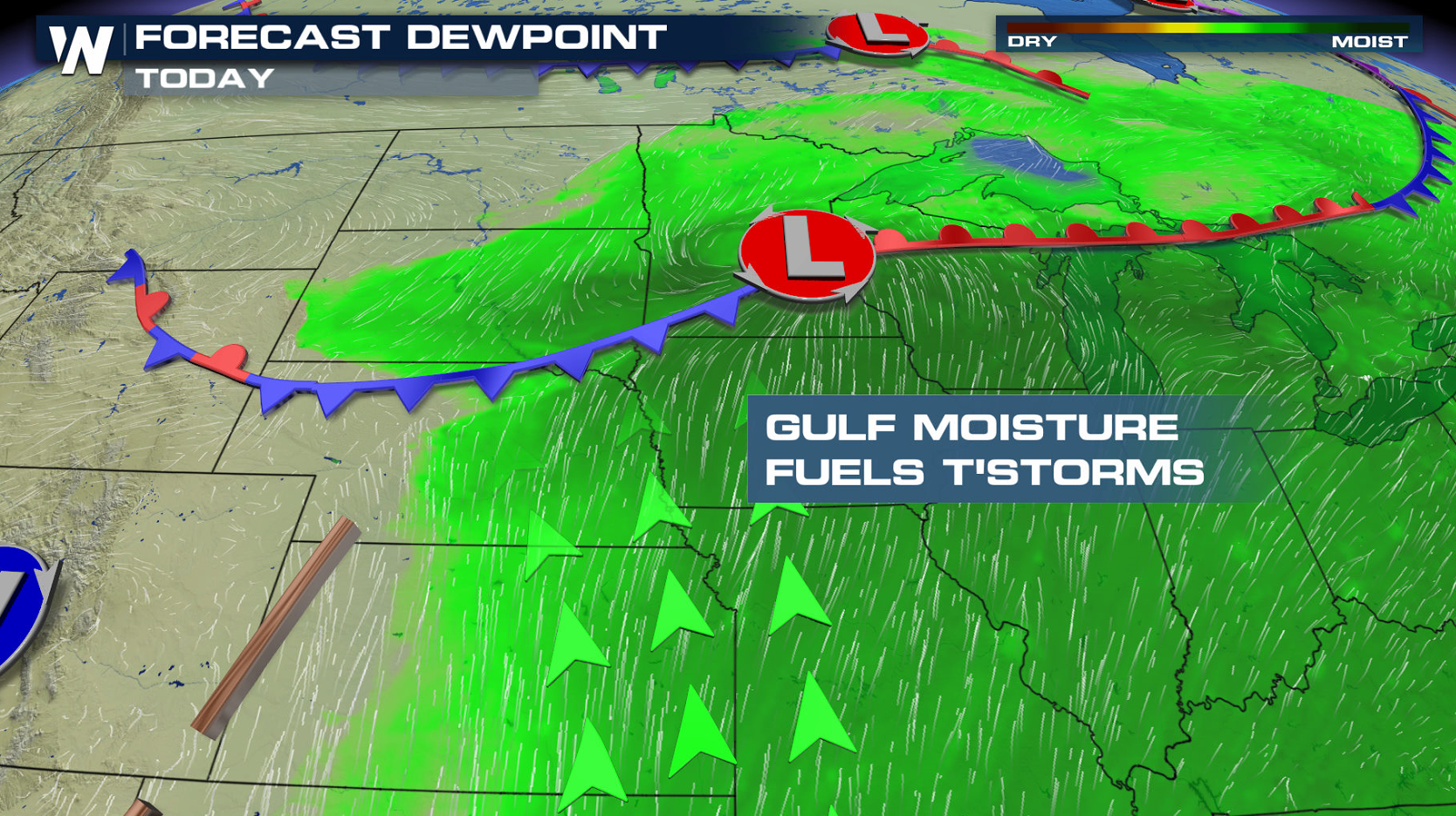 Most of the day will be hot and dry. In the late afternoon, a complex of thunderstorms will likely develop near the warm front and ahead of the low pressure center. All modes for severe weather will be possible: tornadoes, large hail, and damaging wind gusts. As the cluster of storms moves to the east, strong wind gusts and heavy rain will be the biggest concerns.
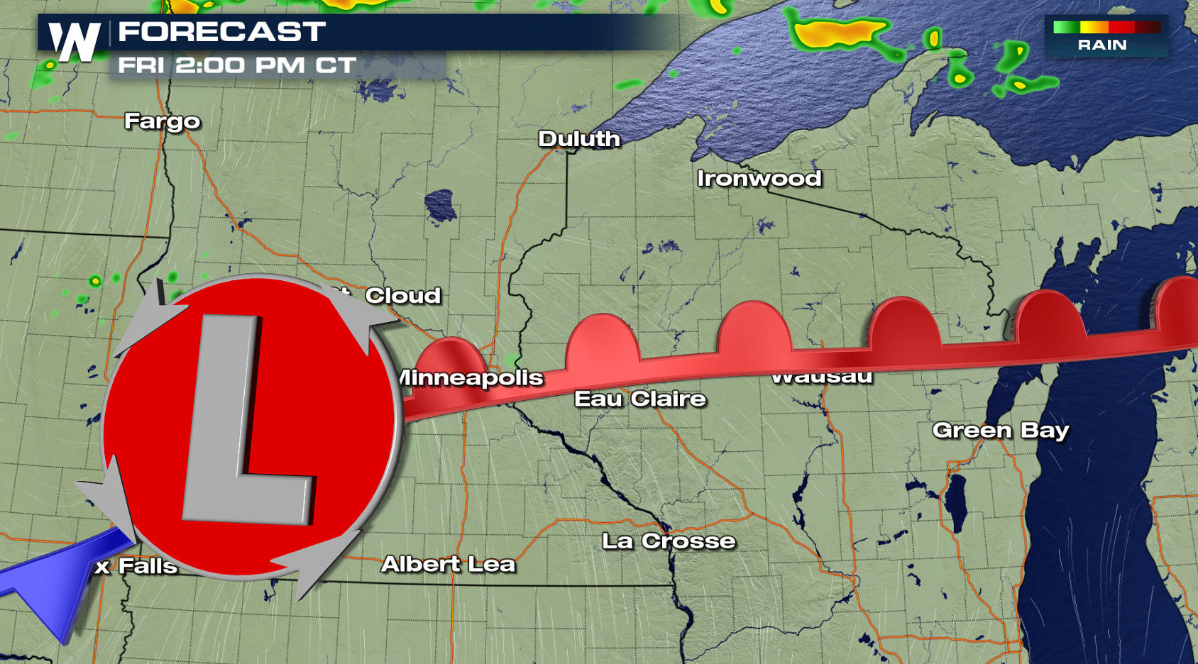
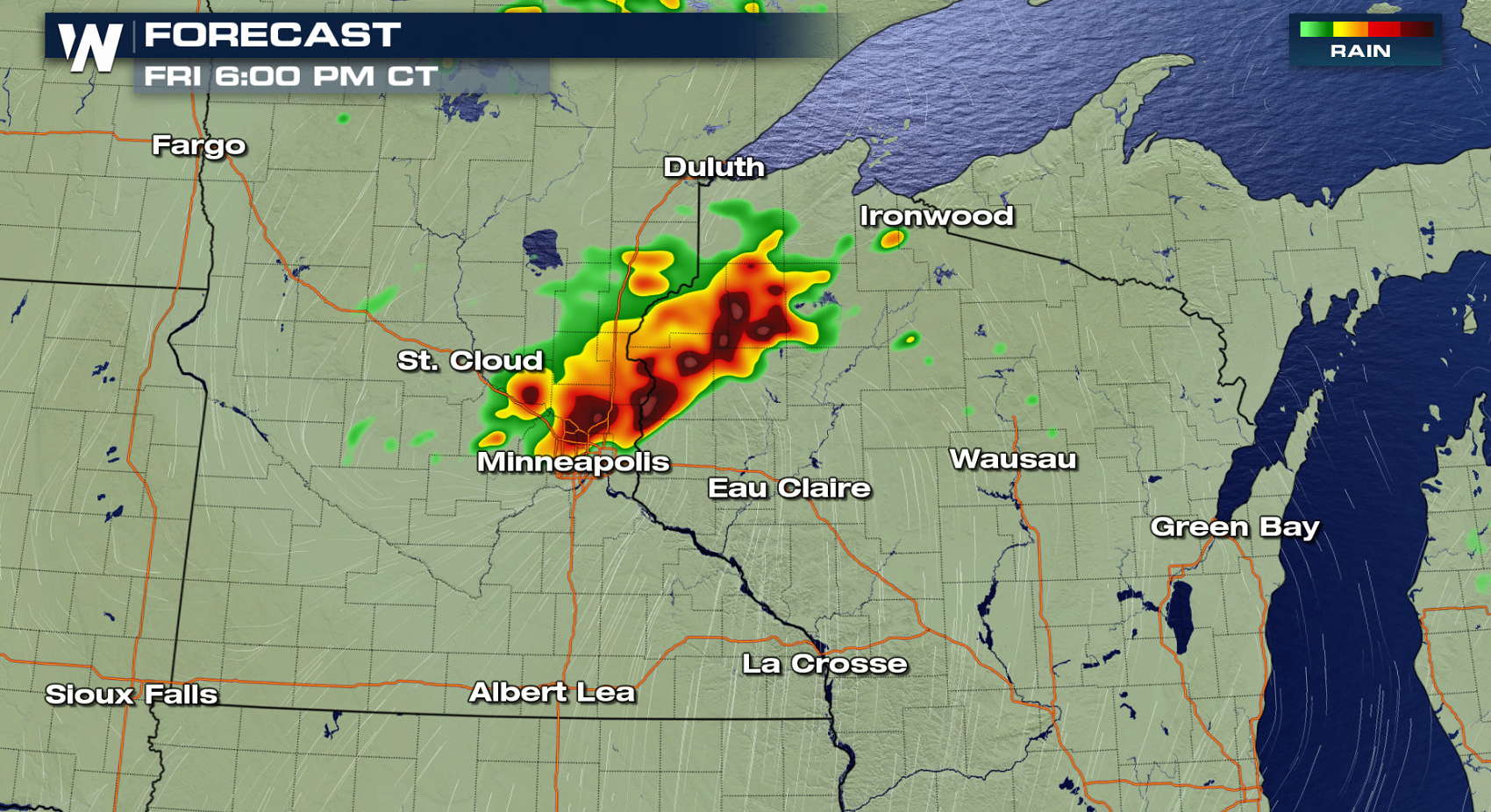
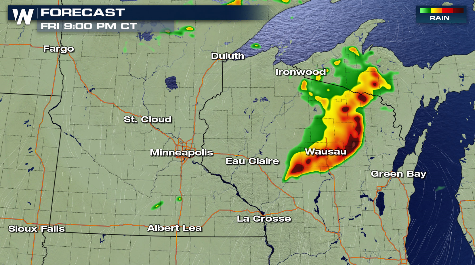 Along with the severe potential, heavy rain may produce flooding, with 2" to 4" of rain possible in the short amount of time.
For WeatherNation: Meteorologist Mace Michaels
Along with the severe potential, heavy rain may produce flooding, with 2" to 4" of rain possible in the short amount of time.
For WeatherNation: Meteorologist Mace Michaels
Warm temperatures and high humidity will lead to strong instability in the afternoon and evening. This will fuel severe thunderstorms throughout the day, which will last into the night.
Most of the day will be hot and dry. In the late afternoon, a complex of thunderstorms will likely develop near the warm front and ahead of the low pressure center. All modes for severe weather will be possible: tornadoes, large hail, and damaging wind gusts. As the cluster of storms moves to the east, strong wind gusts and heavy rain will be the biggest concerns.
Along with the severe potential, heavy rain may produce flooding, with 2" to 4" of rain possible in the short amount of time.
For WeatherNation: Meteorologist Mace MichaelsAll Weather News
More
East Gears Up for Stormy, Wet Weekend
A low pressure system crashing through the Mi
1 Aug 2026 11:35 AM


Flooding, Severe Storms Target the Midwest Again
After an active week of storms across the nor
1 Aug 2026 1:40 AM


After Reaching Category 5, Genevieve Weakens in the Pacific
PacificFausto is now a post-tropical cyclone.
31 Jul 2026 1:30 AM

Flooding Risk Increases as Heavy Rain Targets the Tri-State Area
Tuesday, heavy rainfall moved across the Nort
30 Jul 2026 12:25 AM

Severe Weather: Energy From the Midwest Now in the Southeast
UPPER MIDWEST - Through Monday, dangerous tor
29 Jul 2026 10:30 PM