Using Satellites to Help Forecast Wildlife Migration & Wildfires
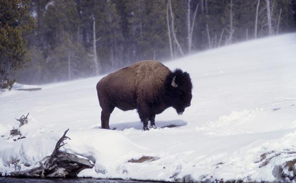
Studying national parks is helpful for this type of climate research, because human land use is restricted in these spaces. With little interference from people since Yellowstone was founded in 1872, scientists are better able to isolate climate change as a factor in any changes they observe there.
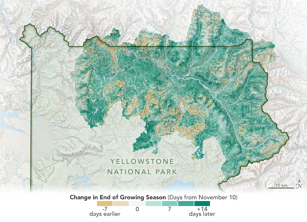 [A study using data from two NASA Earth science satellites reveals that the season for vegetation growth has been getting longer in Yellowstone National Park. Likely a result of climate change decreasing the severity of winters and warming average temperatures overall, this effect on the productivity of grasslands has contributed to the growing number of bison in the park. Credits: Joshua Stevens/NASA Earth Observatory]
With the growing season getting longer across large areas of Yellowstone, the bison have had more opportunity to feed on grass, which has likely helped their population grow. But, as they pursue the best grazing spots throughout the season, they sometimes leave the protected area of the park. Tracking grassland growth can provide a clue to the bison's next move.
"It's complex – we found that the length of the growing season is changing quickly,” said Christopher Potter, an Earth scientist at NASA’s Ames Research Center in California’s Silicon Valley and author of the study. “But, by compiling daily satellite data, we created a near-real-time online tool that resource managers can consult, much like a weather map."
The National Park Service originally approached NASA ten years ago, looking for insight into patterns of growth across Yellowstone’s grasslands. At that point, there was enough long-term, daily satellite data to make a good start on meeting those needs, but to draw really confident conclusions about climate effects, scientists needed to look at a longer period.
An instrument called MODIS, short for Moderate Resolution Imaging Spectroradiometer, now has a record 20 years long. Mounted aboard two different satellites (Terra, launched in 1999, and Aqua, launched in 2002), it has been able to view the entire surface of Earth not covered by clouds every day for two decades. For the climate study, Potter compiled data from this entire stretch – the first time such a long run of daily updates has been compiled and analyzed for this National Park. With the data analysis performed, Yellowstone’s wildlife managers can now check maps tracking the daily change in snow-covered area and the vegetation growth that follows. They’ll use those data to try to anticipate where and when confrontations between bison and human communities are likely to happen and prepare the most appropriate conservation actions at the park boundaries.
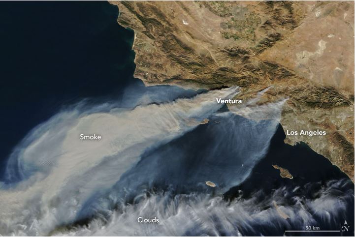 [Thick smoke streamed from several fires in southern California when the Moderate Resolution Imaging Spectroradiometer (MODIS) on NASA’s Terra satellite captured this natural-color image in the afternoon on December 5, 2017.]
Staying Ahead of Fire Season
The same concept can be used to help fight wildfires, and Potter is developing a similar system in Alaska. Across expanses of wilderness that are difficult to monitor, fire fighters have rarely had as much insight as NASA’s satellite data can provide. When maps from the MODIS data show snow starting to melt and vegetation – which is fuel for fire – growing rapidly across the landscape, teams will know within a week’s time where to stand ready to fight potential fires.
"MODIS is the silver bullet for these large-scale wilderness situations where daily updates make all the difference in planning a response," said Potter. "That’s what it was designed for, and it's the only thing out there that can do it."
What’s more, anyone can use the MODIS data this way. Like all data from NASA’s Earth observing satellites, it’s available for download from NASA's data center and, with just a program to make daily comparisons of the measure of interest, these satellite data will have much to tell about America’s wilderness.


