Waterspouts Spotted In Florida This Week

PALM BEACH, FL - On Thursday, twin waterspouts were spotted by the Palm Beach Police Department just offshore of Palm Beach, Florida. Afternoon thunderstorms helped to trigger some waterspouts throughout the day.
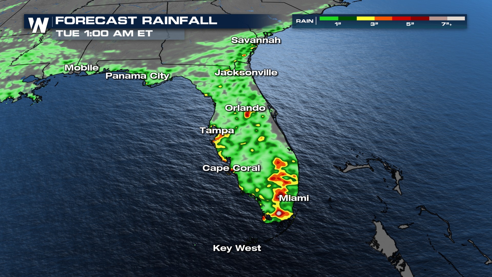
The forecast for Florida remains wet and stormy. As we head into Saturday, with the support of deep moisture from the Caribbean as well as a front to the north, south Florida may receive rainfall totals between 2-4" in some spots. The Weather Prediction Center has issued a MARGINAL (level 1 out of 4) risk for flooding on Saturday for South Florida. A flood watch has also been issued around Jacksonville and far NE Florida.
These areas of heavy rain could fall in some areas that have received 4"+ since Thursday. Saturated soils may lead to localized ponding and flooding.
Coastal Hazards
With an increase in moisture and winds pushing onshore from the Atlantic and into the eastern U.S. coast, marine alerts have been issued through Saturday. This means if you are heading to any southeast coast beaches for a late summer trip, please be sure to pay attention to the color of the flags. If the beach is waving two red flags, it is closed to the public.
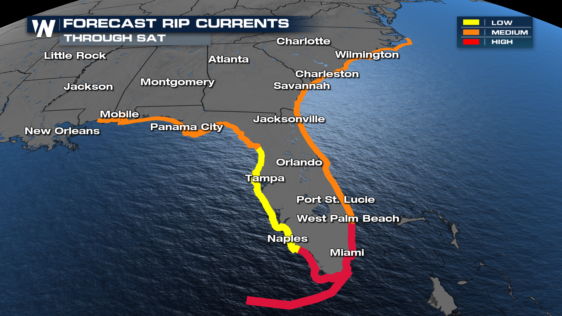
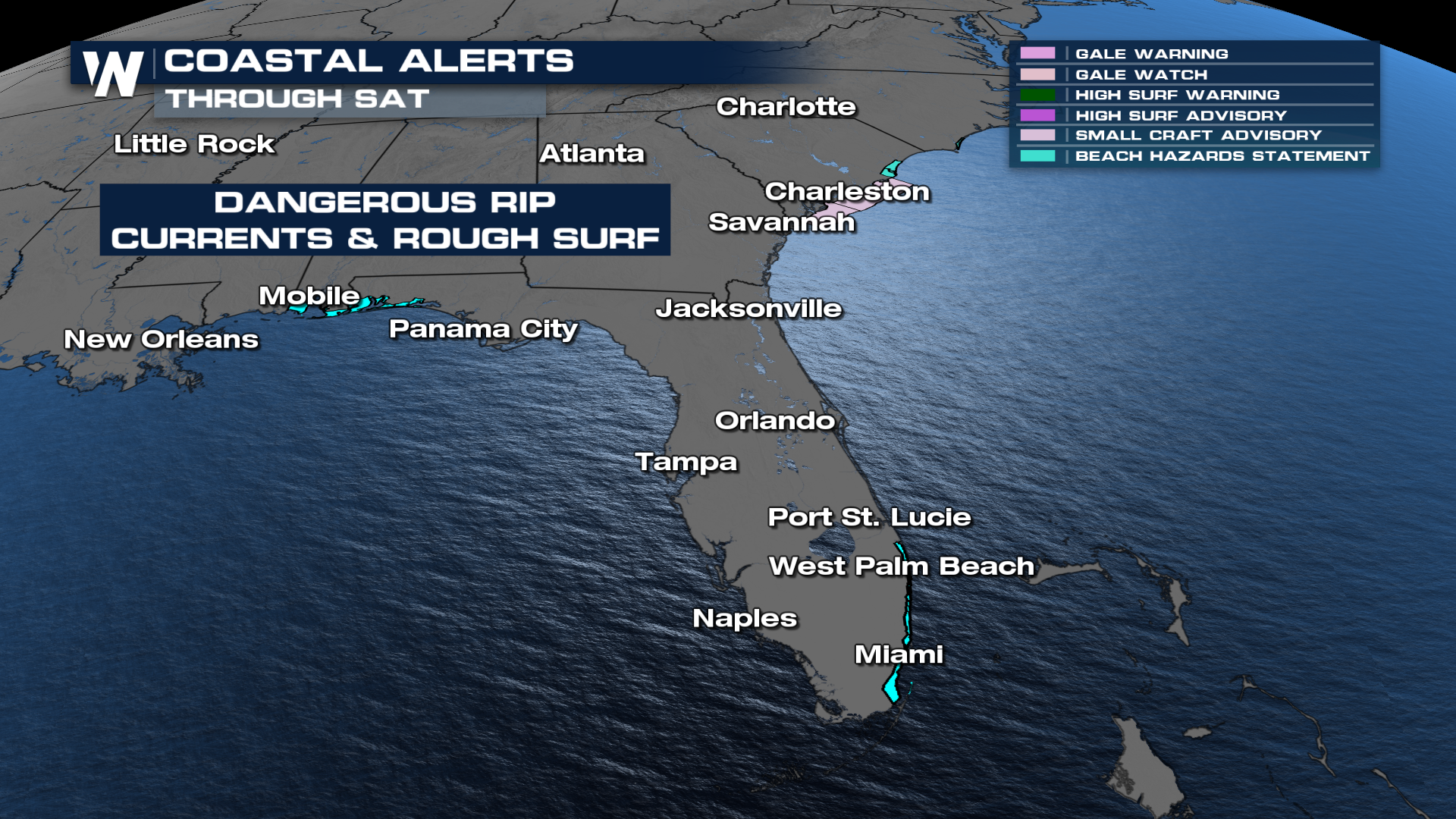 The rip current forecast remains high from Jacksonville, FL through Charleston, SC on Saturday as well, so be cautious if you are spending time in the water.
Looking Ahead
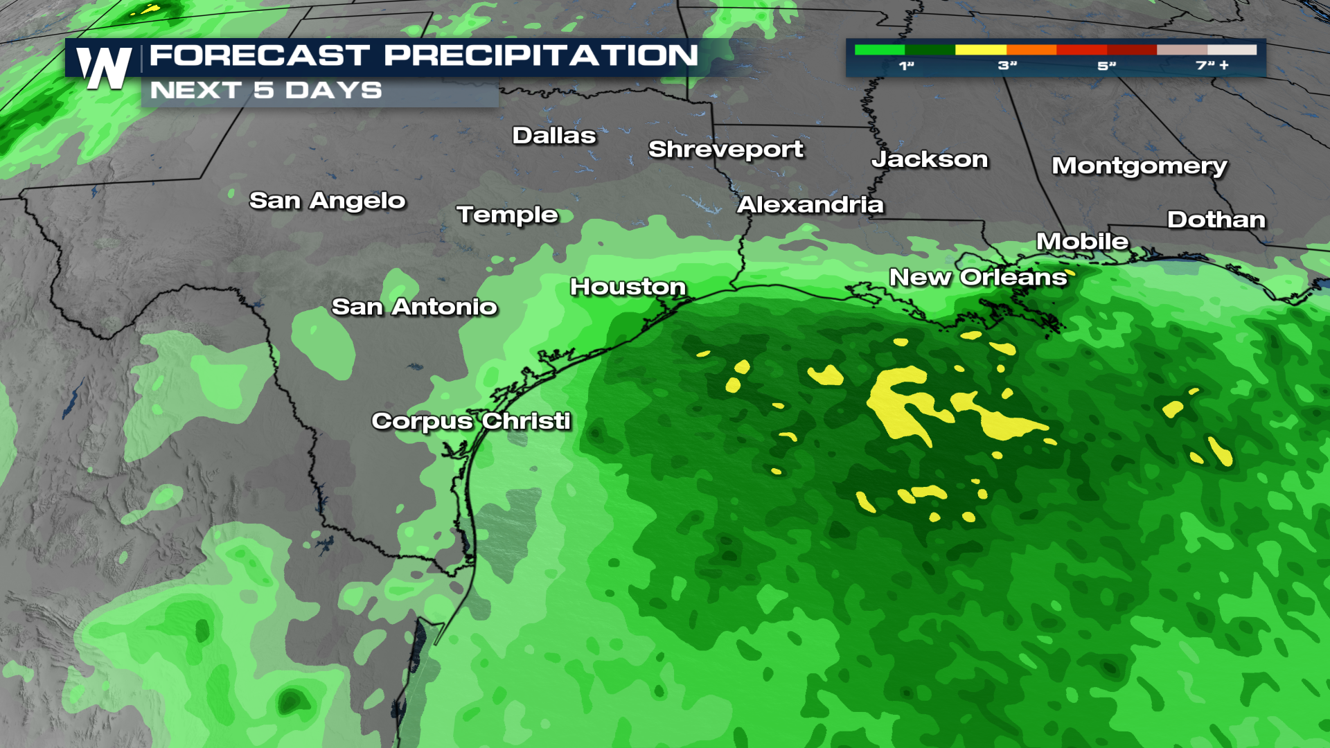
The upper-level low that spurred showers for Florida for much of the week will move west across the Gulf this weekend, undercutting the ridge of high pressure in the MS Valley. This will bring showers and some minor heat relief to the Lone Star State by Monday.
The Weather Prediction Center has already released their Day 1-5 precipitation outlooks and as we get into next week we will be watching for those rainfall totals south of Louisiana, east Texas, and Mississippi.
 For more of these details, be sure to join us LIVE on WeatherNation.


