Severe Storm Threat in the Northeast
Special Stories
3 Sep 2020 10:17 AM
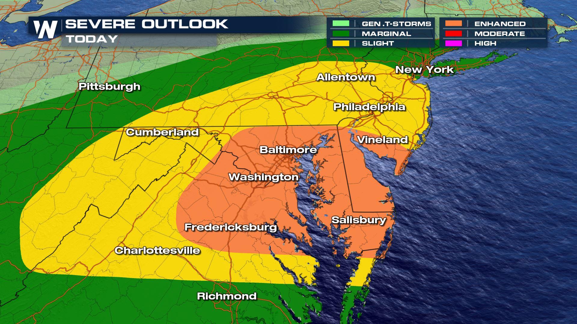
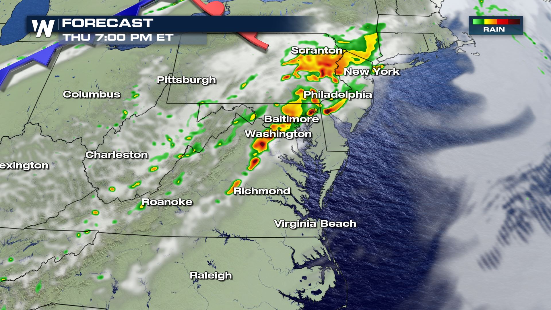
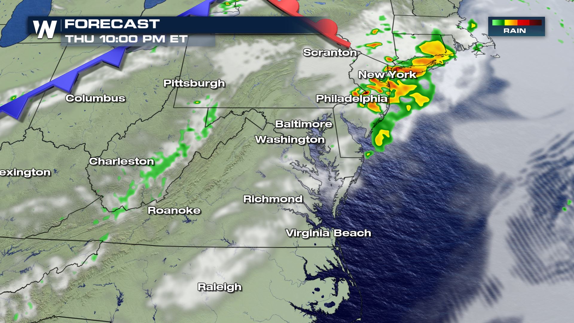
Strong jet stream energy will continue to feed the threat for severe weather in the Mid-Atlantic and Northeast this Thursday. This afternoon, there is an enhanced risk (level 3 on a scale of 1 to 5) and a slight risk for severe thunderstorms (level 2 on a scale of 1 to 5) from Virginia, Maryland to New Jersey and Pennsylvania. This is the most likely corridor that we may see severe storms including the threat for tornadoes, hail, damaging winds, and some locally heavy rain.
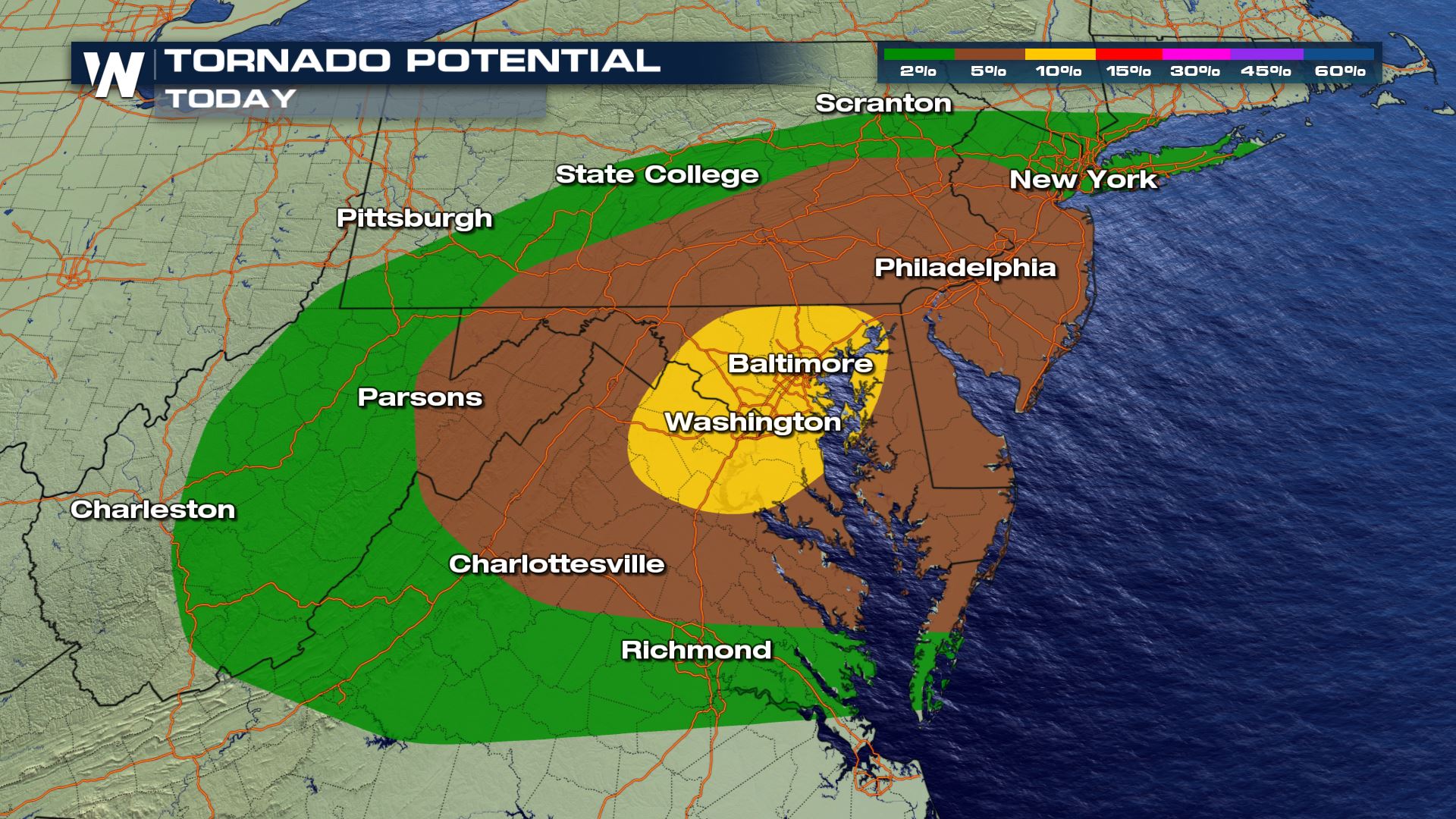
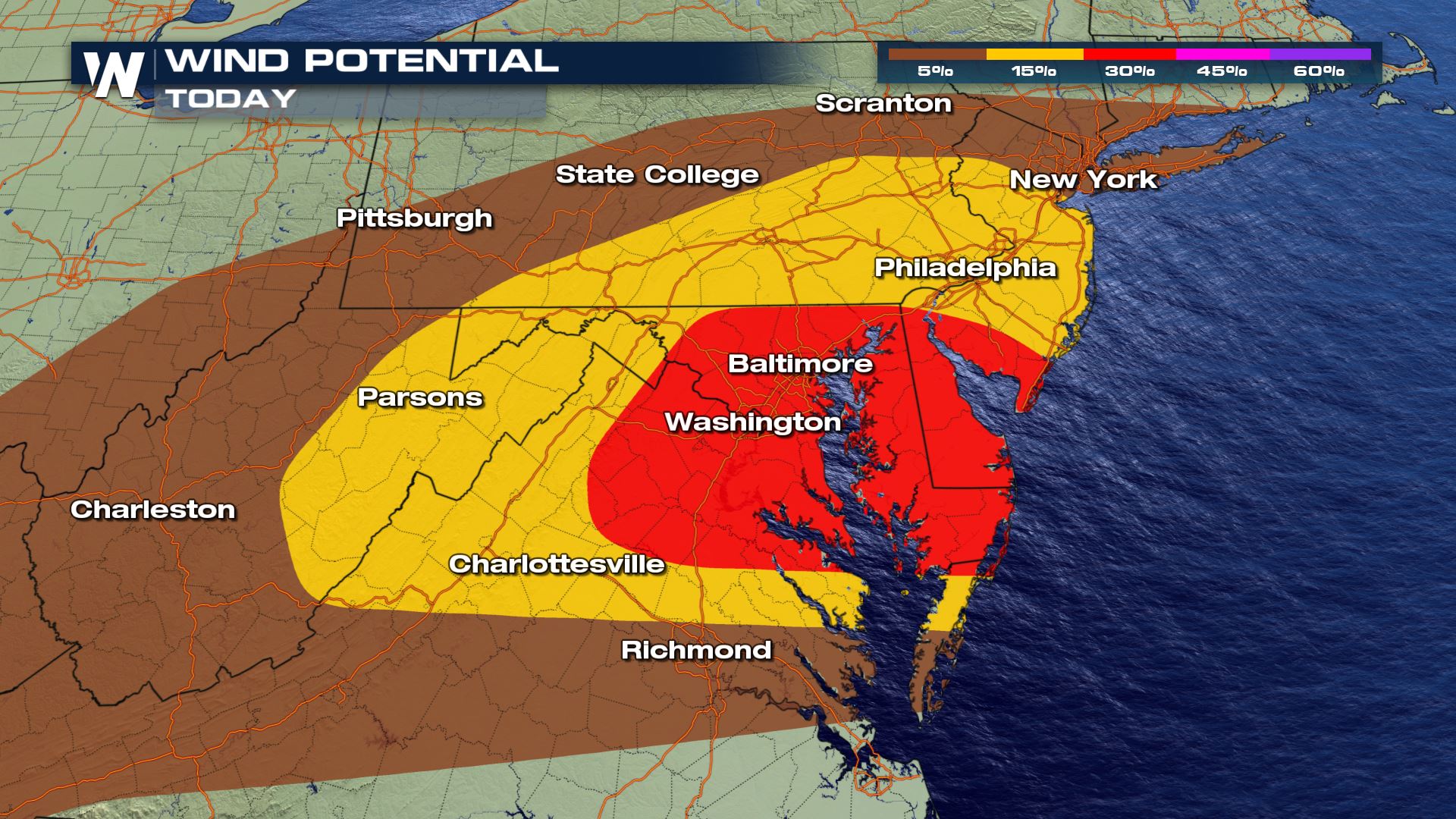 As the cold front moves to the southeast on Thursday, severe storms are possible along the Eastern Seaboard in the Mid-Atlantic. All modes of severe weather will be possible with these storms Thursday afternoon as we monitor a very dynamic atmosphere. Note that even if you are not in the highest highlighted area for tornadoes you should still have a severe weather plan.
A warm front will help southerly flow establish a warm, unstable set-up. As a cold front and mid-level trough help provide lift, strong storms will begin firing during the early afternoon. These will work their way into the enhanced risk area by the late afternoon and early evening.
As the cold front moves to the southeast on Thursday, severe storms are possible along the Eastern Seaboard in the Mid-Atlantic. All modes of severe weather will be possible with these storms Thursday afternoon as we monitor a very dynamic atmosphere. Note that even if you are not in the highest highlighted area for tornadoes you should still have a severe weather plan.
A warm front will help southerly flow establish a warm, unstable set-up. As a cold front and mid-level trough help provide lift, strong storms will begin firing during the early afternoon. These will work their way into the enhanced risk area by the late afternoon and early evening.
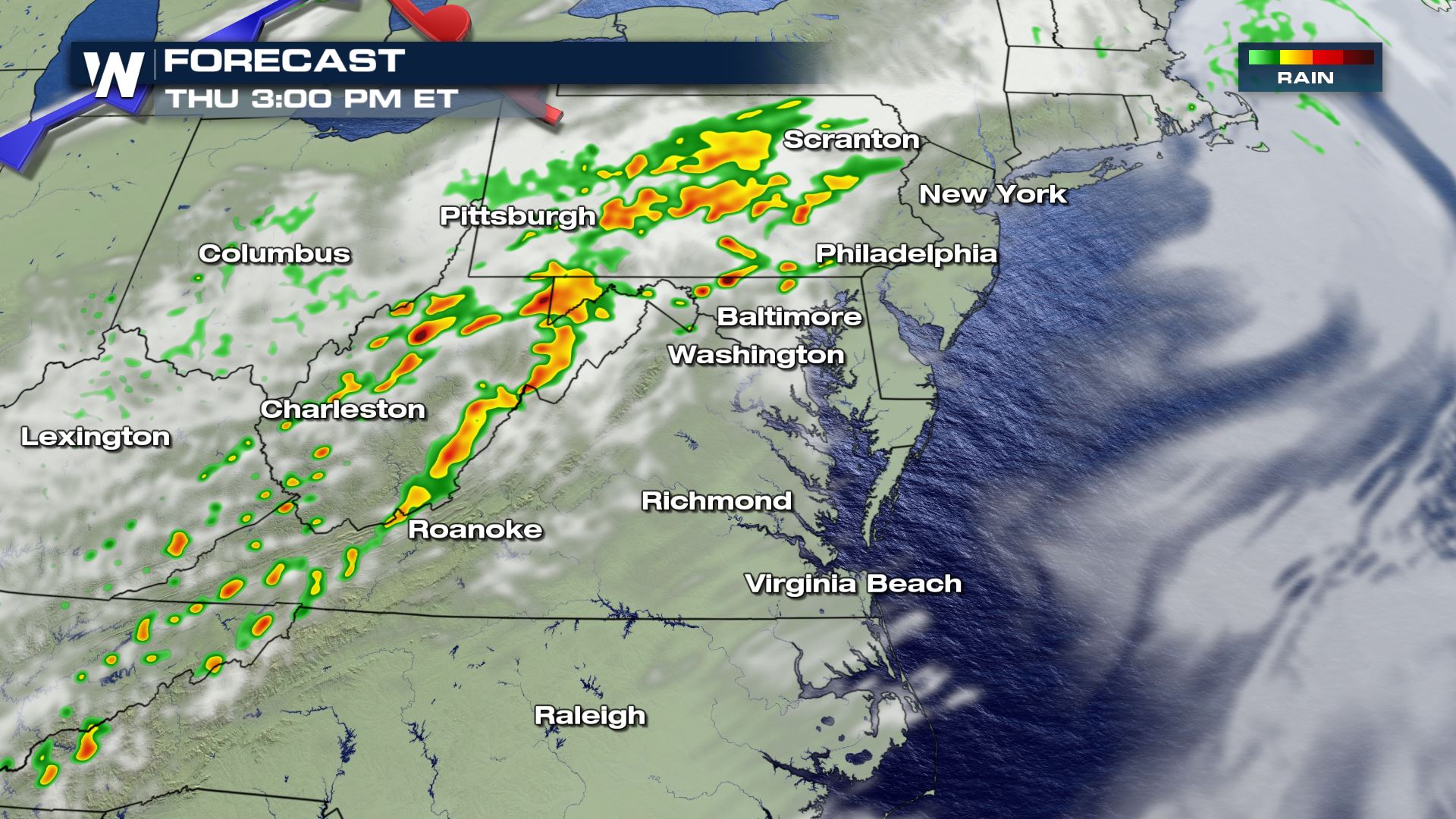
 Because of the recent rainy pattern, much of the Mid-Atlantic has saturated soils. With one to three inches of additional rainfall possible with these thunderstorms, localized flooding could become an issue. A Flash Flood Watch has been issued for Kentucky, West Virginia and Ohio.
 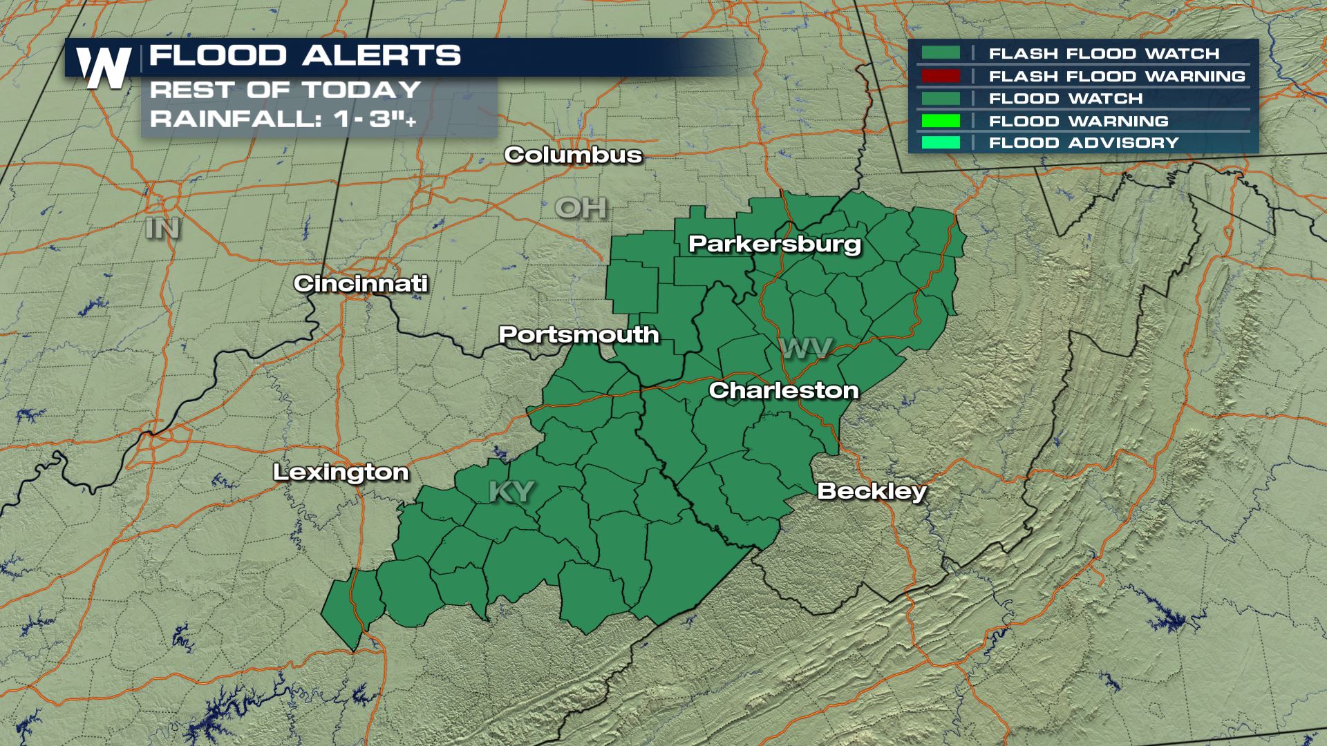 WeatherNation will keep you up to date on-air and online with the latest severe weather forecasts.
As the cold front moves to the southeast on Thursday, severe storms are possible along the Eastern Seaboard in the Mid-Atlantic. All modes of severe weather will be possible with these storms Thursday afternoon as we monitor a very dynamic atmosphere. Note that even if you are not in the highest highlighted area for tornadoes you should still have a severe weather plan.
A warm front will help southerly flow establish a warm, unstable set-up. As a cold front and mid-level trough help provide lift, strong storms will begin firing during the early afternoon. These will work their way into the enhanced risk area by the late afternoon and early evening.
Because of the recent rainy pattern, much of the Mid-Atlantic has saturated soils. With one to three inches of additional rainfall possible with these thunderstorms, localized flooding could become an issue. A Flash Flood Watch has been issued for Kentucky, West Virginia and Ohio.
WeatherNation will keep you up to date on-air and online with the latest severe weather forecasts.All Weather News
More

Severe Storm Threat Returns to the Midwest
After several tornadoes ripped through the Mi
31 Jul 2026 12:10 AM


After Reaching Category 5, Genevieve Weakens in the Pacific
PacificFausto is now a post-tropical cyclone.
30 Jul 2026 11:20 PM

Flooding Risk Increases as Heavy Rain Targets the Tri-State Area
Tuesday, heavy rainfall moved across the Nort
30 Jul 2026 12:25 AM

Severe Weather: Energy From the Midwest Now in the Southeast
UPPER MIDWEST - Through Monday, dangerous tor
29 Jul 2026 10:30 PM

Southeast Flood Risk Lingers Near Stalled Front
A stalled boundary over the Southeast will ke
25 Jul 2026 10:55 AM