Overnight Storms in Texas and Oklahoma
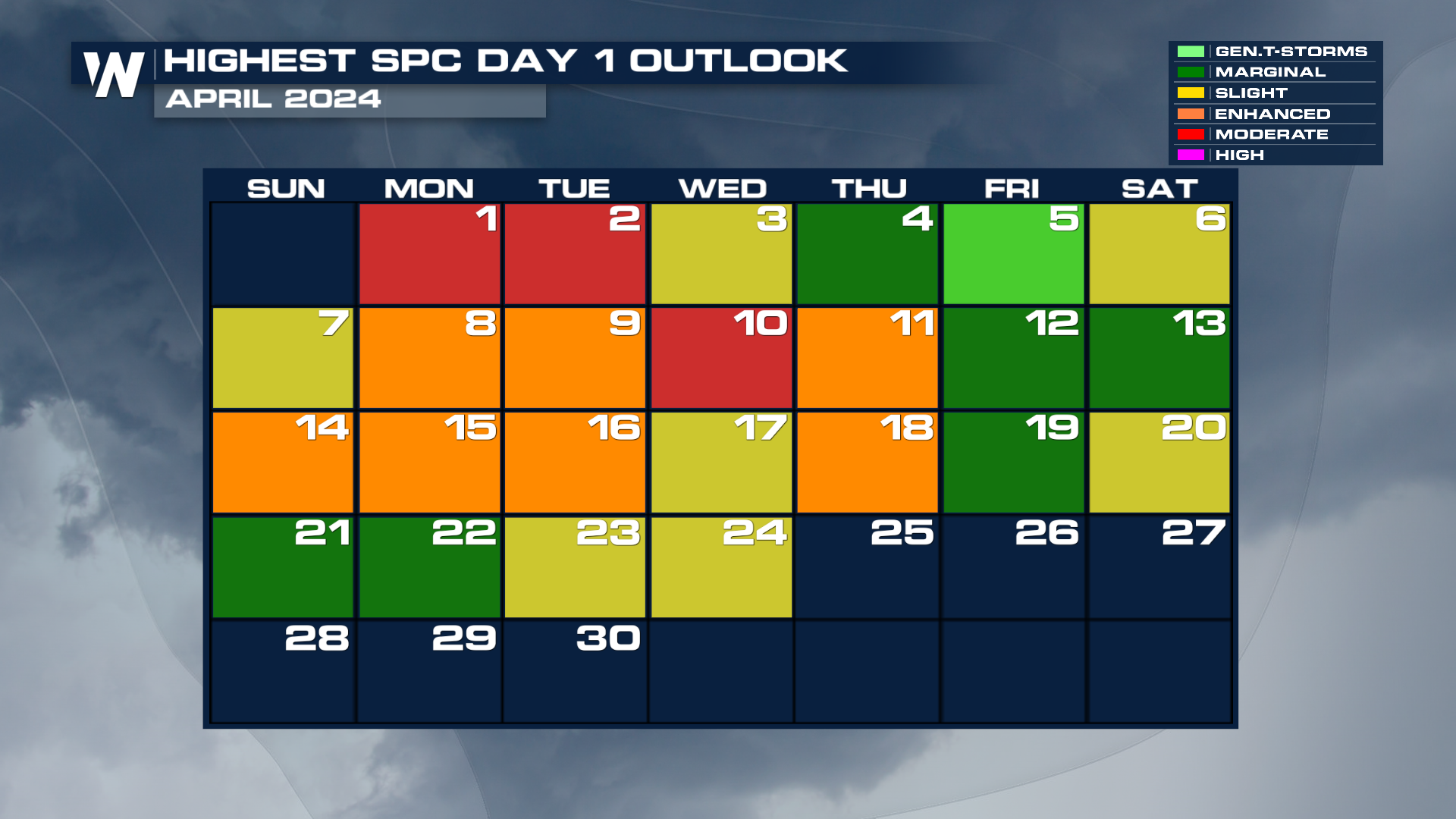
The plains are experiencing an ongoing threat of severe weather as a weather pattern has set up. If it seems like April has been particularly busy with severe weather, that would be correct - except for two days, each day has seen some level of severe weather. More than one-third of those days have been Level 3 or higher.
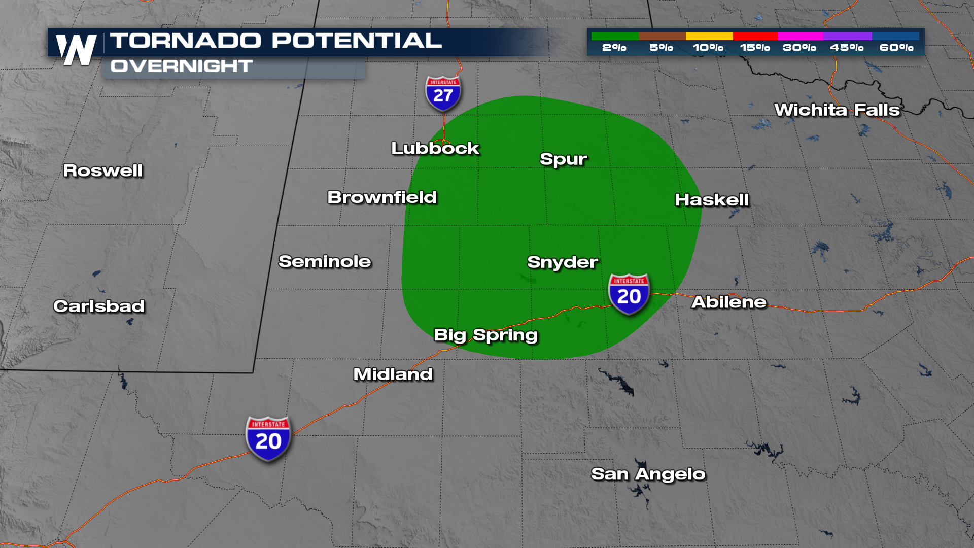
 Overnight, storms look to push through Oklahoma and Kansas north of the frontal boundary. There is still some concern that we may get strong storms overnight capable of producing marginally severe hail and an isolated tornado.
The primary threat includes tornadoes, especially in West Texas from Lubbock down to I-20 including Midland and Abilene.
 The severe weather threat continues into Thursday, Friday and even the weekend for similar areas. Please stay weather-aware!