Rain & Cooler Temperatures Slated for the Northeast
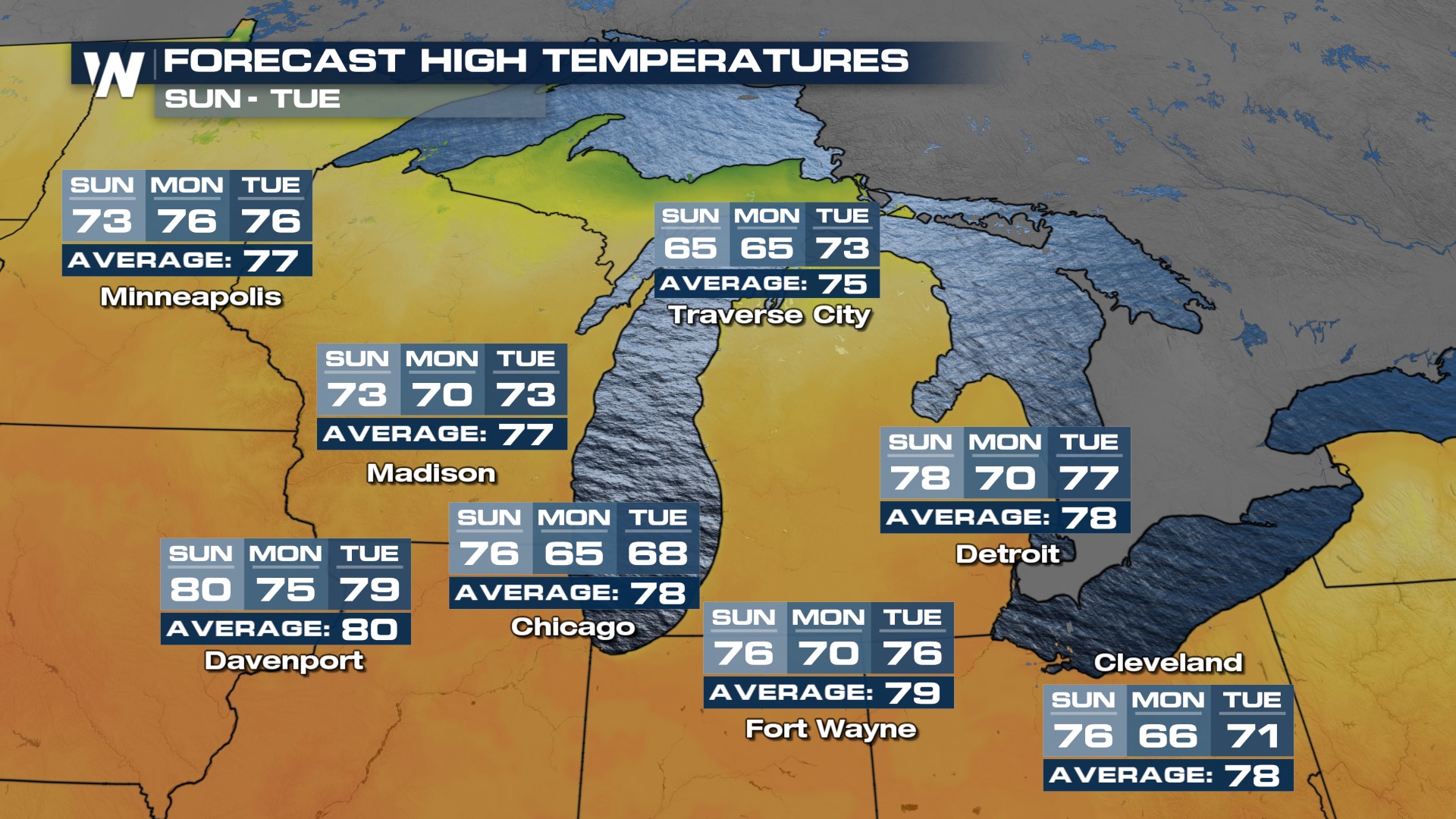
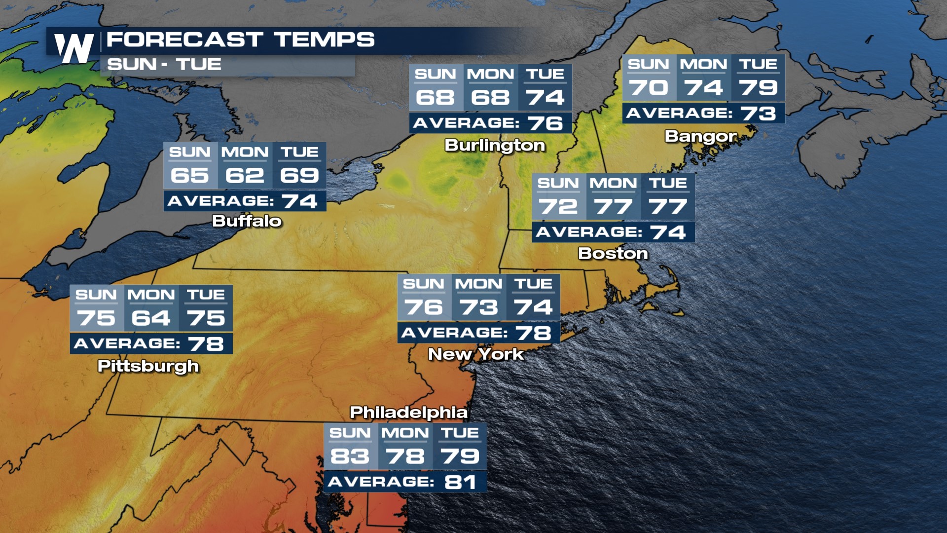
An area of low pressure in the upper atmosphere around Ontario, Canada will keep northwest flow streaming into the Great Lakes and Northeast, moderating temperatures early this week. The biggest influence from this low will be lower humidity, most noticeable in the morning hours when temperatures will drop at or below average for morning lows.
This system will push across the Eastern U.S. on Sunday and early Monday. Some showers and storms will also be possible with enough moisture building along the cold front.
Those lower dew points will also help keep temperatures in check, especially over the Great Lakes region. Around these regions, temperatures will be well below average. The coolest temperatures will be in the Upper Great Lakes region and the Northeast on Sunday and Monday.

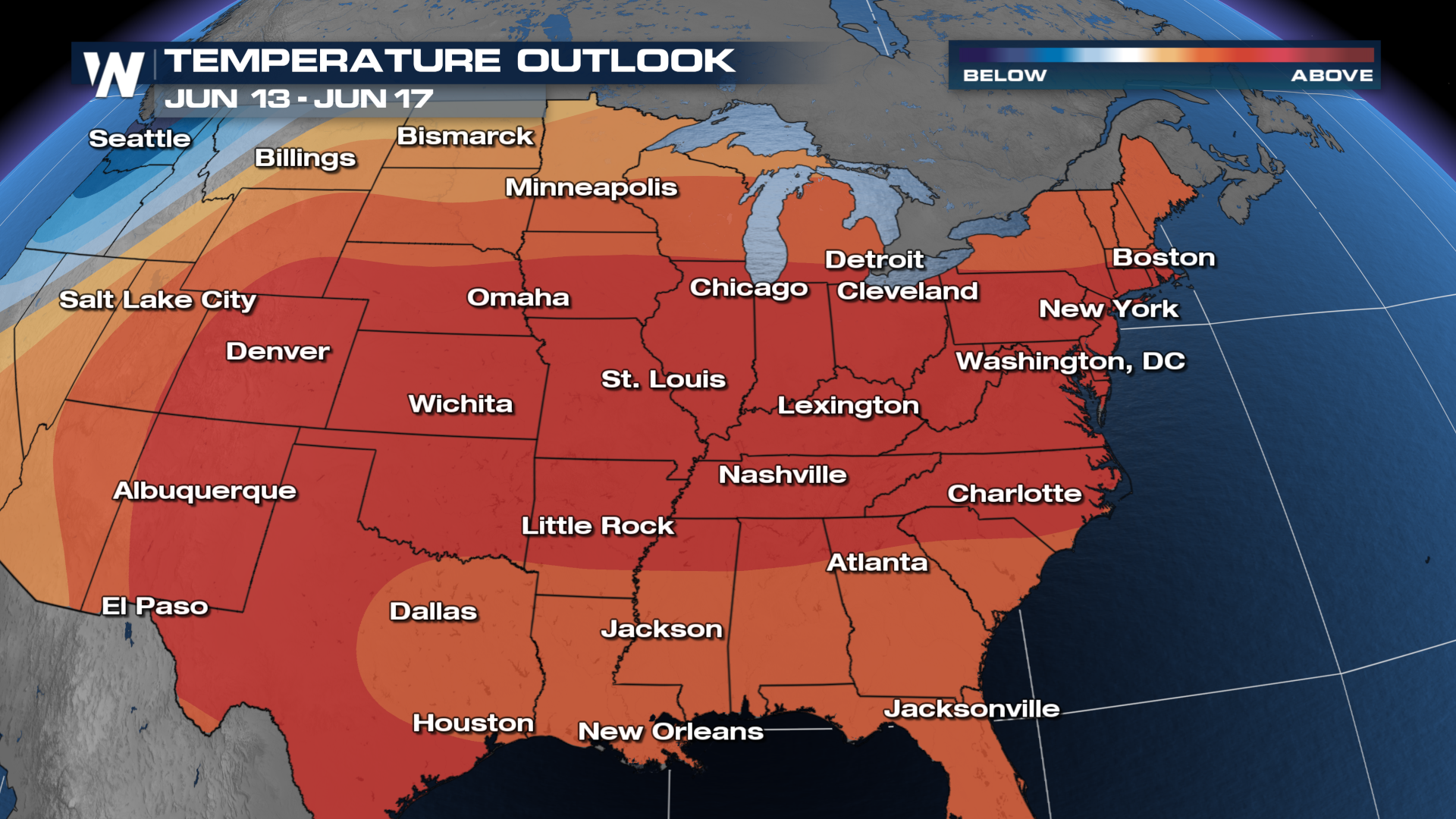
 The extended forecast from the Climate Prediction Center (CPC) shows confidence for warmer-than-average temperatures to return into the third week of June.

Download the WeatherNation App today to watch the forecast at any time.