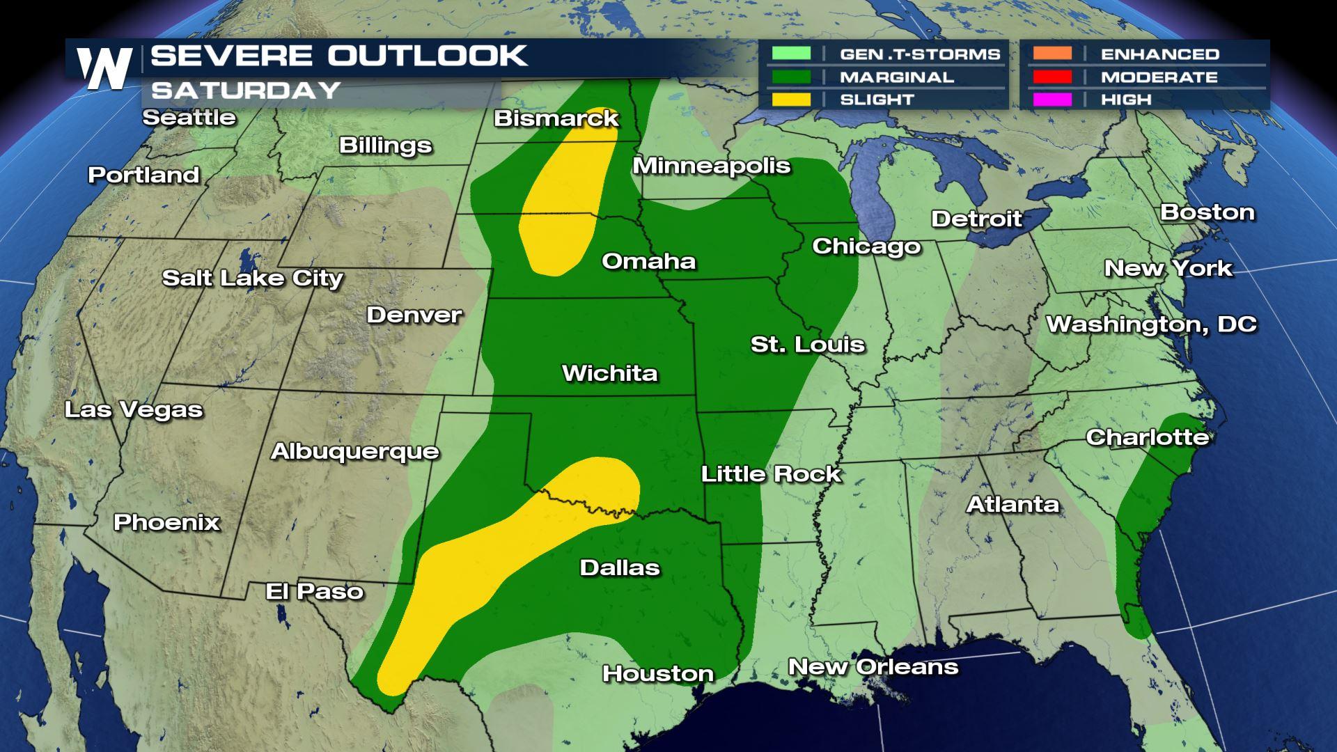
Widespread Severe Weather Risk on Saturday
Special Stories
20 Jun 2020 8:10 AM
A large section of the Central United States will have the potential to see severe thunderstorms develop Saturday afternoon or overnight into early Sunday. Most areas will only see the chance for isolated severe storms, but areas under the slight risk (yellow color in the graphic above) are expected to see the chance for a few severe storms which may be slightly more intense.
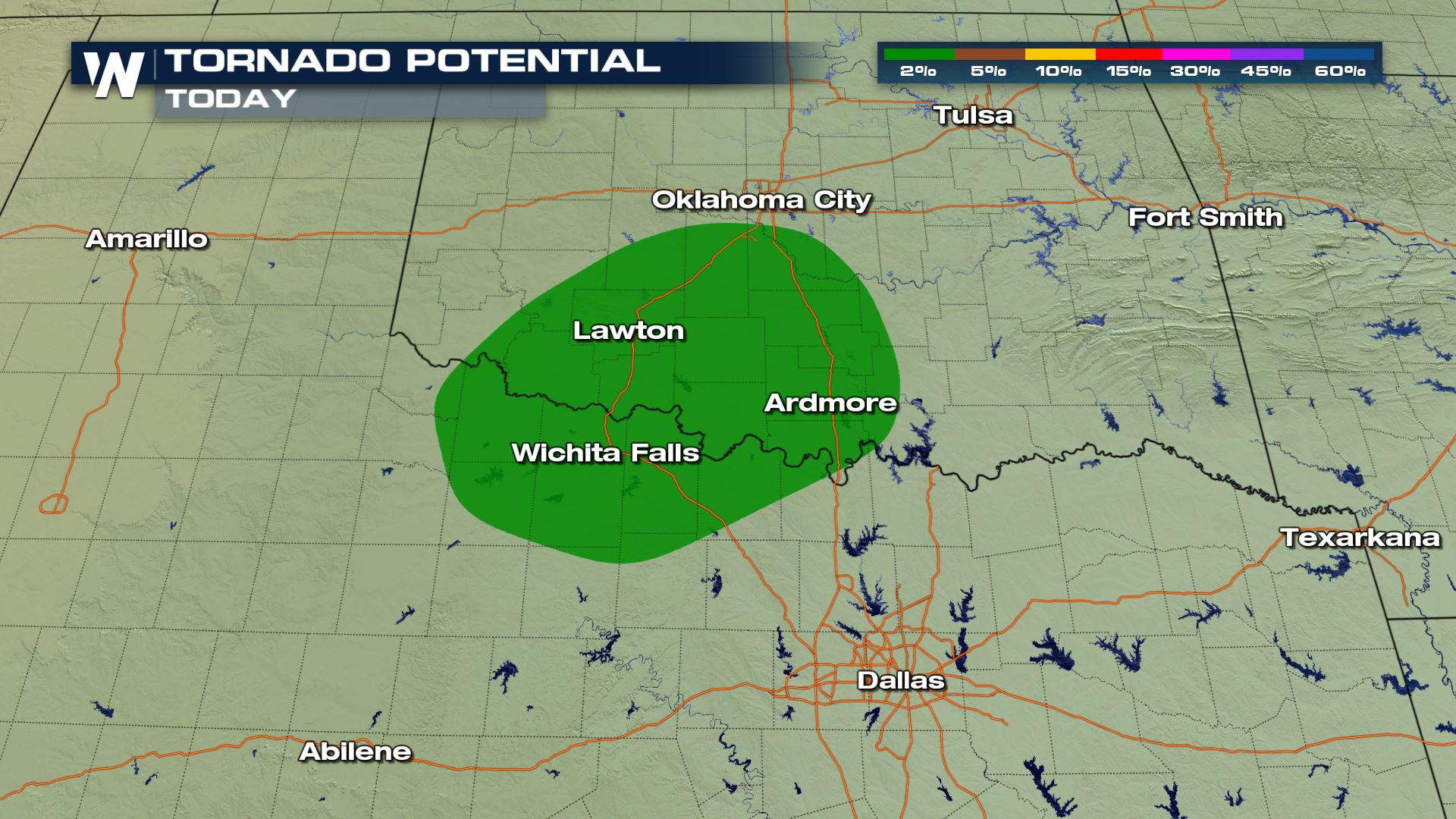
Damaging wind gusts over 60 mph and large hail will be the primary concerns from any strong storms, but there is a small risk for a tornado or two, focused around the Texas and Oklahoma border, including the I-35 corridor.
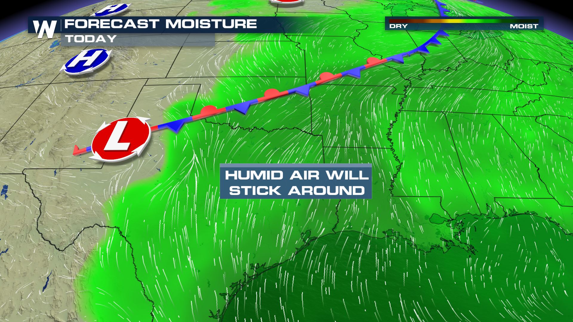
 A cold front draped from Canada south into Texas will act as the primary trigger for severe storms on Saturday, while a smaller cold front moves across the Northern Plains in the Dakotas and Nebraska. Plenty of Gulf moisture will be available for storms and with temperatures forecast in the 80s and 90s, instability will be able to build during the afternoon hours.
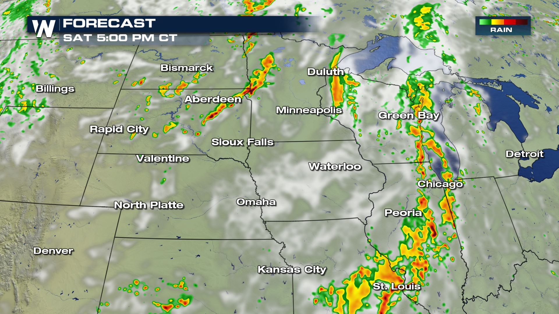
 Intense storms in the Northern Pains and Midwest are most likely during the early and mid-afternoon hours. The snapshot below shows the estimated radar image at 5 pm CT.
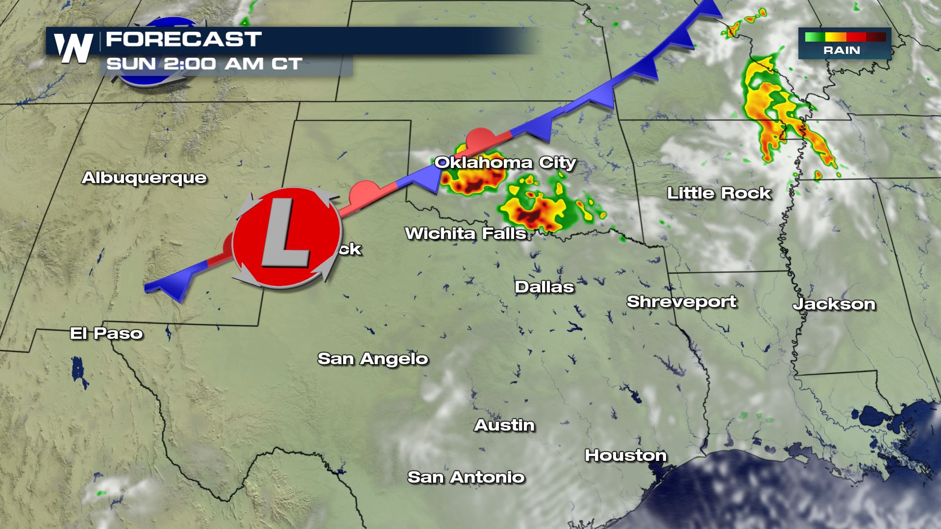
 Here is the model estimated radar for the southern end of the severe weather threat at 7 pm Saturday and 2 am Sunday.
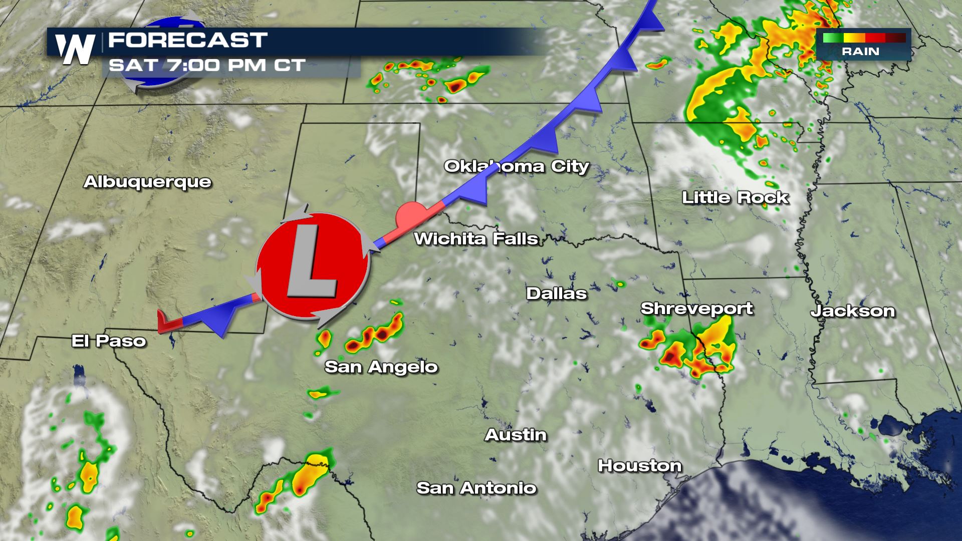 Storms ongoing from Friday night and Saturday morning are expected to drift southeast toward the ArkLaTex, reaching severe potential again in the afternoon. Additional strong or severe storms are expected to initiate in Western Texas and Oklahoma in the late afternoon, with the potential for severe weather to continue in the evening and overnight.
 Stay weather aware if you live in any of the risk areas and remember, warnings are always scrolling on the bottom of WeatherNation broadcasts and live streams.
A cold front draped from Canada south into Texas will act as the primary trigger for severe storms on Saturday, while a smaller cold front moves across the Northern Plains in the Dakotas and Nebraska. Plenty of Gulf moisture will be available for storms and with temperatures forecast in the 80s and 90s, instability will be able to build during the afternoon hours.
Intense storms in the Northern Pains and Midwest are most likely during the early and mid-afternoon hours. The snapshot below shows the estimated radar image at 5 pm CT.
Here is the model estimated radar for the southern end of the severe weather threat at 7 pm Saturday and 2 am Sunday.
Storms ongoing from Friday night and Saturday morning are expected to drift southeast toward the ArkLaTex, reaching severe potential again in the afternoon. Additional strong or severe storms are expected to initiate in Western Texas and Oklahoma in the late afternoon, with the potential for severe weather to continue in the evening and overnight.
Stay weather aware if you live in any of the risk areas and remember, warnings are always scrolling on the bottom of WeatherNation broadcasts and live streams.All Weather News
More
Hurricane Center Monitoring Florida for Tropical Development
Residents and visitors to the Southeast will
30 Jun 2025 10:00 PM

Barry Makes Landfall, Watching Flossie Next
While the Eastern Pacific has made most of th
30 Jun 2025 9:40 PM

Severe Storms For the East Coast Through Tuesday
Frontal systems have been crossing the northe
30 Jun 2025 9:00 PM

Severe Weather Threat Continues in the Midwest
It has been an active, severe season across t
30 Jun 2025 9:00 PM


Where Rain Could Dampen Holiday Travel Plans
AAA is expecting over 70 million travelers to
30 Jun 2025 3:00 PM

Thunderstorms Possible in the Southeast Overnight
SOUTHEAST - Strong thunderstorms have develop
28 Jun 2025 2:40 AM