Widespread Winter Weather Alerts Through Thursday
Top Stories
6 Feb 2019 11:54 AM
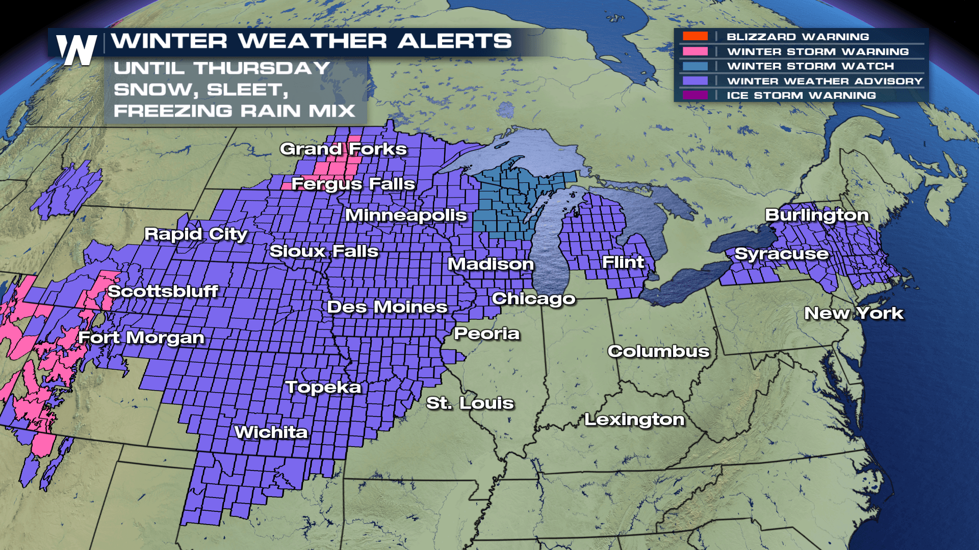
As another winter storm works it's way in the Upper Midwest, a large area will be under new winter weather advisories through Thursday as moderate to heavy snow is in the forecast. The timing for this event will likely begin this afternoon and continue overnight and into Thursday. Our in-house forecast model is showing snow developing this afternoon near the frontal boundary, with rain showers near the warm section of the front.
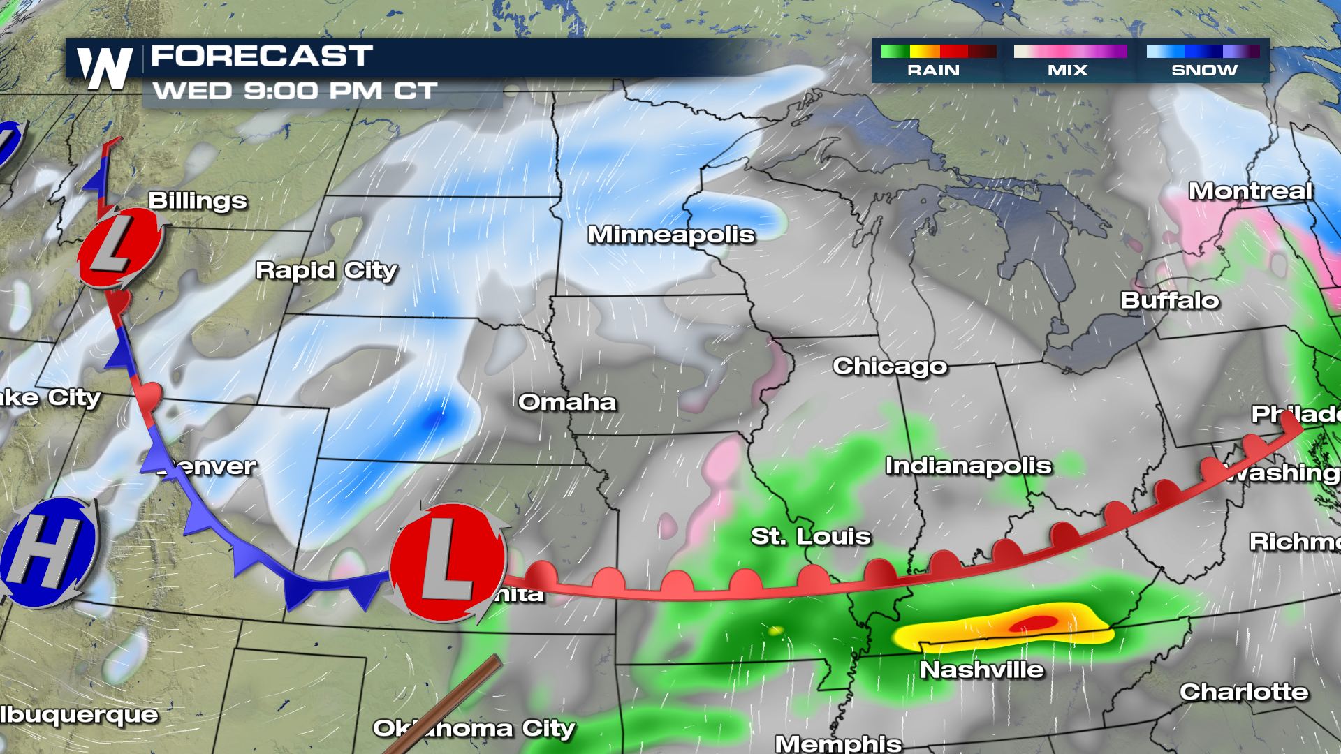
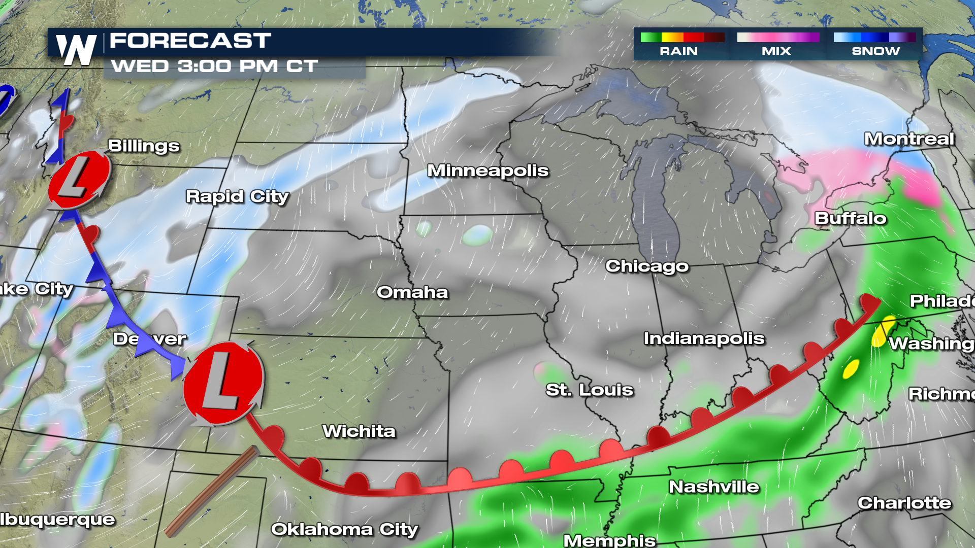 By Wednesday night, snow is likely to fill into the Upper Midwest and Great Lakes as the front slowly shifts to the east. If traveling, please plan on the possibility of icy and/or slippery road conditions through Wednesday night and into the morning commute on Thursday.
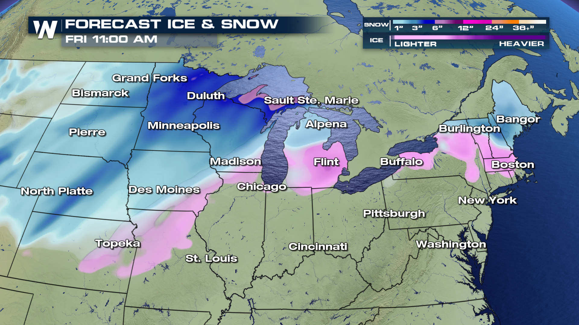
 By Thursday morning, snow will have moved east, with clearing skies behind in the west. Moderate to heavy snow will remain in the forecast from the Upper Midwest and transition into the Great Lakes region throughout Thursday afternoon and evening. We will continue to track rain on the warm side of the front, as temperatures stay above the freezing point of 32°. The storm should move out of the region by Friday morning, leaving mainly sunny to partly cloudy skies to start the weekend.
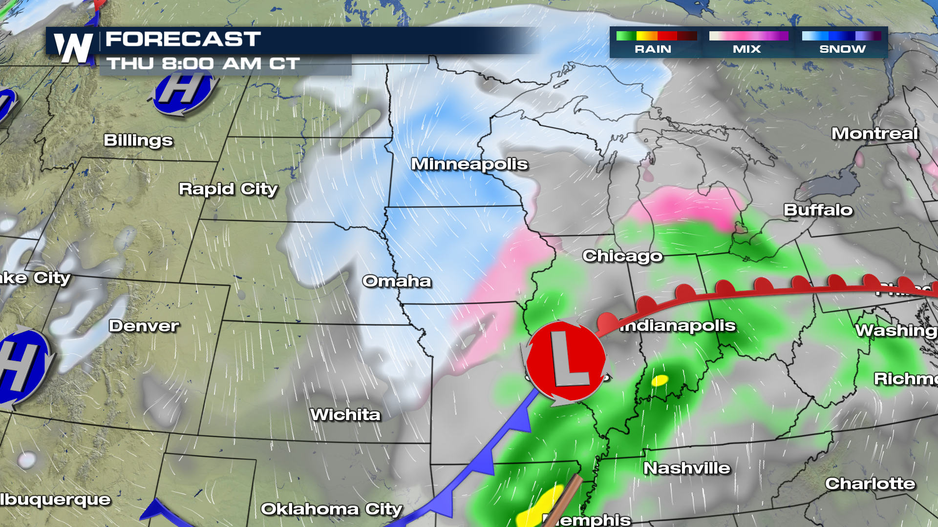 Snow totals will range anywhere from 1" upwards to near 6" depending on location. Near the frontal boundary is where we may also see light ice accumulations from Topeka northeast into portions of the Great Lakes. The freezing line will play a large role in areas that receive ice/rain and or snow. A few miles north or south is all it takes for large variances in precipitation.
 For WeatherNation, I'm Meteorologist Greg Rule
By Wednesday night, snow is likely to fill into the Upper Midwest and Great Lakes as the front slowly shifts to the east. If traveling, please plan on the possibility of icy and/or slippery road conditions through Wednesday night and into the morning commute on Thursday.
By Thursday morning, snow will have moved east, with clearing skies behind in the west. Moderate to heavy snow will remain in the forecast from the Upper Midwest and transition into the Great Lakes region throughout Thursday afternoon and evening. We will continue to track rain on the warm side of the front, as temperatures stay above the freezing point of 32°. The storm should move out of the region by Friday morning, leaving mainly sunny to partly cloudy skies to start the weekend.
Snow totals will range anywhere from 1" upwards to near 6" depending on location. Near the frontal boundary is where we may also see light ice accumulations from Topeka northeast into portions of the Great Lakes. The freezing line will play a large role in areas that receive ice/rain and or snow. A few miles north or south is all it takes for large variances in precipitation.
For WeatherNation, I'm Meteorologist Greg RuleAll Weather News
More
Wildfire Outbreak in the Pacific Northwest
SPOKANE, WA - On Saturday, August 1st, the Ol
3 Aug 2026 1:55 AM

More Storms for the East Through Monday
A low-pressure system that moved through the
3 Aug 2026 1:50 AM


After Reaching Category 5, Genevieve Weakens in the Pacific
PacificGenevieve formed last Friday south of
3 Aug 2026 12:30 AM

Flooding, Severe Storms Target the Midwest Again
After an active week of storms across the nor
1 Aug 2026 1:40 AM

Flooding Risk Increases as Heavy Rain Targets the Tri-State Area
Tuesday, heavy rainfall moved across the Nort
30 Jul 2026 12:25 AM

Severe Weather: Energy From the Midwest Now in the Southeast
UPPER MIDWEST - Through Monday, dangerous tor
29 Jul 2026 10:30 PM