Will You See A White Christmas?
Special Stories
19 Dec 2019 11:50 AM
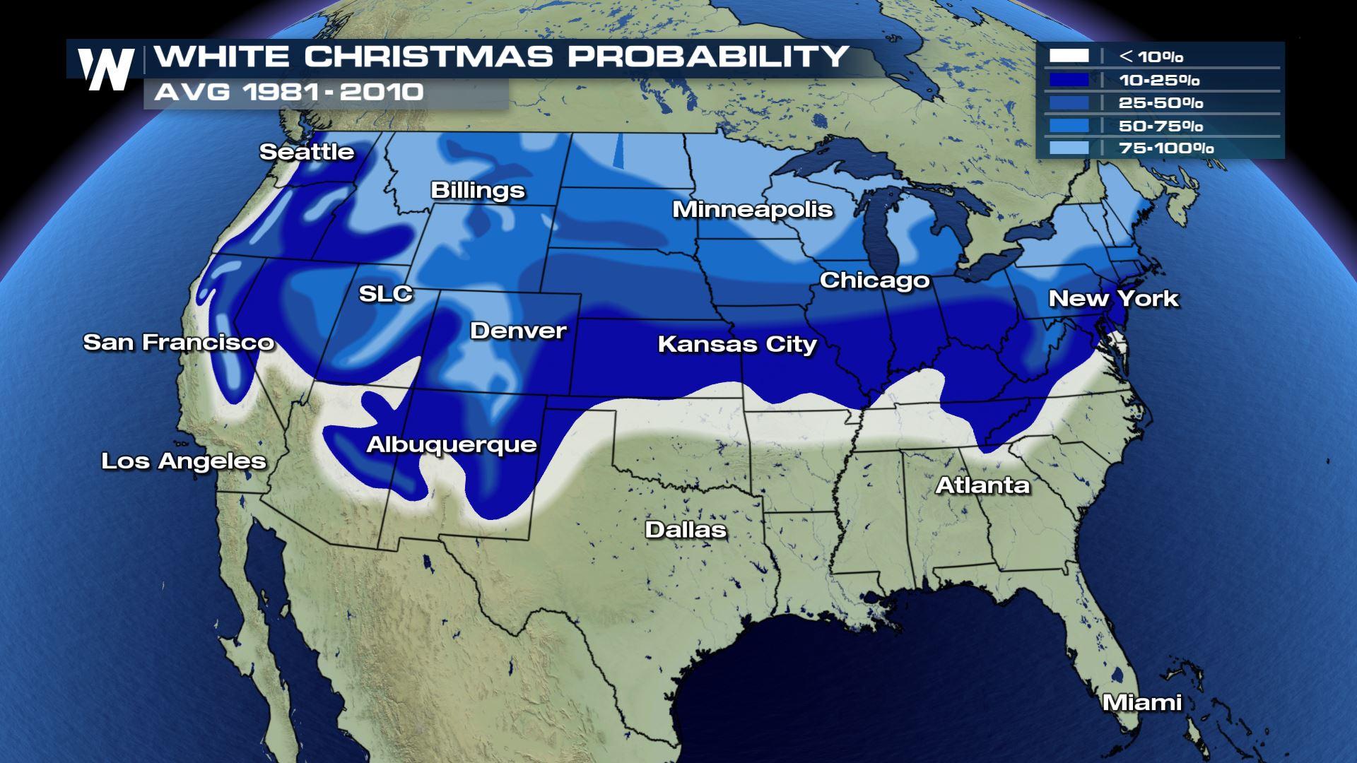
As we inch closer and closer to Christmas Day, the million dollar question on everybody's mind is... "Will I have a white Christmas?" Below is the climatological probablity of areas that have the best chances at seeing a white Christmas. Obviously, the farther north and higher in elevation you live, the better the chances for snow on the ground December 25th! But if you live in cities like Kansas City, Denver, Albuquerque, New York and Chicago, you're chances range from 25% - 75%.
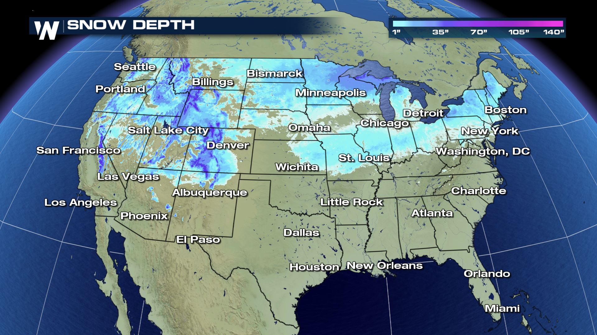
 The current snow-pack is relatively impressive for this time of year, as strong winter storms have blanketed much of the area over the last few weeks.
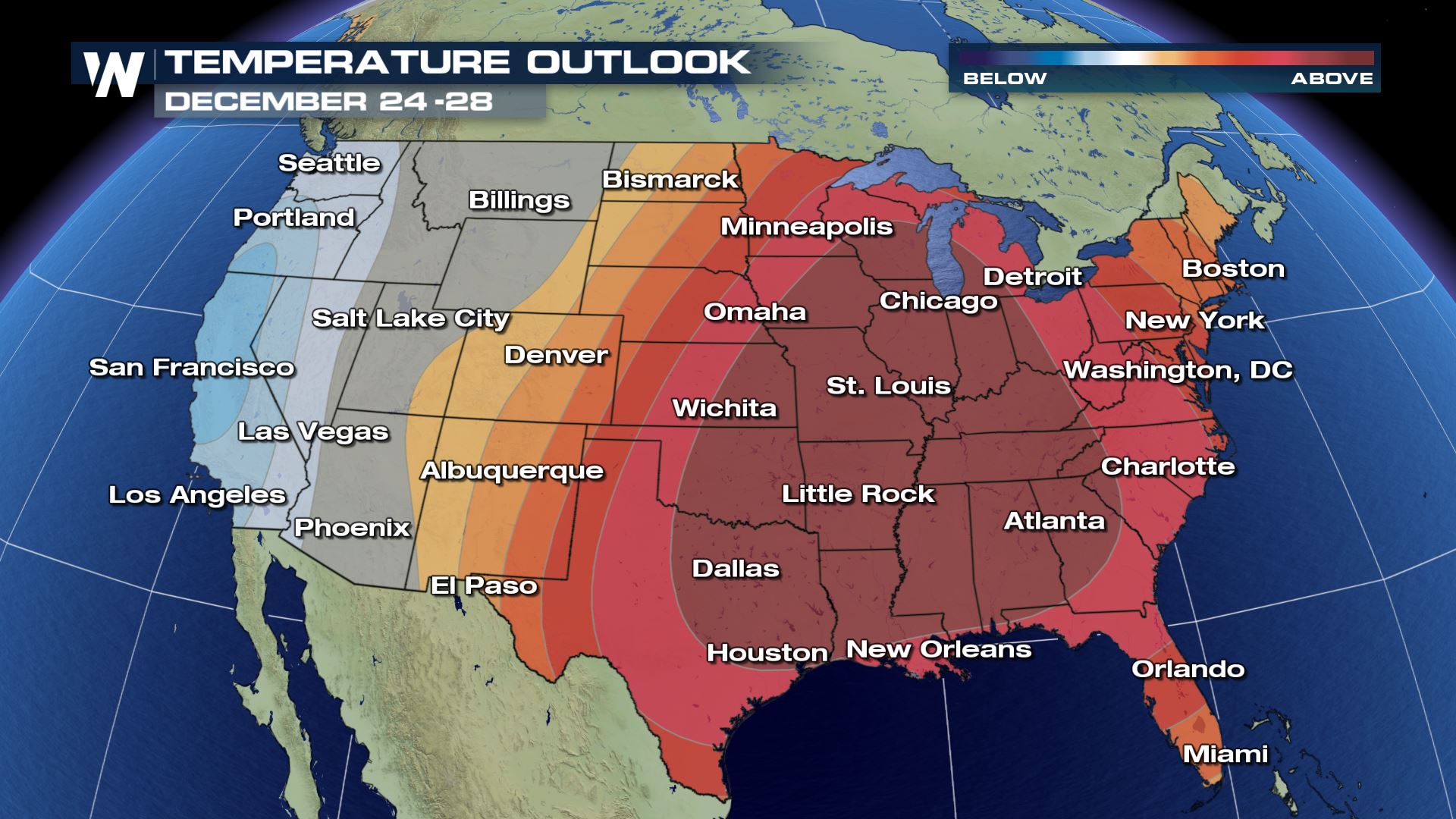
 Despite the current snow-pack through the north, long range forecast models have well-above average temperatures over the next 6 - 10 days. This includes the outlook for December 24th through the 28th. A strong ridge of high pressure will dominate the south, central, northern plains and the Mid West. Temperatures may range anywhere from 10 - 20° above average, which potentially may be a 'snow-eater' for these areas.
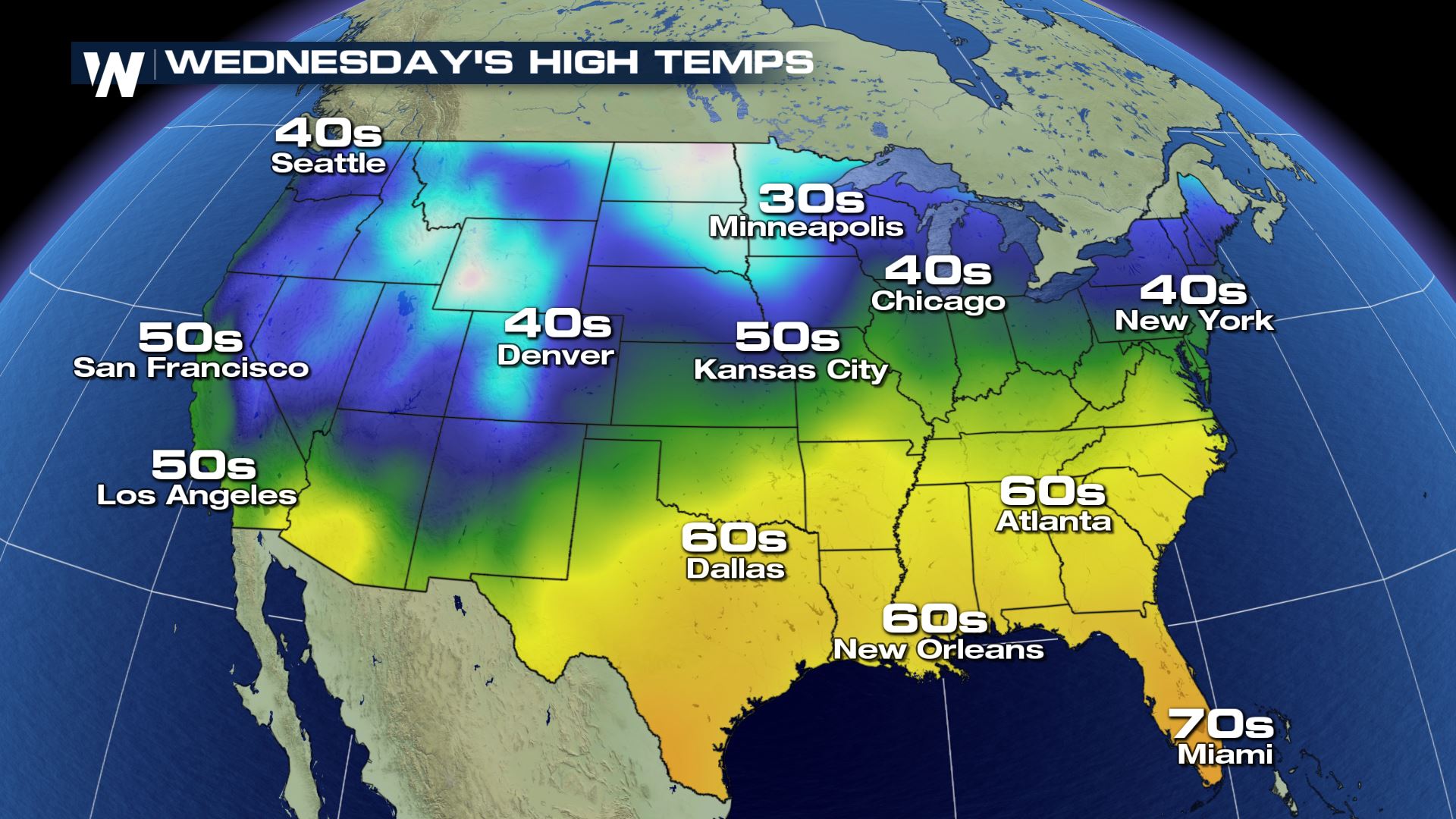
 Here are the forecast high temperatures across the nation on Christmas Day. Afternoon highs likely jump into the mid 30s, well above average, for the Upper Mid-West and High Plains on Christmas!
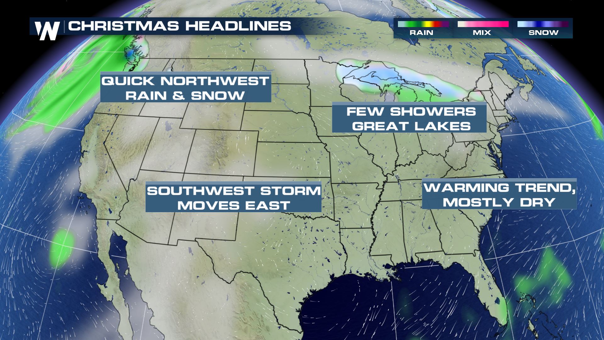
 Below is the expected snapshot for areas that may see precipitation. The bulk of the nation potentially sees a rather quiet Christmas, with very few areas seeing rain and or snow.
 As always, forecast models are subject to change! So make sure to stay tuned to WeatherNation for all the latest developments!
The current snow-pack is relatively impressive for this time of year, as strong winter storms have blanketed much of the area over the last few weeks.
Despite the current snow-pack through the north, long range forecast models have well-above average temperatures over the next 6 - 10 days. This includes the outlook for December 24th through the 28th. A strong ridge of high pressure will dominate the south, central, northern plains and the Mid West. Temperatures may range anywhere from 10 - 20° above average, which potentially may be a 'snow-eater' for these areas.
Here are the forecast high temperatures across the nation on Christmas Day. Afternoon highs likely jump into the mid 30s, well above average, for the Upper Mid-West and High Plains on Christmas!
Below is the expected snapshot for areas that may see precipitation. The bulk of the nation potentially sees a rather quiet Christmas, with very few areas seeing rain and or snow.
As always, forecast models are subject to change! So make sure to stay tuned to WeatherNation for all the latest developments!All Weather News
More
Wildfire Outbreak in the Pacific Northwest
SPOKANE, WA - On Saturday, August 1st, the Ol
3 Aug 2026 1:55 AM

More Storms for the East Through Monday
A low-pressure system that moved through the
3 Aug 2026 1:50 AM


After Reaching Category 5, Genevieve Weakens in the Pacific
PacificGenevieve formed last Friday south of
3 Aug 2026 12:30 AM

Flooding, Severe Storms Target the Midwest Again
After an active week of storms across the nor
1 Aug 2026 1:40 AM

Flooding Risk Increases as Heavy Rain Targets the Tri-State Area
Tuesday, heavy rainfall moved across the Nort
30 Jul 2026 12:25 AM

Severe Weather: Energy From the Midwest Now in the Southeast
UPPER MIDWEST - Through Monday, dangerous tor
29 Jul 2026 10:30 PM