Winter Storm Watch For Upper Midwest
Special Stories
26 Jan 2019 12:35 PM
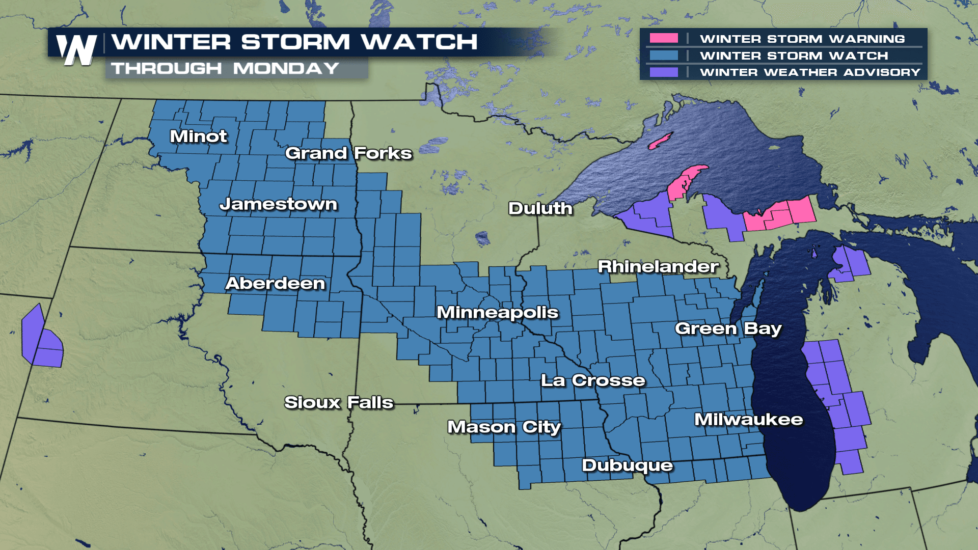
A winter storm is expected to impact portions of the Upper Midwest through the weekend and into early next week.
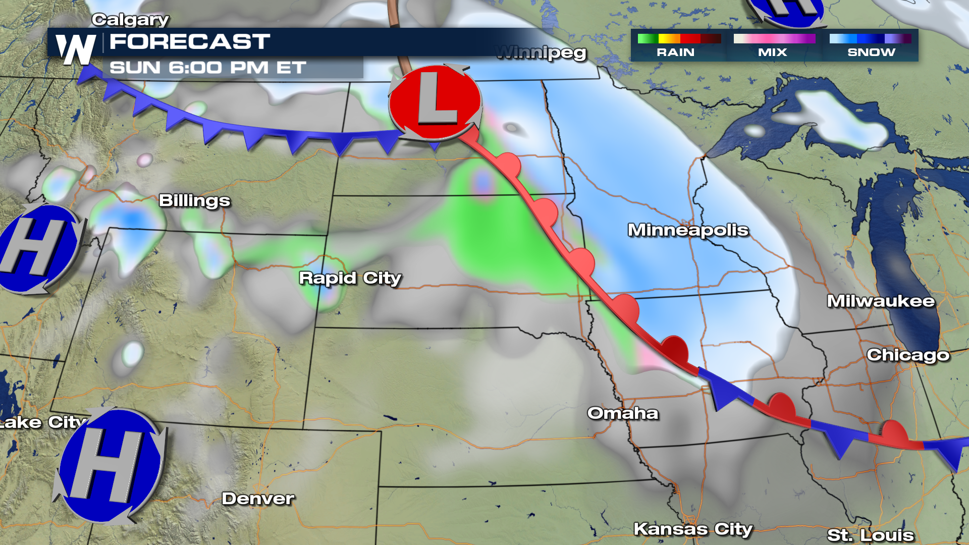 Up to 8" of snow can be anticipated, along with gusty winds in excess of 60 MPH. Blizzard conditions with blowing snow causing reduced visibility may impact travel into Monday morning. Possible whiteout conditions and very cold temperatures will be accompanied with this storm.
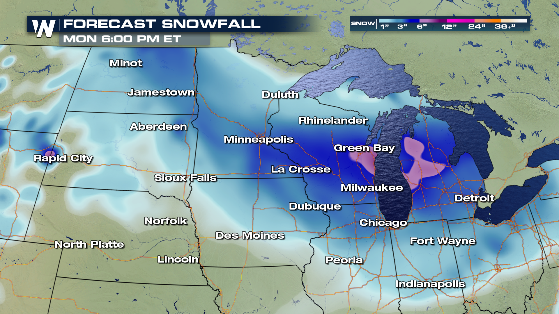 Lows will fall well below zero with dangerous wind chill temperatures near -30 to -45°.
Meteorologist Greg Rule
Lows will fall well below zero with dangerous wind chill temperatures near -30 to -45°.
Meteorologist Greg Rule
Up to 8" of snow can be anticipated, along with gusty winds in excess of 60 MPH. Blizzard conditions with blowing snow causing reduced visibility may impact travel into Monday morning. Possible whiteout conditions and very cold temperatures will be accompanied with this storm.
Lows will fall well below zero with dangerous wind chill temperatures near -30 to -45°.
Meteorologist Greg Rule
All Weather News
More

More Storms for the East Through Monday
A low-pressure system that moved through the
3 Aug 2026 12:20 PM


After Reaching Category 5, Genevieve Weakens in the Pacific
PacificGenevieve formed last Friday south of
3 Aug 2026 12:30 AM

Flooding, Severe Storms Target the Midwest Again
After an active week of storms across the nor
1 Aug 2026 1:40 AM

Flooding Risk Increases as Heavy Rain Targets the Tri-State Area
Tuesday, heavy rainfall moved across the Nort
30 Jul 2026 12:25 AM