Winter Weather for the North Next Week
Special Stories
3 Jan 2019 4:34 PM
The next coast to coast storm is already taking shape off the California coast. But what happens after it spreads rain and snow across the west? This energetic atmospheric pattern is expect to cross the Rockies and tap into Gulf of Mexico moisture early next week.
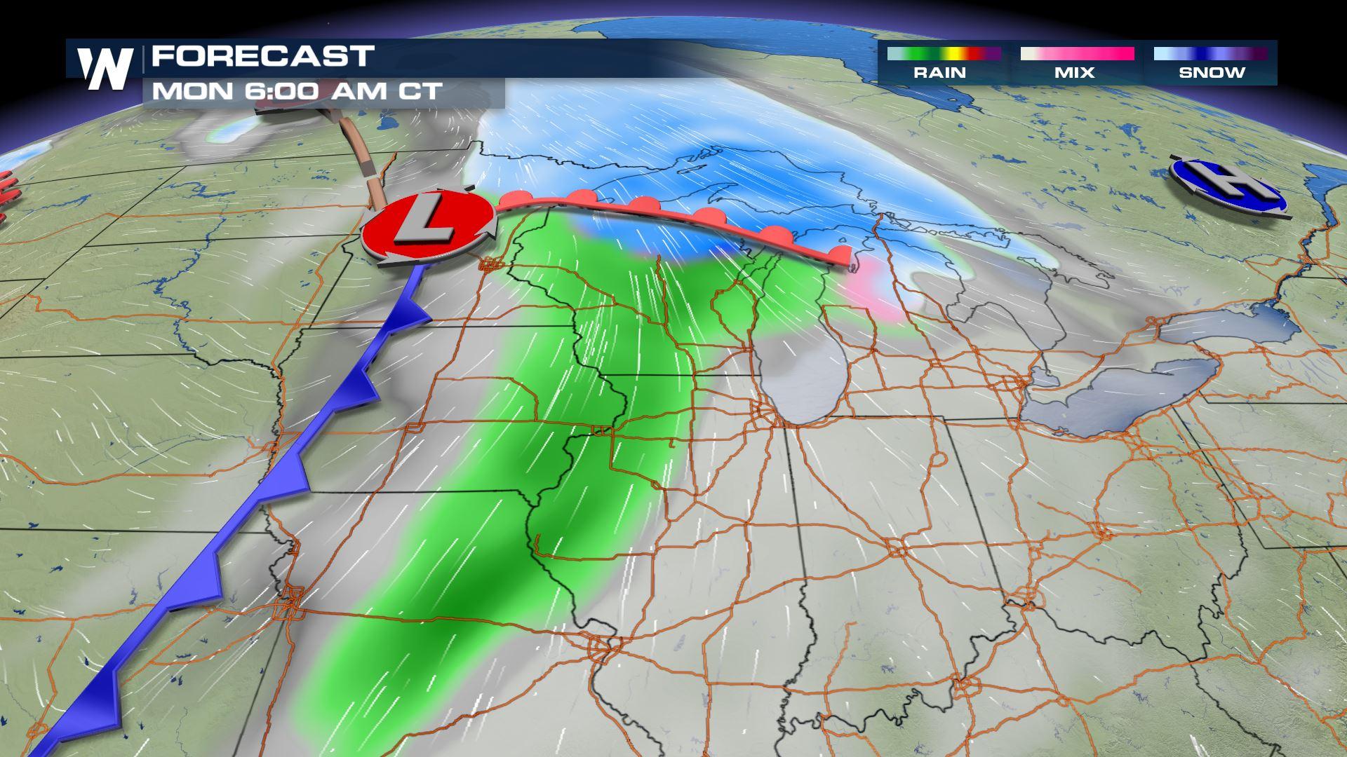
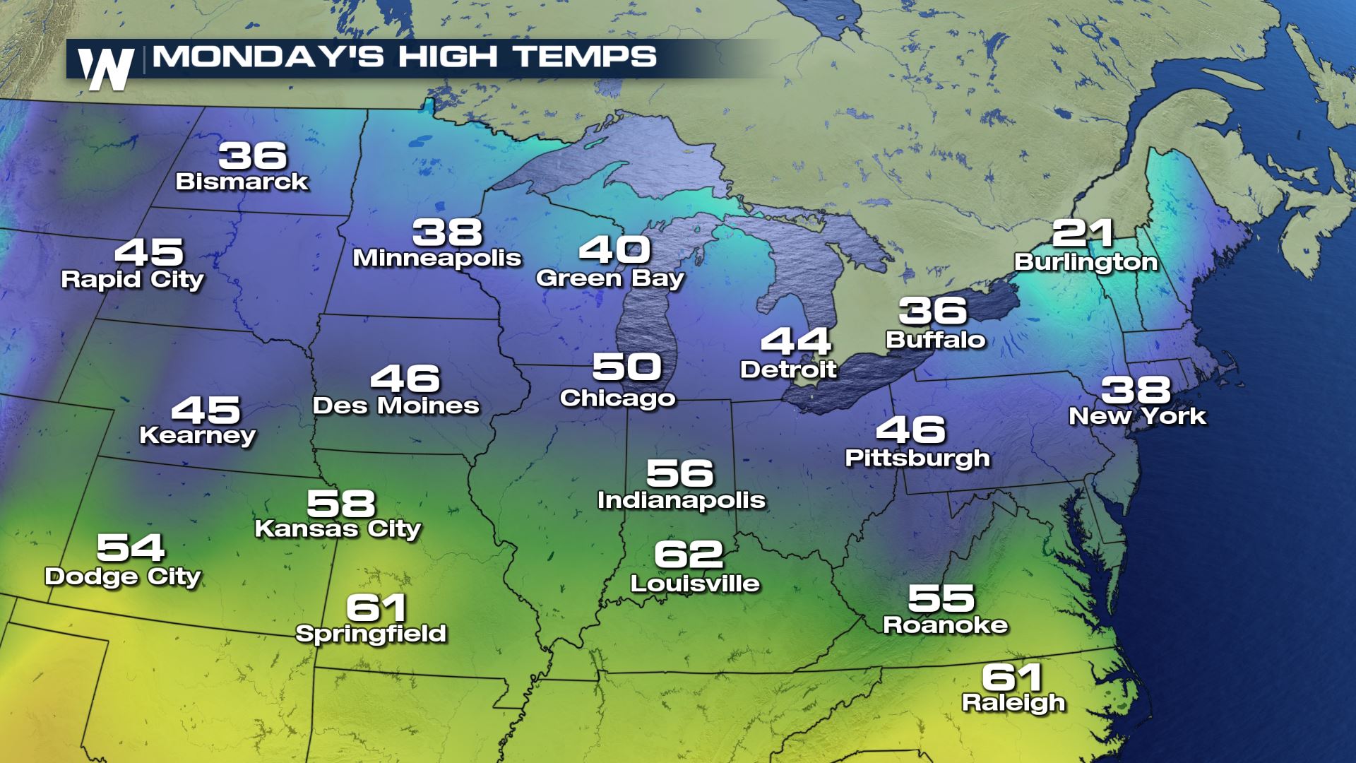
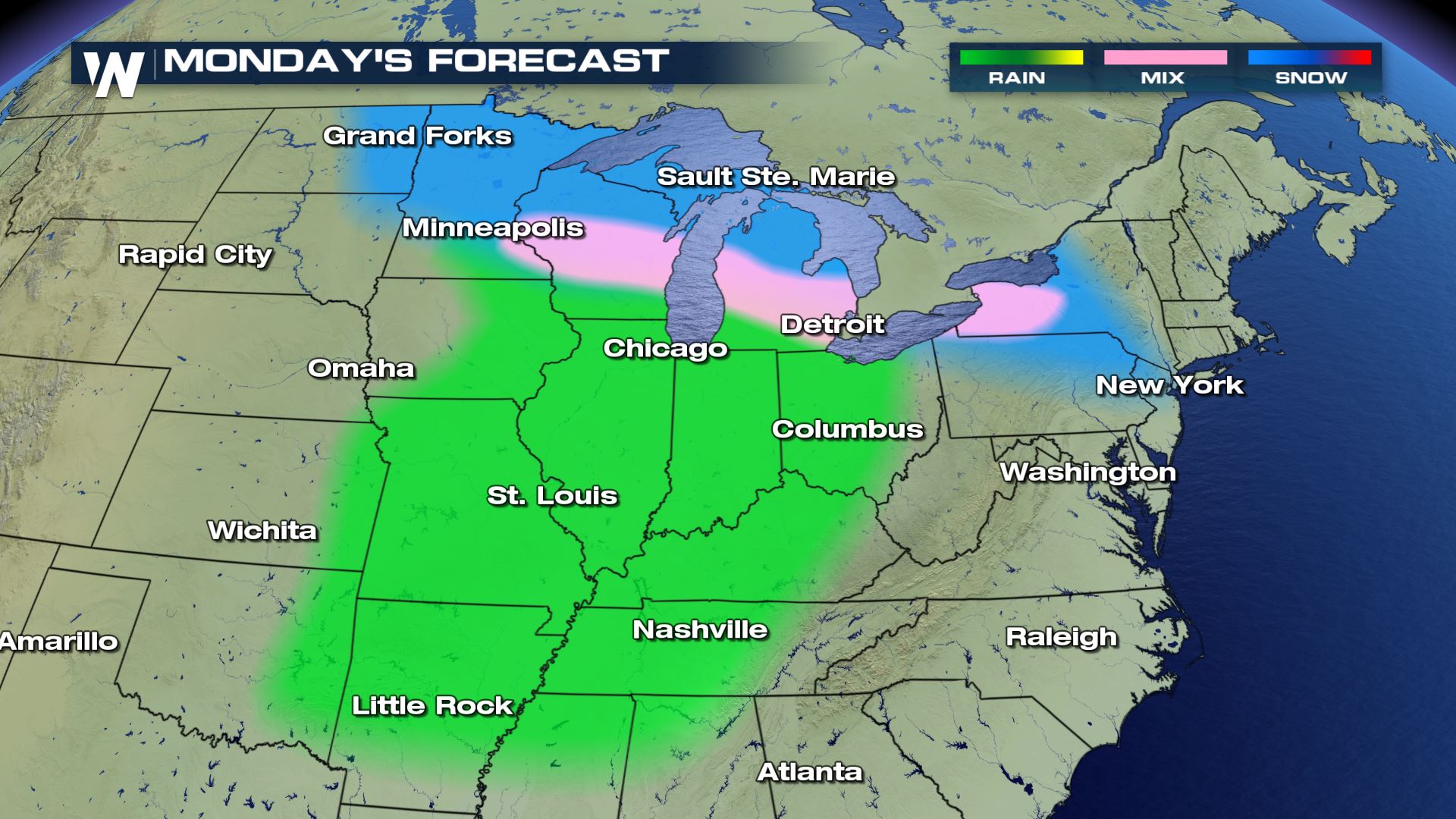
 A lee-side trough will develop at the surface east of the Rocky Mountains. As it builds northeast, moisture from the south will meet up with some cold air in the Great Lakes. Temperatures will warm for much of the US through the weekend. The closer you live to the Canadian border, the better chance you have at seeing snow. Temperatures near freezing could add some wintry mix into the forecast.
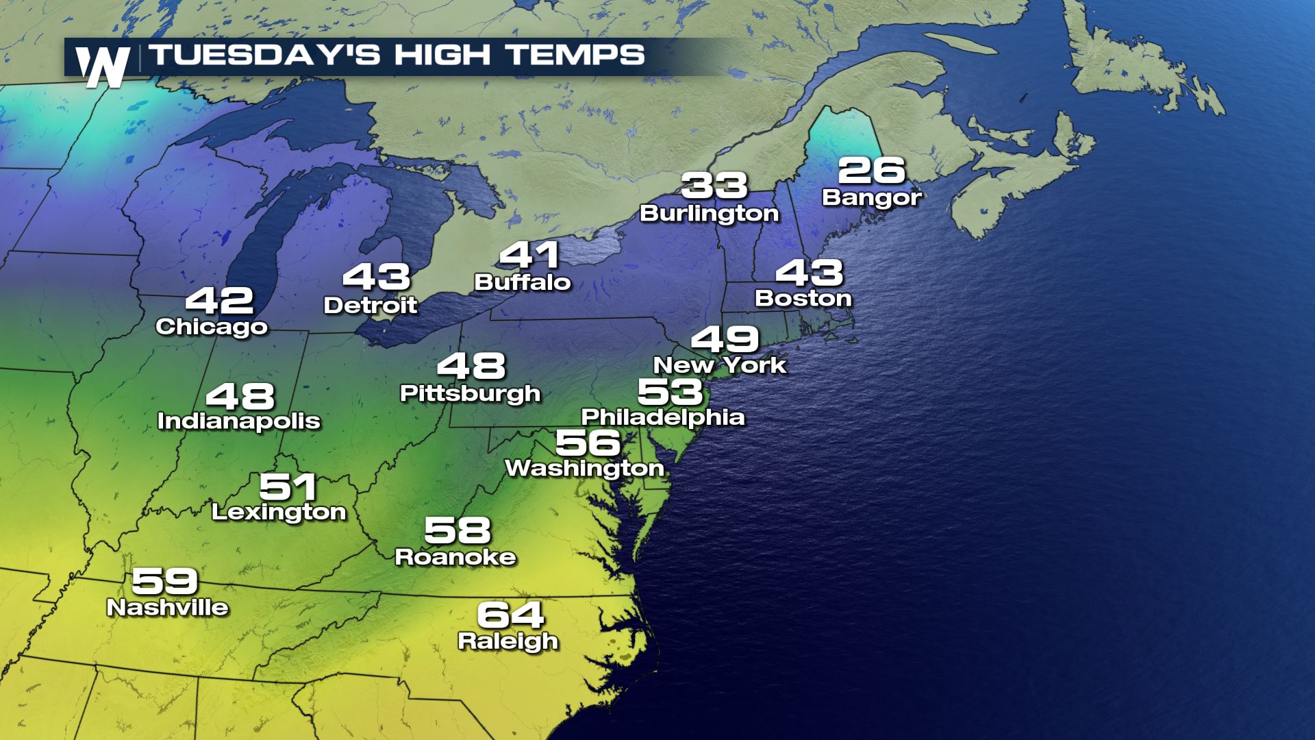
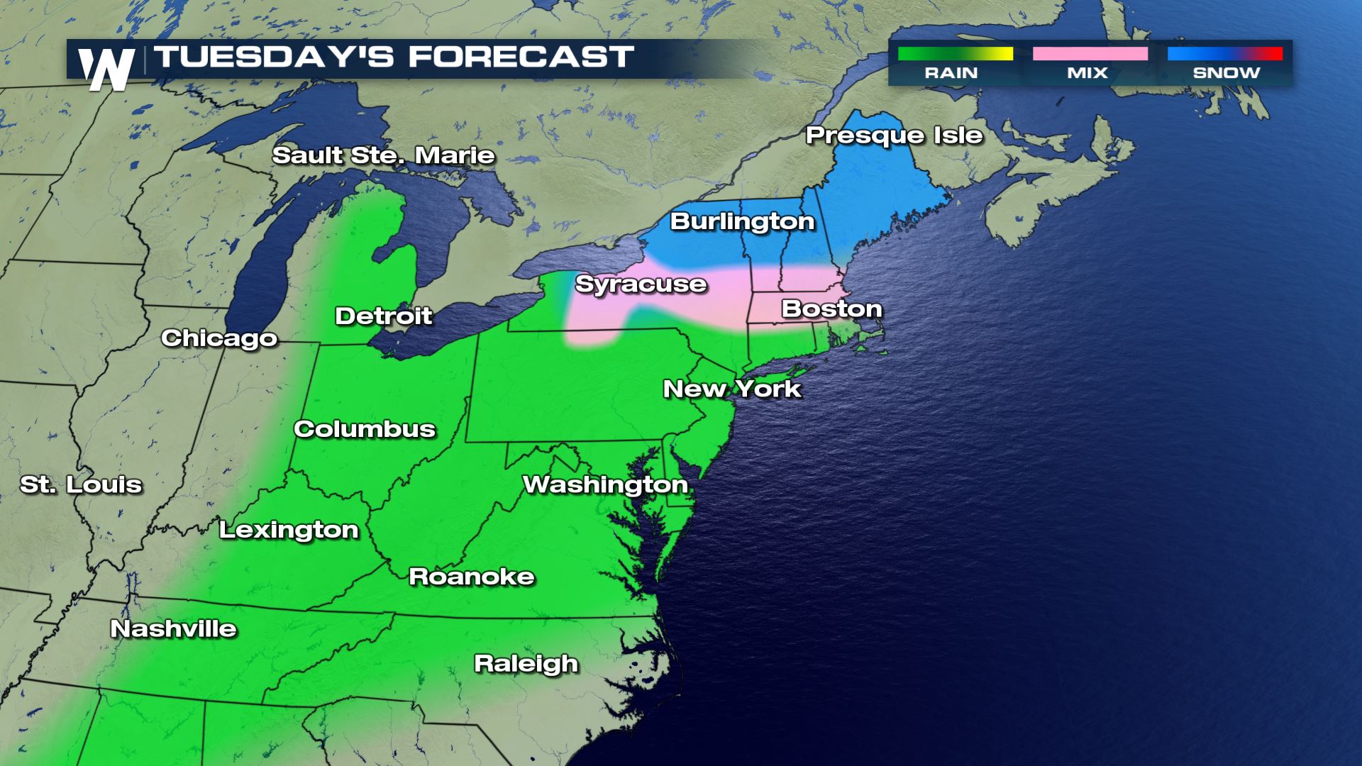
 The snow and cold will spread into the Northeast by Tuesday. Once again, temperature will be a limiting factor in precipitation chances.
 Stay tuned to WeatherNation for updates through the weekend.
-Meteorologist Karissa Klos
Stay tuned to WeatherNation for updates through the weekend.
-Meteorologist Karissa Klos
A lee-side trough will develop at the surface east of the Rocky Mountains. As it builds northeast, moisture from the south will meet up with some cold air in the Great Lakes. Temperatures will warm for much of the US through the weekend. The closer you live to the Canadian border, the better chance you have at seeing snow. Temperatures near freezing could add some wintry mix into the forecast.
The snow and cold will spread into the Northeast by Tuesday. Once again, temperature will be a limiting factor in precipitation chances.
Stay tuned to WeatherNation for updates through the weekend.
-Meteorologist Karissa KlosAll Weather News
More
More Storms for the East Through Monday
A low-pressure system that moved through the
2 Aug 2026 10:40 PM

Wildfire Outbreak in the Pacific Northwest
SPOKANE, WA - On Saturday, August 1st, the Ol
2 Aug 2026 10:35 PM


After Reaching Category 5, Genevieve Weakens in the Pacific
PacificGenevieve formed on last Friday south
2 Aug 2026 6:25 PM

Flooding, Severe Storms Target the Midwest Again
After an active week of storms across the nor
1 Aug 2026 1:40 AM

Flooding Risk Increases as Heavy Rain Targets the Tri-State Area
Tuesday, heavy rainfall moved across the Nort
30 Jul 2026 12:25 AM

Severe Weather: Energy From the Midwest Now in the Southeast
UPPER MIDWEST - Through Monday, dangerous tor
29 Jul 2026 10:30 PM