Quick Clipper and More Lake Effect
Special Stories
5 Nov 2019 8:00 AM
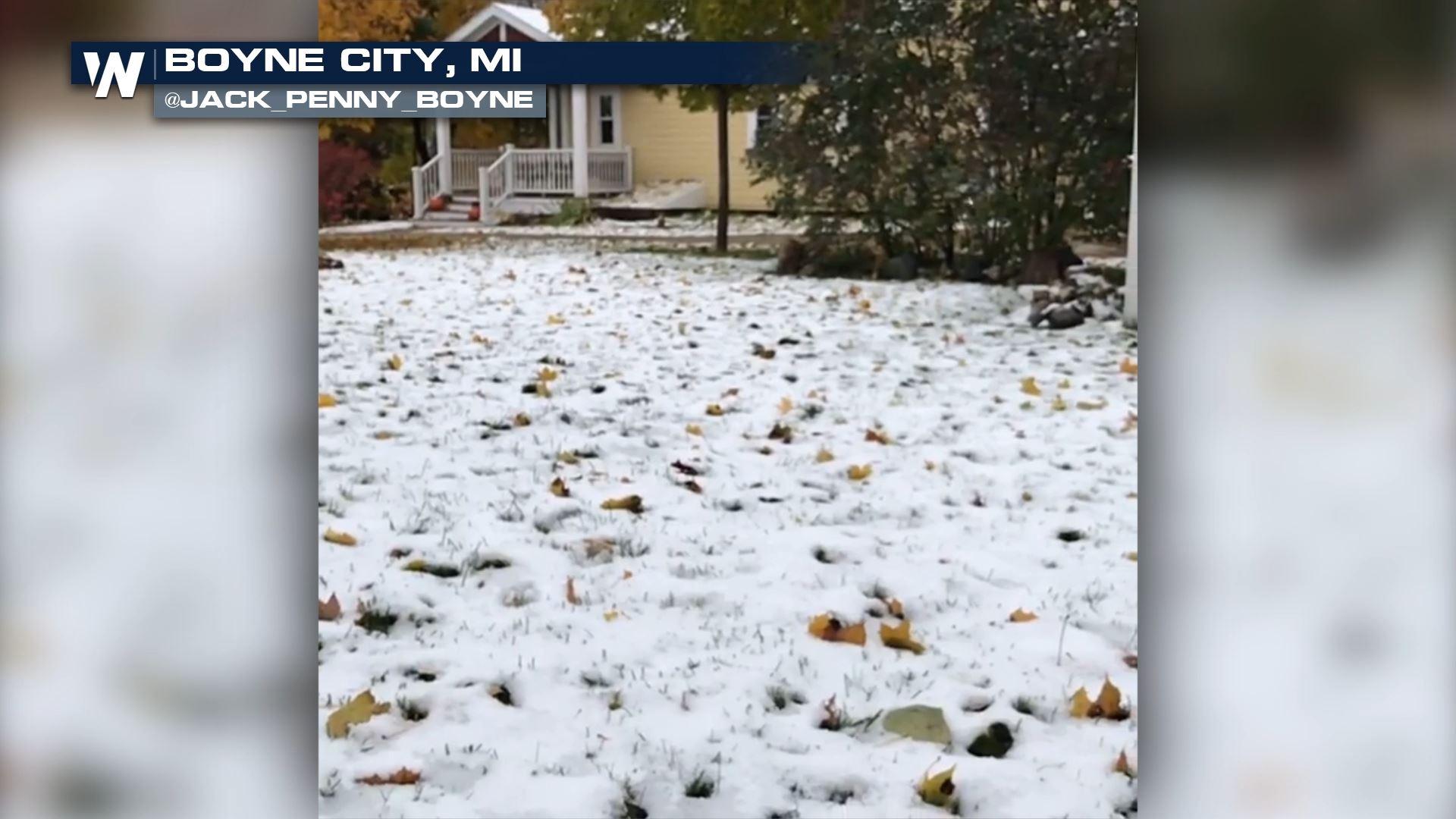
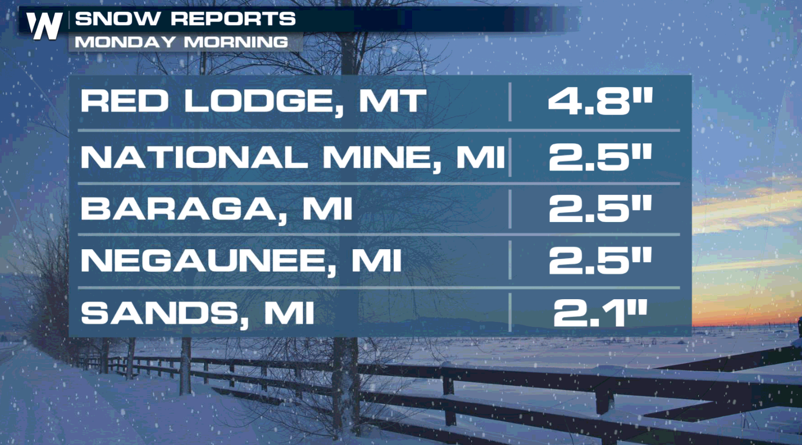
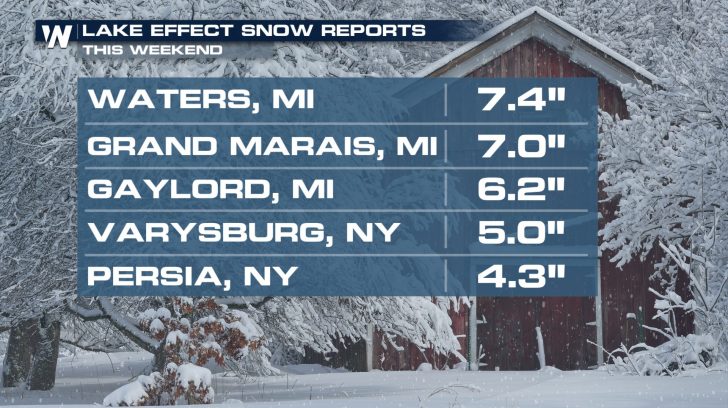
Winter weather continued for parts of the northern US this weekend, including lake effect snow. Several inches accumulated from Montana to New York. Additional snow and cold is possible with another system through the middle of the week.
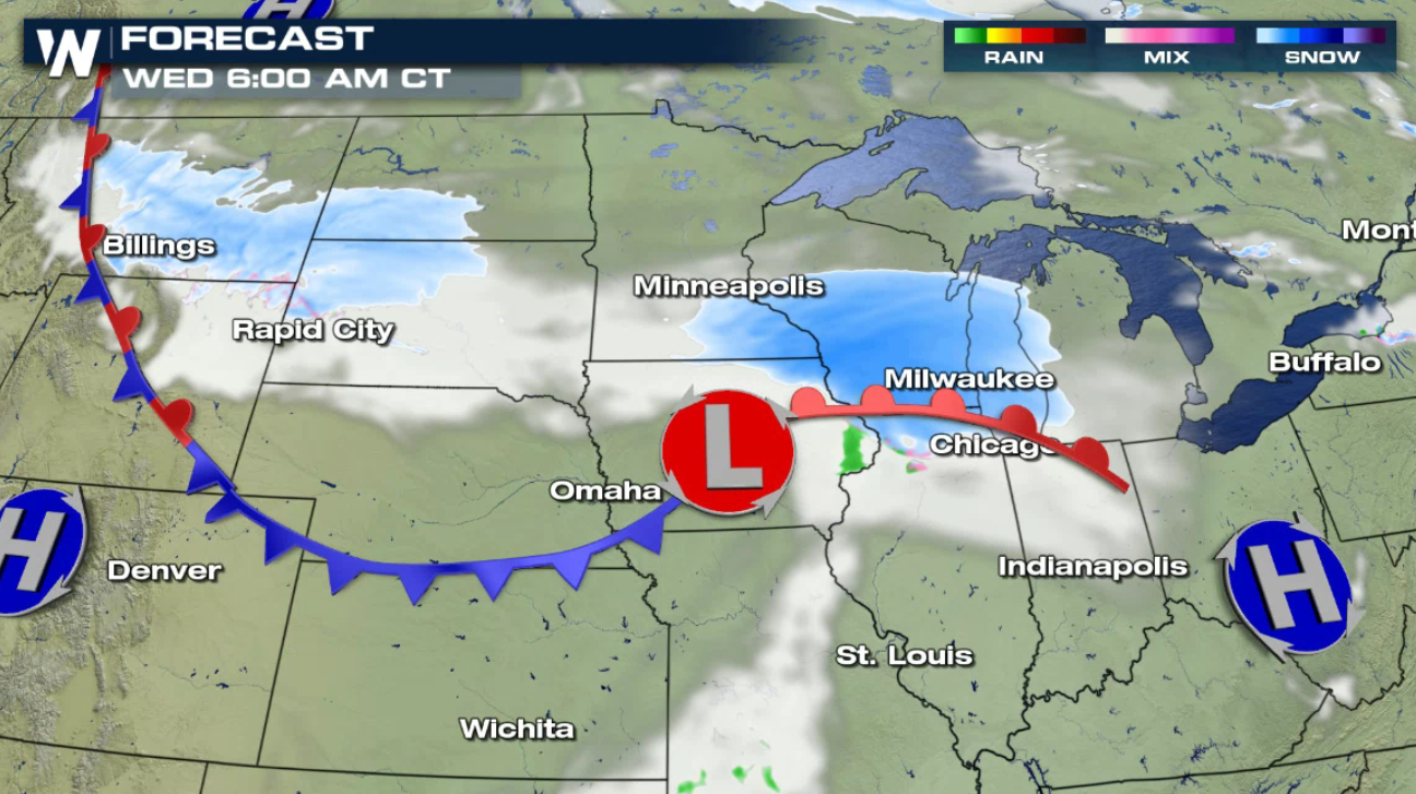
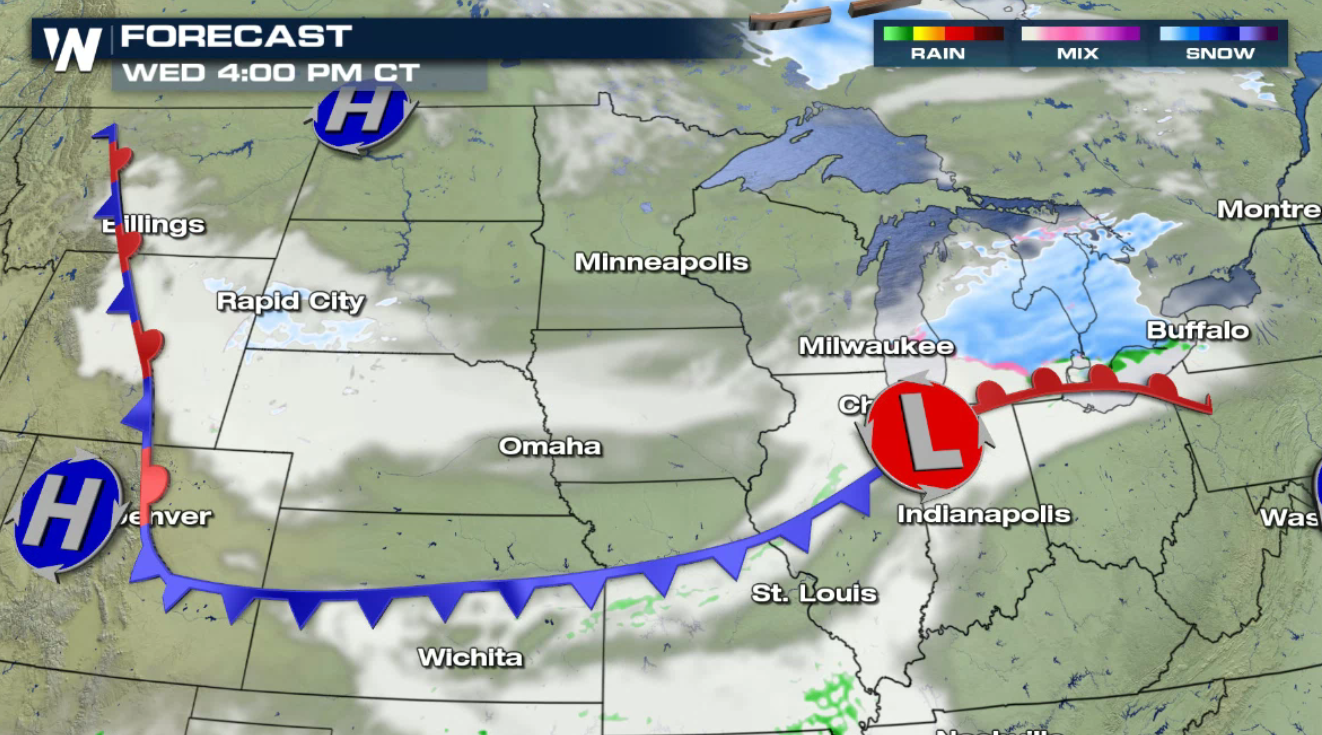
 A quick-moving clipper will bring a scattered precipitation across the Upper Midwest and into the Great Lakes. Snow will push into the region late this afternoon and continue through Wednesday evening.
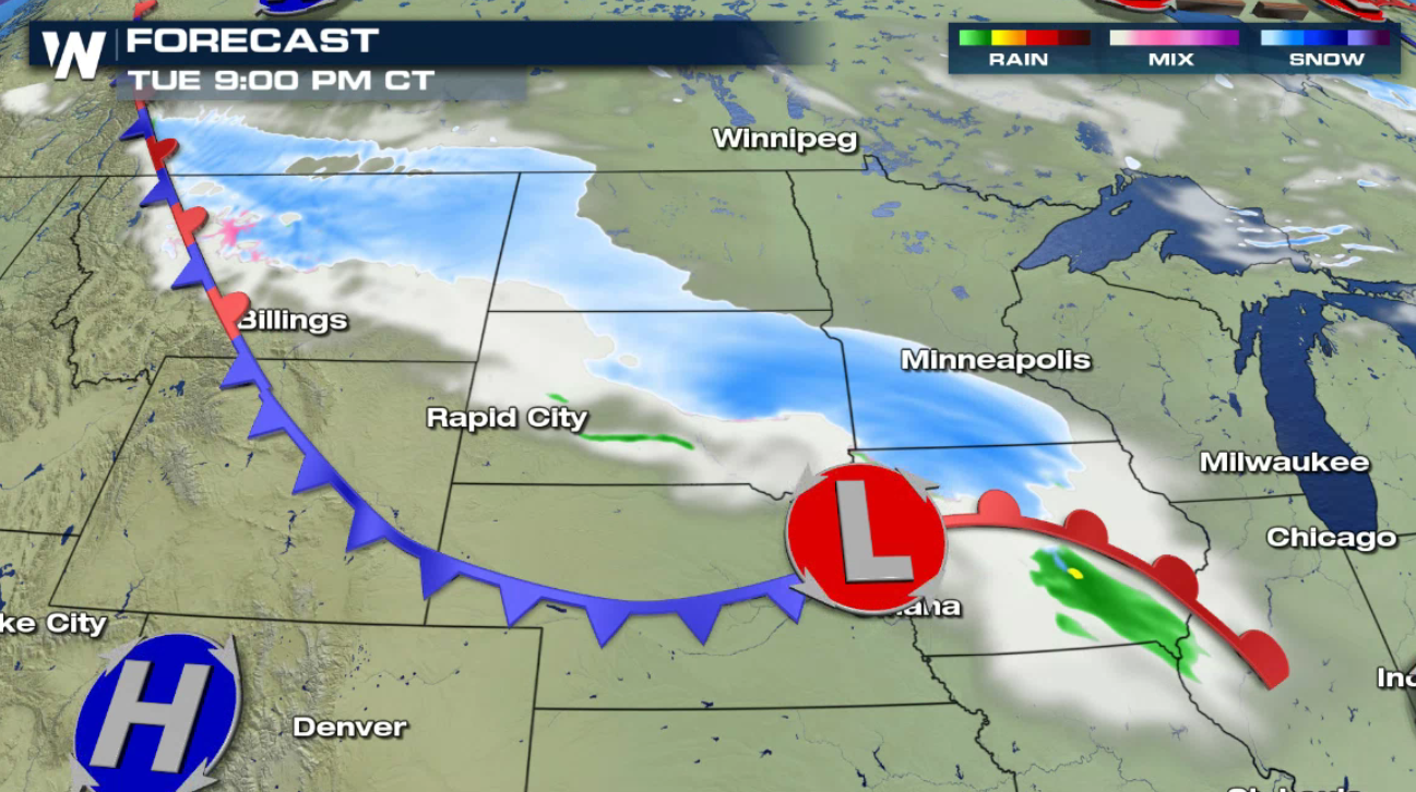
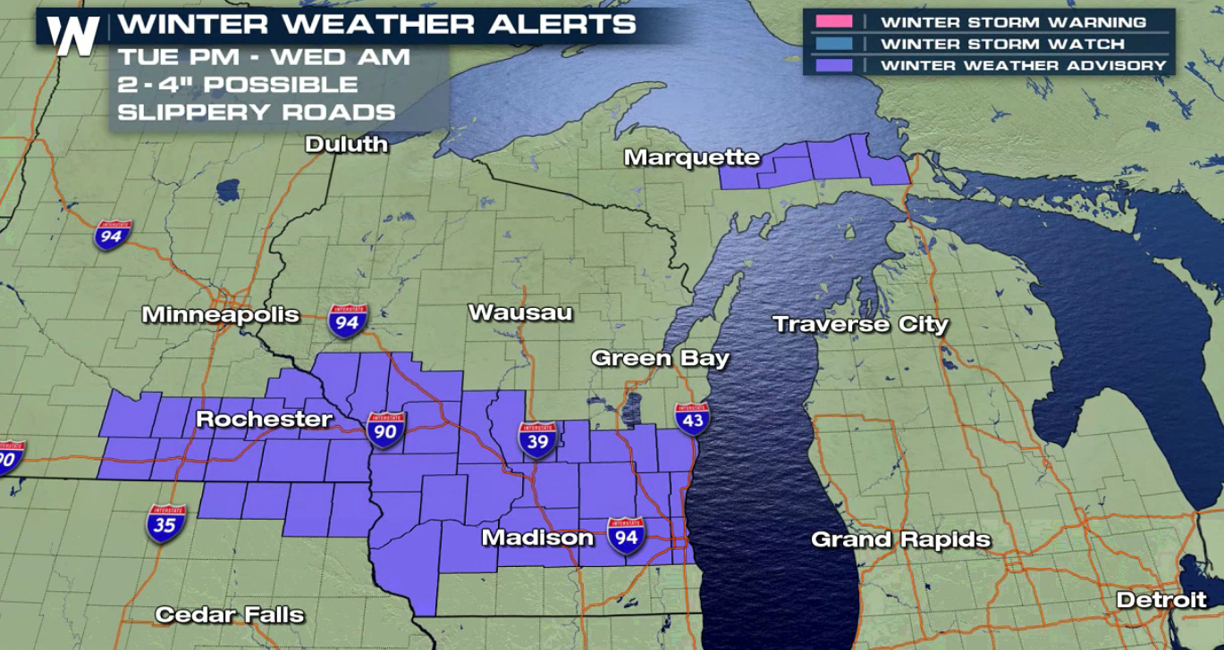
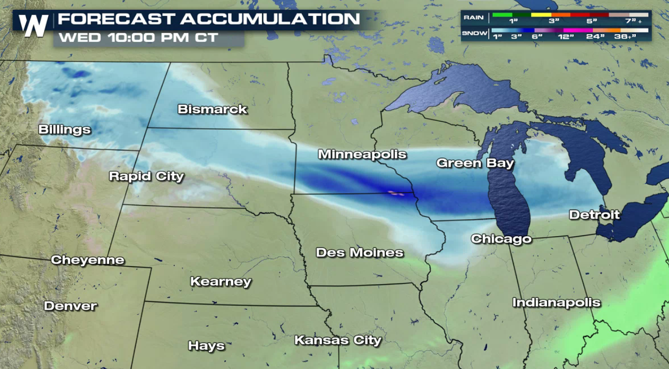
 Snow and rain accumulations will be light. Most snowfall accumulations will end up around an inch or two, with a few spots in the three to six inch range. The northwest wind behind the front will continue to support lake effect precipitation as well. Winter Weather Advisories include parts of Minnesota, Wisconsin and Michigan.
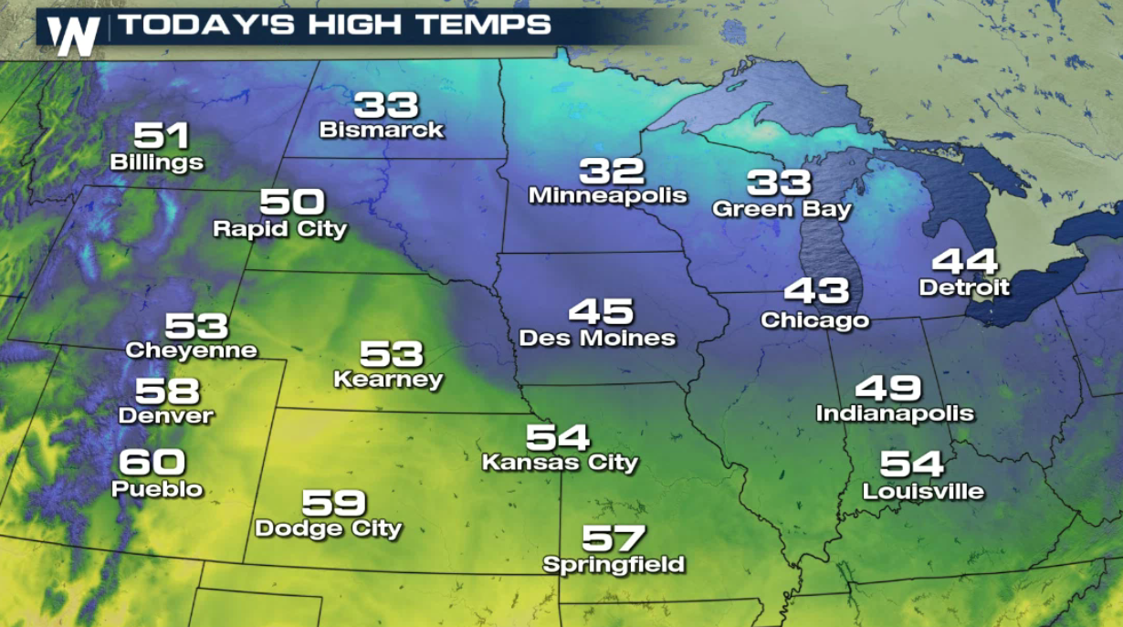
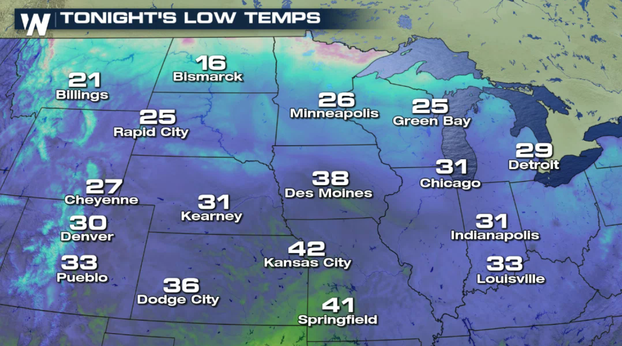
 The clipper and associated cold front will keep the weather chilly. Temperatures will remain below average into Wednesday.
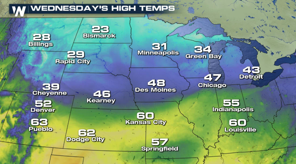
A quick-moving clipper will bring a scattered precipitation across the Upper Midwest and into the Great Lakes. Snow will push into the region late this afternoon and continue through Wednesday evening.
Snow and rain accumulations will be light. Most snowfall accumulations will end up around an inch or two, with a few spots in the three to six inch range. The northwest wind behind the front will continue to support lake effect precipitation as well. Winter Weather Advisories include parts of Minnesota, Wisconsin and Michigan.
The clipper and associated cold front will keep the weather chilly. Temperatures will remain below average into Wednesday.
All Weather News
More

Flooding, Severe Storms Target the Midwest Again
After an active week of storms across the nor
1 Aug 2026 1:40 AM


After Reaching Category 5, Genevieve Weakens in the Pacific
PacificFausto is now a post-tropical cyclone.
31 Jul 2026 1:30 AM

Flooding Risk Increases as Heavy Rain Targets the Tri-State Area
Tuesday, heavy rainfall moved across the Nort
30 Jul 2026 12:25 AM

Severe Weather: Energy From the Midwest Now in the Southeast
UPPER MIDWEST - Through Monday, dangerous tor
29 Jul 2026 10:30 PM