Sunday Severe Weather Update

Special Stories
5 Aug 2018 6:06 AM
A cold front (sometimes stationary) will bring a chance of strong to severe storms throughout parts of southeast Wyoming into the Upper Great Lakes today. All modes of severe weather will be in play, including the risk of tornadoes.
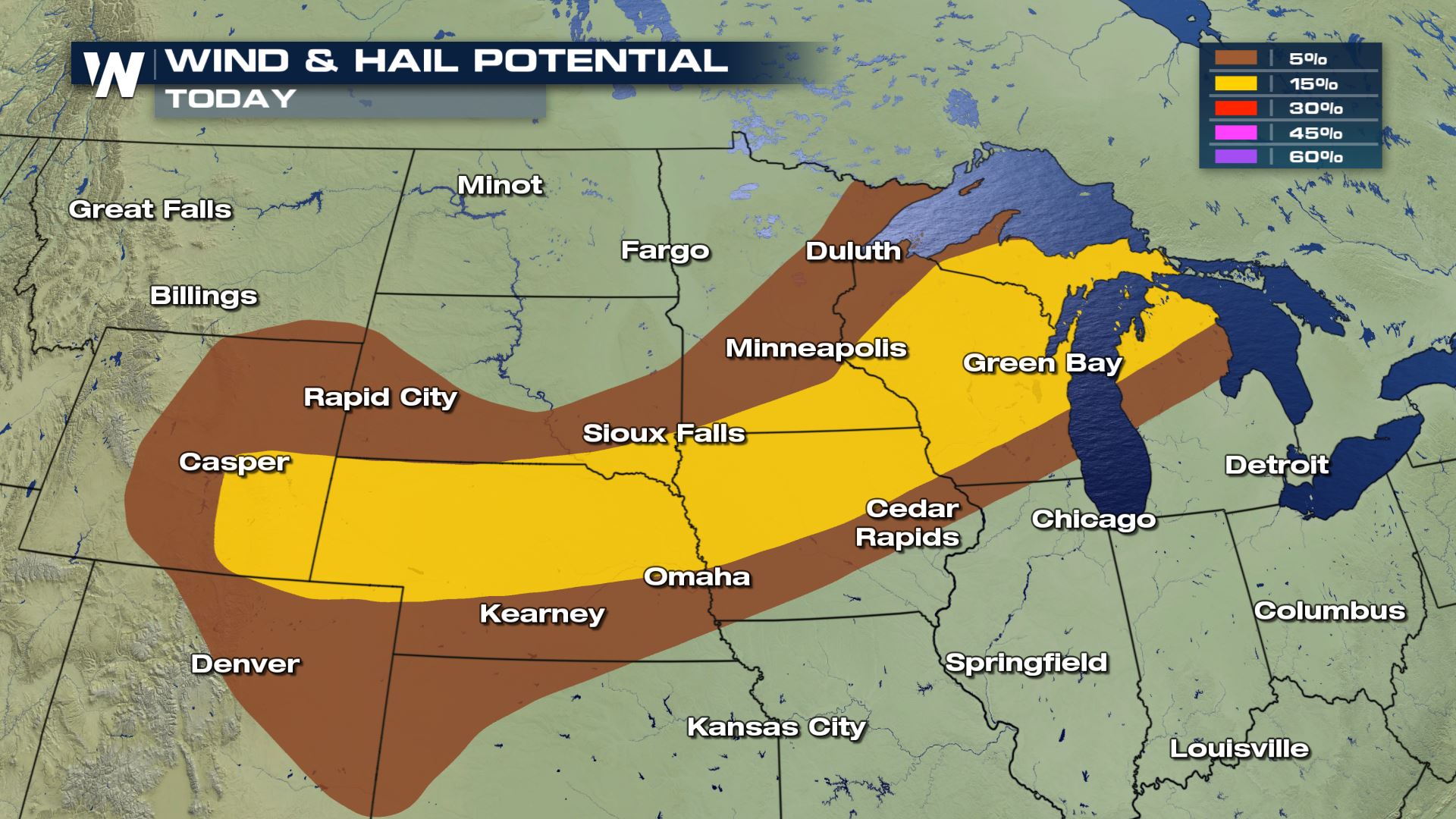
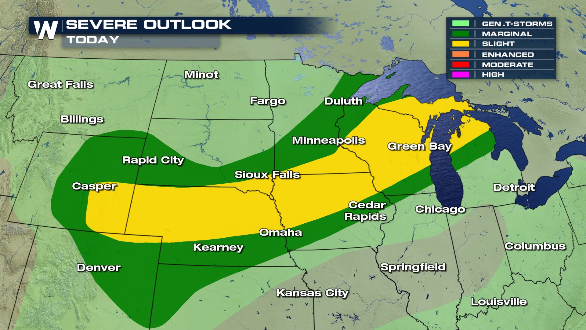 A slight risk of severe weather extends from southeast Wyoming up to the UP of Michigan. These are all the areas that could see heavy rain, large hail, damaging winds and even some tornadoes.
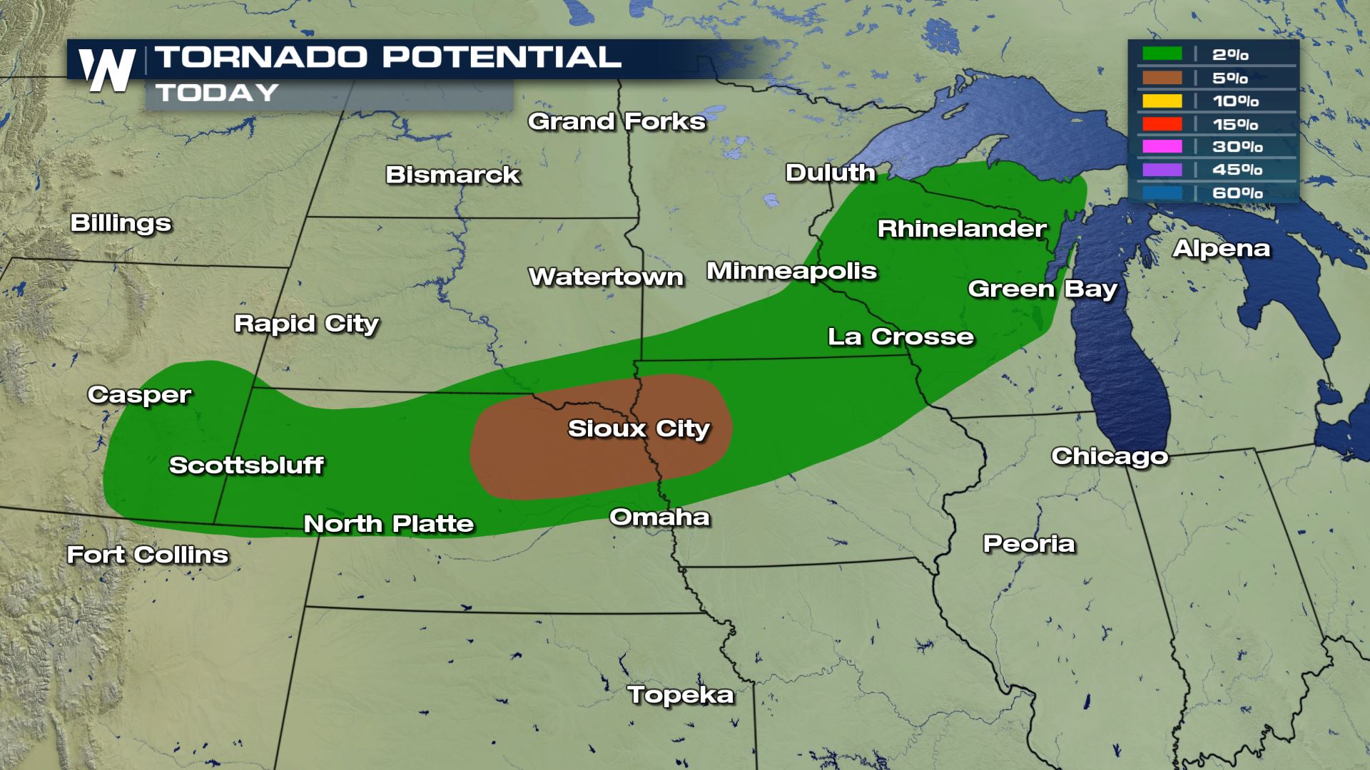
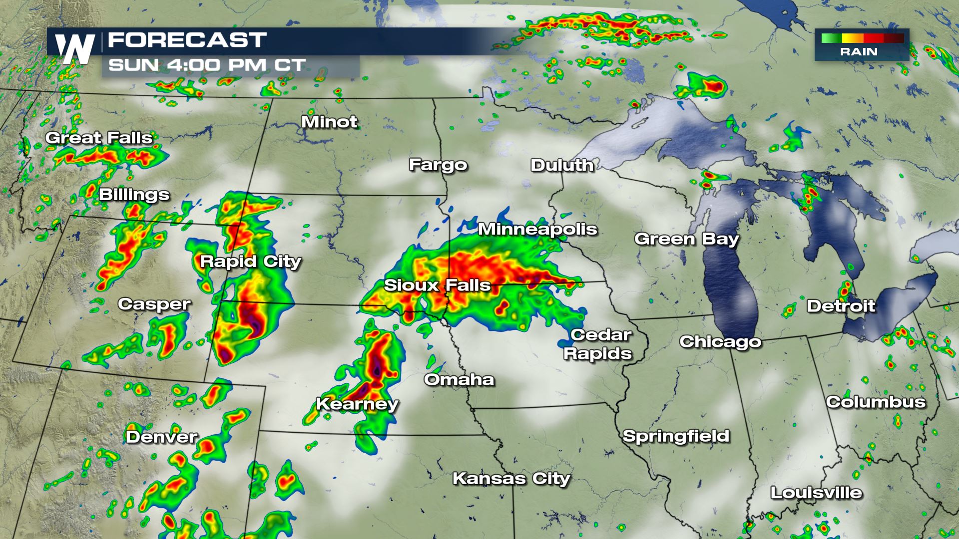
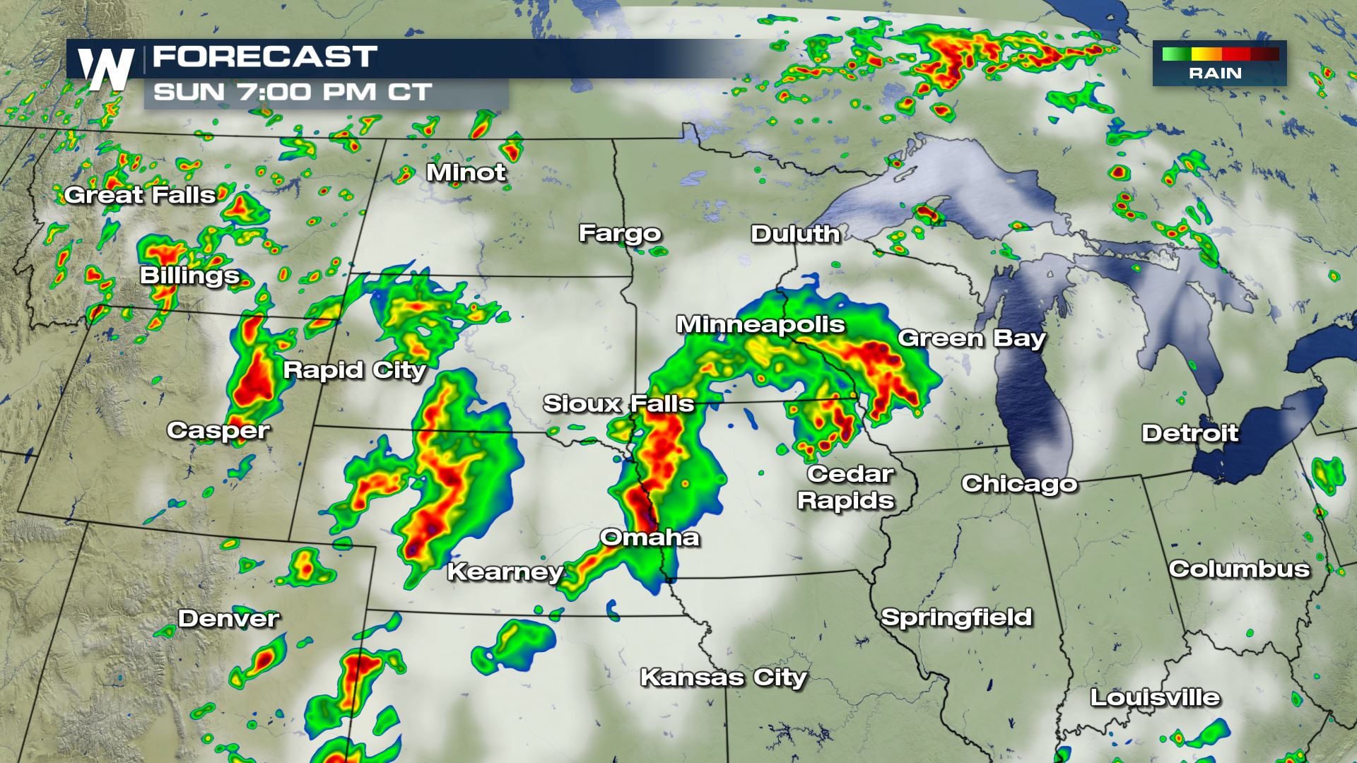
 The tornado risk will be there for the areas under the slight risk of severe weather, but eastern Nebraska and western Iowa will have the highest chances for seeing any rotating thunderstorms today. Hail could be up to 2" in diameter and wind gusts could be up towards 70 mph with some of these storms.
Severe Outlook
A slight risk of severe weather extends from southeast Wyoming up to the UP of Michigan. These are all the areas that could see heavy rain, large hail, damaging winds and even some tornadoes.
Severe Risks
The tornado risk will be there for the areas under the slight risk of severe weather, but eastern Nebraska and western Iowa will have the highest chances for seeing any rotating thunderstorms today. Hail could be up to 2" in diameter and wind gusts could be up towards 70 mph with some of these storms.
Forecast
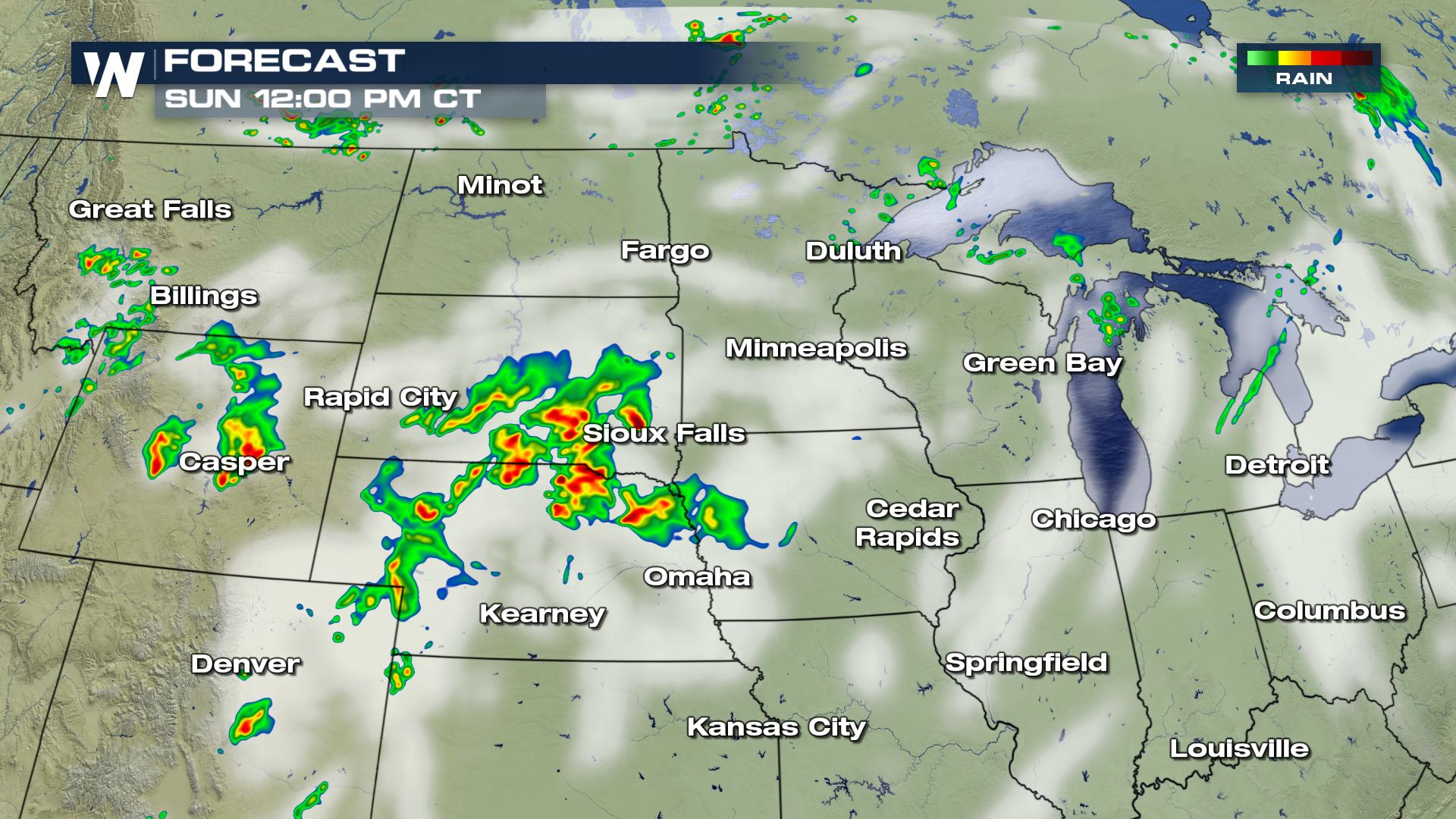
The timing for today's severe storms will be during the afternoon and evening hours. Here is the very latest forecast for today's storms.
WeatherNation
All Weather News
More

Flooding, Severe Storms Target the Midwest Again
After an active week of storms across the nor
1 Aug 2026 1:40 AM


After Reaching Category 5, Genevieve Weakens in the Pacific
PacificFausto is now a post-tropical cyclone.
31 Jul 2026 1:30 AM

Flooding Risk Increases as Heavy Rain Targets the Tri-State Area
Tuesday, heavy rainfall moved across the Nort
30 Jul 2026 12:25 AM

Severe Weather: Energy From the Midwest Now in the Southeast
UPPER MIDWEST - Through Monday, dangerous tor
29 Jul 2026 10:30 PM