Atmospheric River Bringing Rain, Snow, Storms & Wind to the Northwest

NORTHWEST - Rain, mountain snow, coastal impacts, and high winds will all continue to target the northwestern United States from Washington and Oregon inland to Idaho, Montana, and Wyoming.
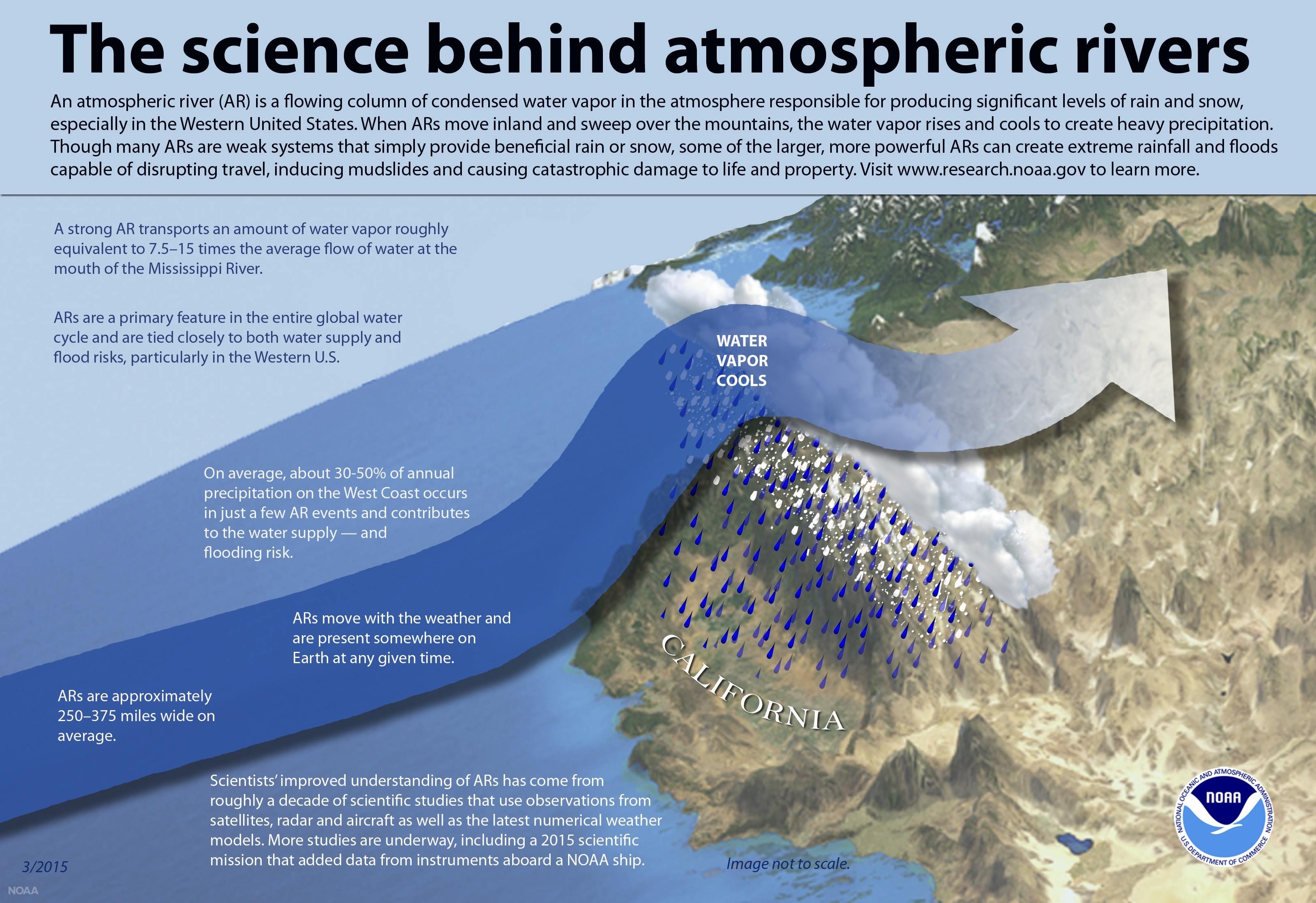
This efficient flow of moisture is known as an Atmospheric River. You guessed it. With so much moisture, the average atmospheric river carries an amount of water vapor roughly equivalent to the average flow of water at the mouth of the Mississippi River (NOAA).
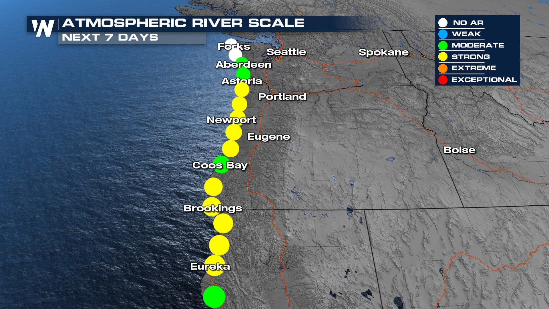
 On a scale from 1-5 of Atmospheric River intensity from CW3E Scripps, this current wave impacting the northwest coast will hit a 3 depending on location. That means strong to extreme impacts can be expected. Impacts include powerful winds, heavy precipitation, and flooding.
 Forecast Timing
A push of coastal precipitation will continue overnight through Tuesday morning in the Pacific Northwest. In addition to the precipitation, forecast models are projecting winds up to 55 mph in Washington and Oregon, and up to 80+ mph in Idaho and Montana.
Impacts
Through Tuesday, coastal areas and enhanced lift from the mountains could mean rainfall totals upwards of 3", but most totals look to be around 1-1.5" in Washington State.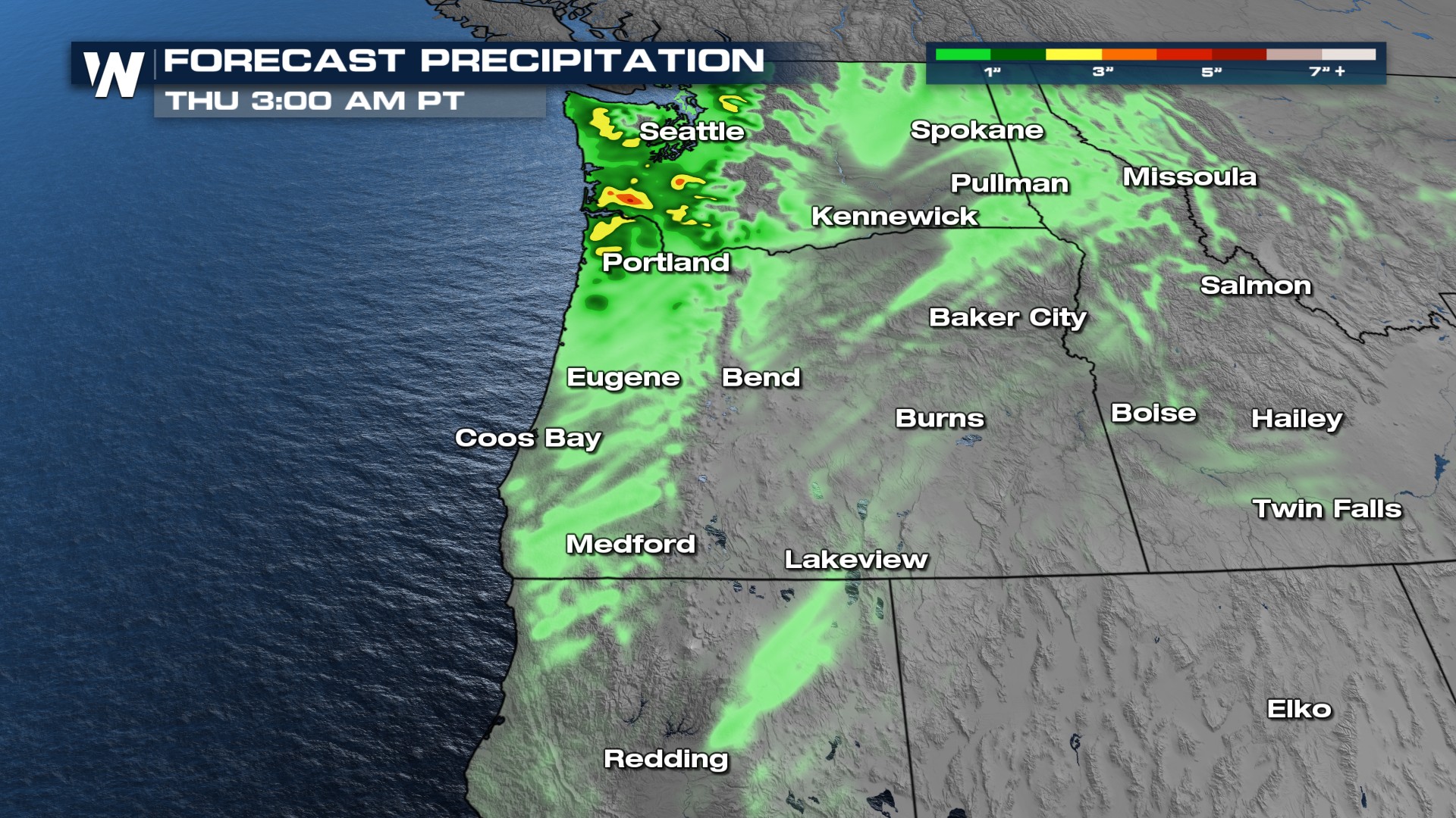 Snowfall totals will be greatest in the higher elevations of the Northern Rockies and Cascades, where up to a foot or more could fall with multiple systems. Keep in mind, as temperatures will generally be mild into next week, snow levels will be higher at times.
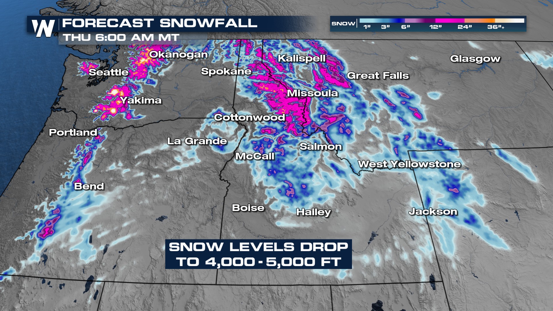
Make sure to tune into WeatherNation for the forecast.


