Parade of Problems Marches On

Choking on wildfire smoke, sizzling in the summer heat, or dodging massive hailstones, the Upper Midwest has been on a run lately. We're going back to dodging storms over the next few days. A few different impulses will stir up trouble from Montana to Minnesota.
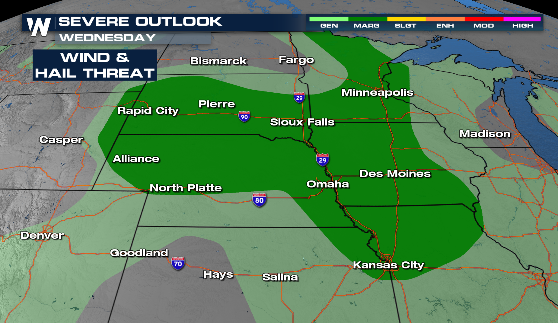
Overnight & Wednesday
Severe storms will be possible the next few days as a frontal boundary taps into extremely unstable air. Multiple severe storms tore through the Northern Plains this evening, and the threat will continue overnight. Damaging winds and hail will be the primary concern. An isolated tornado threat is also possible.
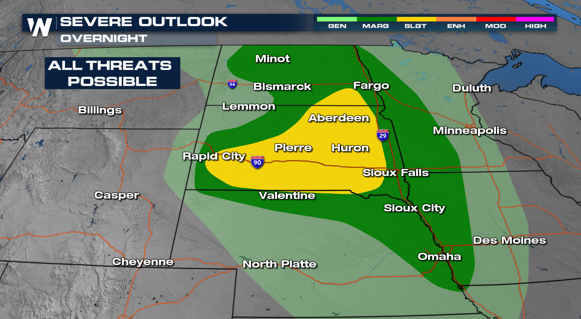
 OVERNIGHT
Storms fired off on Tuesday with damaging winds and hail, torrential rain, and tornadic cells. Storms will continue into the overnight hours as the frontal boundary and it's associated low move to the east. Damaging winds, large hail, and even tornadoes will be possible. Please have ways to get alerts through the late-night hours.
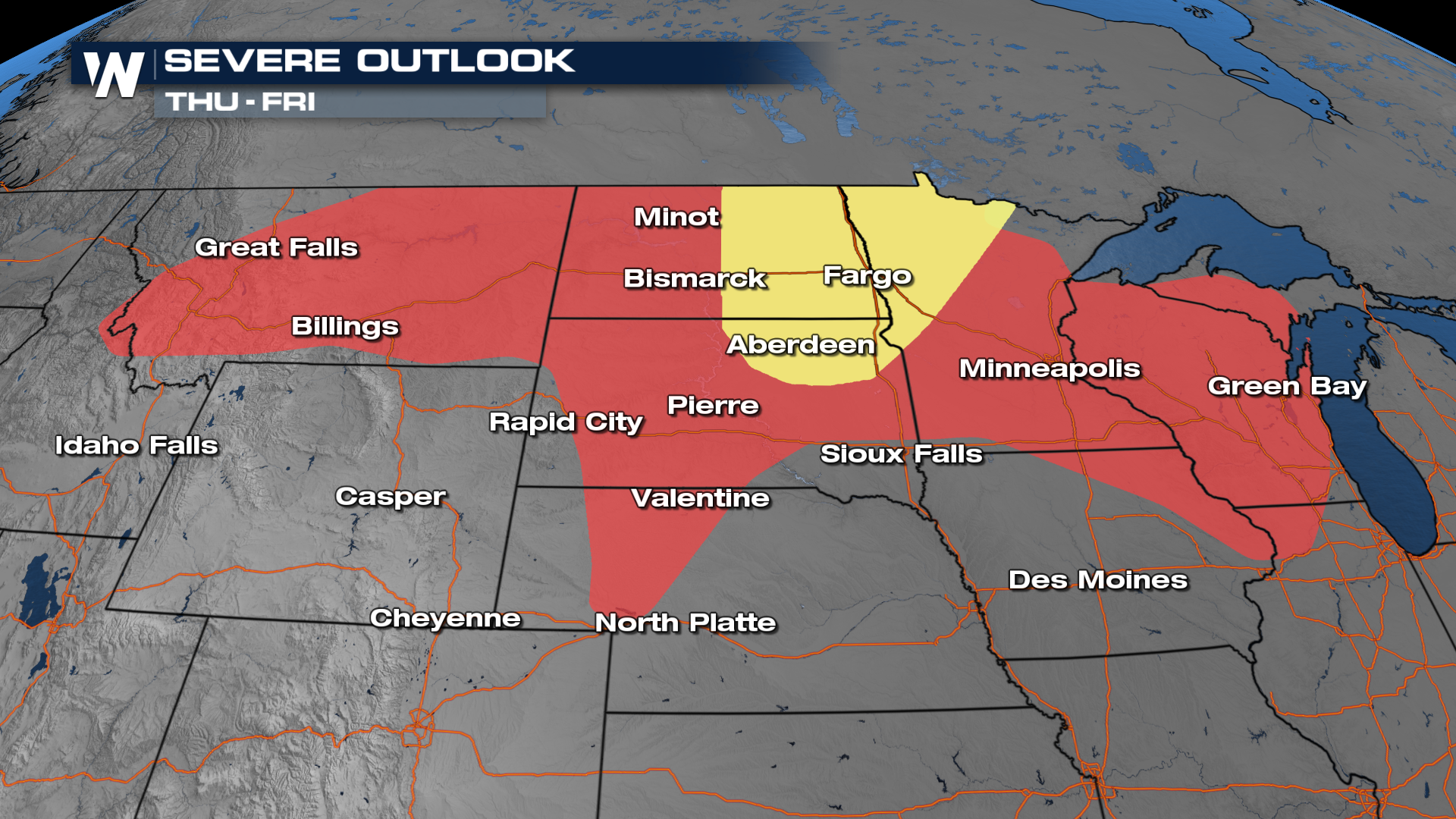
THU - FRI
As we look ahead to Thursday and Friday, the Storm Prediction Center has issued severe outlooks for Thursday and Friday these days. Damaging winds and hail will be the primary concerns.
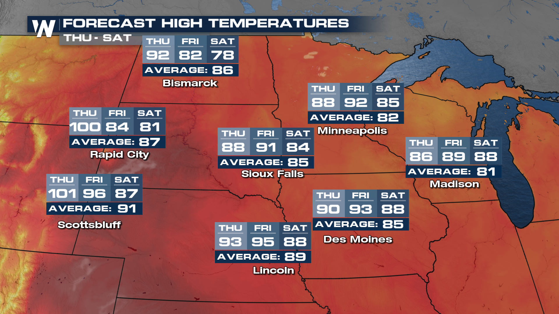
As the frontal boundary moves through, there will be relief from the heat! If you have been looking for temps a tad cooler, this weekend will be that time.