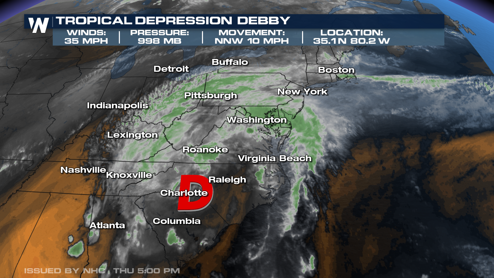
Debby Makes Second Landfall in South Carolina, Now a Tropical Depression

Debby made its second landfall near Bulls Bay in Awendaw, SC at 2 am Thursday as a Tropical Storm. Debby's first landfall happened as a Category 1 Hurricane in the Big Bend of Florida on Monday, August 5th at approximately 7:00 am. Winds were sustained at 80 mph and pressure was at 979 MB. 4 hours later, Debby weakened to a Tropical Storm as it pushed farther inland. On Thursday afternoon, after the 2nd landfall, Debbie became a Tropical Depression.
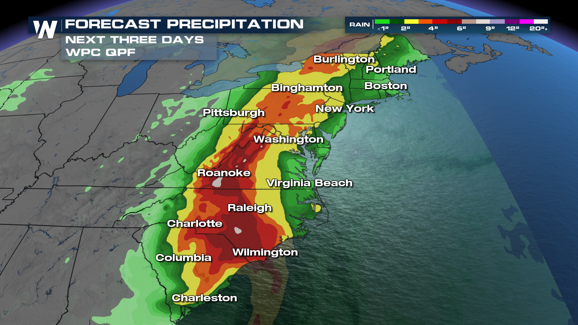
 Heavy rain for the leftovers of Debby will bring a chance for flash flooding across New England. Grounds are already saturated from showers and storms on Thursday and that could very easily lead to flash flooding Friday.
Excessive Rainfall Outlooks remain at a level 4 out of 4, HIGH, into Friday morning. High risks are only issued when widespread and numerous instances of flash flooding that could bring CATASTROPHIC damage are likely.
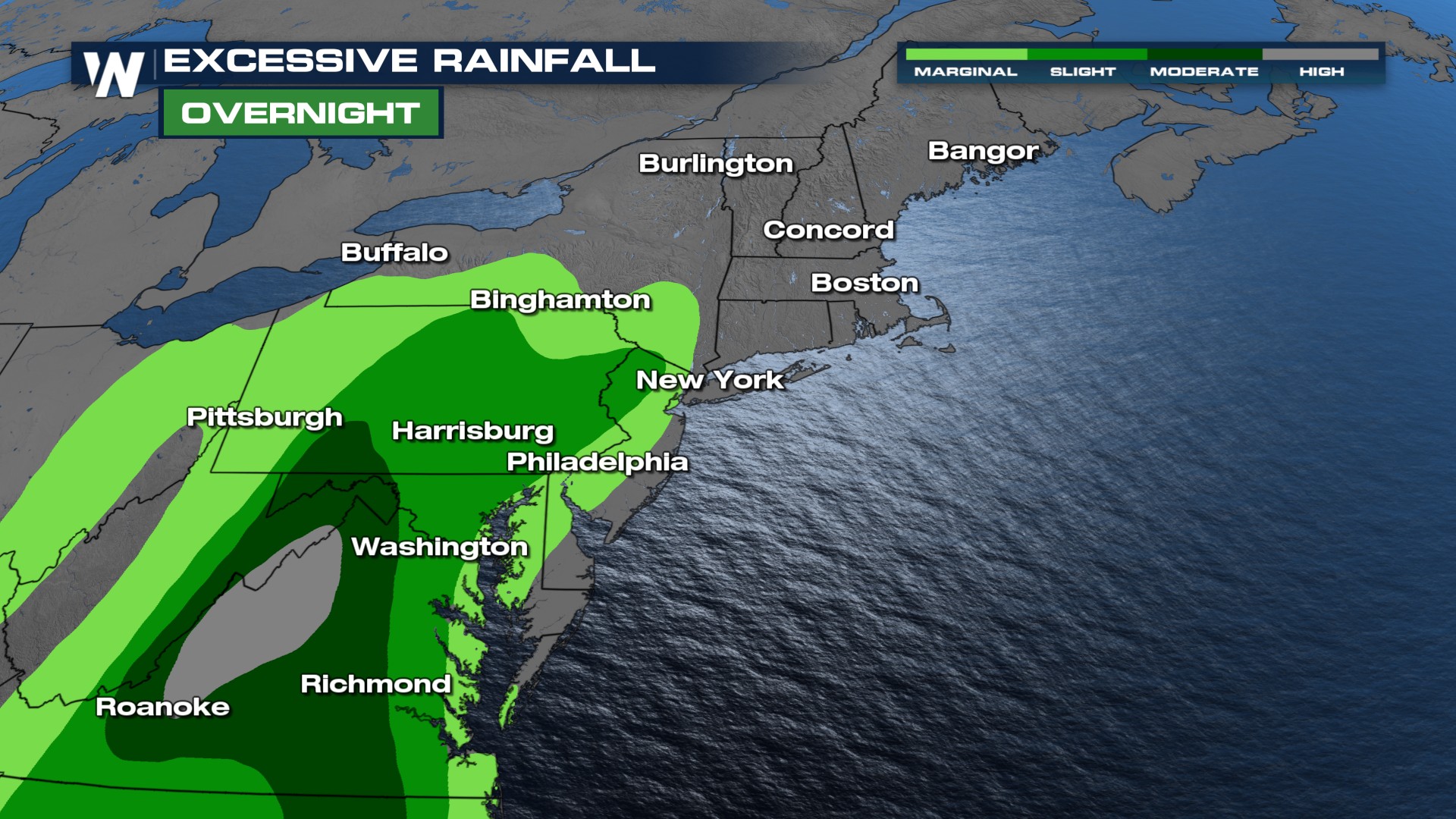
As a reminder, 90% of flooding damages occur on high-risk days, which are the least common outlook issued. Please avoid traveling outside and if you live in a flood-prone area, make arrangements to have an evacuation in place. Flooding is the deadliest weather hazard during tropical systems and Debby will bring a plume of moisture to the Southeast and Middle Atlantic Coasts.
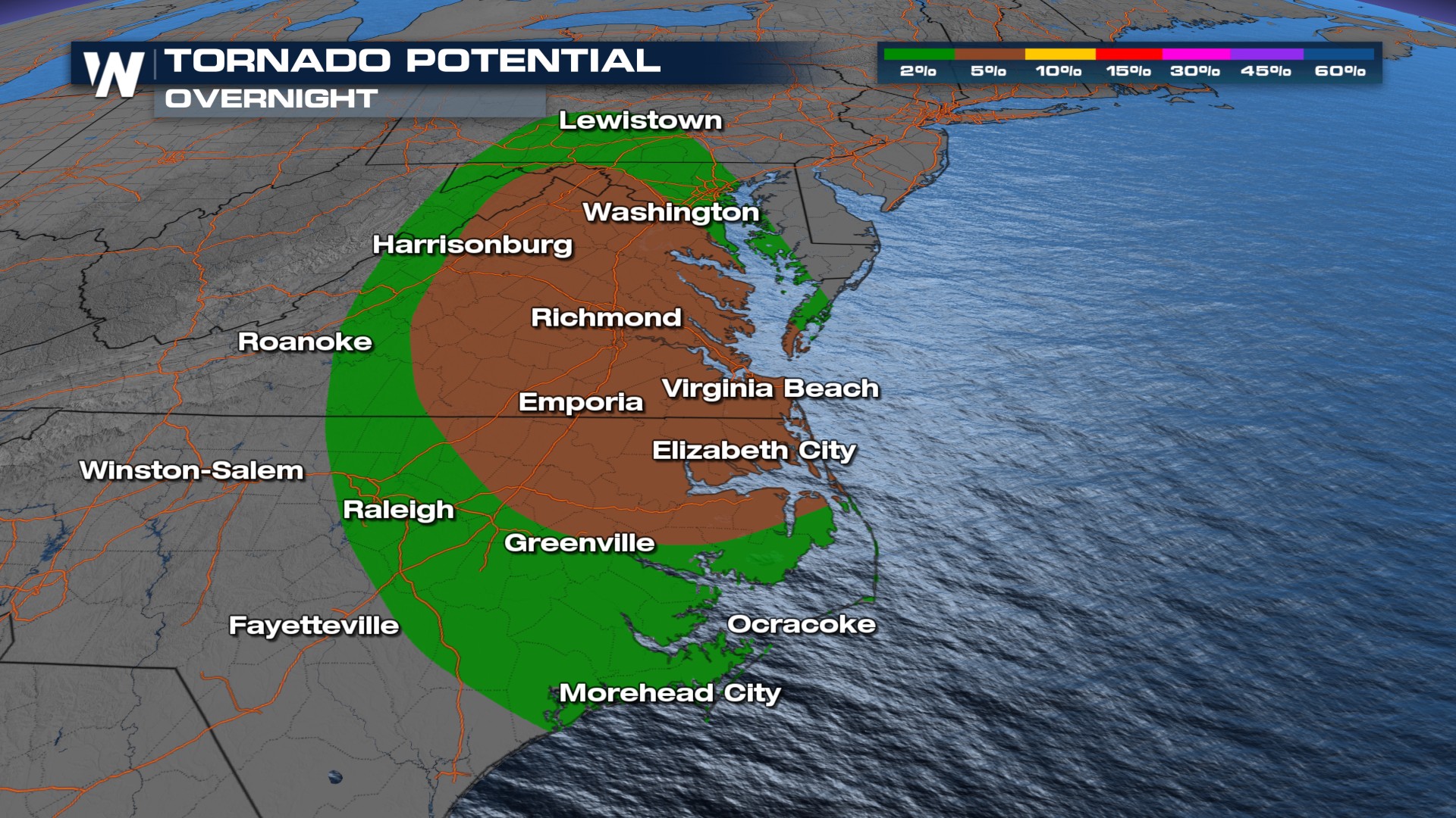
 When Debby moves northeast, alongside heavy rainfall expected, severe storms are expected along the Atlantic Coast. This keeps the tornado potential going through Friday.
As a reminder, 2024 is expected to be above average for tropical activity due to a La Nina forming during the peak of hurricane season in September. It only takes one storm to impact you and the time to prepare is before the storm hits!


