NOAA's Updated Atlantic Hurricane Season Outlook Above Average

The National Oceanic and Atmospheric Administration just updated its Hurricane Outlook. The mid-season update continues to predict an above-average season. Several factors are pivotal, such as warm sea surface temperatures and the possibility of La Nina.
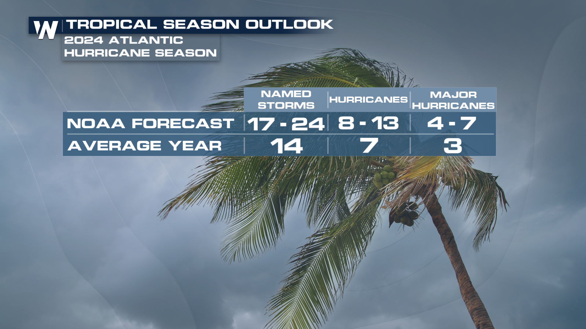
In the previous forecast NOAA called for 17-25 named storms, with 8-13 hurricanes, and 4-7 expected to be major hurricane strength, CAT 3 or stronger with sustained winds of 111 mph or stronger. This was the highest forecast NOAA issued in the initial outlook in May.
Now, like the outlook in May, NOAA’s Climate Prediction Center calls for the number of expected named storms between 17-24, of which 8-13 could become hurricanes, including 4-7 major hurricanes.
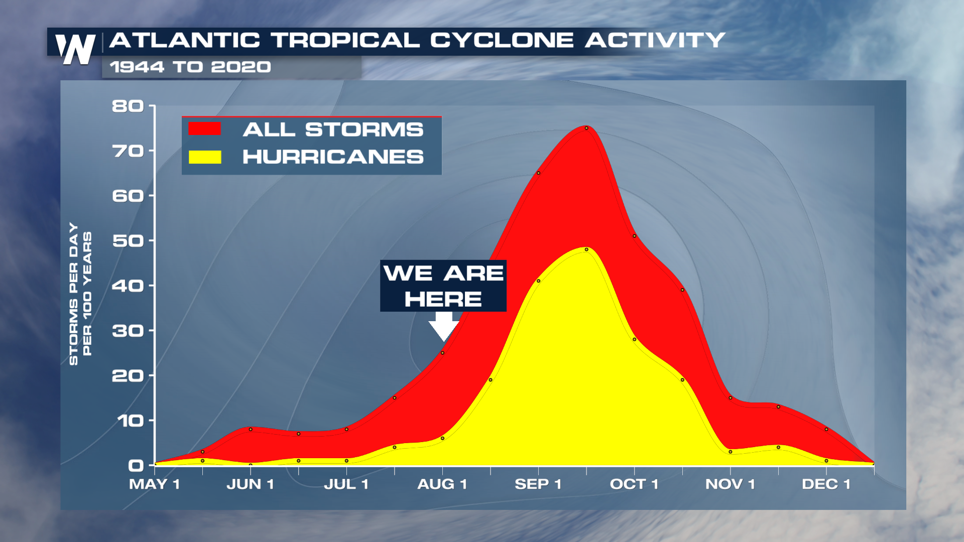
 In a press release issued by NOAA, Rick Spinrad, an administrator at NOAA said, "The hurricane season got off to an early and violent start with Hurricane Beryl, the earliest category-5 Atlantic hurricane on record.” Spinrad also stated that “NOAA’s update to the hurricane seasonal outlook is an important reminder that the peak of hurricane season is right around the corner when historically the most significant impacts from hurricanes and tropical storms tend to occur.”
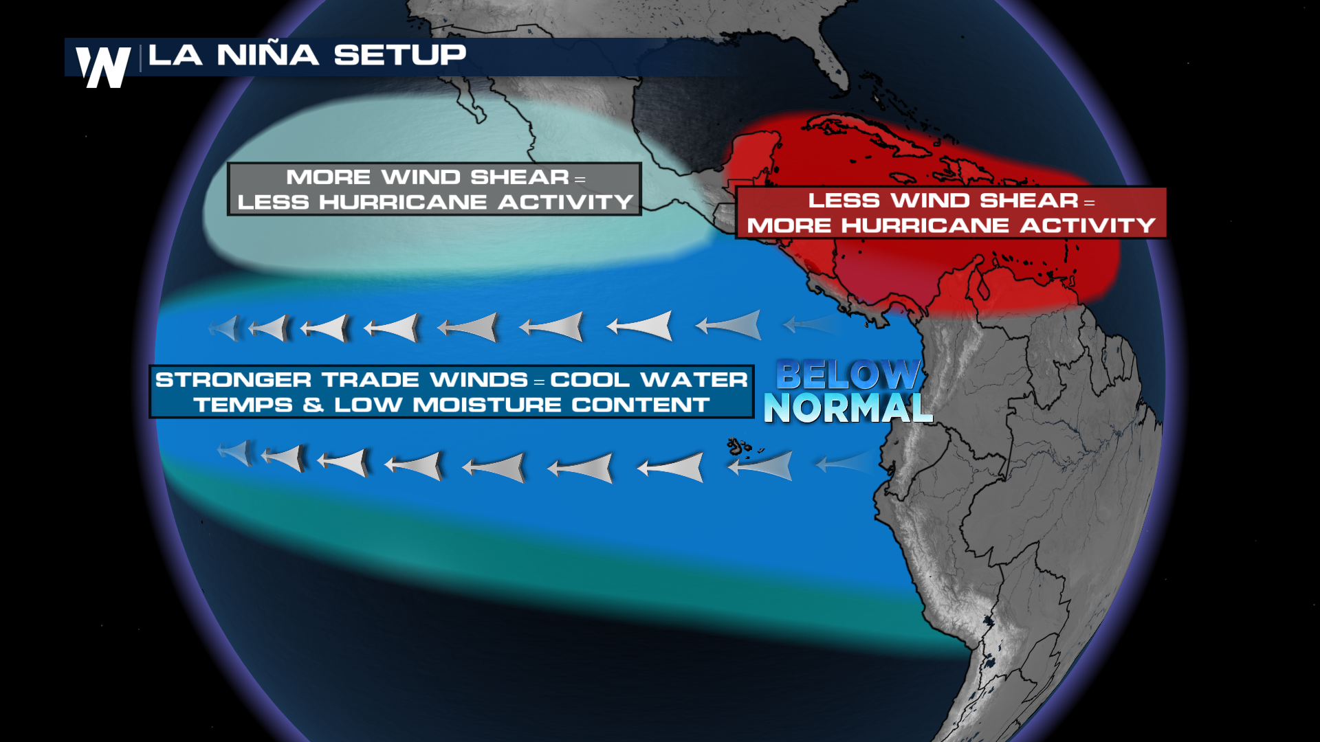
 The reason that this year is expected to be above average is due to warm sea surface temperatures, and La Niña conditions returning just in time for the peak of Hurricane season. La Niña is categorized by cooler-than-average sea surface temperatures in the equatorial Pacific Ocean, typically resulting in less wind shear over the Atlantic and Caribbean oceans. Less wind shear means hurricanes can thrive, rather than be torn apart by strong upper-level winds. In the Eastern Pacific, a La Niña Pattern typically spells below-average activity, which is what NOAA is predicting in 2024.
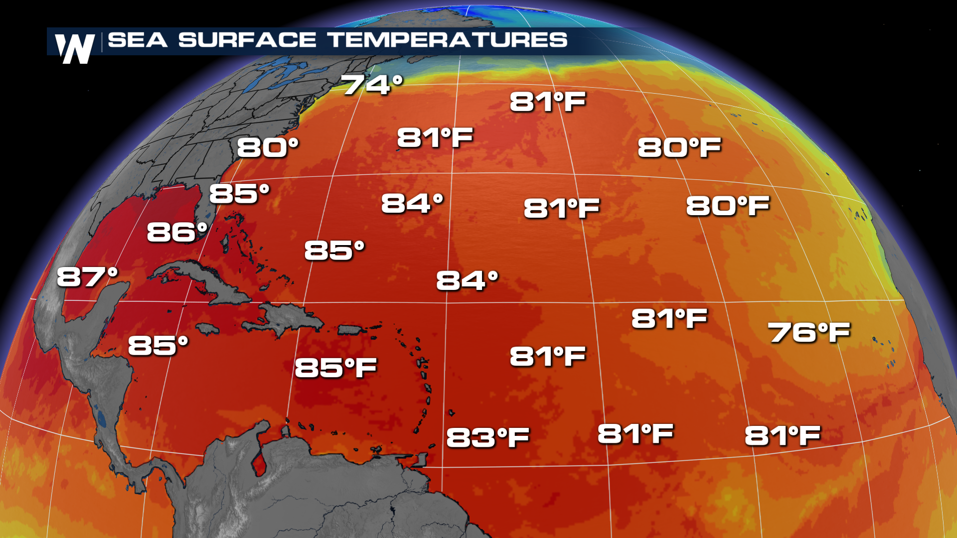
 The other factors are warmer than average sea surface temperatures and an active West African Monsoon. Sea surface temperatures are so warm in the tropical Atlantic that they are nearing records.
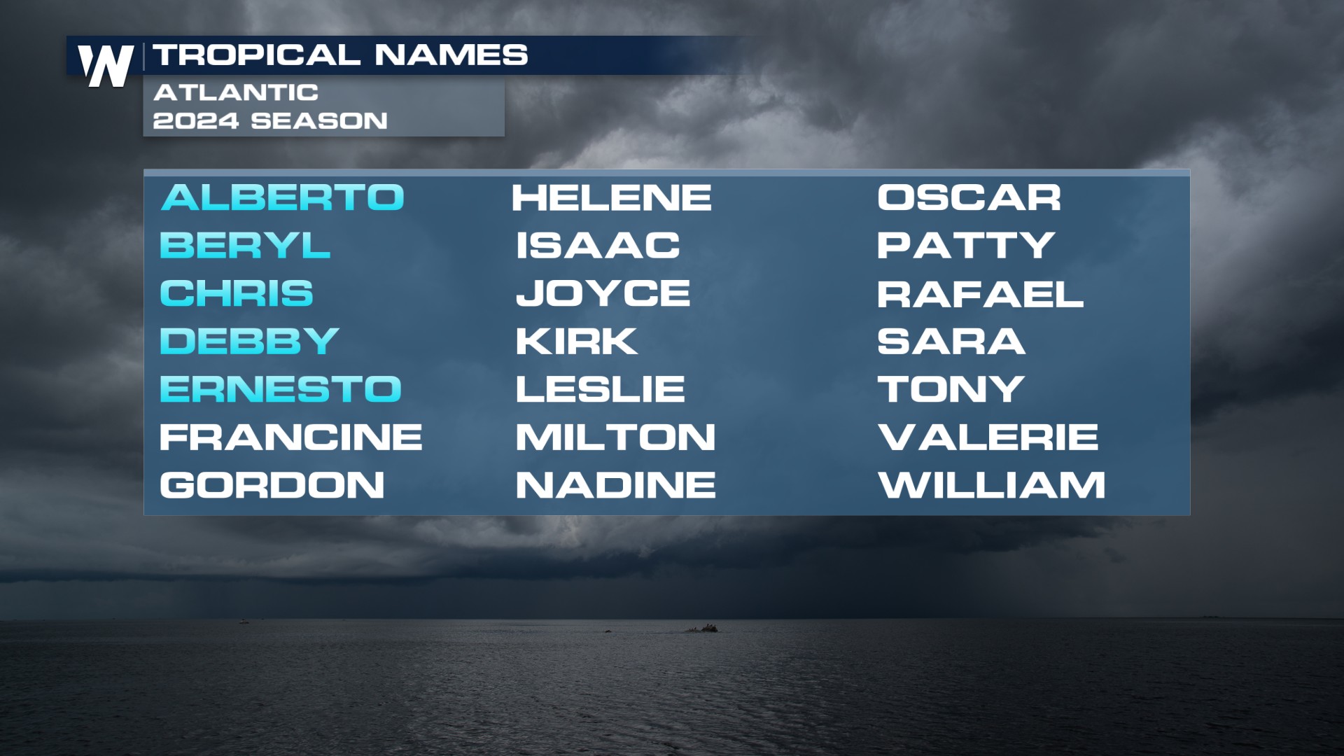
 NOAA's forecast continues to be aligned with Colorado State University , which also calls for a well above average season. The official list of Tropical Names for the Atlantic Hurricane season only has 21 names, and the higher end of NOAA's forecast calls for up to 24 storms. If the forecast pans out, there is an alternate list to supplement. The last time additional names were needed was during the record-setting 2020 season when La Niña conditions were also present. Below is the list of hurricane names.
 As a reminder, these forecasts only account for the total number of storms, NOT potential paths or U.S. impacts. It only takes one storm to impact you and the time to prepare is ahead of the storm. For more on storm preparation, tropical conditions, and alerts, stay with WeatherNation throughout the hurricane season.


