Atlantic Hurricane Season 2024: Expected to be Well Above Average
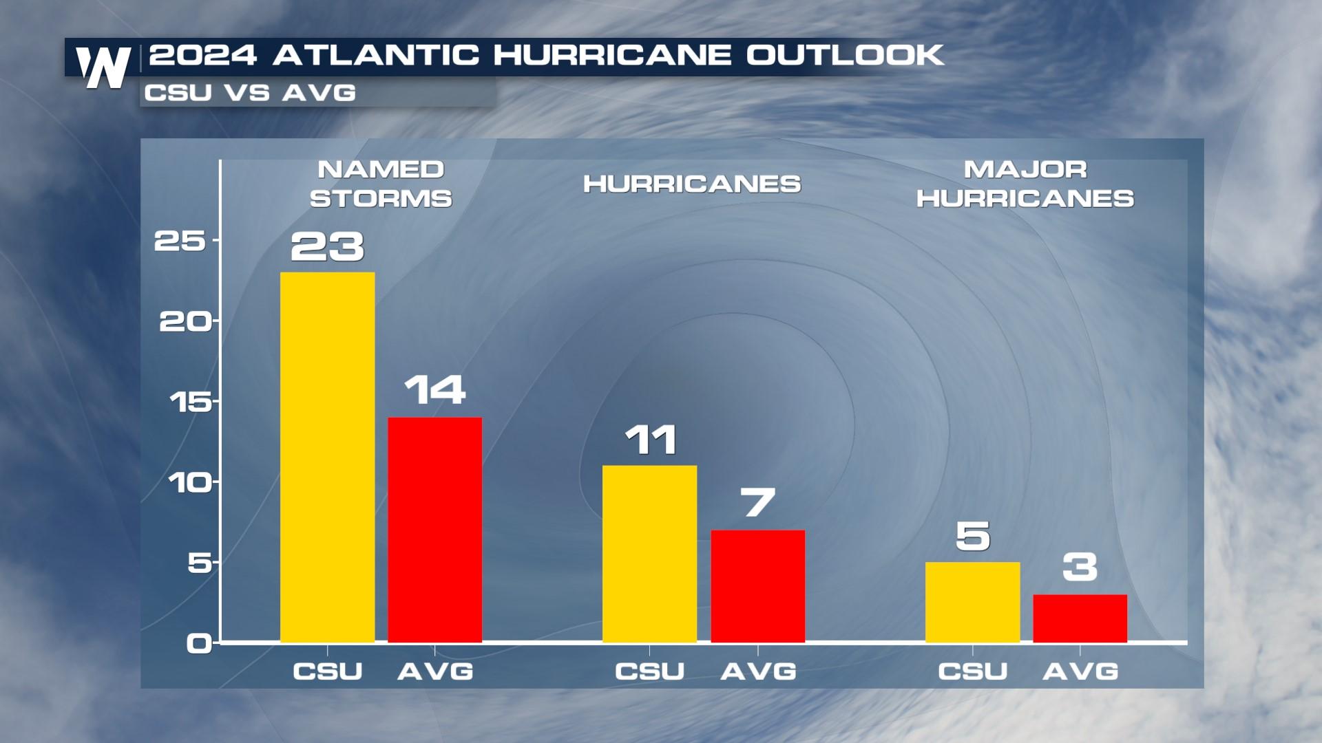
Colorado State University has released its outlook for the 2024 Atlantic Hurricane Season, calling for an above-average season for named storms, hurricanes, and major hurricanes. CSU Forecasters, under the leadership of Hurricane Researcher Phil Klotzbach, attribute the above-average forecast to the La Niña conditions expected in the equatorial Pacific Ocean and warmer than average sea surface temperatures in addition to activity from the West African Monsoon. CSU uses "analog" years, or reference years that show similar characteristics to this one; 2024's reference years are 1878, 1926, 1998, 2010, and 2020, all above average years.
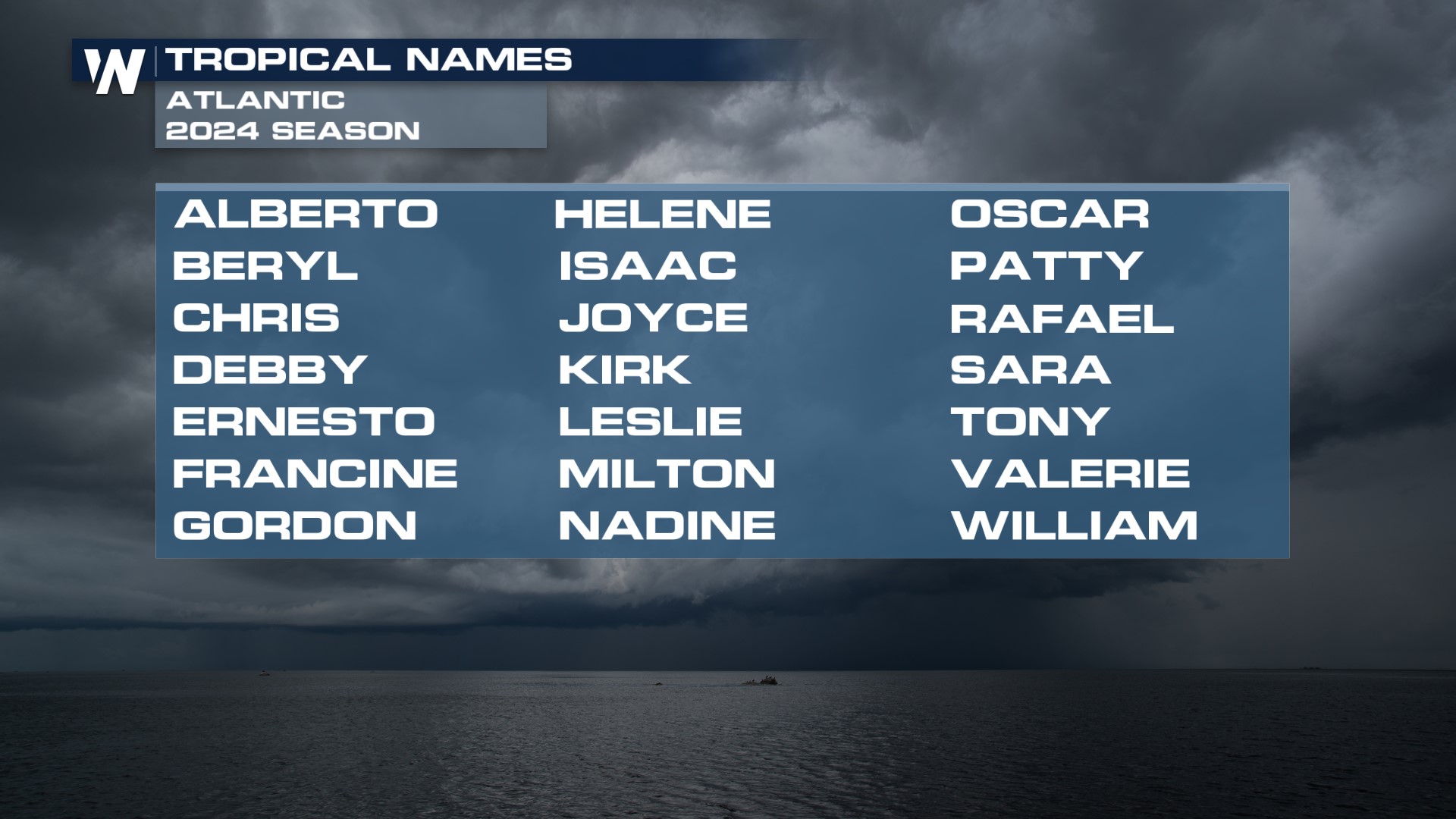
Atlantic hurricane season officially begins on June 1 every year, with the Eastern Pacific Hurricane season beginning on May 15. The National Hurricane Center begins issuing tropical outlooks for both basins on May 15. The first name on the list in the Atlantic is Alberto, followed by Beryl. CSU forecasters call for 23 named storms, but the official list only has 21 names. In the past, the National Hurricane Center would revert to the Greek Alphabet, but following confusion in the 2020 season. Now, there is an alternative list of names that span the alphabet again with the first three of Adria, Braylen, and Caridad.
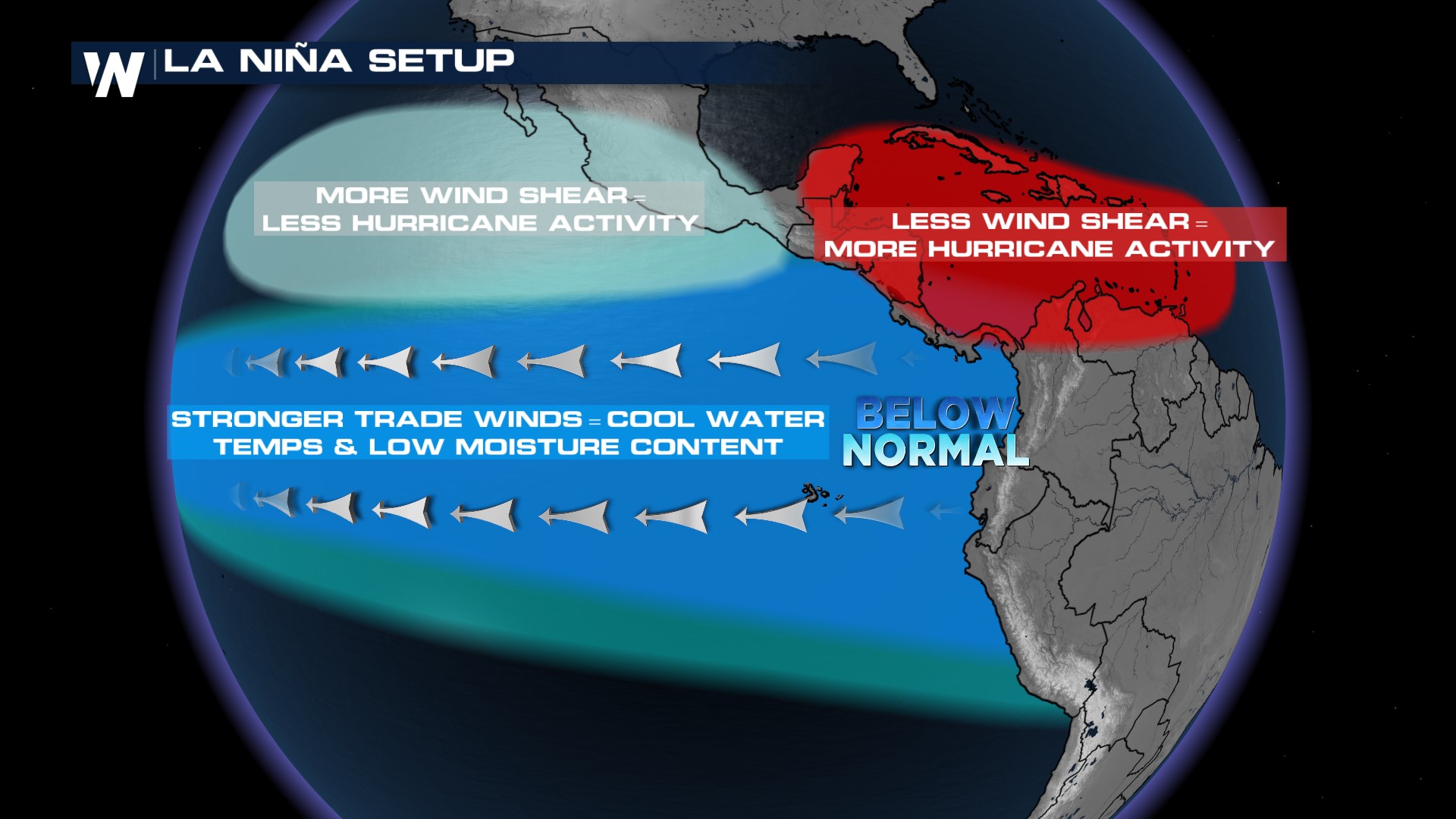
 A La Niña is characterized by cooler-than-average sea surface temperatures in the Pacific Ocean, which interacts with the atmosphere to produce less shear over the tropical Atlantic. Less shear means storms don't get "pulled apart" and have a better chance of surviving in the Atlantic Ocean. The last time we were in La Niña was in 2022, a hurricane season that was above average.
 The 2023 season was influenced by El Niño conditions which typically suppress hurricane season, but warmer than average sea surface temperatures balanced out the influence to give us a generally, average season in 2023.
Sea surface temperatures are also a huge factor in this year's forecast. Warm ocean waters help to develop thunderstorms that then congeal into hurricanes. Climatologically, sea surface temps are at their warmest in September, when there are peaks of energy off of the coast of Africa.
Remember, these are just outlooks and Klotzbach says, "it's important to realize that, you know, this is our first forecast. Historically, the skill is modest just because we're still quite a ways from the events we're trying to predict. Hurricane season doesn't really ramp up historically until August. So we still have a few months to go before the season really ramps up. It's also important to realize that, for in terms of preparations that we emphasize that the coastal population needs to be prepared every year for hurricane season, regardless of seasonal forecast from our group, NOAA or any other group issuing these predictions just because it only takes out one hurricane making landfall near you to make it an active season."
Stay with WeatherNation for the latest safety, prep and tips for hurricane season, streaming 24/7.


