Severe Storms & Flooding Target the Midwest

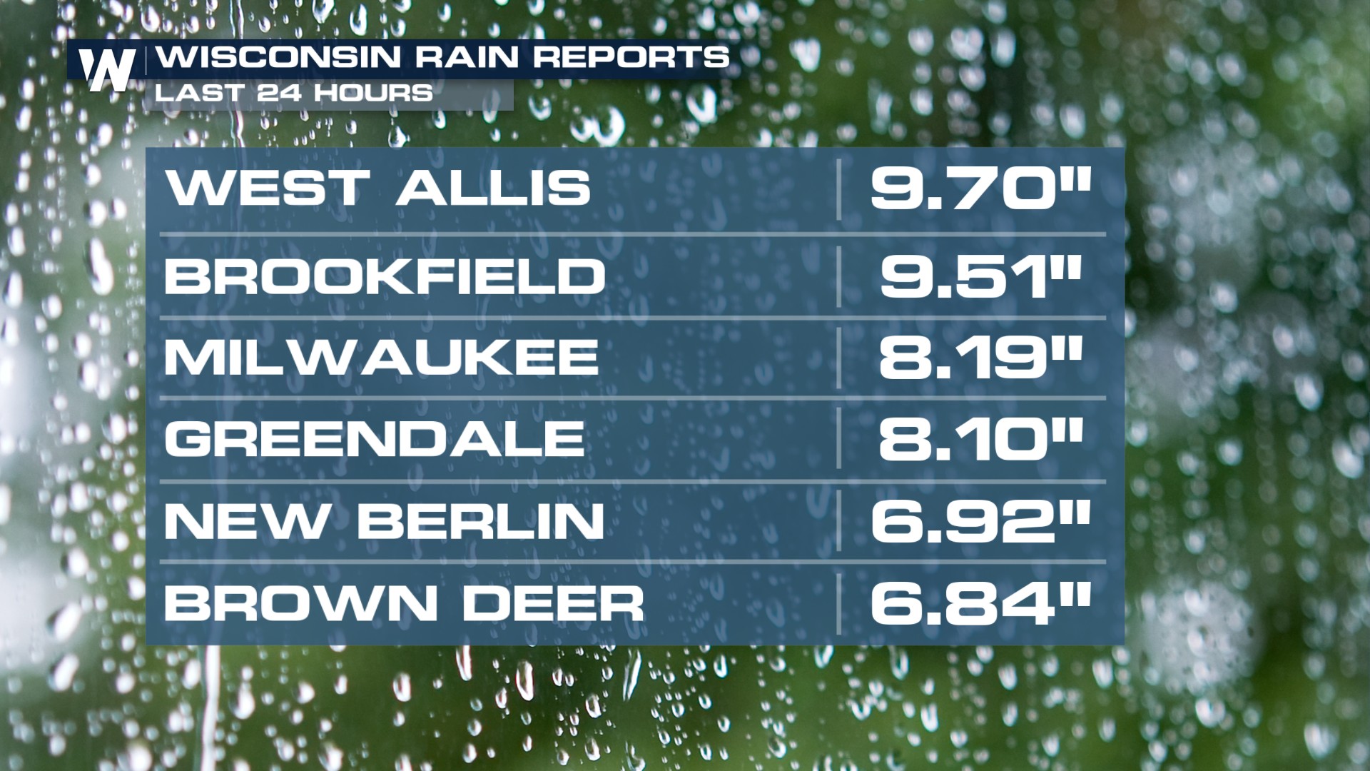
Up to 10 inches of rain created flash flooding around Milwaukee between Saturday night and Sunday morning. This was a major event.
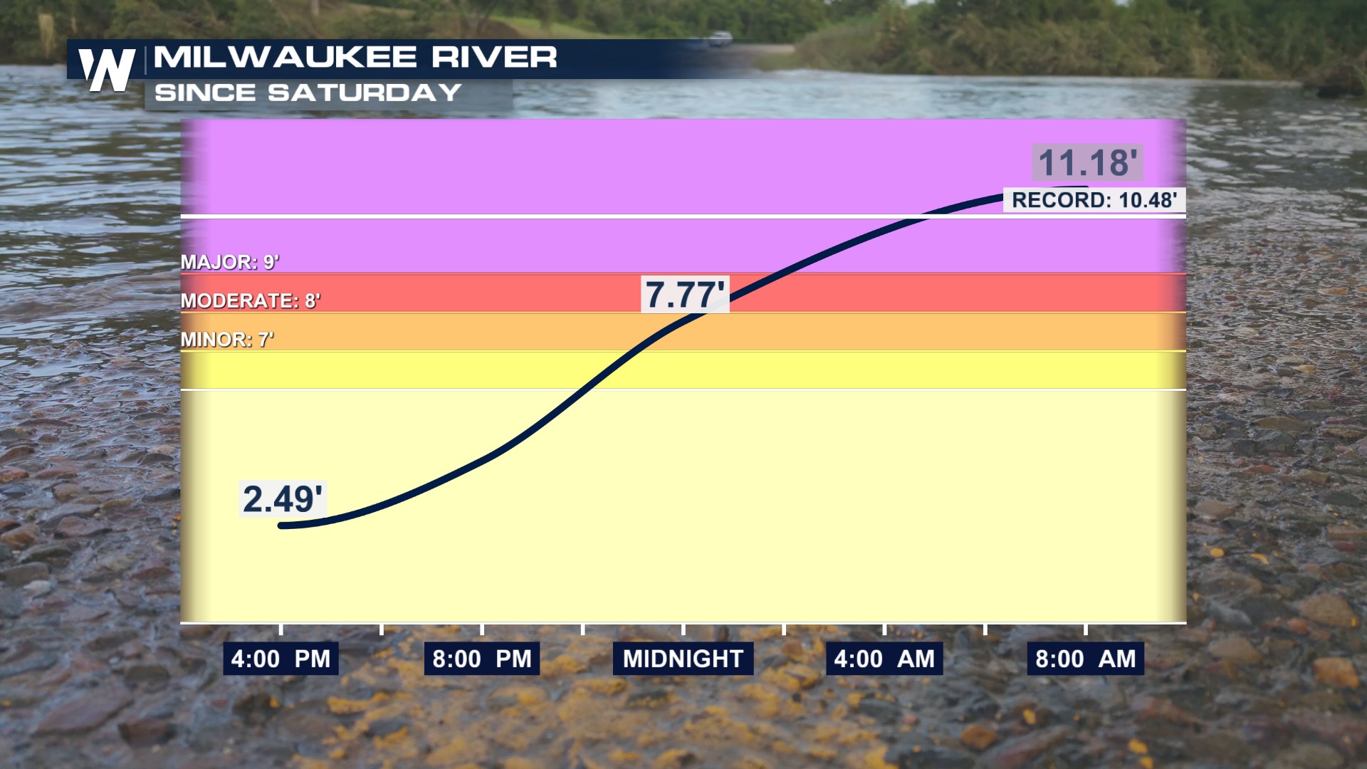
 The Milwaukee River crested at Major Flood Stage breaking it's record crest.
Threat Continues, Shifts to Flooding
The Storm Prediction Center (SPC) is expecting additional severe storms today along the front from northern Michigan to Kansas. Damaging winds are the main concern but large hail is possible, too!
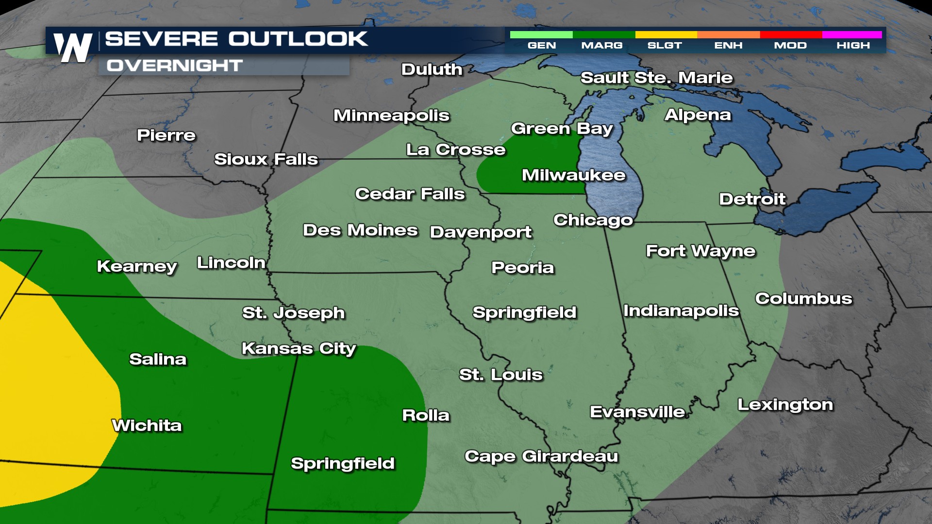
Scattered storms are expected to continue, flaring up with the most activity through the late afternoon into the evening hours. The overnights could be packed with heavy rain as well as MCS (Meso-scale Convection System) potential lingers in these areas.
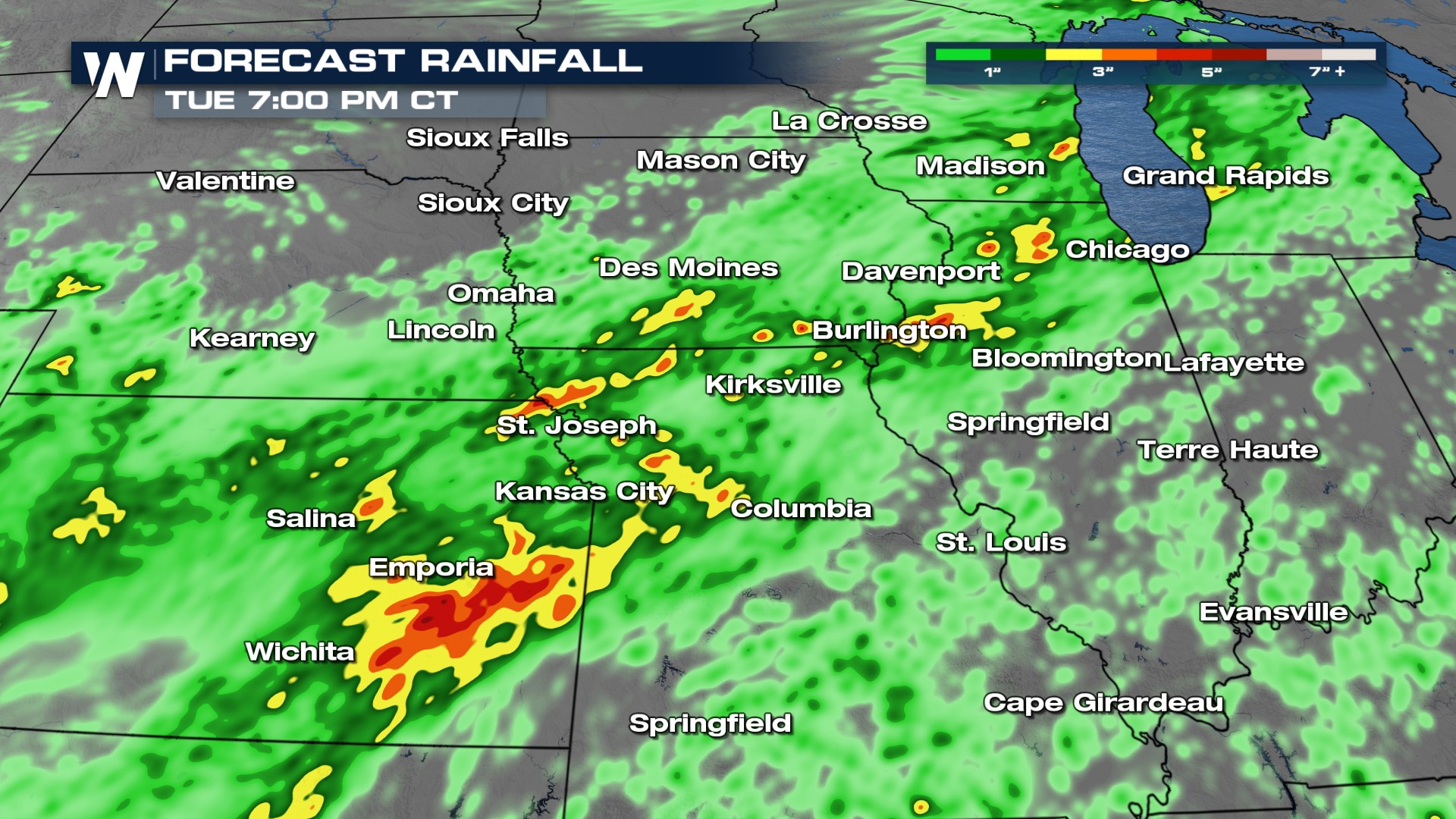
In addition to the severe threat, a heavy rain and flood risk will continue! Milwaukee recorded over 5 inches of rain on Saturday and there's more rain on the way. A Flood Watch remains in effect through Monday for some areas between Kansas into Wisconsin.
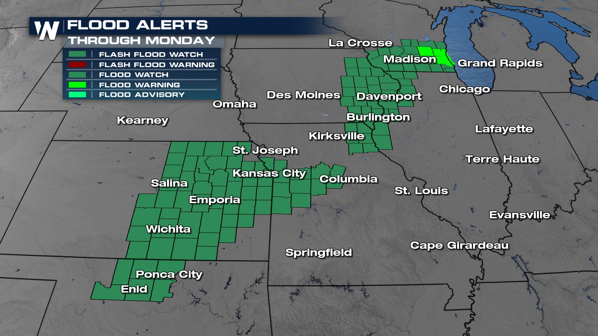
Models are showing several areas for rainfall totals over five inches and flooding could occur.
Stay with WeatherNation for the latest updates throughout the next few days on-air and online.


