Flash Flooding and Severe Weather for the Carolinas This Week

Another stalled front in the Carolinas is forecast to keep storms in the forecast. While we do have severe weather chances, models are showing high rainfall rates and a flood risk for the area. This setup isn't new, however. With the last stalled front on Monday, we've already picked up over 3.5" in parts of North Carolina!
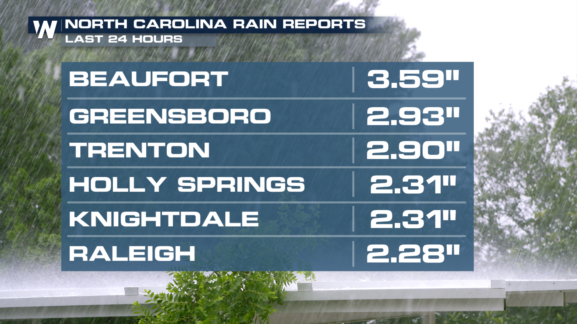
Flooding
With the front sticking around for the long haul, rainfall chances will be in the forecast daily. This stretch makes it all the way out to the weekend! We've got a solid chance of knocking out another 7" of rain across North Carolina on top of what we've already seen!
With a large amount of rain in the forecast, the risk for flash flooding will be present. More than likely, these outlooks will extend into the end of the week!
Severe
With this front, there's enough lift in the atmosphere to give us severe chances for the next two days. With most setups where these storms roll off the Appalachians, damaging winds will be the main concern for the Carolinas.
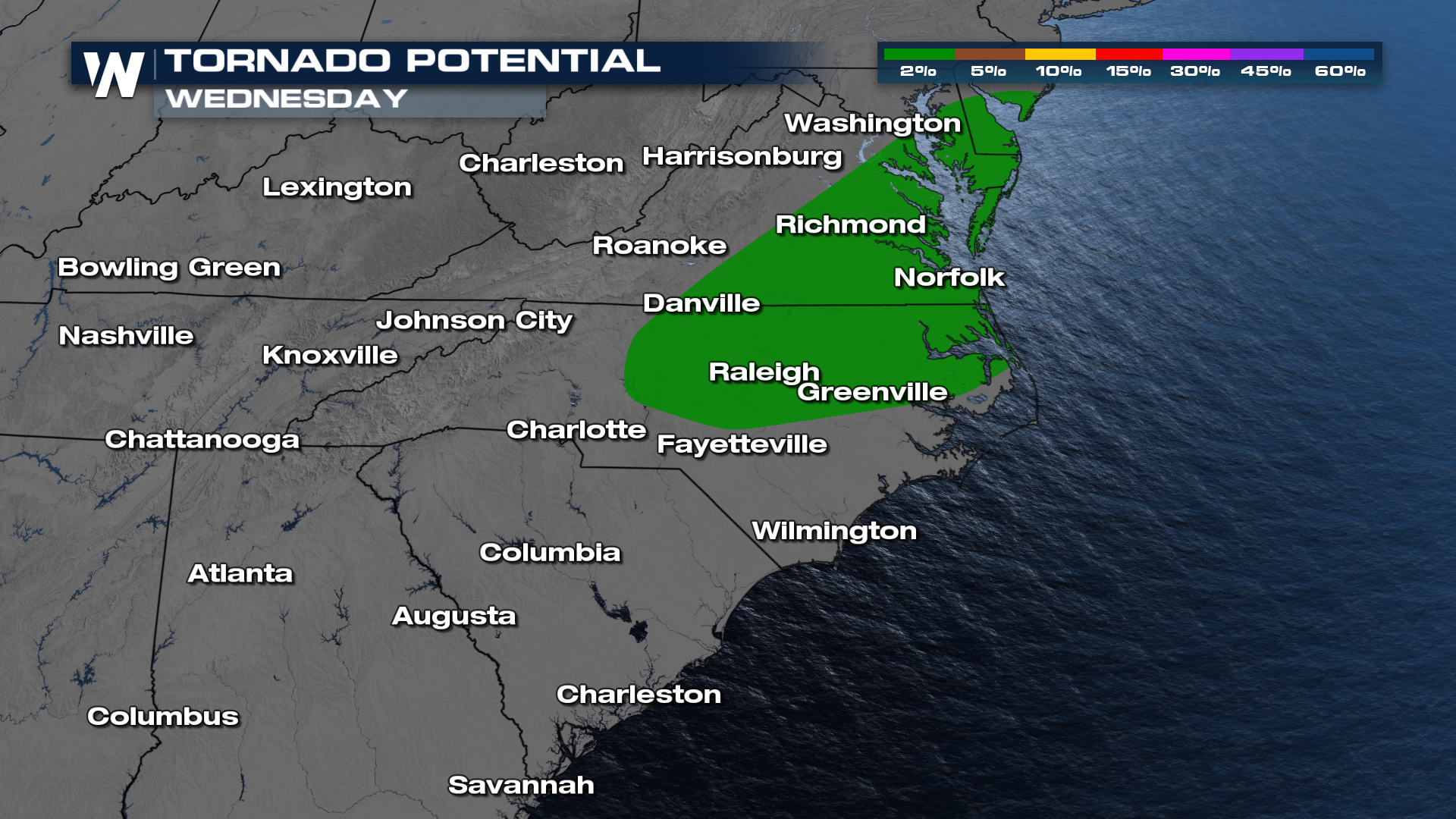
However, we don't want to rule out a chance to see an isolated spin up tornado, as those remain in the forecast come Wednesday.
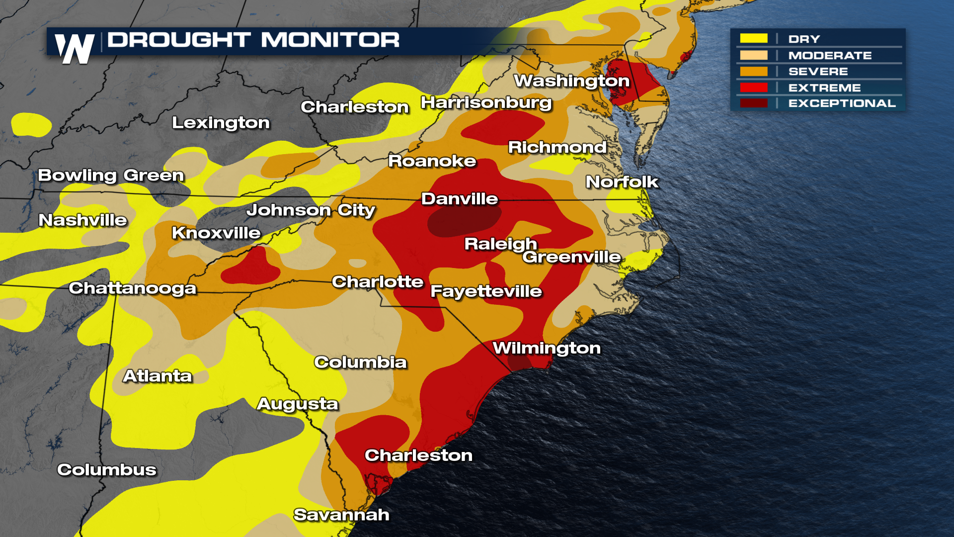
Despite this last week, it's been pretty dry for the Carolinas. Recent updates from the drought monitor show an extreme to even exceptional drought across the Carolinas. Hopefully, all this rain can offset some of those concerns.
Make sure to tune into WeatherNation for the full east breakdown at :10 past the hour! Always remember, turn around and don't drown!


