Heavy Rain and Flood Threat Along the Southeast to Start October

The storm system that brought flooding rainfall to the South Central is pushing eastward into the Southeast. A soggy start to October is underway across the Southeast, where rounds of heavy rain could create flooding concerns through the weekend.
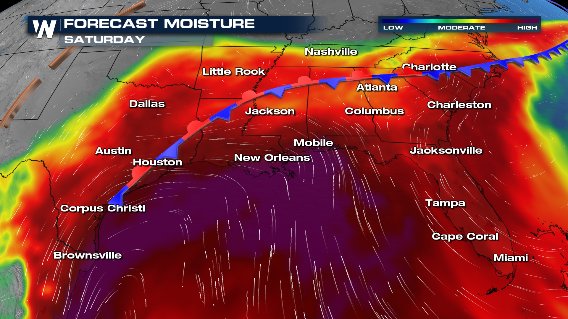
Deep tropical moisture streaming north from the Gulf is combining with an approaching cold front, setting the stage for widespread showers and thunderstorms from the Gulf Coast into the Southeast. The National Weather Service’s Weather Prediction Center has highlighted parts of the region for a Slight Risk of excessive rainfall as the wet pattern continues.
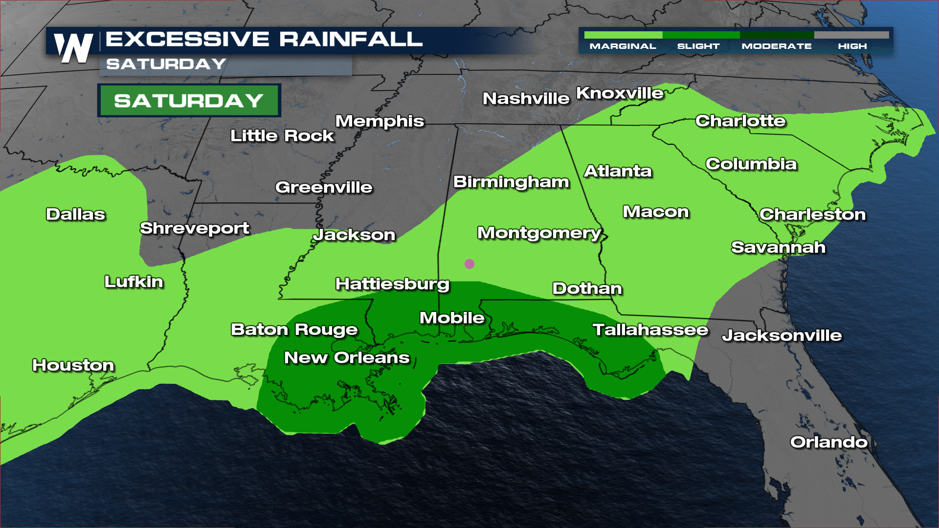
Saturday’s greatest flooding concern will focus along portions of the central Gulf Coast, including areas from Louisiana east toward the Florida Panhandle. A tropical wave moving through the Gulf is transporting an unusually moisture-rich air mass toward the coast. Atmospheric moisture levels are expected to reach near-record or record territory for early October in some locations.
Timing
A few isolated showers and thunderstorms are possible along the front Saturday morning. By Saturday afternoon, expect to see heavy rainfall across most of the Southeast.
By Sunday, the heavy-rain threat is expected to spread farther north and east across the Southeast. A cold front pushing into the region will interact with the deep tropical moisture already in place, allowing rain to expand from the central Gulf Coast through Alabama and Georgia and toward the Carolinas.
Unlike a typical summertime setup dominated by intense afternoon thunderstorms, this event could feature longer-lasting periods of efficient rainfall. Even where individual thunderstorms are not particularly strong, repeated or persistent rain could gradually increase the flooding threat. Cities including Birmingham and Atlanta are among the areas included in Sunday’s Slight Risk for excessive rainfall.
Rainfall from Saturday will also leave some areas more vulnerable heading into Sunday. Multiple-day totals could become substantial, particularly near the Gulf Coast, where several inches of rain may fall before the weekend ends.
Rainfall totals of 3 to 6+ inches are possible Saturday near parts of the Gulf Coast, with locally higher amounts. While some locations entered the weekend with relatively dry ground, rainfall of that magnitude could still overwhelm drainage systems and produce pockets of flash flooding, especially in urban and low-lying areas.
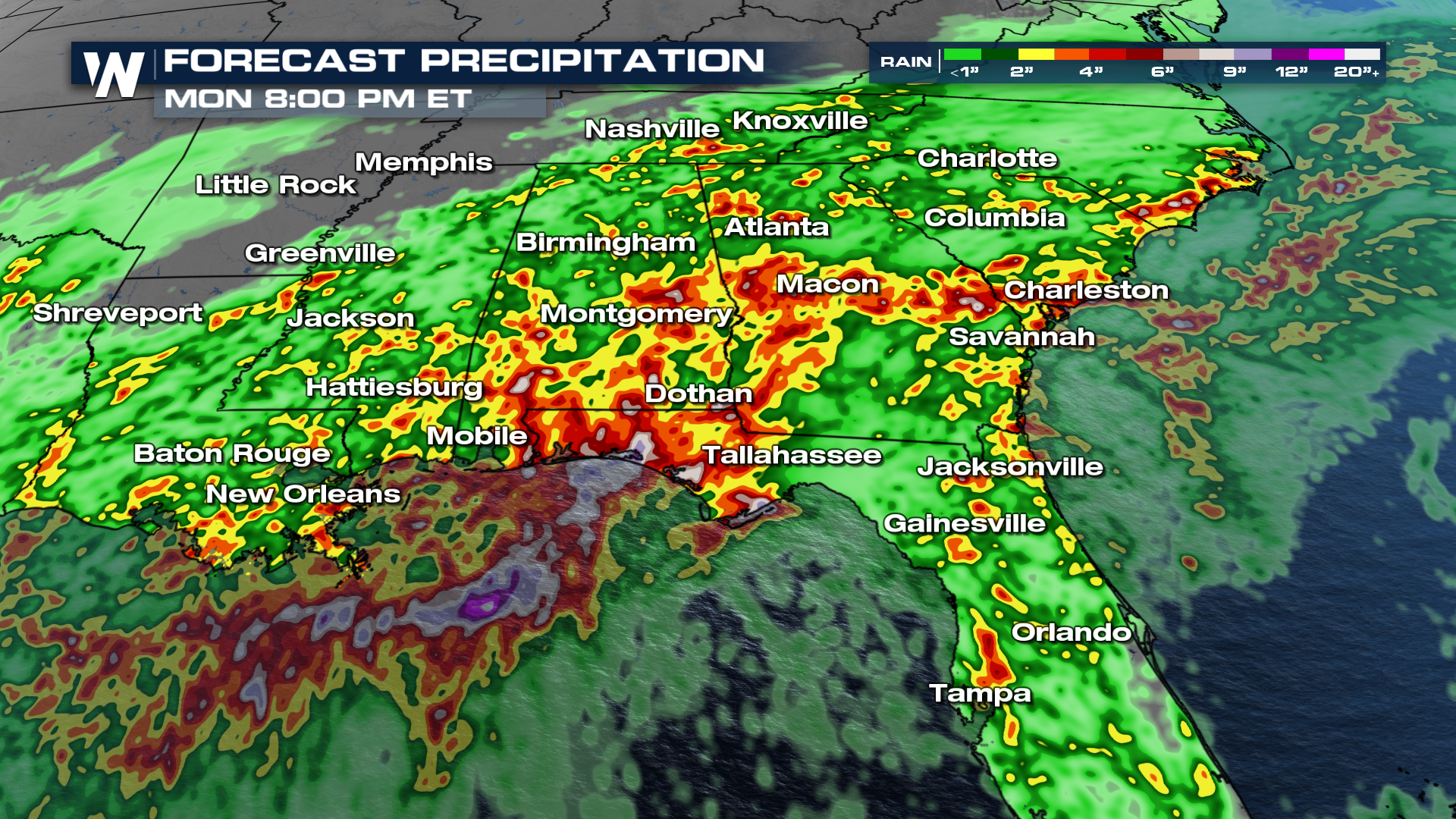
The pattern should begin shifting south by Monday as the front continues moving through the region toward Florida, but flooding concerns will not immediately disappear. Additional heavy rain will continue to be the focus across southeastern Georgia and northern Florida, including areas around Jacksonville. With some locations already receiving significant rainfall over the weekend, additional downpours could cause isolated flooding.
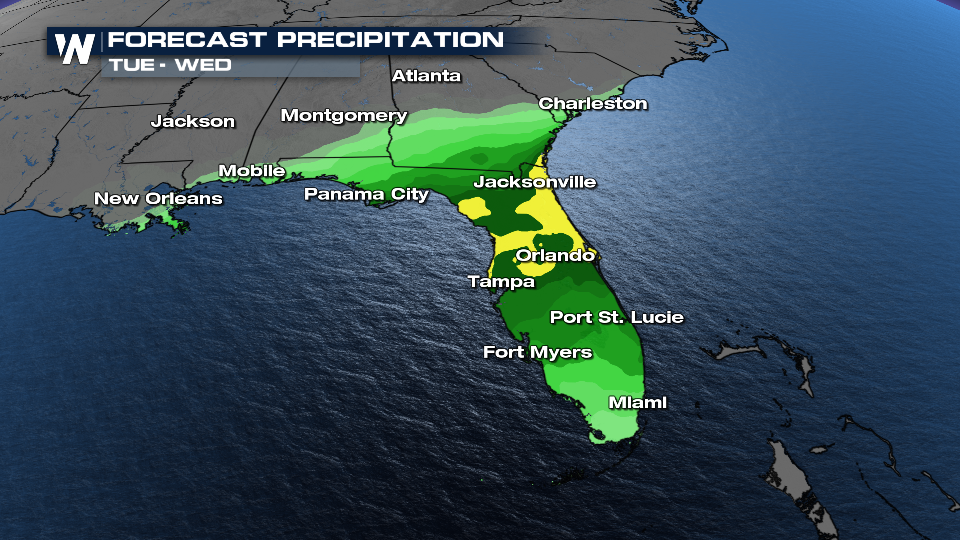
The unsettled weather will provide beneficial rainfall to some drought-stricken areas of the Southeast, but where rain falls too quickly or repeatedly, the risk of flash flooding will remain a concern through the beginning of the new week.
The long term forecast keeps the Gulf Coast very soggy into the middle of October. At least the temperatures are cooling off behind these fronts heading into the month of October.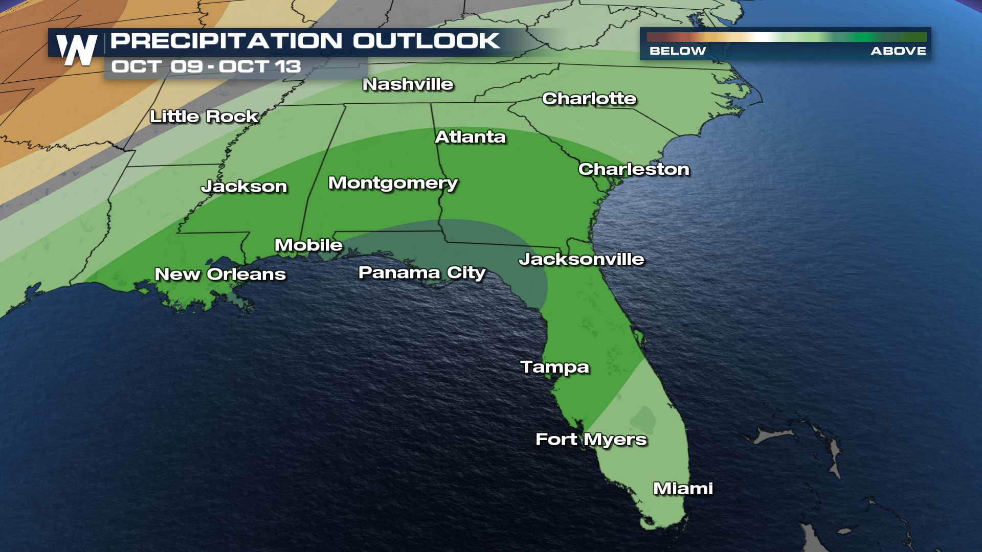 Stay tuned to WeatherNation TV for additional details.


