Late Season Snow for the Plains and Midwest

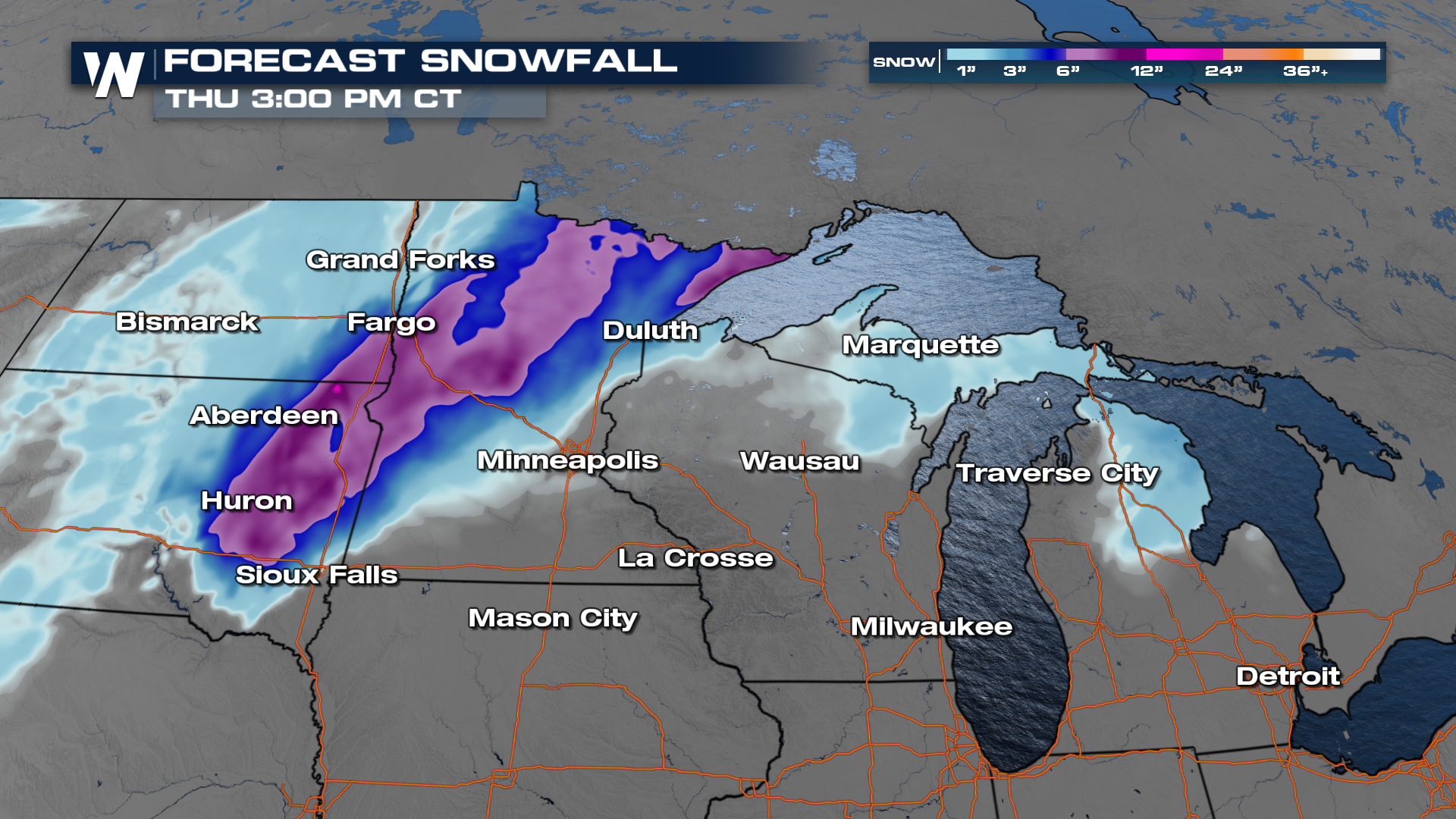
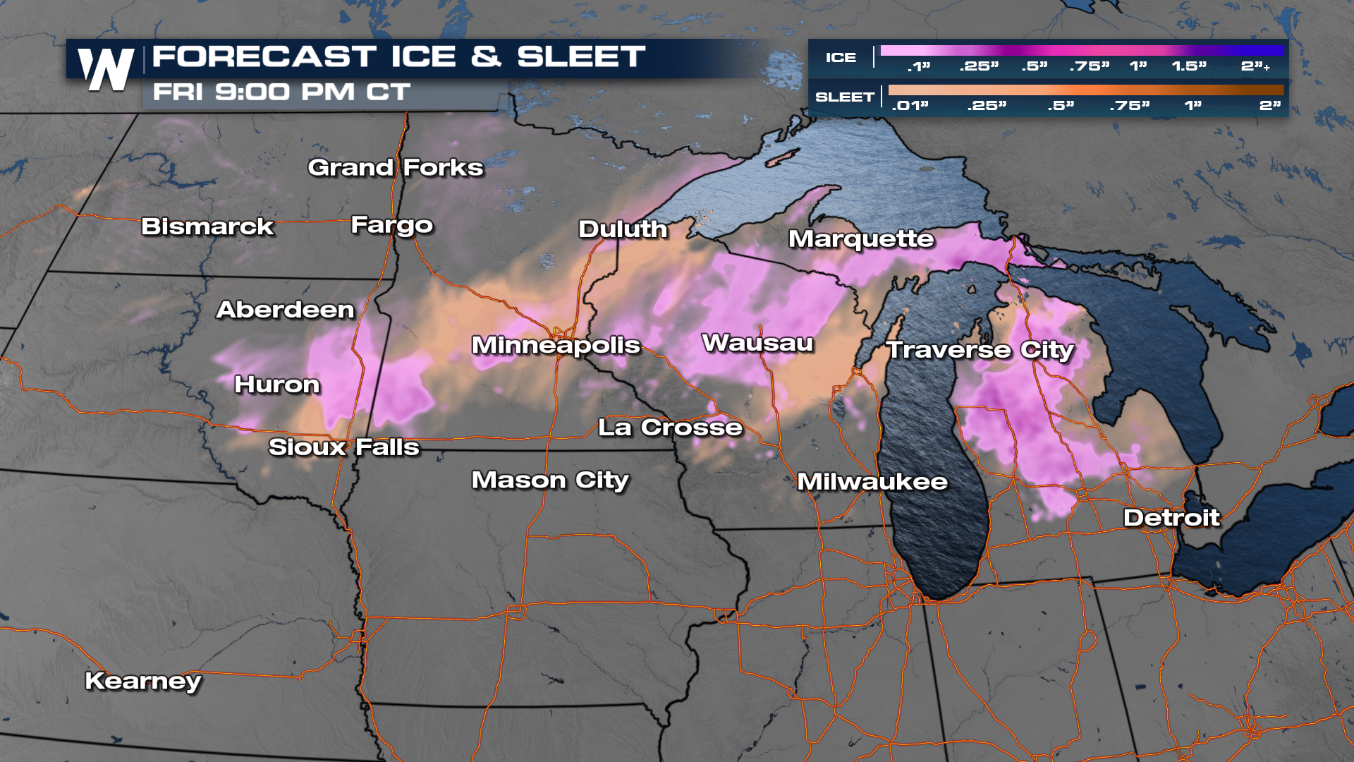
NORTHERN U.S. - Winter Weather continue across portions of North Dakota, South Dakota, Wisconsin, and Minnesota as an upper-level low brings severe weather on the "warm side" and snowy and blizzard-like weather on the "cold side". There is even a ice warning issued in southeastern South Dakota, where ice accumulations up to one tenth of an inch.
Heavy snow, upwards of 6-12", is likely in these areas, but with temperatures right around freezing, rainfall may disturb some of these forecast totals.
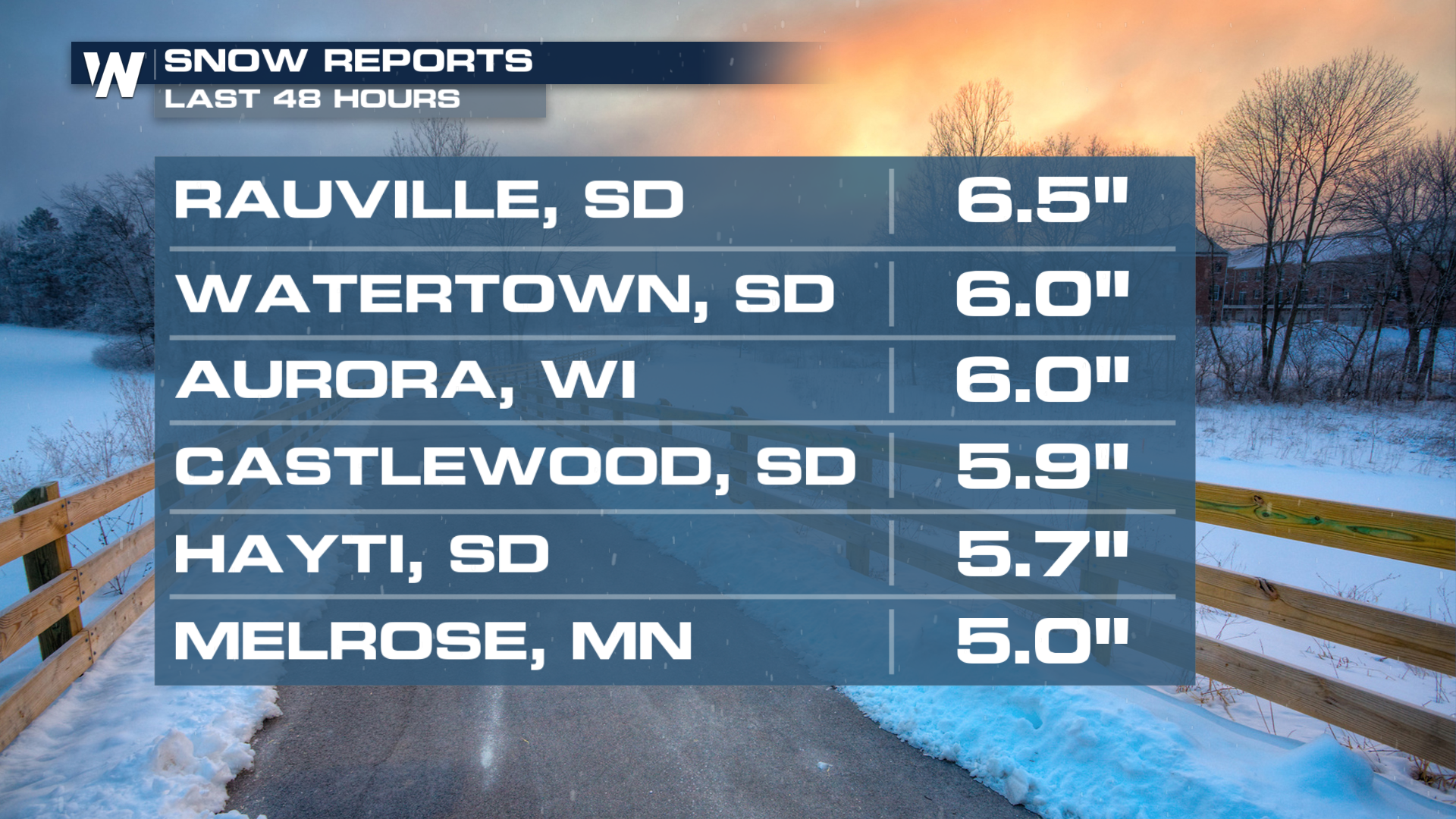
 Totals have already exceeded 6" in some areas over the last 2 days.
 Ice and sleet also remain in the forecast. Watch for slick conditions over bridges and overpasses.
Looking at the forecast timing, as it warms throughout the day, snowy areas turn to rain, and as night falls, rain turns back to snowfall. This will lead to messy conditions on the roadways.
Checkout the north Central regional forecast on WeatherNation :20 past the hour for a more detailed look as the late season snow unfolds.


